dryslot
-
Posts
62,800 -
Joined
-
Last visited
Content Type
Profiles
Blogs
Forums
American Weather
Media Demo
Store
Gallery
Everything posted by dryslot
-
4th of July is still not safe.
-
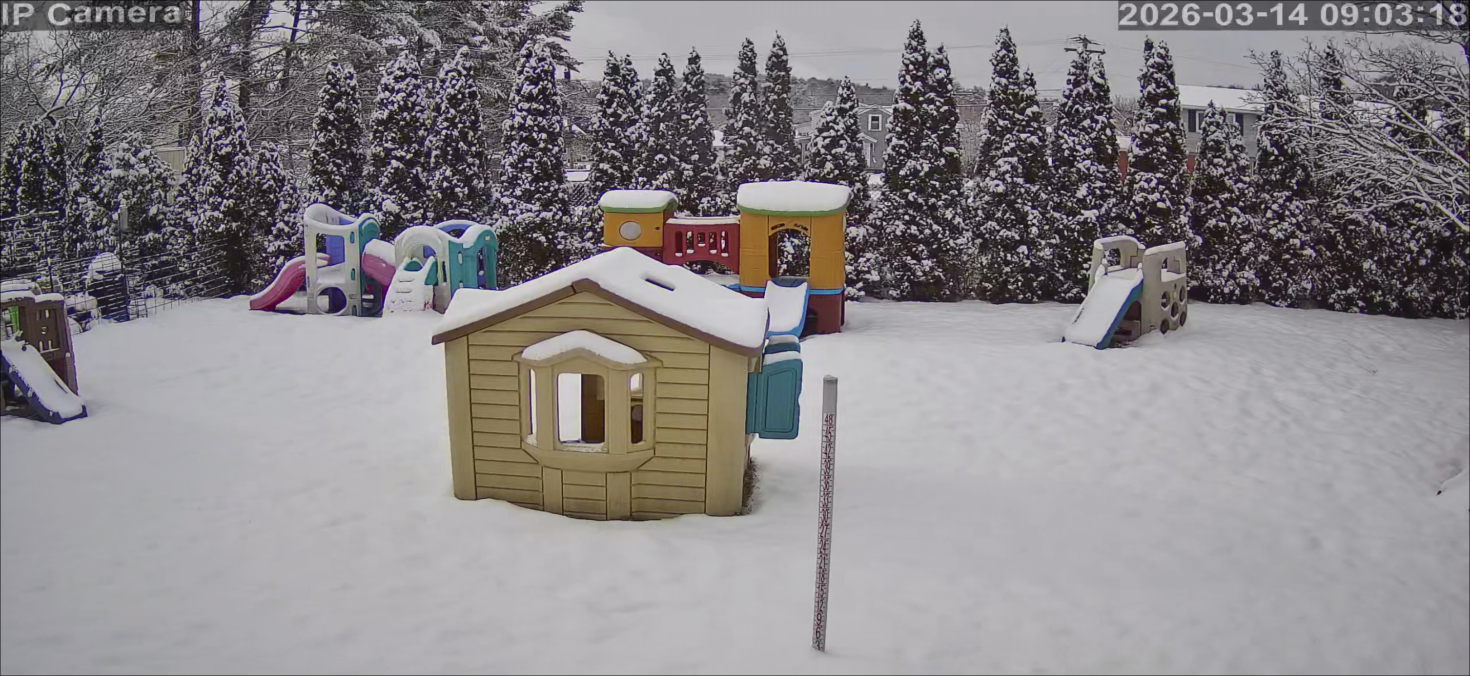
Some wet snow mixing in 35/32° F
-
12z Nam lol.
-
Then it is, If the family shared it, The original source had cred issues.
-
This is questionable as to if he has or not.
-
A -22.9°F departure is impressive.
-
I suppose if we can't get the rain at this point to offset this drought we will take the wet snow, It only pads the stats at this point.
-
I’d take the cold rain at this point, Drought conditions are not good, Snow is useless to me now.
-
Yup cold rain.
-
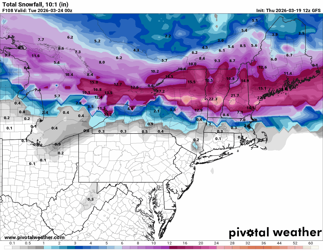
If modeling is correct, More snow in March then Feb up here, Great timing.
-
What blizzard?
-
12z GFS was blowing it up pretty quickly, But i would be hesitant as other models are much tamer over the duration.
-
12z Euro AI has 1.5"+ too.
.thumb.gif.8e0735b4615ea7dda45b5ffd01826000.gif)
-
Yes, That whole mid coast area has.
-
Like WTF?

-
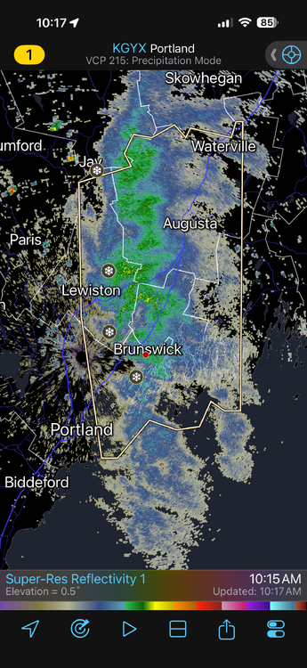
Its a 15 mi wide band, Area of convergence that was not forecast, I was on the fringe and got a coating, Brunswick up thru Augusta has 3-4" and are plowing lol
-
Have not looked at any models for about 2 weeks and just looking now, WTF is up with this the next 5 days? lol
-
OES on the move, Special weather statement for up to 4”
-
DE Maine will.
-
45 quite common up here for gust, 50-60 we can talk.
-
Sell the wind maps.
-
The two 18" storms (Dec-Jan) were the difference, Take those 2 away and it would be subpar here/
-
It was a flizzard here, We missed out on some others too, 19.5" for Feb is all we could muster, And was a bit disappointing after coming off of 30"+ back to back months in Dec and Jan.


.gif.02a69272ee5ebda004e82331ca40ae72.gif)