Stormlover74
-
Posts
24,214 -
Joined
-
Last visited
Content Type
Profiles
Blogs
Forums
American Weather
Media Demo
Store
Gallery
Everything posted by Stormlover74
-
Ewr 94 on a North wind. Wait til it flips around to the southwest. 102 for sure
-
Normally we'd get a widespread line of storms blow through breaking the heat wave The nam is showing that now and blasts us
-
Not getting my hopes up
-
Red sox lol
-
And 53 so late in the season
-
Neighbors canceled a party due to the heat and air quality and it turned out to be a very pleasant evening
-
No but they just enacted a campfire ban
-
Yes they are

-
Central Park is 92
-
Dry and breezy out there. Doesn't feel a degree over 95
-
We were never in the game for today. Was always north and east
-
They put me under a watch for some reason
-
Naturally it heads to areas that just got 3 to 4" of rain Monday
-
Maybe for LI
-
Why?
-
Nam has some activity tomorrow early afternoon
-
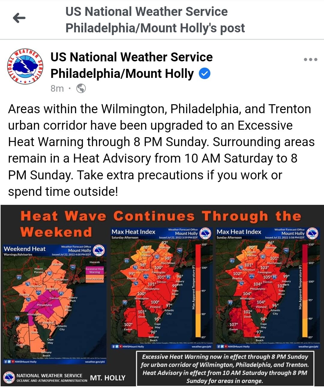
...HEAT ADVISORY NOW IN EFFECT UNTIL 8 PM EDT SUNDAY... * WHAT...Heat index values in the upper 90s and lower 100s. * WHEN...Until 8 PM EDT Sunday. * IMPACTS...Hot temperatures and high humidity may cause heat illnesses to occur. * ADDITIONAL DETAILS...A few locations may reach heat index values around 105 Thursday and then again on Sunday.
-
Ewr is 98. Depending on clouds tomorrow and Friday they could make a run at 5 straight 100 degree days
-
I think he became wthrmn654
-
92/62 here for a real feel of 91
-
Earlier in the day they'll be running just a couple degrees warmer than other stations but they start to pull away by late afternoon. We'll see if today goes the same way
-
Brutal thru Saturday, less brutal after that
-
Ewr 92 as the extended heatwave begins