Flood watch for all of Upton's zones
...FLOOD WATCH IN EFFECT FROM 11 PM EDT THIS EVENING THROUGH TUESDAY MORNING...
* WHAT...Flash flooding caused by excessive rainfall is possible.
* WHERE...Portions of southern Connecticut, including the following
areas, Northern Fairfield, Northern Middlesex, Northern New Haven,
Northern New London, Southern Fairfield, Southern Middlesex,
Southern New Haven and Southern New London. Portions of northeast
New Jersey, including the following areas, Eastern Bergen, Eastern
Essex, Eastern Passaic, Eastern Union, Hudson, Western Bergen,
Western Essex, Western Passaic and Western Union. Portions of
southeast New York, including the following areas, Bronx, Kings
(Brooklyn), New York (Manhattan), Northeast Suffolk, Northern
Nassau, Northern Queens, Northern Westchester, Northwest Suffolk,
Orange, Putnam, Richmond (Staten Island), Rockland, Southeast
Suffolk, Southern Nassau, Southern Queens, Southern Westchester
and Southwest Suffolk.
* WHEN...From 11 PM EDT this evening through Tuesday morning.
* IMPACTS...Excessive runoff may result in flooding of urban areas,
as well as quick responding rivers, creeks, streams, and other
low-lying and flood-prone locations.
* ADDITIONAL DETAILS...
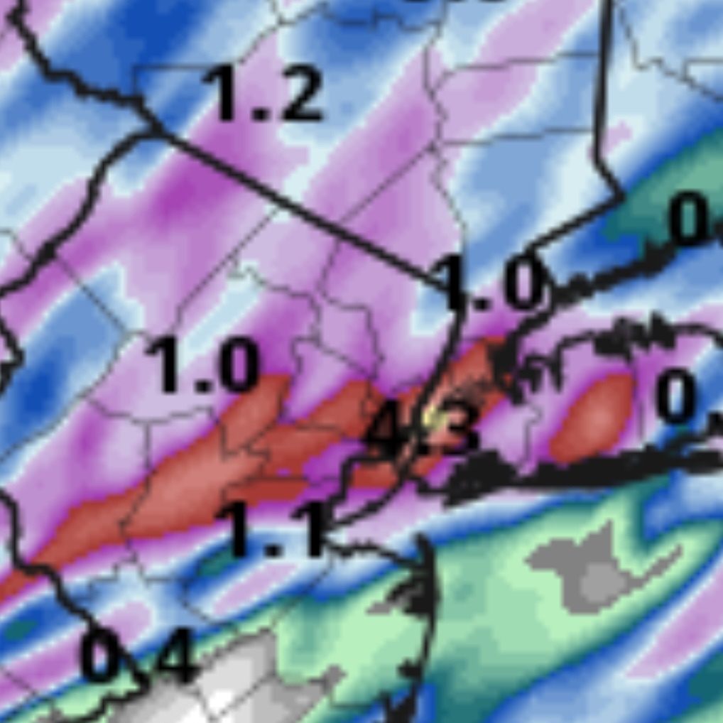
- A basin average of 1 to 2" of rainfall are expected across the area tonight, with locally 3" possible. Much of this rainfall will fall in a 3 to 5 hr period tonight into early Tuesday morning, over areas that have seen 2 to 4" of rain in the last week. Isolated areas of flash flooding are likely, with scattered areas of flash flooding possible in the path of the most persistent thunderstorm activity.