kdxken
-
Posts
9,795 -
Joined
-
Last visited
Content Type
Profiles
Blogs
Forums
American Weather
Media Demo
Store
Gallery
Everything posted by kdxken
-

July 2025 Obs/Disco ... possible historic month for heat
kdxken replied to Typhoon Tip's topic in New England
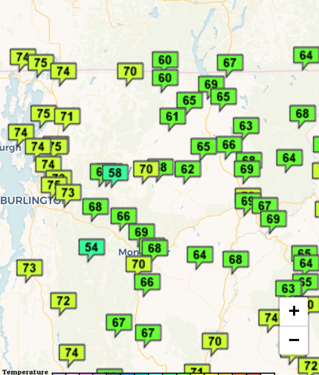
Especially the one on a 500 square mile lake. True representation of Vermont?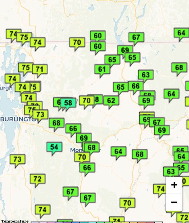
-
July 2025 Obs/Disco ... possible historic month for heat
kdxken replied to Typhoon Tip's topic in New England
Yep, it's par for the course these days. Doesn't get real hot and doesn't get real cold because of all the moisture in the air. -
July 2025 Obs/Disco ... possible historic month for heat
kdxken replied to Typhoon Tip's topic in New England
What the hell went on in 1983 that they had 30 days of 90° or better? Maybe somebody can wake Will from this hibernation. -
July 2025 Obs/Disco ... possible historic month for heat
kdxken replied to Typhoon Tip's topic in New England
Worcester and Providence too? Like where people live? -
July 2025 Obs/Disco ... possible historic month for heat
kdxken replied to Typhoon Tip's topic in New England
I'd say Burlington Vermont. -
July 2025 Obs/Disco ... possible historic month for heat
kdxken replied to Typhoon Tip's topic in New England
You've spoiled like skunked beer. -
July 2025 Obs/Disco ... possible historic month for heat
kdxken replied to Typhoon Tip's topic in New England
Oh I thought you meant July. Top 10 for the entire Summer is a long way off. -
July 2025 Obs/Disco ... possible historic month for heat
kdxken replied to Typhoon Tip's topic in New England
Don't disagree. -
July 2025 Obs/Disco ... possible historic month for heat
kdxken replied to Typhoon Tip's topic in New England
Possible top 10 if the Bermuda high reestablishes itself. Sitting at number 10 for Boston right now. Tomorrow and early next week should do some damage to that however. -
July 2025 Obs/Disco ... possible historic month for heat
kdxken replied to Typhoon Tip's topic in New England
I don't recall anyone saying it was going to be cold. Comfortable maybe which it sure is! -
July 2025 Obs/Disco ... possible historic month for heat
kdxken replied to Typhoon Tip's topic in New England
I don't believe so. -
July 2025 Obs/Disco ... possible historic month for heat
kdxken replied to Typhoon Tip's topic in New England
Boston was what for June + 1.6? July I believe is somewhere around 2.8 with a cold snap coming in. Not what hottest ever Summers are made of. -
July 2025 Obs/Disco ... possible historic month for heat
kdxken replied to Typhoon Tip's topic in New England
Could be, If by " most areas" you mean areas which consider washers and rusty plows lawn ornaments. Boston has 10 days of 90 or above this year and one official heat wave. 1983 they had 30 lol. Didn't even hit 90 in Worcester this week. -
July 2025 Obs/Disco ... possible historic month for heat
kdxken replied to Typhoon Tip's topic in New England
Brief mild up. -
July 2025 Obs/Disco ... possible historic month for heat
kdxken replied to Typhoon Tip's topic in New England
Can it be the hottest summer ever if we only have one heat wave? -
July 2025 Obs/Disco ... possible historic month for heat
kdxken replied to Typhoon Tip's topic in New England
Not ascared.
-
July 2025 Obs/Disco ... possible historic month for heat
kdxken replied to Typhoon Tip's topic in New England
Adding up likes from the past few pages. 753 love this weather, three do not. Might actually be two and a half. Has anyone ever met troll tiger? Likely some annoying bot. -
July 2025 Obs/Disco ... possible historic month for heat
kdxken replied to Typhoon Tip's topic in New England
Don't overdo it. Start slowly. -
July 2025 Obs/Disco ... possible historic month for heat
kdxken replied to Typhoon Tip's topic in New England
-
July 2025 Obs/Disco ... possible historic month for heat
kdxken replied to Typhoon Tip's topic in New England
It's a Friday In the summer. Everyone's skipping out or working from home. -
July 2025 Obs/Disco ... possible historic month for heat
kdxken replied to Typhoon Tip's topic in New England
It was bound to happen. Called the weeks ago. -
July 2025 Obs/Disco ... possible historic month for heat
kdxken replied to Typhoon Tip's topic in New England
It's not even a debate. Couple crackpots like uncomfortable weather. Same folks that stuffed pennies in their noses as kids. -
July 2025 Obs/Disco ... possible historic month for heat
kdxken replied to Typhoon Tip's topic in New England
Beginning of the end? -
July 2025 Obs/Disco ... possible historic month for heat
kdxken replied to Typhoon Tip's topic in New England
If you want a hot breeze just stick your head in the oven for a few minutes. -
July 2025 Obs/Disco ... possible historic month for heat
kdxken replied to Typhoon Tip's topic in New England