

backedgeapproaching
-
Posts
3,678 -
Joined
-
Last visited
Content Type
Profiles
Blogs
Forums
American Weather
Media Demo
Store
Gallery
Posts posted by backedgeapproaching
-
-
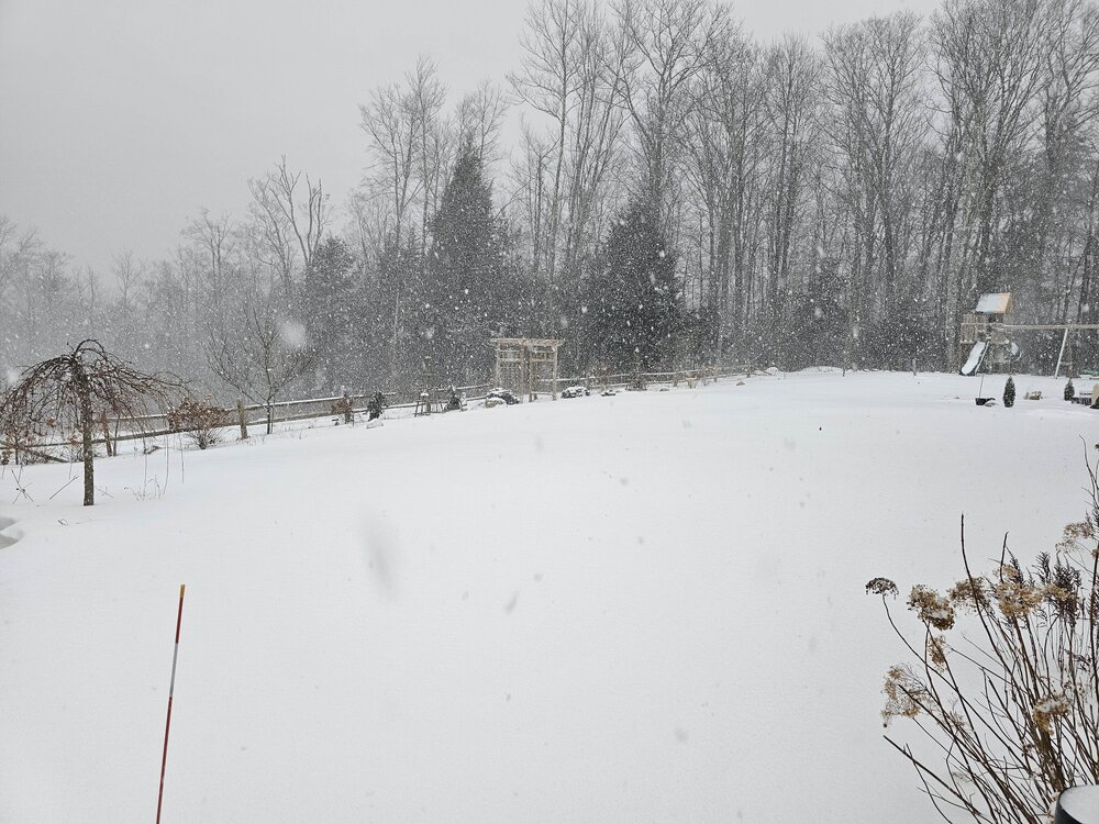
Finally getting some decent rates here with some boderline S+...lots of wind overnight
-
41 minutes ago, mreaves said:
Just measured 8”. About and inch an hour for the last few hours.
Nice. Looks like nice totals from KLW up through your area.
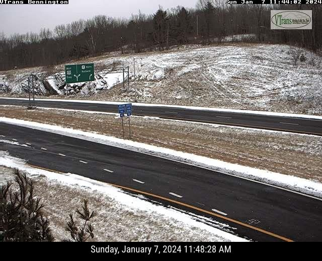
Looking like easy travels through Bennington VT...

-
 2
2
-
 1
1
-
-
2 hours ago, HIPPYVALLEY said:
Wow, only 2.5” back this way and we never got into +SN bands. My NWS forecast was 8-12” so take that down.
30F with a few stray flakes right now.
ALY had a little write up overnight and why the relative porking with the intital WAA push. Only 3-4" here. Local guy at 1900' reported 4.5" and Stratton 5" I believe.
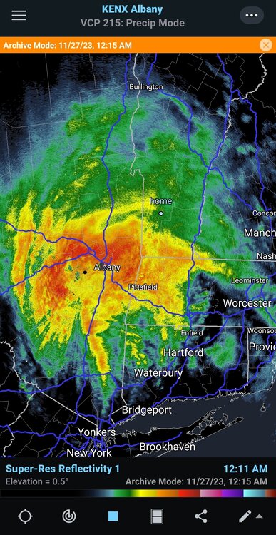
Snow is continuing across eastern New York and western New England, however expectations of spatial coverage has not exactly met reality due to the evolution of the coastal system now currently located east of the Delmarva. According to SPC Hourly Mesoanalysis, the parent shortwave trough has pulled ahead and east of the coastal low, forcing its deepening to come to a staggering halt and stretching energy further east. Because of this, the precipitation shield has shifted to the east with very minimal northward progression. A secondary low pressure core has formed across western Pennsylvania in association with an upper trough, acting as another source to drain energy from the aforementioned coastal low and simultaneously push it further east in tandem with the pull of the upper shortwave pulse.-
 1
1
-
-
7 minutes ago, STILL N OF PIKE said:
deep level E flow the downslope areas in valleys will be notable I think
Yep, pretty deep easterly flow, going to be some valley screw jobs. Places like Hoosick Falls NY will be a local minimum.
-
10 minutes ago, Sn0waddict said:
What’s with the NW CT western MA screw job? Seen it on some models now.
Just showing the downsloping on the western facing slopes with easterly flow. Mesos normally show that on every event. Sometimes accurate, sometimes overdone.
-
 1
1
-
-
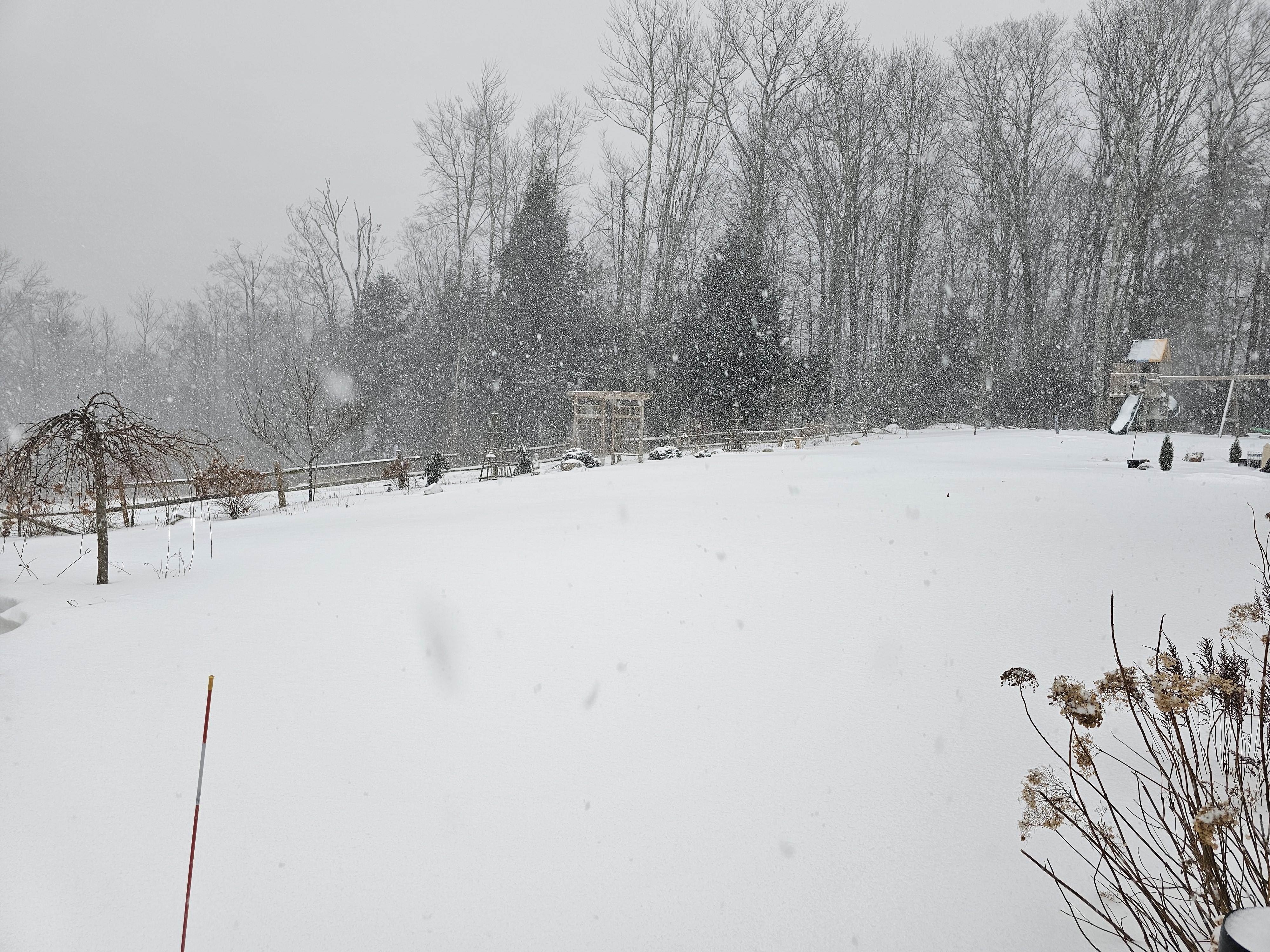
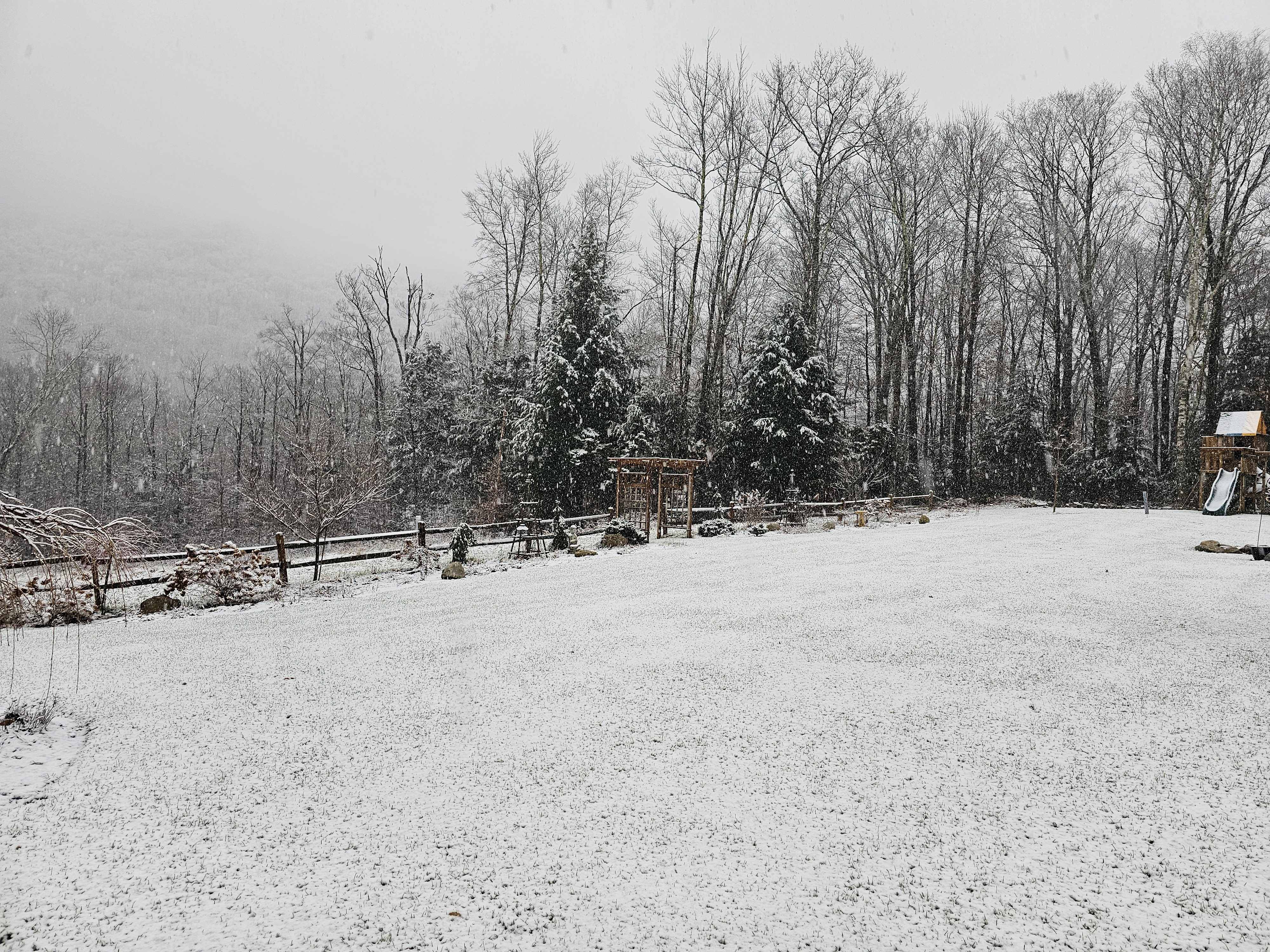
Covering up the lush late Dec lawn..

-
6
-
-
On 12/18/2023 at 5:14 PM, dendrite said:
Soil temp is up to 44°. Let’s grow some grass.
We green still..lol

-
2
-
-
Well, this is what we have come to. Don't think I have ever seen BTV publicly post a percent chance of .1" snow map..
..lol.
-
1
-
-
34 minutes ago, STILL N OF PIKE said:
So it was really Tamarack saying it’s desperation and he lives up there , and Wolfie has been going for decades snowmobiling (or not being able to) in December
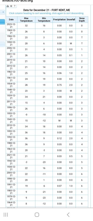
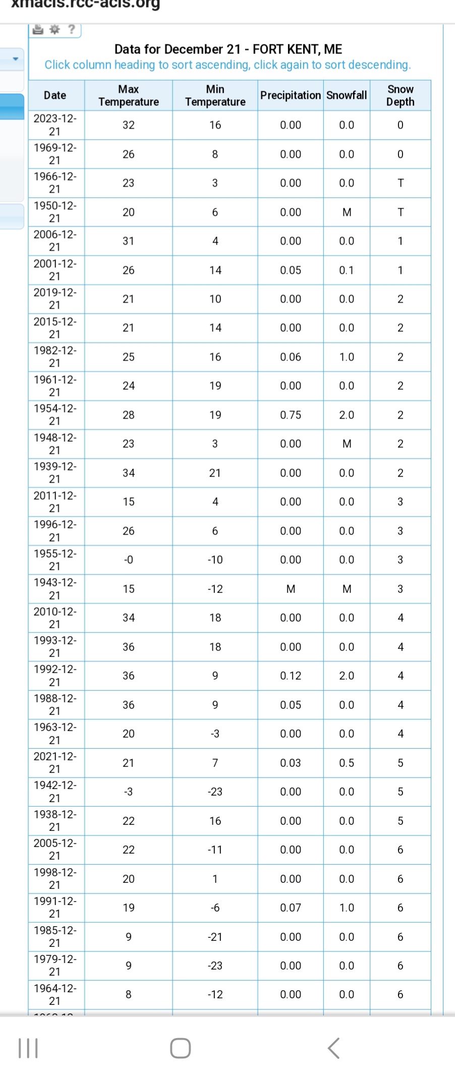
I don’t live up there and I haven’t even seen the picture but I imagine there is a big difference between nearly bare ground and being able to ride . So I can imagine many years with no riding in late December but not many with like a dusting on ground . I have no idea , how much is on the ground and is there any kind of close COOP data that shows how rare or not the current depth (or lack there of) is ?
Looks like only 2 years had 0" depth on 12/21--this year and 1969. Think there are like 70ish years with recorded depth,with some other missing years since the COOP goes waaay back. So actually reporting 0" on 12/21 seems pretty unusual.
-
2
-
2
-
-
59 minutes ago, powderfreak said:
Still coming down this evening at the ski area. Don't dare drop anymore obs in the main thread, lol. Getting dire outside of our little pocket in VT it seems.

You have just about used up your main thread photo quota PF before the first 1" falls in SNE..
Lower than expected totals here just like pretty everywhere in VT this last event. 2.5" sticky wet snow. Think I only have like 12-13" this season. Couple razor thin events where it was just too warm on west slopes. Been pretty decent early on at Stratton/Bromley, few good days have been had out there at both so far, east slopes and elevated have done relatively well here. Tight cutoff to the south for season totals as I think Mitch hasn't had too much so far.
-
Love when BTV puts these elevation graphics out. Cool stuff.
-
4
-
-
15 minutes ago, qg_omega said:
Got a couple of inches even at lake level, 400ish feet. Forecast was just rain, about 7 inches up at Gore and another storm where Gore cleaned up as Whiteface rained, second time this past week
Yea as LongBeach said the bright banding on radar was pretty intense as that blob was heading NE, thought there could be a chance for lower elevations as temps were 33- 34ish here at the time.
-
2
-
-
9 hours ago, LongBeachSurfFreak said:
It’s been absolutely ripping on the Stratton cams for the last few hours. Some of the heaviest snow I have seen In many years of watching the cams. So this is going to be a surprise big one above 2k even down to SvT.
Interesting-I was thinking that looking at my cam overnight. My cam doesn't pick up snow very well at night based on lighting, etc but you could see the Sierra cement really coming down. Only got 2.7" here, but more than I thought since it was mostly rain before midnight.
-
22 minutes ago, powderfreak said:
Steady light snow now.
Pretty interesting at how marginal it is… the ridge lines around here are showing mixed precipitation on the crests and immediately W/NW.
The Worcester Range is causing a pocket of sleet on the east side of Stowe, and the Green Mtn Spine is causing it on the west side. Just the slightest downslope of mid-level air causing sleet.

Yep, lots of pellets here just west of the spine along with some flakes. Maybe even little ZR too, full kitchen sink.
-
Some pretty decent flakes at times actually. 1.2"
-
3
-
-
1 hour ago, dryslot said:
Up in NNE, Its tough to get big totals generally if you lose December due to AN and below avg snow, You really need to have an AN Jan-Feb to build a pack but some years like last year, It all fell up here rather late end of Jan into March but now sun angle comes into play for retention.
I have only had 9 winters here, so not a huge sample size, but Dec has the highest average snow total here, so if you lose that , you fall behind quickly.
-
Always surprised how busy the last weekend in OCT usually is here with peepers.
Not much to look at..
-
2
-
-
This showed up on my FB feed today...
looks like Mars. All the comments of "wow", "incredible"....lol
-
1
-
8
-
-
10 hours ago, WxWatcher007 said:
I take it this is bad too. Just started showing on the grass after the last rainer.

Lawn rust looks like. Normally does not do long term damage. You can put some Fertilizer down to help it grow out.
-
1
-
-
4 minutes ago, CoastalWx said:
Mowed yesterday. Almost got arrested for rolling around nude on the lawn. However, waking up to leaves on a freshly mowed yard is triggering.
Definitely first world problems, but that does get my OCD going too.
-
1
-
1
-
-
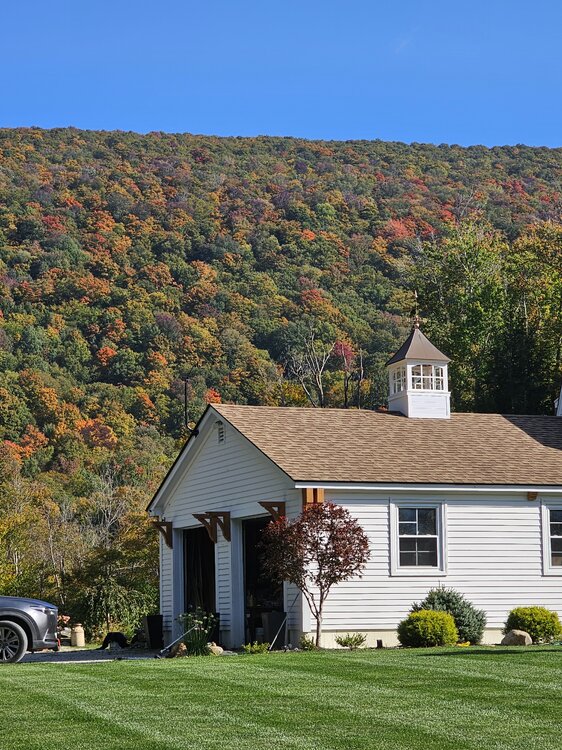
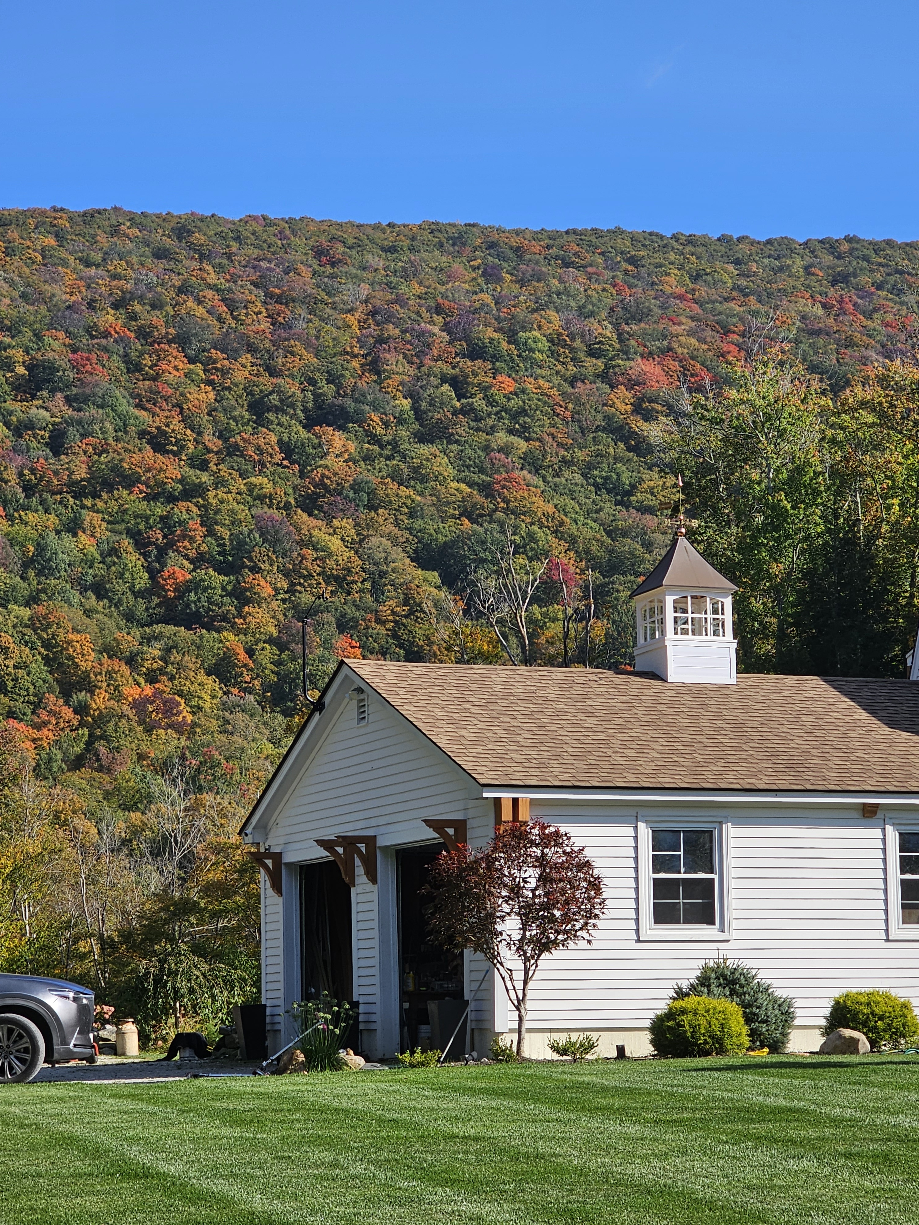
It's early here, but can see some red and orange starting to pop in the hill behind my house, so we will see how the Sugar Maples end up.
-
7
-
-
23 minutes ago, dendrite said:
It’s 9/19 lol. Right on pace with other years.
Got to give to Kevin, he shuts down the resorts every winter and has every Maple going from green right to brown every fall. He definitely stays on brand pretty consistently.
-
23 hours ago, WxWatcher007 said:
I may just wait until spring at this point.
If its a smaller area, spring seeding can work. It becomes more difficult if the area is bigger, you pretty much have to water all summer long to make sure it survives--unless we get a repeat of this years monsoon
")
I would go now, or next fall--again if its the whole lawn or a bigger area.
-
2
-
1
-
-
1 hour ago, CoastalWx said:
Good lapse rates aloft.
Guess that's it. Reading the local community forum stuff, seems like a war zone out there, trees and wires down all over. We had another nasty cell come through with same strength winds, etc
2 within 2 hours, honestly the strongest I have seen living here. Long time residents posting similar stuff.
-
2
-


January 6-7, 2024 Winter Storm Obs Thread
in New England
Posted
Yea, I would guess 4-6 at this point.