

backedgeapproaching
-
Posts
3,682 -
Joined
-
Last visited
Content Type
Profiles
Blogs
Forums
American Weather
Media Demo
Store
Gallery
Posts posted by backedgeapproaching
-
-
Up to a balmy 1.8F....Maybe like 1" give or take.
I know Dendrite said forcing wasn't there, whether forcing, dry arctic air seeping in ,subsidence or whatever--most models nailed it here with little to nothing accum wise.
-
22 minutes ago, PhineasC said:
CMC looks great next for NNE.
Yea, that would be nice. Has 2.5" QPF of snow/IP down here.
-
6 minutes ago, mreaves said:
There were a couple of runs but nothing serious. BTV was thinking 1”-3” and even bumped it up to 2”-5” for eastern VT after that really zonked run but you’re right, this one was never really for us.
Yea, even under some halfway decent radar returns there is nothing at all coming down right now. Stratton summit cam has like miles and miles of VIS..lol. I was always out of it really even here, but, not sure even places east of me in VT got much?
-
7 minutes ago, WxWatcher007 said:
One thing I like about this...it isn't a 28 degree snowfall. Temps dropping through the teens today with good wind and wind chills near to below zero at the peak of this thing. Deep deep winter.
There is certainly some cold air nearby for you guys to tap into.
I'm currently at 0.6F with some very light artic dust falling in SVT.
-
 1
1
-
-
15 minutes ago, PhineasC said:
Sounds silly, but the 2.5 of fluff here on top of the cement base really made things look nice here. Has a deep winter look even if the pack is below normal. Hope to get another 3-4" of the same.
Yep, love those..covers up the "tired" snowpack look.
-
1
-
-
16 minutes ago, PhineasC said:
Very quiet in this thread. What are we thinking about this clipper? Radar shows some returns headed into VT now. Anything going on?
Virga
-
1 hour ago, eyewall said:
Your arctic cold helped us pull off what was a warning level snow for these parts (about 3-3.5 inches). Greetings from the Banana Belt! (It remained in the 20's the entire event was pure powder):


Nice, always loved the eyewall drone shots.
-
2
-
-
-
18 minutes ago, mreaves said:
Or Littleton. Either would work for me and I would be up for it.
Little further south?
")
I guess I'm Im kind of faux NNE anyway down here..lol..
-
2 hours ago, PhineasC said:
LOL winds went south and I spiked to 30 in like a minute.
If your going to downslope, prob the best direction to do it..cant think of many blockbuster snow events on a south wind.
Only issue is a strong cutter making a dent in the pack.
Interestingly, south wind here is one of the few directions that is a non event..even tonight is weird, every station in the valley here is 35-37F while its 31.1F here almost calm.
-
1
-
-
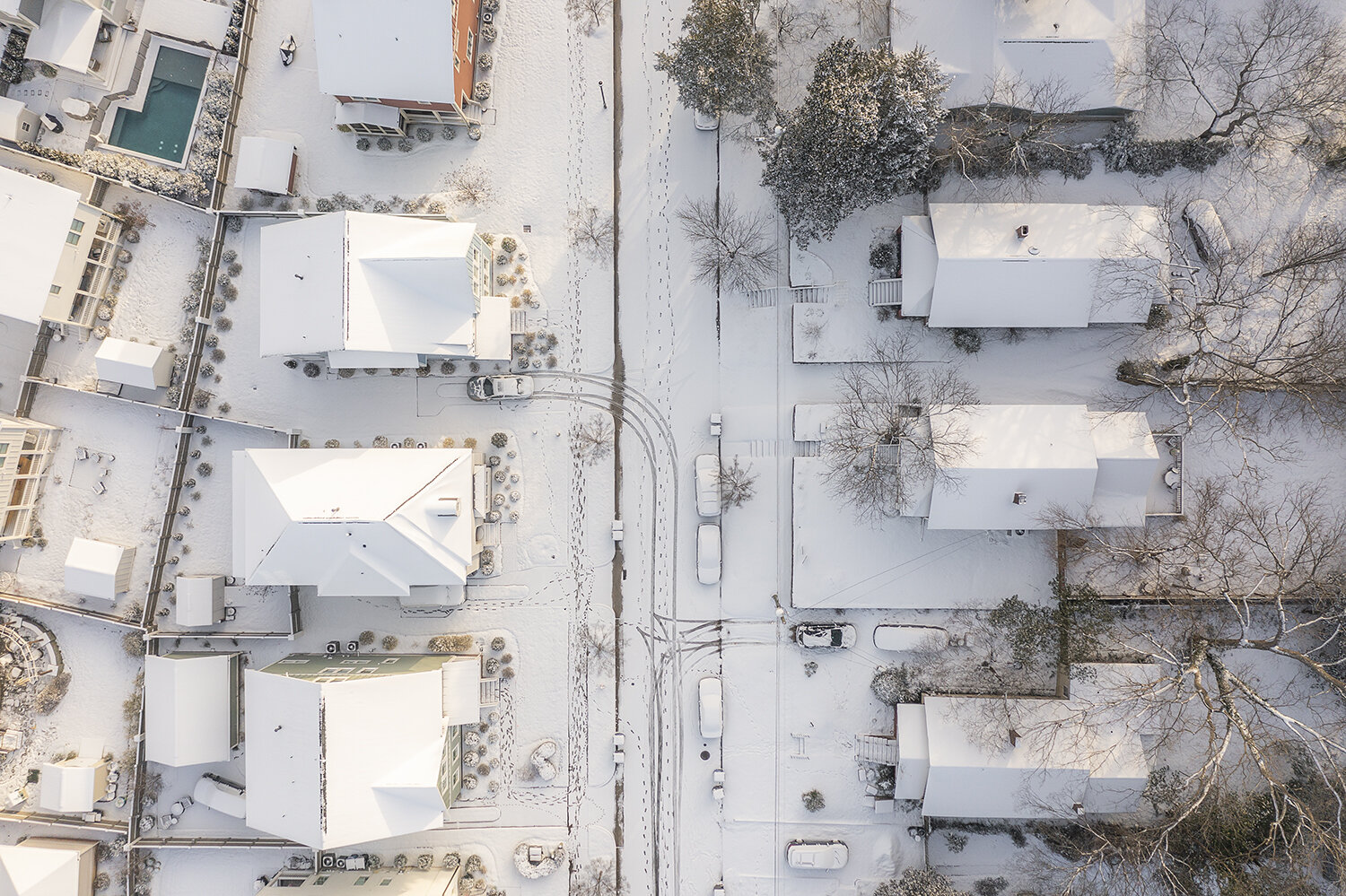
This map sums up this storm pretty well. Terrain influence heavily in play.

-
44 minutes ago, PhineasC said:
Just when I had caught you in the snow power rankings too.
") gonna need a 2 footer here to seal this up.
gonna need a 2 footer here to seal this up.
 Just give up. Its death by a thousand 2.7" upslope's.
-
1
-
-
1 hour ago, wxmanmitch said:
12.3" of snow with 1.27" LE as of 4 pm. Expecting another 2-3" on the backside overnight.
Had exactly 1.27" LE when I melted down..kind of interesting given our vastly different locations. 11.2" total though.
-
1
-
-
Last batch moved through..skies brightening.
11.1" barring any addt snow tonight.

-
6
-
-
11.1" All local hills should be good for 12"+.
Well see if any uplsope materializes tonight.
-
8 minutes ago, PhineasC said:
8 at the measuring stick now.
Mitch must be double digits by now.
Its crushing in the last batch moving through with wind way down. I had 8.3" a little while ago--might be able to squeeze out double digits even here. Surprisingly not that much less than Mitch had. Think the wind and ratios just played havoc on the higher end totals overnight in SVT.
Just super dense base builder stuff.
-
1
-
-
Stuff down here is super dense, this ain't no fake Fluff. Very nice base builder as mentioned.
-
31.4F. Went from blowing and drifting to caking as the warmer air comes in.
-
5
-
-
36 minutes ago, snowgeek said:
6” here in Slingerlands. In a lull with just flurries. Temp 27.
.Congrats on reporting as much as Stratton and Bromley!
I think the winds are just making it impossible to measure honestly, I would think more than that has fallen. But certainly some work to do to hit even bottom end of expected totals.
Hit 51mph on my Davis, snow and blowing snow. No idea how much, seems in the 5-6" range based on eyeball, lots of blowing and drifting and crappy needles falling.
-
13 minutes ago, LongBeachSurfFreak said:
Good old fashioned ripping. 7” and easily 2-3”/hr SVT
Absolute whiteout with the winds over on this side of the Greens. Where are u this year?
-
1
-
-
22 minutes ago, LaGrangewx said:
One thing I know is to never underestimate that area of southern Vermont during a setup like this they almost always over-perform. The terrain there seems to work wonders so even though it’s a quick hit I wouldn’t be surprised if they have some crazy rates for a few hours with the upslope assist. You know that area much better than me but I’ll be skiing Mount Snow next weekend so I’m optimistically saying they get 18+.
Its certainly a "bread and butter" setup for Mt Snow/Stratton/Mitch. I think Ginx posted earlier the possibility of one hour rates in the 3-4" range, couple hours of those and certainly higher end totals possible. I'm just hoping to keep power myself on the western side.
-
2
-
-
32 minutes ago, wxmanmitch said:
Eagerly awaiting the first flakes from what looks to be a doozy here. I knew those NAM runs from a couple of days ago were way too warm as it overdoes WAA in storms with strong dynamical cooling processes. It's best with run of the mill SWFEs, but not these storms.
The E to SE LLJ slamming into the Greens is a big win, giving my spot the maximum possible upslope assist. Modeling is averaging around 2 inches of QPF here from both the front and back of the storm, pretty much all of it snow. Worst case scenario, there may be some brief mix around the time the occlusion comes through here from the south late morning, early afternoon tomorrow, but the 18z 3-km NAM keeps me all snow and has a max temperature of around 32-33° F before we start getting CAA from the south tomorrow afternoon.
Boy do we need this! This is white gold for the ski areas and winter sports around here as it's been a rather anemic winter so far.
ALY bumped up totals a bit in SVT. Went from 4-5" earlier here to 12" now. I don't see that happening in the valley. Also some 18-24" in the Stratton zone, this thing is moving pretty quick for 2ft. Seems a liittle aggressive, even if we can add some backside upslope. Going to be interesting to see this how this plays out across the area with all the terrain nuances that will be even more in play than normal with this event.

-
I have no empirical evidence to back this up, but yesterday seemed liked a record low max for my area since I moved here. Got to 0.9F for high and with some wind, just nasty. I honestly cant recall a colder daytime high past 7 years, maybe I just don't have the steel trap memory of Will and some others.
-
10 minutes ago, STILL N OF PIKE said:
Where will biggest winds be . Outer cape I assume ? Will East coast Or south coast see bigger gusts . Thank you
Definitely a secondary wind max here in SVT on the west slopes. Classic setup to absolutely rip.
-
 1
1
-


NNE Cold Season Thread 2021/2022
in New England
Posted
Going to be some SNE peeps flying up the snow table standings blowing into top spots, well outside of the top 3 that are locked every year of course.