backedgeapproaching
-
Posts
3,819 -
Joined
-
Last visited
Content Type
Profiles
Blogs
Forums
American Weather
Media Demo
Store
Gallery
Everything posted by backedgeapproaching
-
 Lol. BTV going all in on a big time wind event for the mtns and western slopes. Its going to absolutely rip in my backyard, always does in these setup, and this looks pretty high end. Damage certainly in play here I feel like.
 -
For sure. Great day at Bromley with my kids over the weekend, and another snowy day out the window today. I'm at peace with that hideous cutter, is what it is.
-
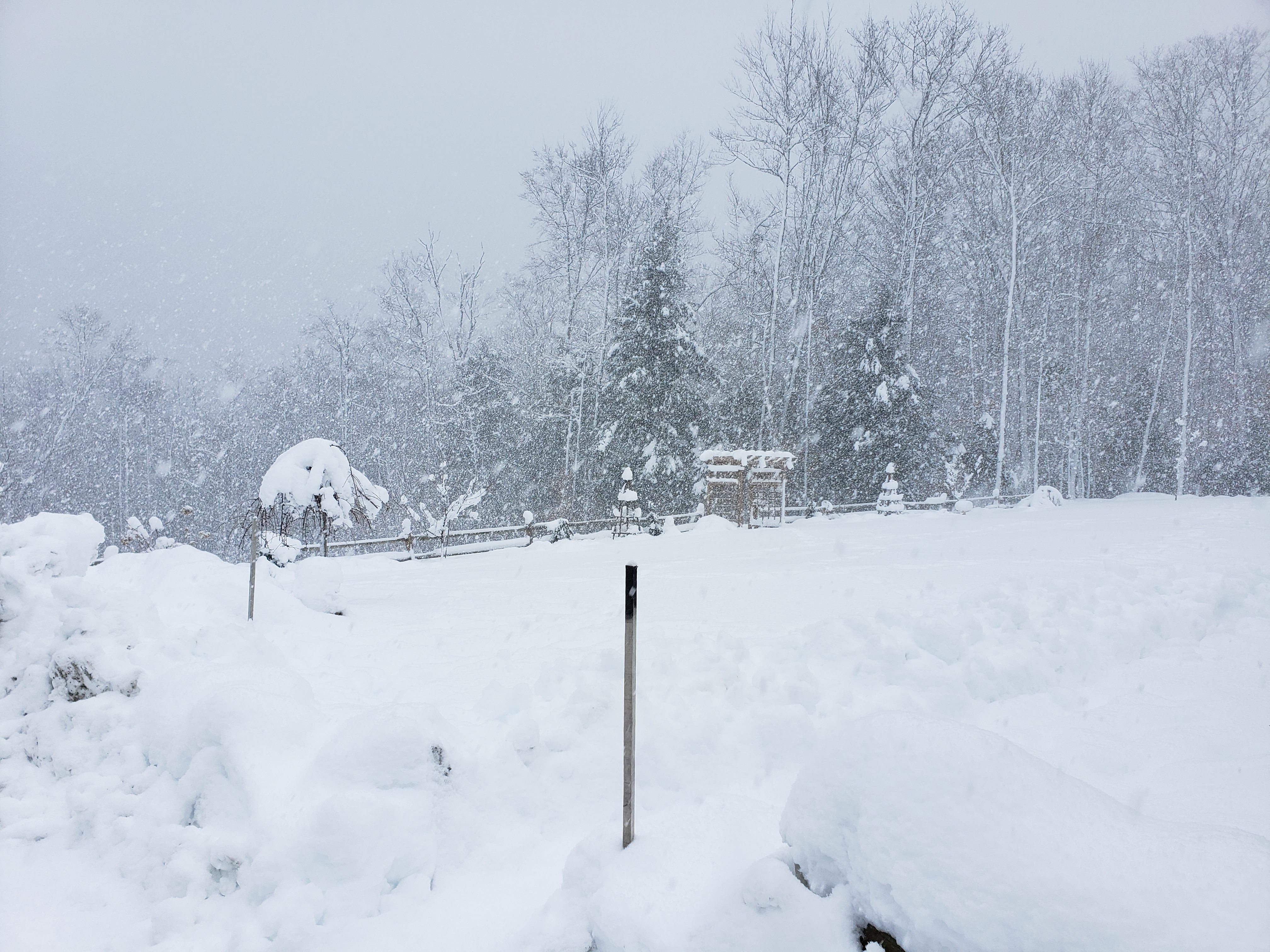
3" new today. Long lasting streamer overhead, perfect snow growth.
-
Preliminarily ... a medium impact partial Miller B, Friday
backedgeapproaching replied to Typhoon Tip's topic in New England
This was larger than normal power outage throughout SVT and CVT. Im guessing you are probably pretty isolated in the backwoods by the looks of it? They take care of us city folk first..lol. -
Preliminarily ... a medium impact partial Miller B, Friday
backedgeapproaching replied to Typhoon Tip's topic in New England
Picked up 5.2" between 8pm and 8am. 22.1" for duration with some lingering snizzle. 19.5" OTG. Got power back after only a few hours, always pretty quick it seems.
-
Preliminarily ... a medium impact partial Miller B, Friday
backedgeapproaching replied to Typhoon Tip's topic in New England
I'm out too here, ughh. -
Preliminarily ... a medium impact partial Miller B, Friday
backedgeapproaching replied to Typhoon Tip's topic in New England
Yep, about 5 mins door to door. -
Preliminarily ... a medium impact partial Miller B, Friday
backedgeapproaching replied to Typhoon Tip's topic in New England
Yeah your right, kept rebuilding when it looked to shut off. Downtown Manchester was rain to tart, but they had prob 6"ish when I was there around 4. -
Preliminarily ... a medium impact partial Miller B, Friday
backedgeapproaching replied to Typhoon Tip's topic in New England
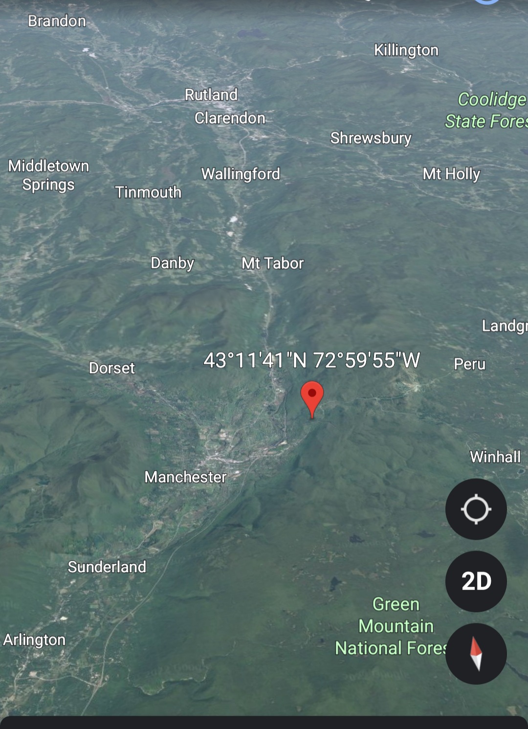
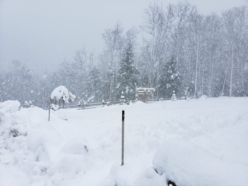
I do some, SE is worse than E and some events are different than others. Not that anyone cares, but I'm tucked in pretty close to the spine and the higher terrain, may negate some of the downsloping effect? I dont know, its weird. But I'm pushing prob 1.5" QPF, so not drying out too much..lol. Roughly where that pin is...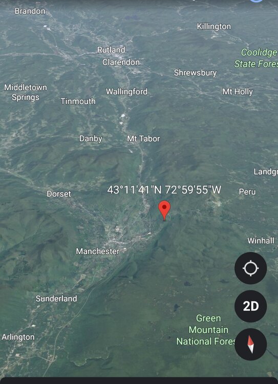
-
Preliminarily ... a medium impact partial Miller B, Friday
backedgeapproaching replied to Typhoon Tip's topic in New England
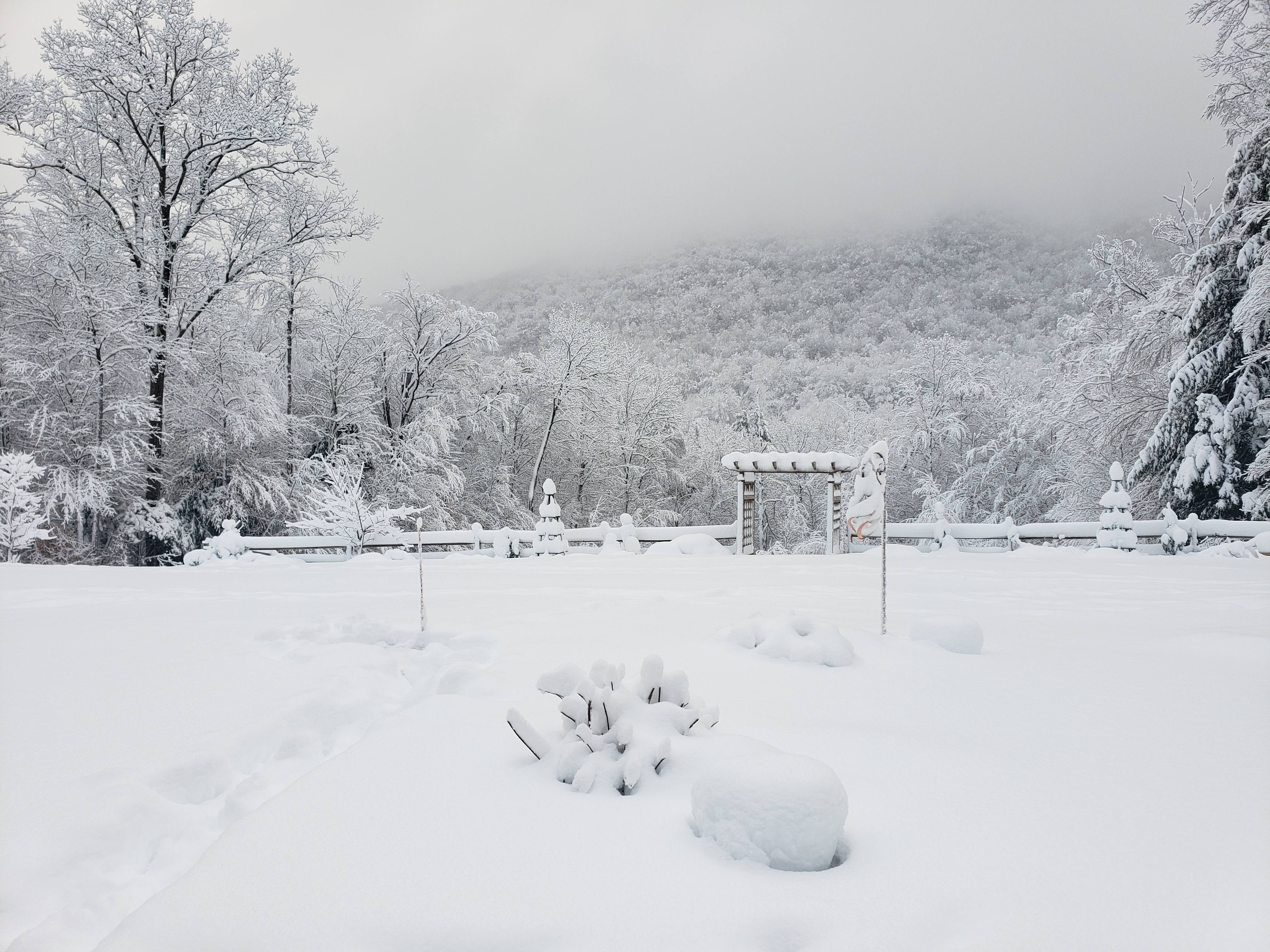
30" up high prob is within reach. Haven't had a long duration event like this in a while it feels like. -
Yea, think you had to pretty high up in the Berks to get anything substantial.
-
Preliminarily ... a medium impact partial Miller B, Friday
backedgeapproaching replied to Typhoon Tip's topic in New England
Man, what a paster here. Definitely the largest event I have seen here of the non powder variety. Super dense stuff. Been 30.3-32F all day 31.9F now. 16" with SN. -
For NH jack? Could be for sure. VT and MA already have reports of 18".
-
The Bennington of NH. I think that was probably expected there with the screaming east flow though..
-
Preliminarily ... a medium impact partial Miller B, Friday
backedgeapproaching replied to Typhoon Tip's topic in New England
Savoy spotter came in at 18.7" at 5pm. North Adams ASOS total precip is .35" of all rain. Crazy storm with downslope/elevation aspect. -
Preliminarily ... a medium impact partial Miller B, Friday
backedgeapproaching replied to Typhoon Tip's topic in New England
12.6" as of 230 on 1.18" LE. Best returns out in ENY now, so definitely lightening up some. Winds still ripping. -
12Z euro drops about another foot here. Doing a measurement at 230, but guessing about 12" so far already. Well see.
-
Yea, they are reporting light snow, but the airport is a few miles from the spine, and the downslope off that High Plateau is brutal. I mean I get it here too, but not nearly to the magnitude.
-
Poor DDH..lol
-
Preliminarily ... a medium impact partial Miller B, Friday
backedgeapproaching replied to Typhoon Tip's topic in New England
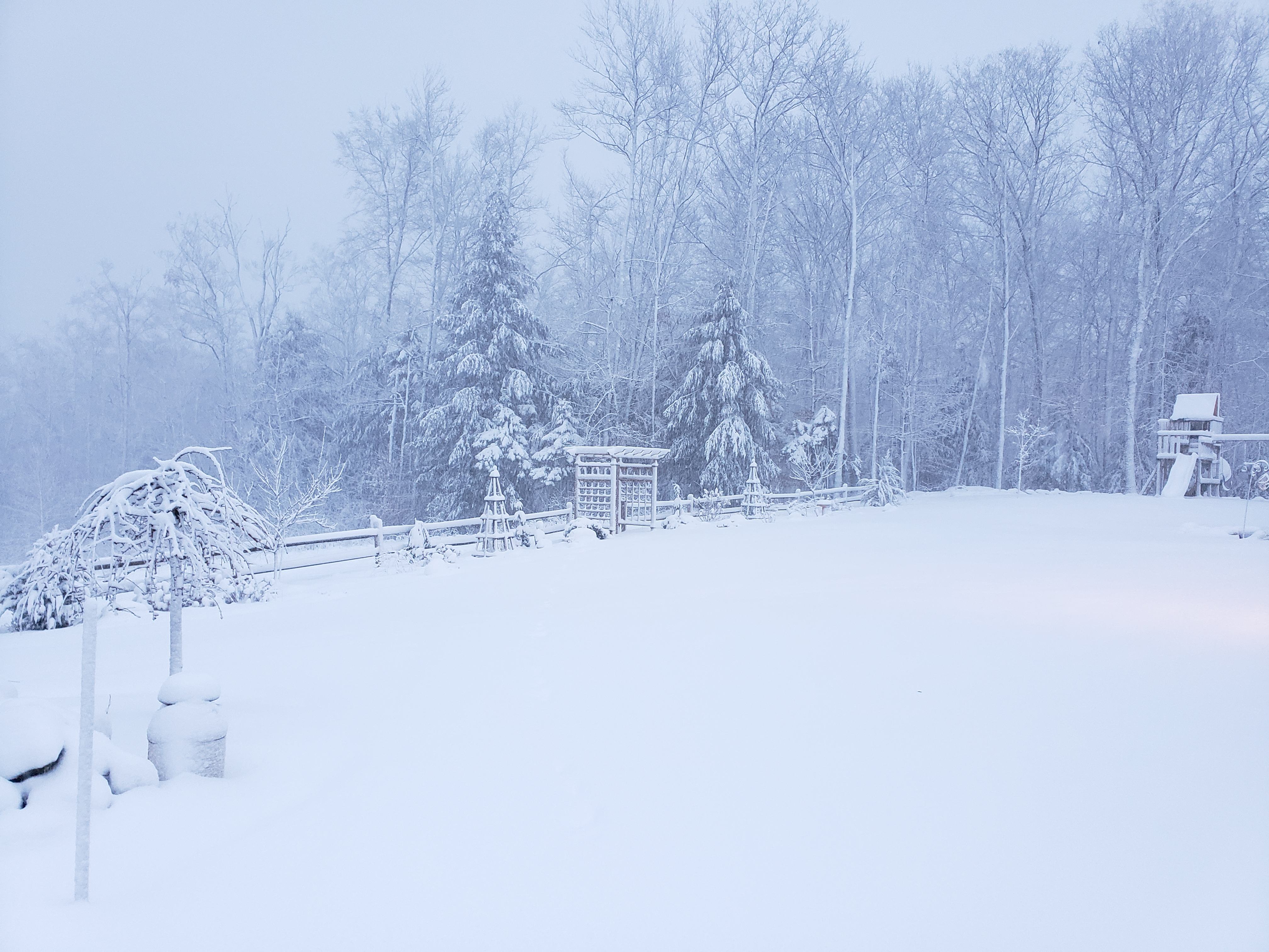
Little more than I thought from just eyeballing. 7.6" on the board. Mod SN now and 30.2F -
Yes, but my kids are not in High School yet.
-
Preliminarily ... a medium impact partial Miller B, Friday
backedgeapproaching replied to Typhoon Tip's topic in New England
4-5" here and I was at 32.5-33f for a good chunk of the overnight, Temp trickled down to 30.8F now. Would guess the bodies have little more.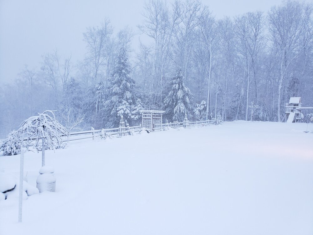
-
My kids school closes ALOT it seems over the past 5-6 years. Its a pretty large area kids come from for the school, not to mention they are tied into Bennington and Rutland as well.
-
Preliminarily ... a medium impact partial Miller B, Friday
backedgeapproaching replied to Typhoon Tip's topic in New England
Actually getting some good flakes on that low lvl easterly flow here at my spot on the western slopes. Coating down, but still at 33.1F. -
Pretty cool graphics from BTV. Haven't seen this before.