

Silas Lang
-
Posts
696 -
Joined
-
Last visited
Content Type
Profiles
Blogs
Forums
American Weather
Media Demo
Store
Gallery
Posts posted by Silas Lang
-
-
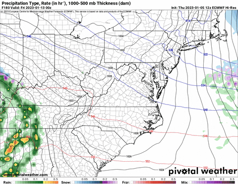
Looks like some big overrunning potential still showing up on the GFS.
-
 2
2
-
-
2 hours ago, Holston_River_Rambler said:
After the GFS's lascivious indulgence yesterday at 12z, the sinner repents and gives us our favorite February pattern!

I know it is only one run, but if the trough dumps out west and fights the SE ridge, we may end up on the boundary.
That is a very realistic and possible progression.
Ah, forget about snow days, schools will be getting some flood days instead. Reminds me of February a few years ago, forget which one, but it was rain, rain, rain.
-
1
-
-
The 6z GFS has the storm from the 18z (Jan 29), just a bit further east. It was gone on the 0z run. Another period to watch.
-
2
-
-
4 minutes ago, Holston_River_Rambler said:
Nice happy hour GFS run for the ever popular day 10 window.
Real nice look. Great storm track with the classic low on the gulf coast to atlantic coast track.
-
2
-
-
Hopefully the cold pattern materializes and actually happens. I swear, outside of 5 days, the models show a different solution everytime. Maybe that's a sign they are struggling with an upcoming pattern change?
-
1
-
-
Had a nice snow burst earlier when I was outside in the jacuzzi, living the dream with a nice beverage in hand.
Still snowing lightly, but looks to be winding down. Not much, but will probably end this with a solid dusting. Hey, that's pretty great for the central valley in a NWF event. I can't complain as that's an over performer considering the situation.
Any reports from Johnson City? That was the best location I have lived in for these types of events. Seems like we could squeeze out an inch, which is feasting for NWF in the valley.
-
1
-
-
3 hours ago, TellicoWx said:
Something noticed on the models last few runs, (outside the Cherohala Skyway, Monroe Co usually doesn't do well in NW flow events..so haven't been following that closely). The Euro/Canadian/RGEM usually pick up on the elevation change fairly well and don't show much for Tellico/Sweetwater/Athens area, but this event they have the 1" line creeping into those areas. Highly unusual, and something to keep an eye on. If they are picking up on something, may be a surprise bust high in the central valley even.
It looks like the RGEM is picking up the "streamers" a bit better than the NAM, which shows no real evidence of them on the snow maps. Now, even if the RGEM is correct on some streamers bursting through the valley, where they set up is anyone's guess. Places could get blanked, while others could get a dusting to an inch. These things are very hard to predict.
NAM seems convinced this is a typical elevation event.
-
Wow, a tornado warning has been issued for Jefferson County. Stay safe, folks. Pretty intense storms so far.
-
5
-
-
6 hours ago, Holston_River_Rambler said:

I don't know how much this plays a part, but it seems pretty common to get a storm on MLK day weekend. We had snow on the ground last year at this time.
-
2
-
-
1 hour ago, PowellVolz said:
Some roads in Knoxville are still covered. This is a road going to Ft City Elem. It’s not exactly off the beaten path.

Yup. I just took the dog for a walk at Adair Park and ran into a few back roads that looked the same. We got up to the 47 here yesterday with sun and still have a lot of snow in spots. I guess this is the result of having the ground so cold. Pretty impressive as this snow was pretty light and fluffy. I expected it to melt quickly.
-
2
-
-
1 minute ago, Runman292 said:
I wish I would have stayed in Oak Ridge, but I had to go to my family's place to celebrate Christmas and miss out on the snow (I would have thought I would be in a good spot for a clipper in Campbell County, but not the case this time). I'm glad everyone else got to see some snow.
Good lord, this is even more concerning. I would have expected at least 50% more that way. Seriously, what's going on?
-
2
-
-
Can someone smarter than me please explain why we have so much snow in the valley? Trying to understand what's at work here.
-
1
-
-
1 hour ago, PowellVolz said:
Been at my in laws in Luttrell installing a ductless A/C Heat unit and just got home. Roads wasn’t that bad until I got close to my house in Halls. It went from a dusting to 1.5” in a few miles. Emory Rd is a disaster. I legit had to put my Wranger in 4 wheel drive to get into my subdivision. Looks like this is going to continue for a while. Another burst is about to move into N Knox Co.
.Yeah, roads are bad. Even well travelled Clinton Highway and Merchants were bad an hour ago.
-
3
-
-
Got over an inch here in Knox. Still coming down. Most impressive clipper in years that I can remember.
-
4
-
-
Yup. Already have a thick dusting here in Knoxville. lol of course the clipper brings more snow than the big historic front. Further proof that big storms and events are not as good as little ones most of the time in the valley.
-
2
-
-
Pretty interesting evolution on the NAM. Don't think I have seen a clipper redevelop in the valley before. Plateau usually kills it for us.
-
5
-
-
4 hours ago, PowellVolz said:
It’s wild… I’ve made it up to 18 and you can legit tell it’s warmer today
.Yeah, today was nice in comparison to yesterday. Cold, but manageable with the sun.
-
1
-
-
Woke up to some light powder on the deck and some very light, fine flakes flying around.
Low was 3 last night. The temp has already tripled to 9! lol
-
3
-
-
Tomorrow is going to feel warm compared to today. Brutal cold. High of 9 here.
-
2
-
-
Radar not looking too hot now. Still wondering about that low level moisture. Any observations? Is it snowing in places where nothing is showing on radar?
-
I know we are pretty much in a now casting scenario, but the NAM looked better for everyone. Last 3 runs.

-
7
-
 1
1
-
-
Looks like the front is moving a tick faster on modeling. For example, the HRRR now has Knoxville below freezing at 12 instead of 1. I think that's been the trend everywhere?
-
3
-
-
25 minutes ago, TellicoWx said:
Also have to take into account the downsloping off the plateau. For east Tennessee area, the only places i look to have anything of possible significance is the plateau and east of Hwy 411 toward the foothills/mountains.
That's my guess. Downsloping. Seems pretty consistent with topography. Counties directly bordering the plateau to the east get the worst shaft.
-
1
-
 1
1
-
-
Looks like the cold air is a lot slower to get here on the RGEM as well.

February 2023 Medium/Long Range Pattern Discussion Thread.....Torch or Tundra???
in Tennessee Valley
Posted
Big GFS run for TN.