
bwt3650
-
Posts
1,570 -
Joined
-
Last visited
Content Type
Profiles
Blogs
Forums
American Weather
Media Demo
Store
Gallery
Posts posted by bwt3650
-
-
1 hour ago, PhineasC said:
LOL this thread is dead. Been a pretty slow couple of weeks since the early Feb storm. Hope we at least get back into a bread and butter pattern soon. Next week shows a pretty lengthy spell of light upslope stuff, at least.
dead beats melting, tho.
-
1 hour ago, alex said:
This last storm, while it may have added significant density to the pack, has really changed the conditions on the mountain. Anything not groomed today was just outright awful - essentially cement. We definitely need some pow.
On a funny note, the deck in front of my dining room window is unshoveled and my dog can now walk on the snowpack without sinking in, so when she goes by the window she looks the size of a horse lol.
Jay survived this pretty well, but it was a classic thaw/hard freeze for southern Vermont/Catskills. The Mt. Snows, Magics and Hunters of the world look pretty un-skiable right now. Killington looks like they are reopening the 25 or so trails they closed yesterday for tmrw, so maybe thats the cutoff in Vt, but for anything south of there, Thurs night/Friday isn't going to fix this. Hopefully, Monday comes through. I would think the northern greens/whites recover fairly quickly with what looks like several decent bread and butter shots over the next week or so.
-
23 minutes ago, MRVexpat said:
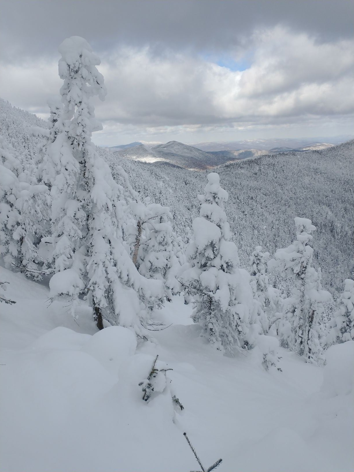
Spent 4 days skiing Jay and touring the surrounding area last week. Pretty incredible snow given the complete lack of thaws the past month or so. Definitely had that bottomless feel that you crave. First time skiing Big Jay from the top as well. That and the Mansfield chin are truly the definition of "steep and deep" in the region.

Been a great stretch...no liquid or thaw/freeze has kept it fresh and any crust out of it. Def flirting with the end of the streak tmrw, but should recover quick with the famous J-spin upslope insurance policy later in the week after the Friday Storm. No Snorkel storms, but just good quality, consistent skiing.
I haven't made it to big jay, but it's on my list (need someone experienced who knows it)…did you go up from the 242 parking lot or from that spot off Northway?
-
11 minutes ago, powderfreak said:
Skiing in sleet can be painful but everyone has face masks, ha. Skiing on sleet is wonderful. It’s so smooth. Freezing rain though and the situation changes quickly.
Hopefully sleet and not a ton of freezing rain...any liquid is going to make weds pretty bad with that quick, hard freeze after the precip shuts off. Southern Vermont resorts might be in trouble. Better hope thurs refreshes.
-
3 hours ago, powderfreak said:
Snowy two weeks on the EPS.

Shifting toward later season climo...reason why March is the best New England ski month of the winter.
-
 1
1
-
-
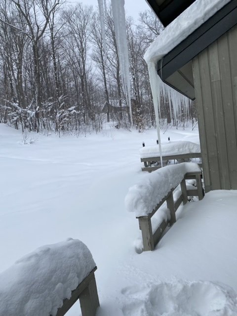
No gutters here..if that one on the corner was at any height, it could be a dagger straight through the heart of anyone underneath.
-
2
-
-
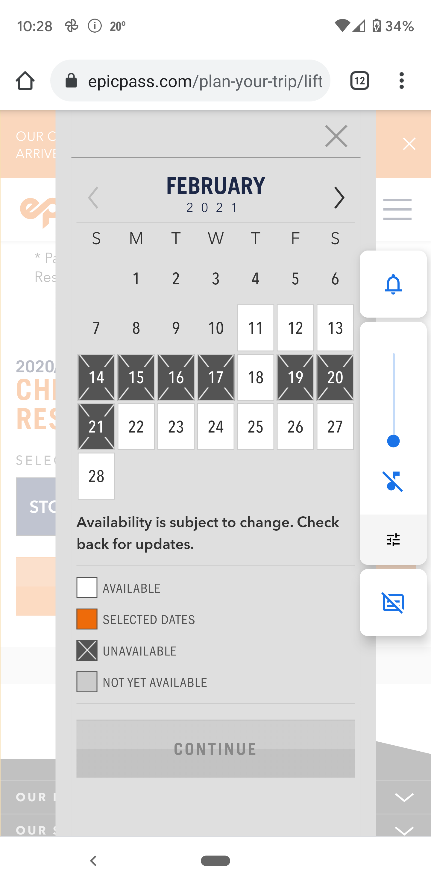
15 minutes ago, dmconno said:
It's amazing to see how every other Vail resort mountain on the East coast has availability except for Stowe which right now only has Thursday available to reserve next week.@powderfreak. Definitely the crown jewel of Northeast ski areas.
Peak ski week, limited capacity and best conditions in a couple years. Not surprising...hunter is similar.
-
1 hour ago, CoastalWx said:
PF takes some of the most diligent reports and we know we can rely on him. But Jay Peak?
 I haven’t seen their recent reports much over the last few years, but I know people who went up there several years ago and were basically like WTF are they talking about when it comes to measurements.
Having spent a good chunk of winter up here this year, I haven’t seen any crazy exaggerations. I’m not saying it doesn’t happen at all, but most days when I check the conditions report, they are pretty close to what I’m walking out to and I’m at 1850’. They do report broader ranges and as I’ve mentioned, if you always use the higher number “we picked up 3-5 on the hill today” and adding the 5 up all winter, I could see that skewing it a little, but I’ve never woken up to 2 and the report says 6. Those woods are deep right now.
Pf is as accurate as they get, so I’m sure it’s not the same here. Post mlk, it really has snowed almost non-stop. Maybe one year I can be up here a full winter and really accurately document and see how off they are.
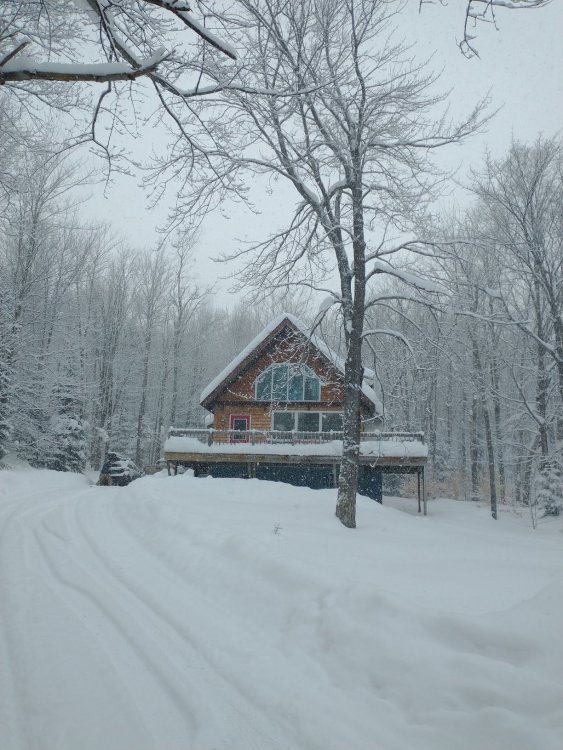
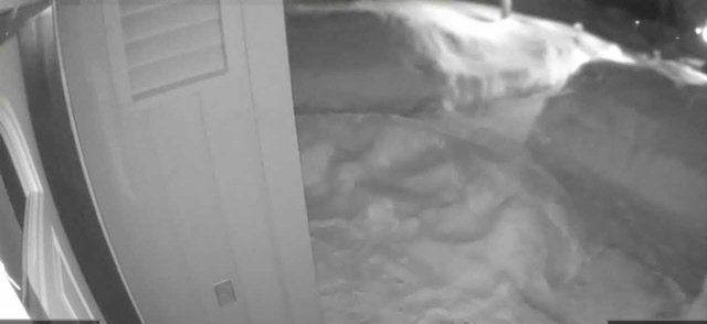
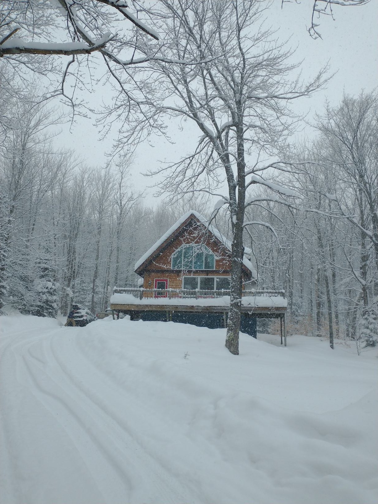
Tough to tell in the picture, but that’s outside my front door currently and while that’s where they cleared the sidewalk, you can still tell the overall depth is probably over three feet.
-
17 minutes ago, powderfreak said:
See this is true but also not. For my location east of the Spine, I need to look at the 2.5 degree scan for the beam to see over the Spine at 4,000ft. It samples the sky at 5,500ft over my place, despite being only like 23 miles away.
Looking at the 0.5 degree scan for Phin, that samples the air at actually a slightly lower elevation at like 5,300ft despite being 67 miles from the radar site.
Where I am and where Phin is, the radar hits us at the same height overhead despite massive differences in distance from the radar dome. Anything lower than that really gets blocked by the Spine here. BTV's lower scans are useless and only look up and down the Champlain Valley.
I'm not sure why it picks it up better here but there's also significant downwind drift of that fluffy snow. Like it often looks like it's not snowing over my house as the air, but I know if the radar is showing a wall of echoes that ends just east of the mountain crest, that will hit me. Wonder if the same thing is happening up there where Phin is getting downwind drift off those mountains to his NW. That's why I get a lot of stars are out looking east but it's snowing surprisingly steadily from the west, ha.
Completely misses me at jay. I’m starting to learn how to anticipate what’s coming and the flow a little. Closest spot that it picks up is probably Richford. Not sure if it has anything to do with how isolated the snow is sometimes also. Not always, but there are times where it literally shuts off just 7-8 miles down 242.
-
1 hour ago, MRVexpat said:
Got a place just south of Jay Pass for the week, right where Big/Little Jay dump out. Looking forward to touring in the backyard and getting some midweek days in at the resort! Looks like tomorrow will bring yet another refresh to the area, otherwise what are thoughts on bread and butter related chances throughout the week?
I’ll let the others more familiar with the meteorology, flow and wind pattern this week comment, but I will say that tues and weds look good for powder refills and right now, the woods are so deep that they don’t even really need much more than that when you will be there. People are starting to pick up on how well the northern greens are skiing so maybe it will start to get a little more crowded, but mid week has been amazing and empty; zero lift lines. Everything is staying fresh. I would recommend the glades off ullrs (andres and beaver) as well as everglade right now. Also, the tram is not running weekdays, so hike up north way and Valhalla will be untouched or if you know the pump house.
-
6 minutes ago, PhineasC said:
Yep, have the lights on now watching it come down.
Radar is clear and that's usually when I am getting hammered with upslope.
GYX says: "snow showers possible in the north."
Game on.
Yep...”snow showers” have a whole new meaning up here...I’m used to that phrase for passing flurries; now, it means light it up, upslope is coming. I’ll take snow showers for days.
-
17 minutes ago, PhineasC said:
Heaviest here seems to always happen at night when everyone is asleep. Every time.
Kind of cool, tho. Going to sleep watching the flood lights and wake up to 4-6 of fresh powder.
-
51 minutes ago, alex said:
Really good snow here too now. I mean, not Jersey good, but good
")
I mean, let’s put Jersey winter in perspective..nice to see a good streak back home, but I think I’ll keep the place in jay.
-
4 minutes ago, J.Spin said:
Don’t most sites in NNE at elevation have snowpack depths of 30”+ at this point? From the map, it looks like some sites in that area might be in the 20”+ range, but not 30”+ unless they really got hit hard with another storm today.
Def over 30 up here.
-
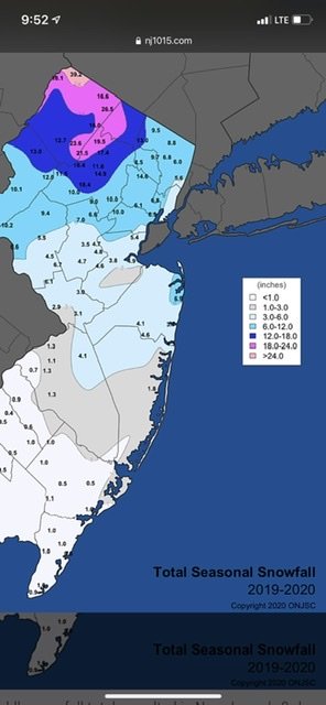
I have about 28” in NJ...what’s uncommon this year is the snow on snow pattern setting up, not necessarily the depth at one single moment. It’s great to see down there as it’s been a couple years since there has been a real snow pack mid winter feel, but it still can’t compare to northern vermont. Overall winter retention is completely different. It’s great for the local ski areas tho, who some seasons ski on completely man made garbage most of the year. Even hunter opened all of hunter west for the first time in a few years..
I agree...I root for snow anywhere. I live seeing places that miss for a while score big, especially knowing the averages will come through up north.
-
4 minutes ago, alex said:
Can’t get over how nice the glades are. And it’s snowing quite nicely! My kids are having a blast on the T bar. I much prefer the gondola lol

That looks like a nice open glade to learn in!
-
44 minutes ago, powderfreak said:
It's about climo time of year for the furthest south of the baroclinic zone... I think we'll be snowy enough regardless to keep the snow parade going.
It's moose fart season, every little ripple brings some fluff. Keeps things looking great. We were out at Ranch Camp last night here in Stowe Village and I couldn't believe how much it looked like scenes from western ski trips to like Park City or Colorado. Just mushroom caps of snow... even without a huge depth, the fluffer nutters just stack so nicely. If we can stay cold and keep adding 1-6" events and keep the ski town stoke vibe high.

That 12z GFS run was serviceable for sure on the whole though. Run it out, it's still a snowy 2 weeks with no chance of a rainer. Just keep throwing a little snow on top.

This is turning into a hell of a snow season for me. It seems lately I leave snow up north to drive back to snow in Jersey. And from a weather geek standpoint, two totally different type events producing results. I’ve been enjoying the daily 3-6 refreshers perfect for ski season and tracking the synoptic nor-easters for Jersey snow. A 44.1 spot in nj and 31.8+ in jay is quite the two week stretch, knowing that the globals will miss a lot of our bread and butter.
-
3 hours ago, powderfreak said:
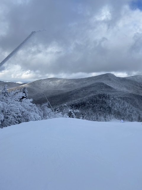
Some great turning conditions out there after 8" in 24 hours at the High Road Stake.


2" yesterday through 4pm and then another 6" overnight.


Dude, I need a photographer like you..can’t compete with these shots..great stuff.
-
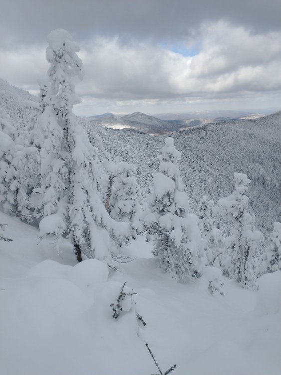
Conditions are the best they have been since the storm late last feb...powder everywhere. Very squally today; it was be puking snow for thirty minutes, then sunny, then foggy, then snowing again. But the woods were deep no matter what. We picked up about 4 last night and another 2-3 during the day. Really enjoyable skiing the past couple days despite imperfect weather.
-
2
-
-
I’m probably about the same...it is steady right now, but lightened up a bit.
-
44 minutes ago, powderfreak said:
@bwt3650 and Jay is going to get crushed. They are going to time this with the beginning of a long fetch WSW flow band off Lake Ontario. I feel pretty good about that area near/on the International border getting crushed next 24 hours.
Really picking up now..those echos look like they are heading straight up from just east of btv. Think it could turn into a flood light staring night and a powder morning.
-
1 hour ago, powderfreak said:
Red Sled and Major Jones that feed into Tres Amigos... a personal favorite. There are some secret spots tucked in there that photograph well, ha.
Yeah, it was good stuff...national was fun too; giant soft bumps. Went to spruce early and got off sensation to what seemed like hurricane force winds and thought the day was going to suck, but turned out to be pretty solid. I def need to explore those woods more next time.
-
23 minutes ago, J.Spin said:
Yeah, I see that moisture approaching on the radar, and flakes have started falling here at the house.

Picked up about 2 here today and just started snowing steadily again. Radar looks good for some decent burst heading up this way.
-
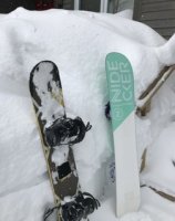
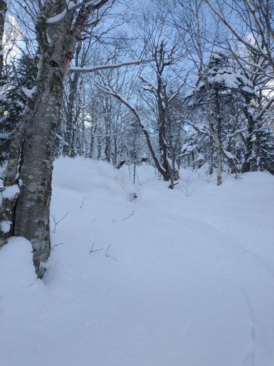
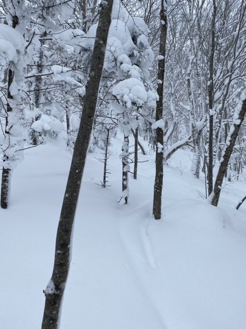
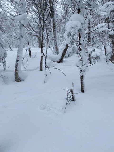
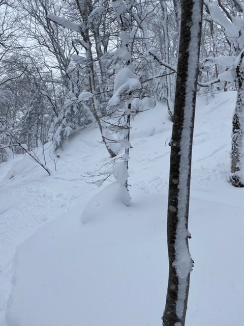
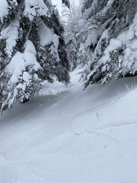
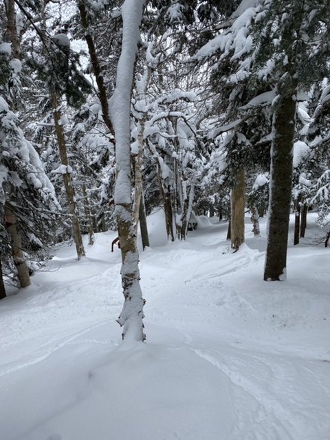
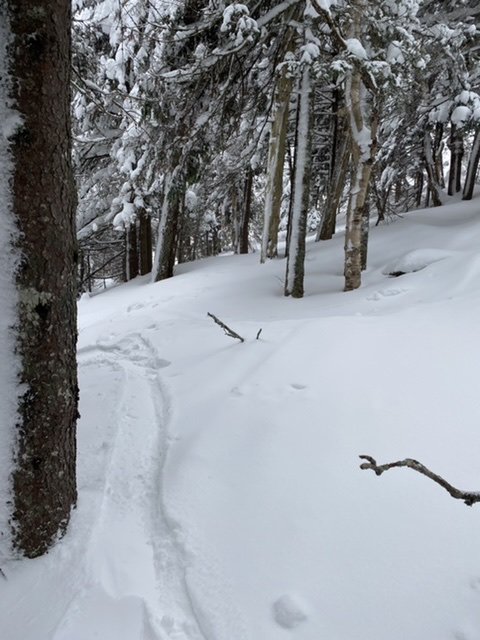
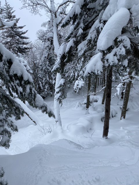
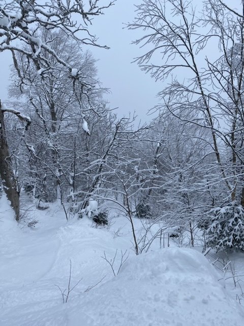
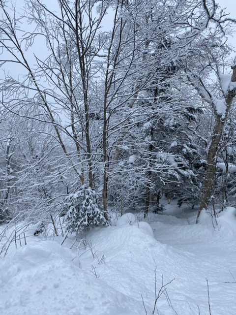
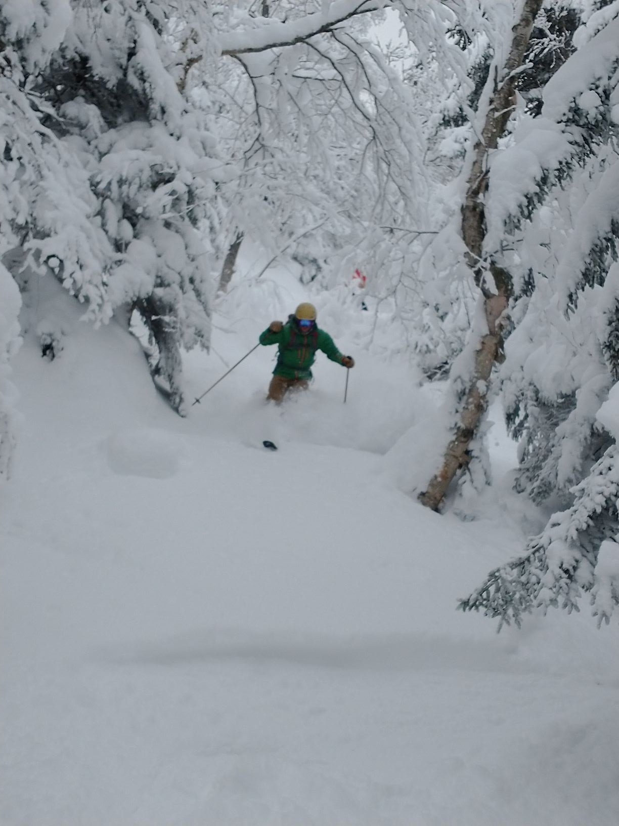
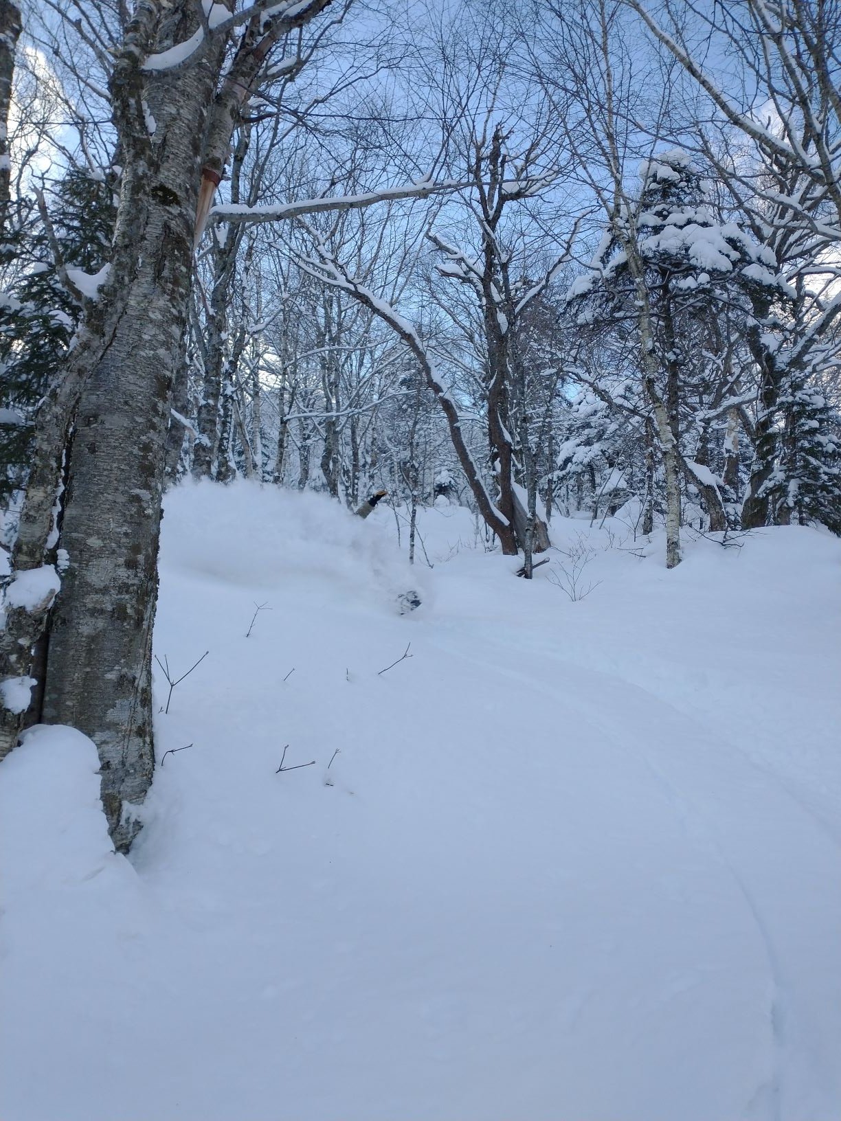
Getting lost in the woods today in pf land.
Woods were deep and some barely touched stashes. Foggy up top but overall, great day. Not really sure where this was but i ducked in somewhere off of upper hayride. Tight up top but, opened up somewhat.
-
1
-


February the climo snow month
in New England
Posted
What sticks out about this winter in Jersey is the pack and lack of torchy days. Jersey has had snow on the ground all month and probably will into early March. That’s a long streak for the climo. While it hasn’t been record cold, there haven’t been any 55-60 degree days either, which easily happen most winters. With the exception of the the rainer the other day, lots of low 30s for highs and low teens for lows, which is perfect for a wintery feel.
Up at jay, nothing memorable for that climate; maybe even a little low on the snow, but consistent, with no torch or washouts since the grinch. Maine looks like the area that has really been shafted this year.