jjwxman
-
Posts
343 -
Joined
-
Last visited
Content Type
Profiles
Blogs
Forums
American Weather
Media Demo
Store
Gallery
Everything posted by jjwxman
-
The December to Remember 7th-8th blue turd winter threat thread.
jjwxman replied to lilj4425's topic in Southeastern States
You've been NAM'd -
The December to Remember 7th-8th blue turd winter threat thread.
jjwxman replied to lilj4425's topic in Southeastern States
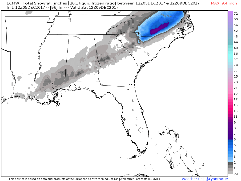
The 12z Euro snow accumulations:
-
The December to Remember 7th-8th blue turd winter threat thread.
jjwxman replied to lilj4425's topic in Southeastern States
Looks good for the Triad/Foothills.