Pennfisherman
-
Posts
51 -
Joined
-
Last visited
Content Type
Profiles
Blogs
Forums
American Weather
Media Demo
Store
Gallery
Everything posted by Pennfisherman
-
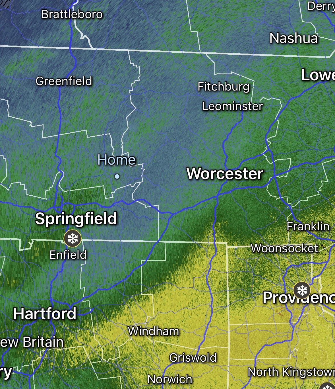
So do we just dry slot now for hours till that final wave pushes through?
-
Very helpful. Thank you
-
Is there somewhere on AmericanWX or somewhere online to learn how to read these? I see them all the time and have no idea how to break them down.
-
33 and rain here
-
"Don’t do it" 2026 Blizzard obs, updates and pictures.
Pennfisherman replied to Ginx snewx's topic in New England
Even with relatively bad radar returns, its been heavy snow for hours here. 8" so far and coming down hard. I could only imagine what's going on down in RI. -
"Don’t do it" 2026 Blizzard obs, updates and pictures.
Pennfisherman replied to Ginx snewx's topic in New England
Just a quick 4-9” over then next few hours! Wild -
"Don’t do it" 2026 Blizzard obs, updates and pictures.
Pennfisherman replied to Ginx snewx's topic in New England
Pretty underwhelming up here so far, I’m envious of you guys down south/east. Im hoping this band can make it to me.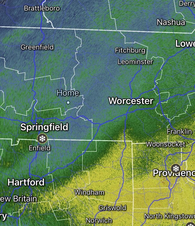
-
“Cory’s in NYC! Let’s HECS!” Feb. 22-24 Disco
Pennfisherman replied to TheSnowman's topic in New England
Is there a link? -
“Cory’s in NYC! Let’s HECS!” Feb. 22-24 Disco
Pennfisherman replied to TheSnowman's topic in New England
So soon! It’s amazing the trend this took. -
“Cory’s in NYC! Let’s HECS!” Feb. 22-24 Disco
Pennfisherman replied to TheSnowman's topic in New England
What’s a general start time for this? Tomorrow evening? -
“Cory’s in NYC! Let’s HECS!” Feb. 22-24 Disco
Pennfisherman replied to TheSnowman's topic in New England
These include .1-.3 from tonight’s event. -
“Cory’s in NYC! Let’s HECS!” Feb. 22-24 Disco
Pennfisherman replied to TheSnowman's topic in New England
A few days back you said something along the lines of “give this a day and this thread will look like Juno” I did the haha emoji. You nailed it, nice work! -
Looks like radar is building in nicely over NY. Might pick up a few more inches if it holds together
-
“Cory’s in NYC! Let’s HECS!” Feb. 22-24 Disco
Pennfisherman replied to TheSnowman's topic in New England
This is including todays/tonight's snow right? pretty misleading for northern areas. -
When does this start tomorrow? Before noon?
-
“Cory’s in NYC! Let’s HECS!” Feb. 22-24 Disco
Pennfisherman replied to TheSnowman's topic in New England
As big of a shift as it was, looks like we need another 50-100 mile shift NW for anyone in outside of i95 -
What’s the deal with Wednesdays system? Looks like most models have snow line at the MA/NH boarder except the GFS which practically brings snow to the CT coast.
-
Radar looks insane, do we really still have 8-15+ hours of this?
-
4.25” mod/heavy snow 8°
-
Approaching 1” in Belchertown. Heavy band moving in shortly
-
5°, snow started about 30 minutes ago. Dusting
-
“Cory’s in LA! Let’s MECS!” Jan. 24-26 Disco
Pennfisherman replied to TheSnowman's topic in New England
I grew up on Long Island and we rarely saw rates higher than 10:1. This was because we were surrounded by water and were always in the razors edge for mixing. I am in central mass now, and keep reading things about high ratios… 12:1 and 15:1. How common is that up here and how likely is that with this storm? -
“Cory’s in LA! Let’s MECS!” Jan. 24-26 Disco
Pennfisherman replied to TheSnowman's topic in New England
Impressive. Does this use 10:1 or is this taking all models with all ratios into account. -
January 2026 regional war/obs/disco thread
Pennfisherman replied to Baroclinic Zone's topic in New England
There are probably 10 people itching to be the one to make the thread! Hold off! -
January 2026 regional war/obs/disco thread
Pennfisherman replied to Baroclinic Zone's topic in New England
Snow starting to mix in here. 32.1 degrees. Icy mess