
CAPE
-
Posts
34,276 -
Joined
-
Last visited
Content Type
Profiles
Blogs
Forums
American Weather
Media Demo
Store
Gallery
Posts posted by CAPE
-
-
4 minutes ago, WxWatcher007 said:
WHY IS AGHOLOR ON THE HANDS TEAM

Why is Agholor on the team? So mediocre. OBJ is clearly done. Ravens need to get another receiver.
-
 1
1
-
-
Imagine betting on the Ravens to cover the spread, and watching that mess at the end.
-
Just now, WxUSAF said:
Good thing there’s no style points in the NFL. We’ll take the win.
I hate this team lol. Just so ugly.
-
Nice answer by the offense.
-
1
-
-
Just now, WxUSAF said:
They always play to the level of competition…
I fully expected them to be flat. That's just what they do against teams they should crush on paper.
-
Lol Ravens. Nice way to start against an inferior opponent.

-
8 minutes ago, pazzo83 said:
lol 72/64 here in Tenley - just another humid October day
79 here, and more humid than yesterday. Looks like mid 70s tomorrow(at least early) before the cooler air starts filtering in.
-
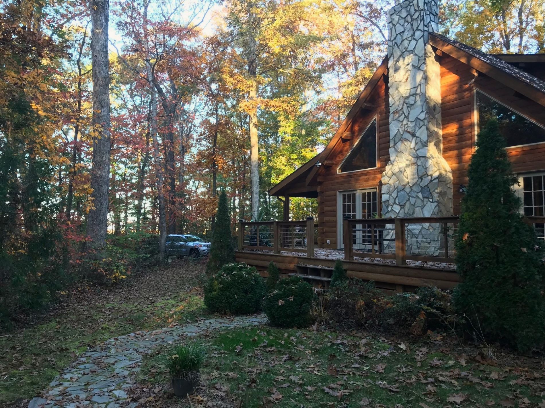
Perpetual leaf drop from some of the oak trees the last couple days, mostly the white oaks. Seems early.
-
1
-
-
Putrid outside. Worse than yesterday here. Can't wait for this hellish airmass to GTFO here.
-
1
-
-
I suppose it's time for Ji to start a digital snow thread.
-
1
-
-
26 minutes ago, jayyy said:
We take. For the love of god, please no sustained -PNA this winter
Just in general: Nina= Aleutian ridge = -PNA
Nino = Aleutian low = +PNA
Plenty of other variables/modulators though, so these teleconnections are far from locked in or static. With the overall increase in ocean heat content, this stuff becomes even harder to predict.
-
4
-
-
4 minutes ago, Eskimo Joe said:
Is that because it help build a western ridge?
There are always variations, but the short answer is yes.. it leads to a +PNA.
-
1
-
-
20 minutes ago, WxUSAF said:
WDI for *some* sort of December snowfall is pretty high. I’m hoping we can grab a 2-4” type deal at least before shorts weather for Santa.
Yeah it has been awhile, outside of a brief flizzard that some of us saw last year.
-
1 minute ago, WxUSAF said:
The only thing this Nino is guaranteed to produce is an Xmas torch. Lock it up.
Probably lol. As usual, patience will be required. Mid Jan into early March will likely be our wheelhouse, if there is to be one.
-
3
-
-
13 minutes ago, Terpeast said:
Yeah, we have a pretty good idea on this nino. I’m mostly tracking the mid lat pac and pdo
It's all about how the atmosphere responds now. This is going to be a moderate to maybe strong event by the numbers, but that doesn't mean all that much at this juncture. PDO trend is encouraging. Lets see if the Aleutian low can get established, and in a favorable location. Pretty important in order for us to get the outcome we all want.
-
1
-
-
It's finally time to stop tracking ENSO for most of us. We got us a Nino, now lets see what it can do.
-
16
-
 1
1
-
-
Not sure the lowlands see first flakes as the GFS op has been suggesting, but nice to see h5 looks like this in the near term. A month later this might be pretty interesting. As it stands, the western highlands may very well see some snow during these 2 periods.


-
10
-
-
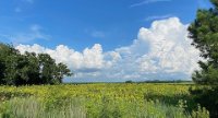
Lots of color, but not as vibrant as last Fall. Plenty of leaf blowing from now through the end of November.


-
6
-
-
High of 77 here. This is pretty gross. Looking forward to mid-late next week.
-
4
-
-
Looks like a frosty morning across the area next Thursday as the unseasonably warm weather finally abates and a series of cold fronts move through.

-
4
-
-
Need some Fall HH beer talk up in here. Who is drinking what?
Really like the DFH PA Tuxedo with the spruce notes. Very much a Fall season Pale Ale.
Drinking a Utopias barrel aged 120 min IPA atm. Complex and totally delicious. Buzzing.
-
3 minutes ago, Terpeast said:
THIS is exactly why I retain some optimism for our area and not as doom-and-gloom as many posters are.
If coastal areas can still get cold enough and foot+ blizzards, then we almost certainly can and will get these when the conditions are right - and this winter will be the best chance we have since 2016.
I agree. Been mostly bad luck for places along the fall line and just west lately wrt climo snowfall. The worm shall turn, and mostly likely it occurs in a Nino.
-
1
-
-
2 minutes ago, Terpeast said:
Yeah I really don’t agree with zip for the coast. But you know how TV mets are, they don’t really forecast for the fringes of their area.
Interestingly, that area has done very well in recent Ninas. Jan of 17 and 18( I chased both), and again multiple times in Jan of 22. Two blizzards and 2 other storms of 10" plus. Maybe Ninos generally aren't cold enough anymore for the immediate coast, outside of a +PNA/-EPO pattern with cross polar flow.
-
1
-
1
-
-
2 minutes ago, Terpeast said:
That may be the case. But all the research I've been doing so far is leading me to a similar conclusion, but I'm waiting for the new runs early November and the new MEI value. I have a feeling that there'll be a new fly in the ointment, whether for better or worse.
One coastal storm with a somewhat offshore track and some cold in place-historically pretty common in a Nino- could dump a foot or more of snow right along the coast. That 0-6" call for that area busts with a single event. Ofc that is a DC focused 'forecast', so no one would really notice or care.
-
1
-
1
-

October Banter 2023
in Mid Atlantic
Posted
Eight games in, what has OBJ shown you? Bateman has been decent, but lets see if he can stay healthy. Love Zay, but is he a number one? If they are going to make a move before the deadline, a receiver is probably near the top of the list, along with some help on the edge.