All Activity
- Past hour
-
80 today. Blowing dust west of town. There have already been several blowing dust advisories this year. Seems like more than any year in the previous 15 but I might have recency bias.
-
Get scooter on it.
-
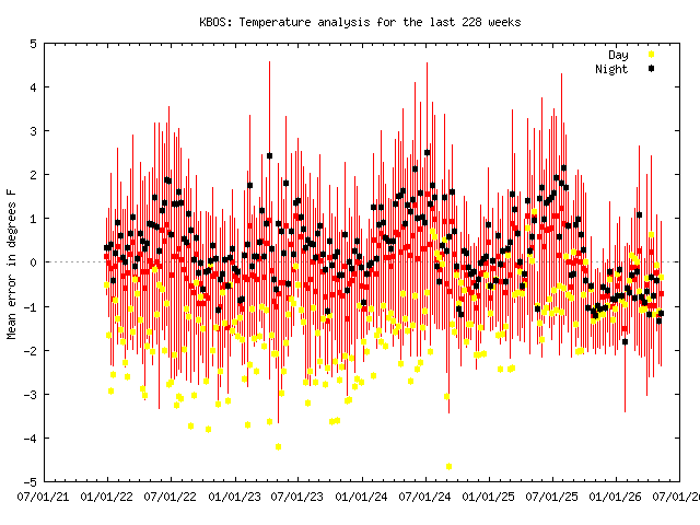
Step change at BOS last Oct/Nov? Looks like mins shot up quite a bit?
-
Wind direction?
-
How is BOS +0.7 and everyone else so much cooler?
-
Anything they can do they try and try and fail and fail again. Things no one likes to see
-
still well over a month away from "summer" arriving and they're already crashing out
-
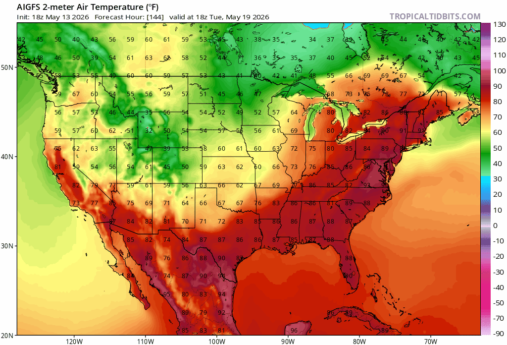
Looks like a mild to possibly semi warm holiday weekend based on guidance . Just hope to avoid showers .The reheat furnace comes Mem Day itself on into early Junorch
-
I’ll let you two speak for each other, ha. I just didn’t see any real difference between those two images so you guys are showing about the same thing IMO.
-
Bite this
-
Oh you moved to Worcester?! Congrats!
-
A few +10-15s will be more than a bite
-
What’s ORH and BDR?
-
Might want to take another look Chief.
-
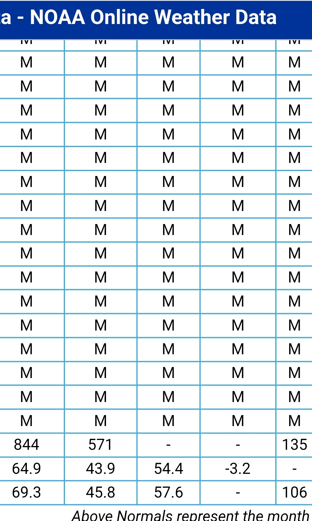
At BDL?
-
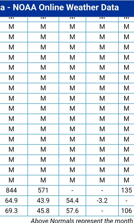
I wouldn't bet on it. BDL is only 3.2° below normal for the month. This week will take a significant bite .
-
This month is all AN to date
-
Yeah not sure why he’s forecasting cold rains like his map depicts . ACATT grasping after failed cold May
-
its going to be.. a few warm to hot days wont cut it
-
Exactly, It's from what he posted. Warm and then cool and cloudy over the weekend.
-
lets keep trending the cooler air south.. still 5 days to go
-
Sister ?
-
Didn’t they also have this month WBN?
-
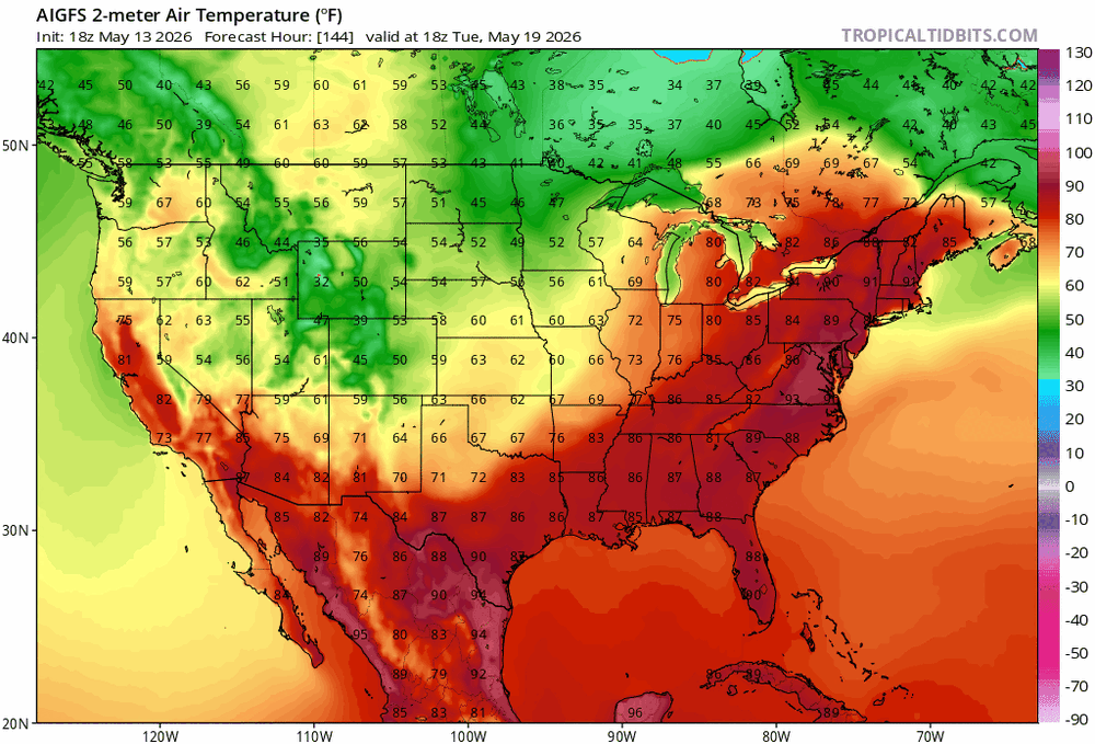
Aren’t those both showing similar things? Admittedly don’t know climo as well, but is BDL like mid-70s around then? So goes from like almost +20 to -5 or so for highs between Tuesday/Wednesday and the weekend?


.thumb.gif.f92b16c631a1d15d405ed77b33f0710d.gif)