

TellicoWx
-
Posts
2,101 -
Joined
-
Last visited
Content Type
Profiles
Blogs
Forums
American Weather
Media Demo
Store
Gallery
Posts posted by TellicoWx
-
-
Bartlett, TN has picked up an additional 1.1" in the past 30 mins. Collierville, TN..

-
 9
9
-
-
Looking at the final runs that preceded the start in Little Rock and Memphis..so far GFS has probably been the closest for both. NAM did better for Memphis..Euro has been under for both.
-
4
-
-
1 minute ago, Vol4Life said:
At this point, I don’t know how much plumes matter. Would love to see what the plumes were for Arkansas and Memphis. I bet the storm is outperforming them.
With the convective nature, not surprised...will bounce around with the uncertainty of where/if they form.
-
Just now, 1234snow said:
Does the TIMS model apply if it is in Memphis during a snowstorm?!?
Lol, TIMS got recharged here with the rain the other night. Had thunder for a couple hours with the last rain, rattled the house.
-
2
-
-
Looking at NWS Memphis weather graphic..think safe to say they missed it. Shows 1"-2"...2" reports starting to come in already, with more to fall.
-
4
-
-
Drummonds, TN (North of Memphis)

-
7
-
 2
2
-
-
-
Add Memphis to the thundersnow list
-
3
-
1
-
-
Nice uptick on the 23z HRRR for any folks just west/northwest of Nashville
-
1
-
-
Folks already giving Little Rock mets a rough time on social media lol...posting pics measuring 2"-3" saying "yep, looks like a dusting"
-
2
-
 1
1
-
-
6 minutes ago, John1122 said:
NM, I read the tweet wrong. They were launching it with heavy snow falling. The balloon didn't get heavy and fall.
Little Rock NWS tried to send a weather balloon up but its snowing so hard the snow weighted it down and it came back. The snow was sticking on pavement and all there.
Lol...I was about to say. Never heard of that before.
-
1
-
-
2 minutes ago, dwagner88 said:

This is what I am concerned about.
Something to keep an eye on
-
Southern stream dynamics starting to fire over LA....AR dynamics is being driven off the northern stream. Where these two collide is going to be intense (all signs point to the eastern valley/plateau
-
1
-
-
1 minute ago, dwagner88 said:
At this point I’m looking for the fly in the ointment. I can’t help but notice robust convection originating in the gulf around 200 miles due south of the FL/AL border. It is persistent and appears unmoving. I’m wondering what affect it will have on moisture transport later if it doesn’t clear.
Depends on the orientation between Mobile and Tallahassee...more perpendicular it is, the more it can disrupt transport. Seen the opposite as well if it is orientated NNW.
-
1
-
-
1 minute ago, McMinnWx said:
I’m hoping it dumps snow here.
All the ingredients are checked off...enough cant be said how the timing couldn't have been much more perfect (overnight) to max out potential (takes solar aspect out of it). Someone in the southern valley is in for a helluva show.
-
1
-
-
Thundersnow in downtown Little Rock
-
1
-
-
10 minutes ago, Wurbus said:
I'm going to have to get a nap in soon so I can watch this sucker overnight.
Just woke up from mine, and about joined the stroke club after looking at the 18z RGEM (it's typically very close for my area). 12" line knocking on my backdoor.
-
2
-
-
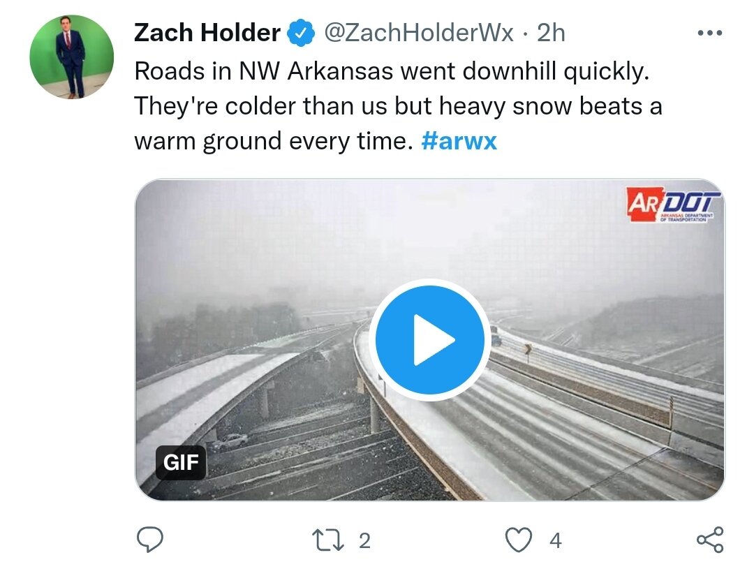
Hammering in NW AR...2"-4" reports coming in


-
9
-
1
-
-
12z GEFS ticked up..it underperformed almost as bad as the 3k in NW AR at 6z/0z

-
3
-
-
I49 in NW AR is being closed...6z GFS/HRRR seem to have had the best handle there for what it's worth. Nam 3k did very poorly.
Understatement of the year for those folks..alot of wrecks reported. Was near 70 yesterday.

-
5
-
-
Ended up getting about a 10 min shower..got a dusting in the grass. Thats actually decent for this type system.
-
1
-
-
3 minutes ago, Kasper said:
Maybe you’ll pick up some overnight, very odd for Athens to get dumped on with NW flow and Tellico nothing!
Up on Skyway and Coker Creek do ok in these, town very rarely scores
-
1
-
-
1 minute ago, Kasper said:
@TellicoWx Anything yet in Madisonville?
I'm at home in Tellico..not even a flurry lol. Sweetwater is snowing...snow on sides of the road and parking lots are white.
-
1
-
-
Lol, I can't even buy a flake today
-
3
-
2
-


March 11th-13th Winter Weather Event. Winter's last gasp?
in Tennessee Valley
Posted
That is a huge cave to the GFS...NAM did something similar correcting at last minute for Memphis area