

radarman
-
Posts
13,624 -
Joined
-
Last visited
Content Type
Profiles
Blogs
Forums
American Weather
Media Demo
Store
Gallery
Posts posted by radarman
-
-
12 minutes ago, dendrite said:
This run has sleet up to NH lol
Point and click soundings suggest that hydroclass algorithm might need some work. There might be dry air in the DGZ, but the column is cold in some of those areas, even the warm(er) layers aren't all that warm.
-
 1
1
-
-
yep, those are for nowcast time
-
2
-
-
With so much competition for windblown glop, we should be allowed to claim crystalline feathers falling straight down all to ourselves.
-
 1
1
-
-
Word to the wise... If Berkshire East gets a foot+ of light snow, don't go hard charging under the new quad. Danger is lurking. Seriously.
That said, the surfaces on the snowmaking trails has been exceptionally good considering, guns have been blasting, and the next 4 days should all be worth the trip.
-
2
-
-
16 minutes ago, CoastalWx said:
Tetris??
they probably use some kind of IDW method to smooth it, but it breaks if they're averaging in zeroes from gridcells over the ocean, so they just crop the coastline where those could factor in.
-
3
-
-
I'd go 6-10" in the Pioneer Valley. We always have our red flags and failure modes, but for the most part we've been in the middle of guidance for a while, so might as well be bullish.
-
Watches up
CTZ002>004-MAZ002>014-026-RIZ001-003-050930-
/O.NEW.KBOX.WS.A.0001.240106T2100Z-240108T0600Z/
Hartford CT-Tolland CT-Windham CT-Western Franklin MA-
Eastern Franklin MA-Northern Worcester MA-Central Middlesex MA-
Western Essex MA-Eastern Essex MA-Western Hampshire MA-
Western Hampden MA-Eastern Hampshire MA-Eastern Hampden MA-
Southern Worcester MA-Western Norfolk MA-Southeast Middlesex MA-
Northern Middlesex MA-Northwest Providence RI-Western Kent RI-
Including the cities of Hartford, Windsor Locks, Union, Vernon,
Putnam, Willimantic, Charlemont, Greenfield, Orange, Barre,
Fitchburg, Framingham, Lowell, Lawrence, Gloucester,
Chesterfield, Blandford, Amherst, Northampton, Springfield,
Milford, Worcester, Foxborough, Norwood, Cambridge, Ayer, Foster,
Smithfield, Coventry, and West Greenwich
327 PM EST Thu Jan 4 2024
...WINTER STORM WATCH IN EFFECT FROM SATURDAY AFTERNOON THROUGH
LATE SUNDAY NIGHT...
* WHAT...Heavy snow possible. Total snow accumulations of 6 to 12
inches possible. Winds could gust as high as 40 mph.
* WHERE...Portions of northern Connecticut, central, eastern,
northeastern and western Massachusetts and northern Rhode
Island.
* WHEN...From Saturday afternoon through late Sunday night.
* IMPACTS...Travel could be very difficult. Snow loading from
heavy wet snow may lead to power outages.
* ADDITIONAL DETAILS...Heaviest snow most likely north and west of
the I-95 corridor.
PRECAUTIONARY/PREPAREDNESS ACTIONS...
Monitor the latest forecasts for updates on this situation.
-
Even final totals aside, the idea of waves and waves of mid-level induced bursts with light weenie snows in between is very appealing right now. Something to be embraced after the stretch we've had.
-
3
-
-
nammy starting to pick up on Kev's snow for tomorrow predawn?
-
1
-
-
We were 19 this AM, meanwhile the east slope is low 30s.
Gorgeous sunrise
-
I like that at the surface we have almost a SWFE event like retreating HP situation that might provide some resistance, lest that jet ushers things away too fast. All the same, I'm expecting a fairly quick hitter.
-
Start snowing Saturday evening out here, sun by first chair?
-
17 minutes ago, CT Rain said:
Might as well just stay in Dallas, right?
I'm flying into DFW on Sunday.
April is an awesome time to be there that's for sure.
-
The sun was a very welcome sight this afternoon. Quite pleasant out, finally.
-
1
-
-
3 minutes ago, CoastalWx said:
Gfs was close but not biting. We watch.
1 minute ago, CoastalWx said:Gfs wasn’t bad looking on the 8th either at this stage.
coastal areas favored, but agree on both. Things are looking up IMO. Folks need to let these last few passing showers wash them clean of 2023.
-
Just booked to Springfield OH and will proceed N from there.
Texas would be better but good luck to anyone trying to drive out to totality from the metroplex. That's gonna be a sh*tshow to say the least.
-
until the 300+ hr op gfs prints out a bomb, the pattern change isn't happening
-
2
-
 1
1
-
 1
1
-
-
11 minutes ago, DJln491 said:
Euro didn’t bite
7 minutes ago, NW_of_GYX said:It just doesn't snow in SNE anymore. Clown map yes, SNE snow weenies bridge jumping also yes.
The sooner SNE folks toss December and embrace AOB temps to kick off Jan... ignore clown maps and track the possible developing -EPO ridge with signs of split flow and an STJ... the better for all.
-
1
-
-
Dec 2015 was the second warmest on record at INL (soon to be 3rd). Also featured well BN snows. Figure some additional amount of climate warming, plus the (solar max related?) AO spike the last 2+ weeks, with a particularly hostile pacific and here we are. Certainly smashing a record by that much is noteworthy, but the cards appeared to be stacked against them from the get go this December.
-
I swear it isn't a matter of schadenfreude when I say that should the skiing out west be lackluster this year, after the true epicosity that was last year, I can't get too worked up about it.
That said I was happy to see powder alert emails showing up in my mailbox yesterday from Sugar Bowl.
-
1
-
-
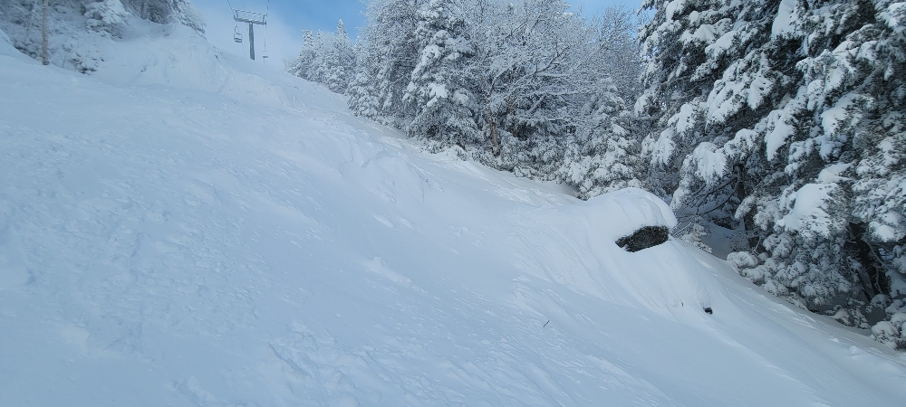
Berkshire East is open today and probably skiing pretty good on limited terrain. You give these places 36-48 hours to blast the guns and the surfaces improve immensely. With climo rapidly improving, even marginally BN nights and dry days will make for rapid expansion in the 1st week of Jan. Skiers were treated to a high end December up north, now we move onto carving and winter conditions.
-
1
-
-
Post rainstorm pattern as depicted looks ideal for pond ice formation. Shades of similarly snowless early Jan 2015.
Edit- referring to the ice and the timing, not the pattern.
-
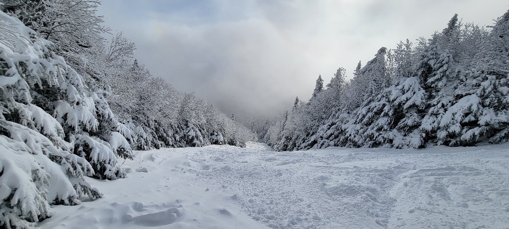
4 hours ago, powderfreak said:
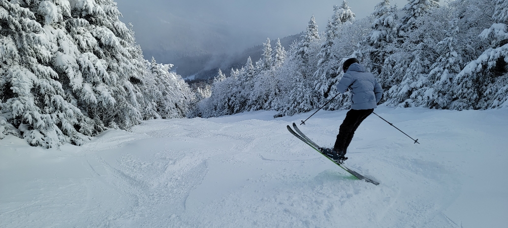
The scenes in general don’t really get any better in New England for winter vibes.
Agree. Times like these the skiing almost becomes secondary and the main attraction is just being there wandering around.
-
5
-
-
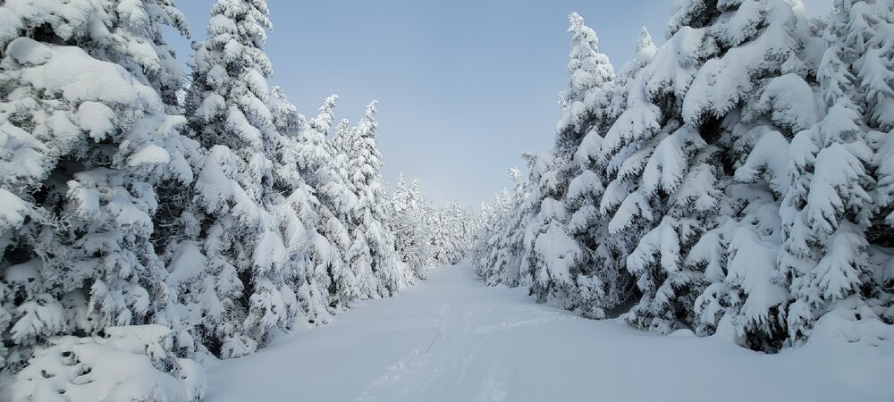
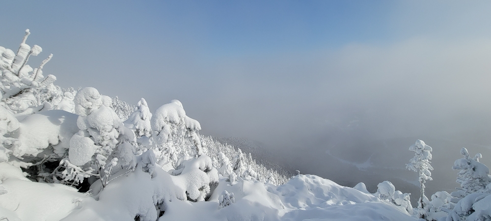
Love kicking off the season getting straight into the good stuff.
-
9
-

Monitoring first regional significant winter impact event. Magnitude likely tempered. At this time NE PA/SE NY and SNE primarily. Jan 7/8.
in New England
Posted
we shuffle?