Disco-lemonade
-
Posts
317 -
Joined
-
Last visited
Content Type
Profiles
Blogs
Forums
American Weather
Media Demo
Store
Gallery
Everything posted by Disco-lemonade
-
-
yea sorry crashed right when i posted try this one http://surfchex.com/cams/carolina-beach-web-cam/ hopefully the oceanic's cam will be back on soon
-
Water level at wrightesville beach is getting higher, waves are looking pretty robust. http://surfchex.com/
-
This may be the nuttiest gfs run I have ever seen
-
Yea this is bad, and it's not like usual where we get a sheared out destabilized mess. This is something extraordinary
-
Please refer to the NHC forecast track cone
-
You're right I've been so concerned about ILM that I haven't really given much consideration to MBY...
-
Agreed I'm down there every other week, so many great friends in the path of this, has me very worried.
-
My concern is if this hits cat 4 people aren't going to know what to expect.
-
I'll tell you, remember hurricane mathew a few years back? I was living in wilminton at the time, only a cat 1 (first hurricane I'd experienced), but when you see long leaf pines bending in ways they shouldnt over someones house, knowing they could snap at any moment will scare the bajeebus outta you. And the noise of it all I'll never forget... Then driving back through lumberton the amount of tree damage was surprising for how far in land they were. Straight line winds can maximize gust potential very quickly.
-
I agree, Florence may be the sum of all fears... I don't understand those dudes up in maryland rooting for it to go up the Chesapeake, makes me wonder, do they even get it?
-
Here, go ahead and see what kind of storm surge could be expected from a cat 2 on the outer banks and surrounding locations. http://noaa.maps.arcgis.com/apps/MapSeries/index.html?appid=d9ed7904dbec441a9c4dd7b277935fad&entry=1
-
Southeast Sanitarium - A Place to Vent
Disco-lemonade replied to Jonathan's topic in Southeastern States
lol nam qpf is always wrong at this range -
Southeast Sanitarium - A Place to Vent
Disco-lemonade replied to Jonathan's topic in Southeastern States
rdu will smell the flakes -
Southeast Sanitarium - A Place to Vent
Disco-lemonade replied to Jonathan's topic in Southeastern States
give people an inch they'll take a yard! their back yard that is -
Southeast Sanitarium - A Place to Vent
Disco-lemonade replied to Jonathan's topic in Southeastern States
start watching the line of storms just east of the keys this is where the hrrr is beginning to show the low forming we need a dedicated obs thread.thumb.png.c4d28d926a6f77fca29dd2a96fce7ebc.png)
-
Southeast Sanitarium - A Place to Vent
Disco-lemonade replied to Jonathan's topic in Southeastern States
people act like the precip maps for the globals are gospel when the hrrr can barely nail down <12hrs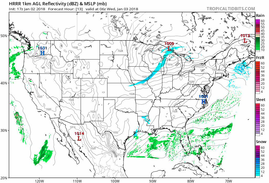
-
Southeast Sanitarium - A Place to Vent
Disco-lemonade replied to Jonathan's topic in Southeastern States
servers are starting to struggle must be from the party theyre having up in the north east forum -
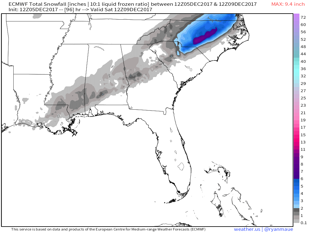
hmm id be willing to bet that band headed towards atlanta is going to change to snow soon
-
NAM is a tiddly bit colder and much slower with the precip
-
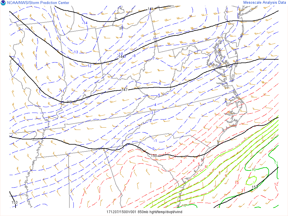
Who knows I'd bet a good few of us will at least see some unexpected flakes, which is more than I got 2011-12 Heres the link http://www.spc.noaa.gov/exper/mesoanalysis/new/viewsector.php?sector=17&parm=850mb&underlay=0&source=1
-
All I can say at this point is keep a close eye on that 0c line and your thermometers!
-
tease tease tease

-
gfs once again weaker with the gl low


.png.06e522cb42f10e6ddc86c49afe0317ce.png)