

Boston Bulldog
-
Posts
501 -
Joined
-
Last visited
Content Type
Profiles
Blogs
Forums
American Weather
Media Demo
Store
Gallery
Posts posted by Boston Bulldog
-
-
Just now, HIPPYVALLEY said:
OK. That is good info!
Just now, STILL N OF PIKE said:This was the feedback I was looking for and hope to recall in future
There is a reason why there is so much concern about convection ruining phasing dynamics in some potential high end bombs off the coast. Threading the needle isn't easy. This setup seems "messy" enough that boring background dynamics should win the day and get this thing up the coast without convective issues.
-
 3
3
-
-
4 minutes ago, HIPPYVALLEY said:
That's a wild card to watch right up through go time.
Considering the first wave is fizzling out and the secondary wave is what provides the primary forcing, I wouldn't be too concerned about that occurring. Not like there is a deep cyclonic center that is getting shunted east by the convection, the synoptic sweet spot downstream of the second wave will win out at the surface in this look even if the convection does some wonky things early in the evolution.
-
1
-
 3
3
-
-
Closed surface contours making landfall on the Florida Big Bend. Obviously lowest pressures jump north in the next frame, but the GFS seems to be really struggling with the convection down south.
-
19 minutes ago, STILL N OF PIKE said:
So um is this sampled now
Yesterday some folks / Mets thought it would bounce around till 0z , when it was fully sampled or do we see enough of a model consensus to increase confidence decently
(worked all am and have been sleeping off and on )
“Pieces are on the board” now so to speak, but one or two runs with enhanced data doesn’t mean a solution is suddenly locked in. Sampling isn’t a silver bullet by any means, just better information. Need wait and see how the models trend with all of this new data being assimilated.
I threw out 0z tonight as being a rough time when the repercussions from this new information would become evident over a few model cycles. We have seen more run to run continuity today so far
-
2
-
1
-
-
Recent GFS outputs seem to have some substantial convective interference with the SLP track as it traverses southern AL, MS and GA.
I don’t see any other guidance with the SLP being pulled so far south by convection.
EDIT: Looking into this, seems to first surface at the 18Z run yesterday
-
2
-
-
27 minutes ago, powderfreak said:
In my mind, the atmosphere is fluid. So I look at all of the terrain generated snowfall like rocks in a river. The inversion is the depth of the water, in the river scenario, and that’s what matters IMO. The inversion height can explain most mountain snows.
In this case, it was a light flow overall but with a 900-850mb inversion. Maybe some acceleration of the flow over and down the lee side, only for speed convergence to occur as the flow slows down slightly on the lee side. The air was being squeezed out around the peaks. A void was created downstream of the peaks, air rushed in to fill the void and where it collided (convergence) when wrapping around a peak, it created a narrow band of snow on the backside of the higher peaks.
Some turbulence and convergence (atmosphere is fluid, Iike water over rocks), brought localized narrow WNW to ESE bands of snow over 12-24 hours.


Fantastic overview, the final graphic reminded me of some shown to my class during a video in our Atmospheric Physics unit on turbulence. Honestly I only remember that video, not because of the examples and graphics shown, but because of how the professor was constantly lighting his pipe during the lesson.
Hard to beat that introduction at 0:45. What a legend
-
1
-
1
-
-
Would be foolish to lock in any sort of solution until we see how the trough digs over the W-US and interacts with the surrounding dynamics. The models are having a difficult time placing and orienting the shear vorticity feature behind the trough, which has a direct impact on synoptic scale forcing for our cyclone.
It's an age old adage, but once the SW hits the west coast, improved sampling at the upper levels should lead to a decisive move. While I'm not saying throw out tomorrow's guidance, I would expect a distinct trend that emerges around 0z tomorrow night to be the fate of the system.
-
10
-
1
-
-
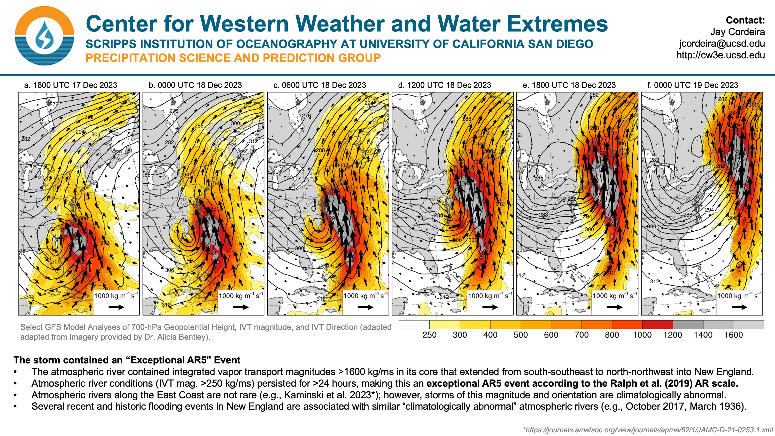
For posterity's sake. Wow.
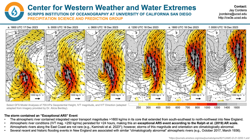
Dr. Alicia Bentley's IVT graphics are top of the line in showing AR intensity.
-
1
-
-
I love this visualization via @OceanStWx
https://x.com/OceanStWx/status/1738405055425102072?s=20
Not every cutter is built the same. Some have entrenched CAD even as the warm sector comes in. Some cut through Minnesota and lose forcing while stalling the warm sector in SNE. Some rip through the Syracuse and bring in a moist NW flow to refresh the N Greens when the sfc low flies north. The worst ones have no redeeming qualities outside of remarkable meteorological accomplishment (far before my time but the Cleveland Superbomb comes to mind)
This most recent storm will rest in the annals across NNE, not just for its quantity of precip, but for how horrendous the preceding airmass was. Combine the awful preceding conditions (feel like most cutters can dam some cold before the sfc low goes west) with a literal Category 5 AR (Ralph, 2019 slide 4 https://cw3e.ucsd.edu/cw3e-event-summary-17-18-december-2023-east-coast-ar/) and we get the worst cutter we've seen since 2020 at a minimum. I've been tracking NNE snowpack for about a decade and I cannot remember such a remarkably horrid event. Rotting snowpack and 98th percentile integrated vapor transport incoming. We had a buzzsaw coming our way with nowhere to hide.
Fundamentally this is a snowy region and the pack will recover. A moose can fart and suddenly Froude numbers indicate that Big Jay should be getting 3-4" overnight. As PF showed, the Mansfield stake is somehow at the mean. This highly anomalous event has the region licking it's wounds, but thank god it happened in December and not February or March. Lotta ballgame left for 2023-24, we won't see a demon like last Monday for a while. More great storms will come, and more storms will cut west a bit less maliciously. Ultimately the anomaly came through. Think snow.
-
13 minutes ago, NW_of_GYX said:
no expert here but seems like SSTs are cooling in the area of the W PAC where the lack of a gradient has been theorized for the strange ENSO response.
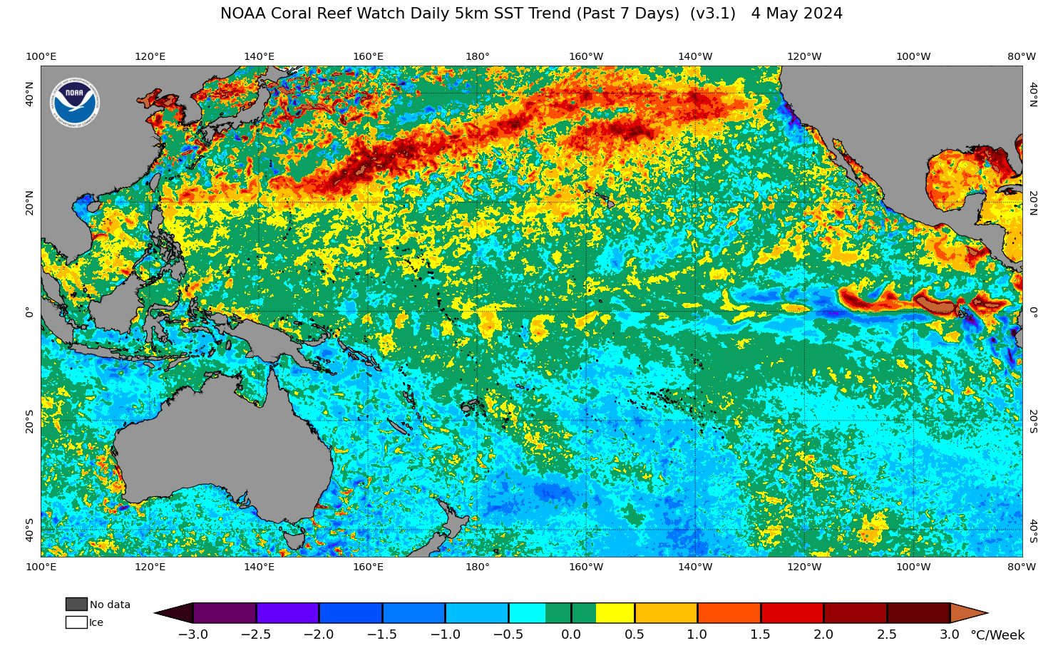
Still warm but you can start to see the gradient appearing in the W PAC
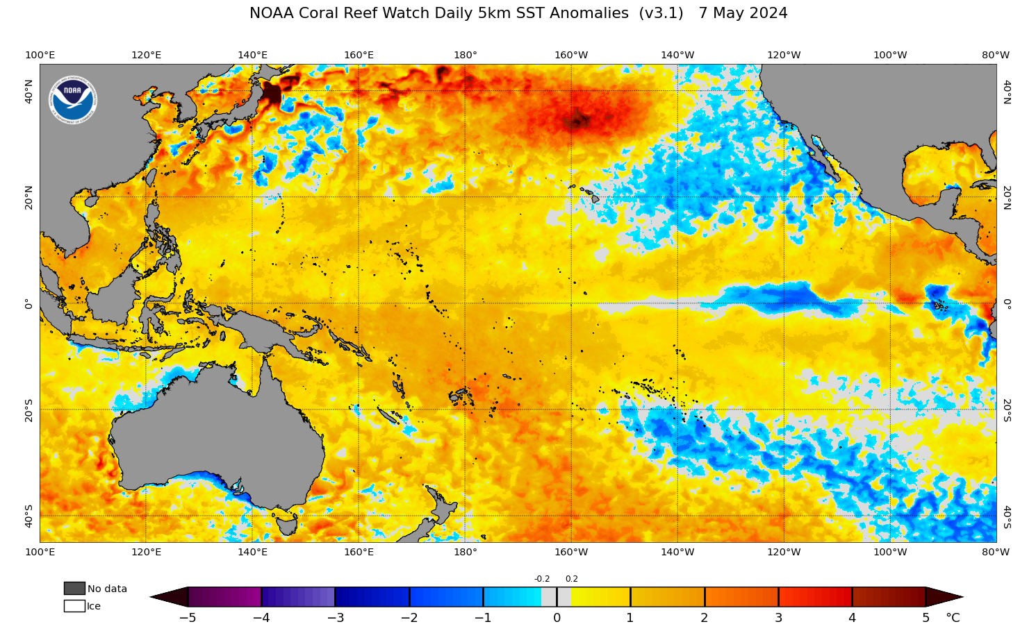
Yes, the ridging from earlier this month has been supplanted by a series of cut off lows spinning off CA, which has helped to cool that region of SSTs recently. While not a one-for-one action/reaction, it's no surprise that the door is beginning to crack open for modestly sized storms to reach the Sierras as the end of the month and new year approaches.
Regardless, I fail to see these E-PAC changes registering as a major forcing for our neck of the woods, at least in the medium range.
-

-
1
-
2
-
 11
11
-
-
41 minutes ago, STILL N OF PIKE said:
Anyway , I was surprised to see how poorly Mammoth Mountain was doing .
26” inches to date . I imagine they have extreme variation from month to month and year to year but I was curious if anyone in the lower 48 had a decent December .
Maybe Jackson Hole? (edit yup 125” summit / 76” mid mountain ) they average upper 400’s up top
Tetons and the Cottonwoods are the only good resort skiing in North America right now outside of Alyeska and the interior Canadian Rockies. Pretty brutal December for the Cascades and Coastal BC with extremely warm ARs bringing rain to the peaks and washing away snowpack. Sierras have been pretty high and dry so far, save for some warm cutoffs bringing some snow way up high (8-9k+), and mostly rain to the resorts.
The Northern Pacific is just so incredibly warm right now, outside of where the storms directing the ARs have been upwelling water southeast of Alaska. Mets more knowledgeable than me on this part of the world (Bryan Allegretto) have been attributing the lack of a strong PAC latitudinal SST gradient as one of the causes behind why the West Coast simply not getting the typical El Nino connection so far. Large scale ridging assisted by the warm pool has been directing moisture north of California, with no cold air around to tamp down snow levels when these features make landfall. When those warm ARs go away, cutoffs have been meandering just offshore and out of reach.
Moving into the new year it seems as though more windows will open, but the one lesson I've learned so far is no matter how strong an El Nino is in ONI, if you don't have that gradient in SST across the PAC throw away traditional ENSO climo for the West Coast. Synoptic fundamentals often win out, no matter how strong your subseasonal forcings are.
-
1
-
1
-
-
Today was no exaggeration a top tier spring skiing day at Mad River Glen. Variable conditions with elevation (packed powder up high, hard pack down low) evolved into a universal corn surface that peeled away underfoot with ease in the bumps. I was concerned when I skinned to the top of the double before opening bell, as the entire place was either a coral reef or threatening to become manky. Instead, the hard pack softened and the wet snow ended up being confined to a small slice of elevation around mid mountain. Some sort of shallow funky inversion must have been in place last night.
The trails themselves were super spicy with rocks and stumps everywhere. You had dealers choice of fun techy bump lines in all directions off the summit. Caution was necessary though, troughs were often rock riddled, forcing some quick decision making in order to find creative lines. Cat Bowl skied the best I can remember. Paradise was totally ledged out down low, quick feet were needed to navigate this chokepoint.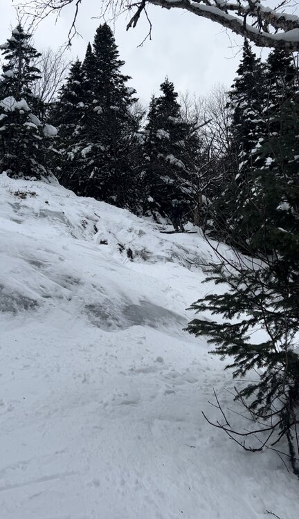
The thin base exposed several very fun features all over the mountain, with normally hidden ledges appearing on Chute and cliffs/ledges on lift line growing dramatically in size. Given how forgiving the surface was, many of these airs were very much in play. Chute in particular had a sporty double drop up high.
Meanwhile the tower 10 and 11 ledges on Lift Line offered several big combos.
So rare to ride this terrain before the new year, let alone in conditions like this! What a start to the season-
5
-
-
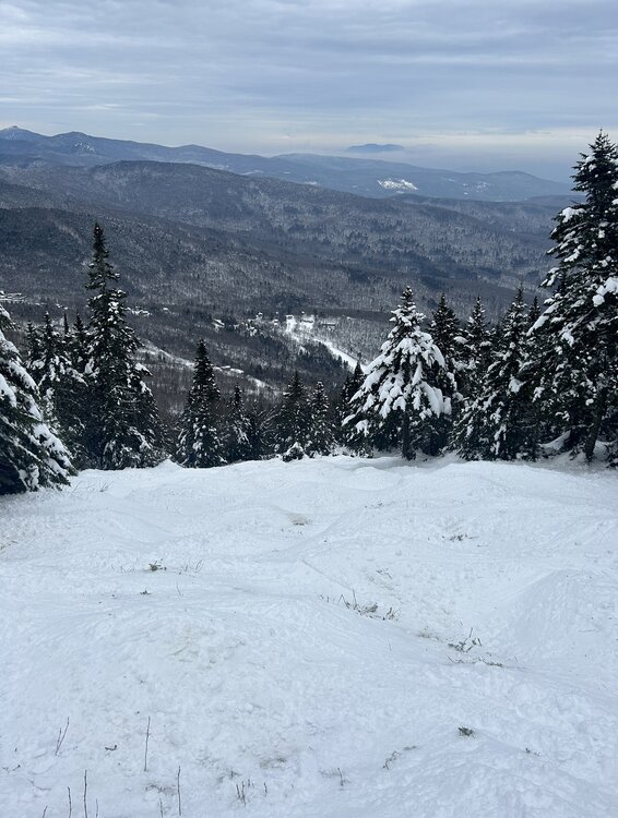
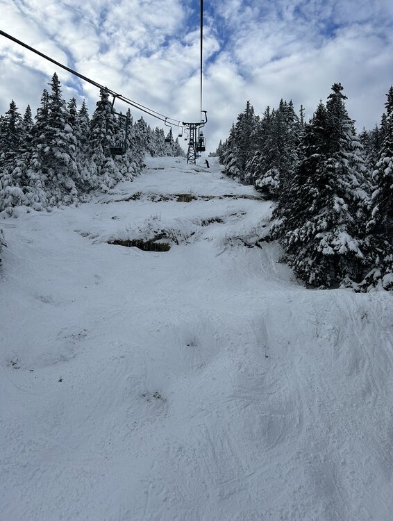
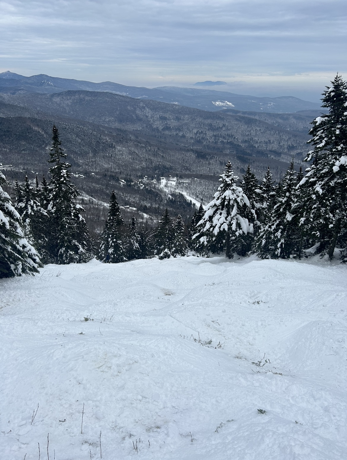
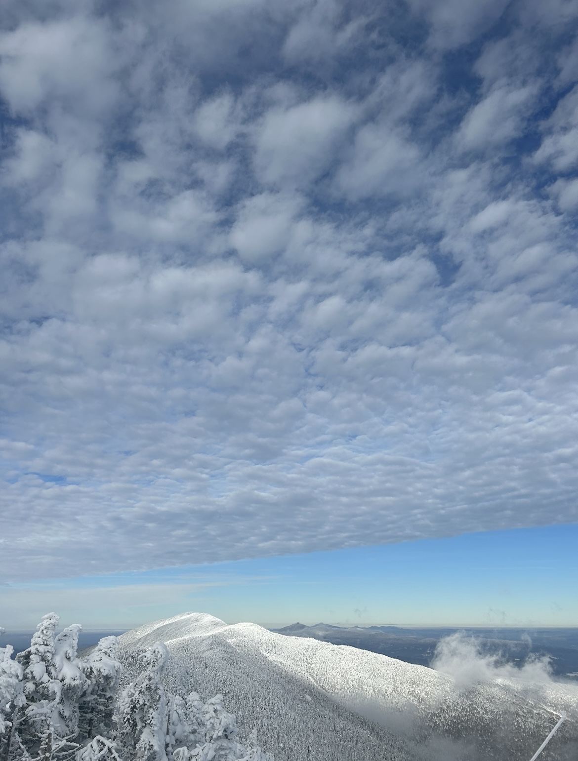
A beauty of a day up high at Sugarbush with immaculate views north towards Camels Hump and Mansfield. Getting a bit skied off in most spots, but taking the hike along of the Long Trail to Castlerock was well worth the effort for some softer turns. For December 8th, hard to do better than this

-
4
-
-
18 minutes ago, powderfreak said:
6z was even more ridiculous lol.

How legitimate is this emerging upslope signal once the coastal low passes? I assume further east trends would help bring the flow into a more favorable direction
-
I would normally caution against those snowfall maps on the backside of a cutter’s cold front. As we frequently see, CAA often arrives too late/dries everything out.
This looks a bit different though, given how disjointed this system is as the primary passes through the Great Lakes. The redevelopment along the front grows more impressive with each run, and that seems to be the dynamic boost needed to overcome the issues noted above. Good trends for resorts along the spine of the Greens!
-
3
-
1
-
-
3 hours ago, J.Spin said:
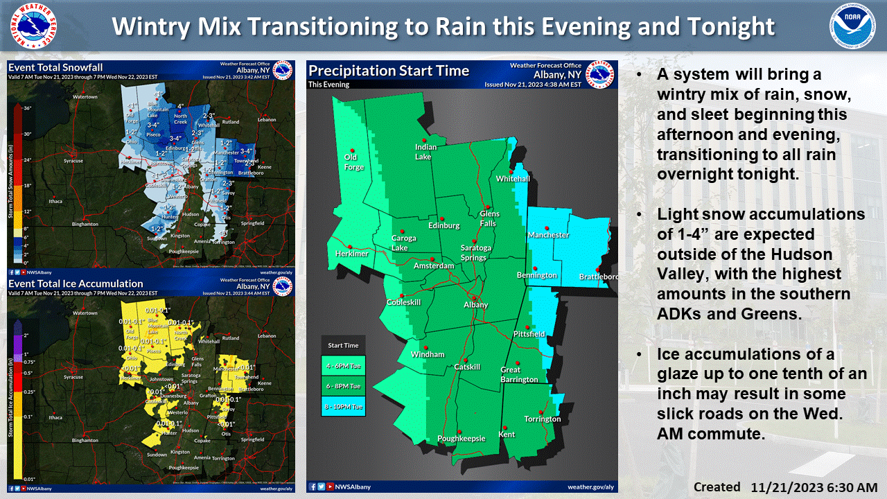
About a half hour ago I received a text alert that we’d been put under a Winter Weather Advisory – this seemed to come on pretty quickly, just as the snow was starting up here, so I assume the BTV NWS has seen something in the latest modeling that had them go with the advisory. We are getting a bit of slushy accumulation when the snowfall intensity is high enough, but with the marginal temperatures, it seems like heavier snowfall is what it would take to get any sort of substantial accumulation down here in the valley.


I really like how this map from BTV shows the intersection of synoptic and mesoscale dynamics at play in Central VT. If there was ever going to be a Killington bullseye with QPF distributed relatively evenly across the VT, this would be it. Ample forcing for orographic ascent is delivered to the region by SE flow curling around the vortmax that is both traveling across far southern VT and is tilted SE to NW with height. Simultaneously, the flow which "originates" from the CRV is relatively unimpeded until reaching the peaks just south of the Killington area. Add in a more little elevation near Killington to help take care of the marginal airmass and... bullseye!
Meanwhile, orographic dynamics are not maximized farther north given the amount of terrain upstream
-
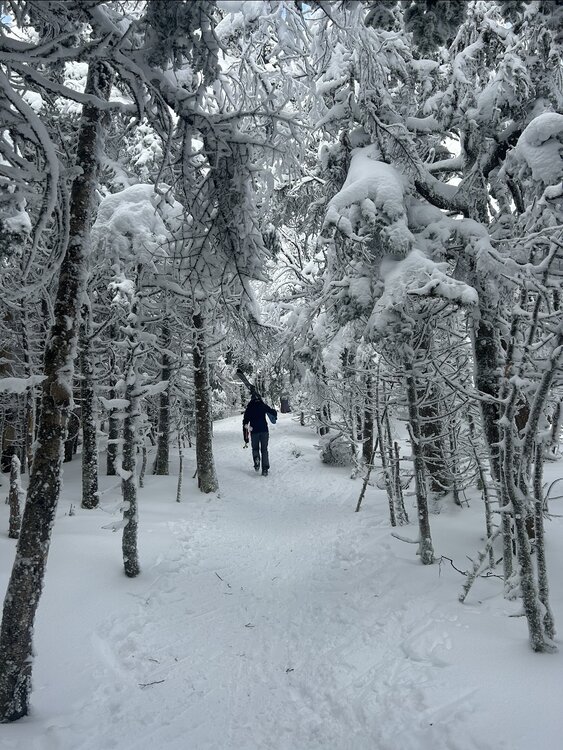
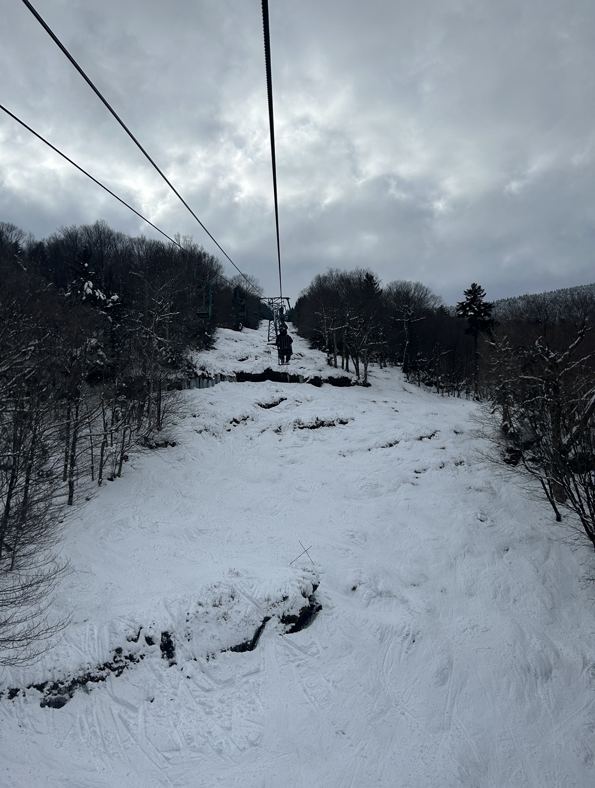
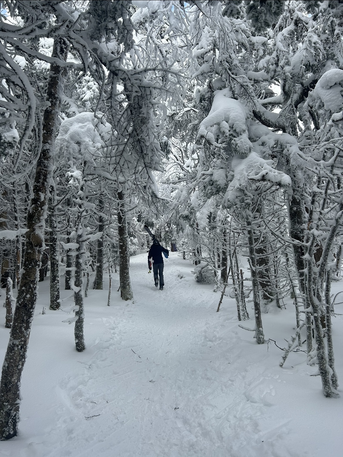
Certainly no natural snow options at Stratton today, but major props to the snowmaking team there for getting a decent slice of terrain open. 3 distinct 1350' vert routes were available to lap off the Ursa Express, with one extremely crowded egress route back to the base. Icy conditions for sure, but for day 1 on snow I can't complain.
Looking up North American/Frank's Fall Line from the mid mountain lodge
-
3
-
-
Bright banding approaching Canton MA as the column saturates and precip picks up, would love to see some flakes mix in. 39/31 right now so I'm skeptical there is enough oomph behind the wet bulb to do the trick. Correlation coefficent is hinting that some mixing may be to the NW, slicing through Dedham and Westwood, so good rates are gonna be needed for that to crash south.
Hardly has gotten into the 30s at all this year down in the tropics (Manhattan), never really understood how powerful the heat island is there until I moved there. Appreciating the wintery feel up here today
-
13 minutes ago, snowgeek said:
2” here in Albany. Pleasantly surprised. Roads are horrific. No sign of plows.
.Wow, NWS had zilch and the HRRR had about 0.5" for Albany. Nice little overperformer over there
-
Great looking band heading into Southern VT and the Berkshires!
-
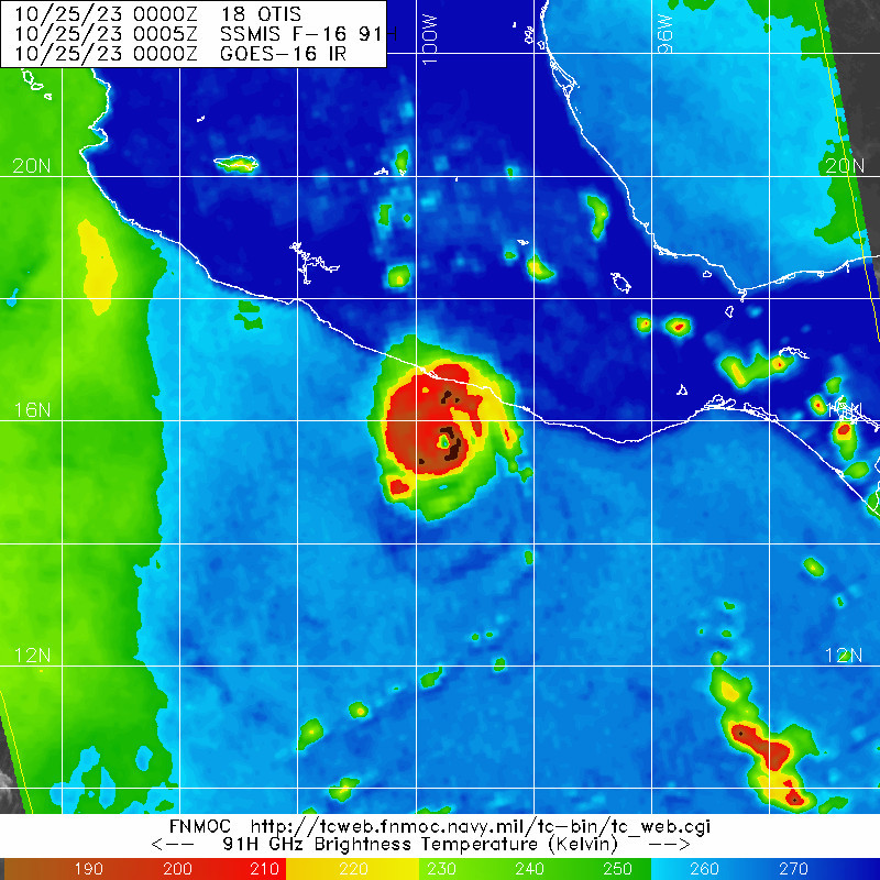
A sensational and horrifying microwave pass on Otis

-
2
-
-
Been a bit tuned out on recent developments for our weekend storm, so I only just now have caught up on how this thing has trended... what a shame if this was January. Hopefully we are getting our blown phases out of the way in the preseason (at least according to the GFS)

Looking at the Z500 evolution is especially painful with the southerly vort getting slung out east. Make no mistake about it, this would be a solid hit, but more in the "close but no cigar" caliber rather than a true classic.
One final note, take a look at a rare October Manitoba Mauler diving into the midwest upstream of our weekend storm. Seems like the clipper train has really dried up in recent years, maybe getting it going early is a good omen?
-
Can anyone guess the direction of the shear over the western MDR this morning?
-
2
-


January 2024 -- Discussion
in New England
Posted
7mb weaker through the lakes at 150hr and as such a much more substantial coastal reflection forms, with a transfer to GOM by 162hr