

hudsonvalley21
-
Posts
3,872 -
Joined
-
Last visited
Content Type
Profiles
Blogs
Forums
American Weather
Media Demo
Store
Gallery
Posts posted by hudsonvalley21
-
-
I would say that I have had 2 inches over the last hour or so... Somewhere between 6 and 7 on the ground now, but it is impossible to know for sure due to the drifting and blowing snow. Some really intense snow coming down now.. Just epic.
Good to hear

Band after band on the way.
-
Nice, let us know the rate if you can
I would est. 1-2" in the last hour.
-
Bombs away soon. Radders is getting pounded.
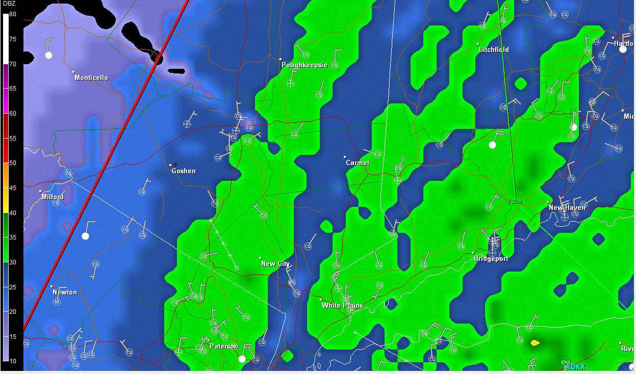
I'm getting clipped by it too. Just on the western edge. est. about 4" down now. I'm around 1/2 mile west of the hudson.
-
URGENT - WINTER WEATHER MESSAGE
NATIONAL WEATHER SERVICE NEW YORK NY
432 PM EST SUN DEC 26 2010
...DANGEROUS WINTER STORM TONIGHT INTO MONDAY...
NYZ067-270545-
/O.CON.KOKX.BZ.W.0002.000000T0000Z-101227T2300Z/
ORANGE-
432 PM EST SUN DEC 26 2010
...BLIZZARD WARNING REMAINS IN EFFECT UNTIL 6 PM EST MONDAY...
A BLIZZARD WARNING REMAINS IN EFFECT UNTIL 6 PM EST MONDAY.
* HAZARDS...HEAVY SNOW AND STRONG WINDS...WITH CONSIDERABLE
BLOWING AND DRIFTING OF SNOW WITH NEAR ZERO VISIBILITY AT
TIMES.
* ACCUMULATIONS...10 TO 15 INCHES...HIGHEST ACROSS THE EASTERN
HALF OF ORANGE COUNTY.
* IMPACTS...EXTREMELY DANGEROUS TRAVEL CONDITIONS DUE TO
SIGNIFICANT SNOW ACCUMULATIONS...AND STRONG WINDS CAUSING
CONSIDERABLE BLOWING AND DRIFTING OF SNOW. VISIBILITIES WILL BE
NEAR ZERO AT TIMES...WITH WHITEOUT CONDITIONS POSSIBLE.
* TIMING...SNOW WILL BE HEAVY AT TIMES TONIGHT...AND THEN TAPER
OFF FROM WEST TO EAST MONDAY MORNING.
* WINDS...DURING THE HEIGHT OF THE STORM TONIGHT...WINDS WILL
BECOME NORTHWEST 20 TO 30 MPH WITH GUSTS 40 TO 50 MPH.
-
Hey guys. Down here in southern rockland county in Nanuet. It is coming down very hard now. 2 inches... I think
Hey, good luck down there. Have the same up here.
-
Snowing sideways right now. Wind howling. My weather station isn't working, but i'd guess 20mph sustained winds with gusts around 30. As nasty as I've seen in my 3 years in POU...During the Snowicane last year, we were in mostly rain out east here in Pleasant Valley.
I grew up in Buffalo, so it's nice to see some WNY wind and snow out this way.
5 pm Obs.
NYZ052-065-067-262300-
HUDSON VALLEY
CITY SKY/WX TMP DP RH WIND PRES REMARKS
NEWBURGH SNOW 19 18 93 NE14G25 29.60F VSB 1/2 WCI 6
MONTGOMERY LGT SNOW 22 18 85 NE16 29.59F VSB 1 WCI 8
POUGHKEEPSIE SNOW 20 16 84 N15G28 29.62F VSB 1/2 WCI 6
ALBANY FLURRIES 18 9 68 N16G25 29.78F WCI 3
$$
-
Thanks and you're all welcome. Enjoy the band when it rocks you. Nothing like 2-4 inch/per snowfall with the winds rippin' and whippin' too. Envy you buggers but my time will come. Remember: Have fun and enjoy!
Thanks
Hope it will shift a bit more to the north and give you a bit more. Could have some thundersnow with some of those bands. -
Let's do this! 60mph gusts tonight and Monday possible! The drifting will be awesome.
Game on!! I don't remember Orange county was under a Blizzard Warning. Tonite will be insane! Keep those flashlights nearby

-
NATIONAL WEATHER SERVICE NEW YORK NY
631 AM EST SUN DEC 26 2010
.NEAR TERM /UNTIL NOON TODAY/...
VERY LIGHT SNOW NEAR KGON...BUT OTHERWISE DRY AT 11Z WITH BAND OF
PCPN BEGINNING TO TAKE SHAPE OVER THE DELMARVA AND STRETCHING
NEWD. WATER VAPOR INDICATES THIS IS THE WAA ZONE. TD/S STILL IN
THE TEENS AND LOWER 20S ACROSS THE CWA. WITH MAIN LIFT S OF THE
CWA AND MOISTURE LIMITED OVER THE CWA...WILL KEEP IT MAINLY DRY AT
SUNRISE..WITH LIGHT SNOW DEVELOPING FROM SE TO NW THROUGH NOON.
SIGNS OF THIS ALREADY TAKING PLACE AT KMTP WITH CLOSING DEWPOINT
DEPRESSIONS AND DEVELOPING RADAR ECHOS.
6Z MODEL UPDATE...BOTH THE GFS AND NAM SUPPORT A GENERAL 12-16
INCH SNOWFALL FROM THE HUDSON RIVER EAST. BANDING WILL LIKELY
RESULT IN LOCALIZED 2 FT AMOUNTS. GFS LOW TRACK IS 40-60 MILES
FURTHER NORTH THAN THE SREF AND NAM.
.SHORT TERM /NOON TODAY THROUGH TUESDAY/...
NO CHANGES TO THE WINTER STORM HEADLINES...YET.
TWO MAIN FCST ISSUES THIS MORNING. FIRST IS THE WIND. SECOND IS
THE POTENTIAL FOR RAIN ACROSS ERN LI.
MODEL STORM TRACK HAS CONSOLIDATED WITH THE 00Z RUNS. THE ECMWF
TRACKS ALONG THE 3Z SREF. GFS ABOUT 20MI NW OF THE ECMWF...AND
THE NAM SLIGHTLY E OF THE ECMWF.
QPF AND RESULTANT SNOWFALL FCST RELATIVELY UNCHANGED WITH A
GENERAL 6-18 INCHES LIKELY. LEAST AMOUNTS ACROSS THE W AND HIGHEST
AMOUNTS E...WHERE RAIN DOESNT HOLD THE NUMBERS DOWN.
WITH REGARD TO THE RAIN...CLOSE PROXIMITY TO THE LOW MAY ALLOW
FOR THE COASTAL FRONT TO PENETRATE WWD INTO ECNTRL LI. THE TWIN
FORKS ARE MOST SUSCEPTIBLE. AS THE LOW MAKES IT/S CLOSEST APPROACH
HOWEVER IT UNDERGOES OCCLUSION. IT SHOULD BE NOTED THAT H85
TEMPS NEVER RISE ABOVE FREEZING ACROSS THE CWA. FOR THIS REASON
HAVE KEPT THE AREA MOSTLY SNOW BUT THERE REMAINS UNCERTAINTY.
ANYWHERE FROM CNTRL LI WWD WILL BE ALL SNOW.
THE DEEP LOW WILL PRODUCE A POTENTIALLY DAMAGING WIND FIELD. BL
WINDS IN THE GFS OVER 60KT. NAM WIND FIELDS ARE WEAKER...BUT THE
DEEPER ECMWF GIVES SUPPORT TO THE GFS. FOR THIS REASON HAVE BUMPED
WIND GUSTS UP TO 45-60 MPH. LOCALLY HIGHER GUSTS POSSIBLE ACROSS
MOST OF LI. HAVE KEPT THE WARNINGS INTACT...BUT WILL INCLUDE
WORDING STATING THAT AN UPGRADE TO A BLIZZARD WARNING IS POSSIBLE.
BECAUSE THE HIGHEST WINDS...ESPECIALLY ACROSS THE INTERIOR...WILL
BE TONIGHT...THERE IS STILL TIME TO OBSERVE WHAT ENSUES OVER THE
OCEAN.
THE STORM WINDS DOWN MONDAY WITH STRONG WINDS CONTINUING. THE
ACCUMULATING SNOW APPEARS IT WILL BE OVER BY 15Z ATTM. DRY WITH
LESS WIND TUE.
-
Merry Christmas to all. Hope santa brought all of us snowblowers, we will be needing them.
-
Thanks. I just got a look at Tombo's map so I have a better idea now. I'm dreading another storm like 12/19/09 when I got 1 whole inch
 but that doesn't look like it's in the cards as of now anyway
 You might get a call from the TH- Record tonite.
-
From what I have seen of the Euro - this is the dream scenario for the Lower/Mid Hudson Valley and nice for the Upper Valley also. It does have 2/1978 written on it somewhat and that was the best storm I was ever in while in the Mid Hudson Valley. My Dad worked at IBM POU and it took him about 4 hours to get the 20 miles up to near Kingston where he had to sleep on a guys floor.
 That was epic...love to see that again.
We'll see. I would wait another run or two too see what they show. There was alot of flip flopping the last few days. If it does pan out the lake regions will have their fun too. Looks like a late night tonite looking at dr. no.
-
Oh the snow guns ate firing away again tonight. I just took a peak outside and see steady light snow and working on a coating now. Nice.
Hope the winds take it your way. Snow machine effect snows.
-
Just a dusting IMBY but the wind probably blew most of the snow away.
Sneek out and hook up the snow machine on the golf course.

-
I have a heavy coating too.
 The difference here is there's almost no wind at all. Most of the main roads had dried off after the rain but most of the side roads were still wet and have to be kinda sketchy right now.
Have a coating down as of 9:00. streets are snow covered. Still light snow falling and radar filling in slightly. 25.8.
-
Just had some thunder and heavy downpour roll thru from the south.
-
Currently at 27.0. Clear skies and calm winds have had it drop off nice. Forcast low IMBY is for 29. Also, the ground surface is frozen, going to have some ZR a quick runoff tomorrow.
Uptons short term.
NATIONAL WEATHER SERVICE NEW YORK NY
752 PM EST SAT DEC 11 2010
.NEAR TERM /UNTIL 6 AM SUNDAY MORNING/...
-- Changed Discussion --TEMPS THIS EVENING HAVE COOLED DOWN QUICKER THAN FORECAST. UPDATED
DATABASE BASED ON LATEST TRENDS AND OBSERVATIONS. DEPENDING ON
HOW QUICKLY TEMPS WARM...AND HOW FAST PRECIP MOVES IN FROM THE
SOUTH WILL DETERMINE EXACTLY WHERE FZRA OCCURS. IT DOES APPEAR
THAT ADVISORIES ARE FINE WHERE THEY ARE...EVEN NORTHERN MIDDLESEX
AND NORTHERN NEW LONDON COUNTIES. THIS WILL OF COURSE NEED TO BE
MONITORED...BUT I DO BELIEVE THAT ANY FROZEN PRECIP OUTSIDE OF THE
ADVISORY AREA WOULD BE VERY SHORT LIVED.
MODELS IN REASONABLE AGREEMENT THROUGH SUN MORNING. STRONG LOW
PRES CONTINUES TO DIG THROUGH THE GREAT LAKES AND WILL APPROACH
THE OH VALLEY BY DAYBREAK. AHEAD OF THIS LOW...A WARM FRONT
ASSOCIATED WITH WEAK LOW PRES WILL LIFT ALONG THE COAST AND
TOWARDS THE NORTHEAST.
AS THE WARM FRONT APPROACHES FROM THE SOUTH...SOME LIGHT RAIN
WILL DEVELOP ACROSS THE SOUTHERN HALF OF THE CWA. FOR THE
INTERIOR...DESPITE AN INCREASE IN CLOUDS...SFC TEMPS LOOK TO STAY
AT OR BELOW FREEZING FOR A GOOD PART OF THE NIGHT. WITH AN
INCREASING EASTERLY FLOW...TEMPS IN THE MIDDLE LAYERS OF THE
ATMOSPHERE LOOK TO WARM TO 2-4C WHILE SFC TEMPS SLOWLY WARM ABOVE
FREEZING. AS SUCH...ANY PRECIP THAT FALLS WILL FALL AS A PERIOD OF
FREEZING RAIN...WITH PRECIP MIXING WITH AND CHANGING TO RAIN BY
DAYBREAK SUN.
FREEZING RAIN ADVISORY IN EFFECT FOR INTERIOR LOCALES FROM AROUND
MIDNIGHT TONIGHT THROUGH SUN MORNING. TOTAL ICE ACCRETION LOOKS TO
BE LESS THAN 0.10 INCH.
FOR SOUTHERN ZONES...LESS THAN 1/4 INCH QPF EXPECTED.
LOWS OCCUR THIS EVENING...THEN RISE OVERNIGHT.-- End Changed Discussion --
-
GREAT NEWS!!!!!!!!!!!!!!!!!!!!!!!!!!!!!!!!!!!!!!!!!!!!!!!!!!!!
I'm here!
What happened to the old board?
Glad too see you found us here.
-
15.2 at 10pm
-
What's your elevation there?
We'll see if I get that low but it should be the lowest of the season for sure. For whatever reason raditonal cooling is hit or miss IMBY. It seems like I tend to stay a bit warmer but there have been a few instances when I radiated very well and wound up colder. I haven't been able to figure out the reasoning but I sometimes wonder if my weather station location is a factor as it sits on a little hill in the yard with a 4-6 foot drop off on three sides. Anyone else think that this could be a factor?
I wonder if living near the golf course makes a difference. If you have a breeze there due to the open area, there is no area for the cold to air to pool since it will settle in low lying areas. For instance, KSWF is at 581 ft. IMBY, I'm at 125 ft. in Butterhill along the Moodna creek bed shelterd from the wind. I can be a couple of degrees colder than KSWF. It could be just a slight breeze that makes a factor. Just my thoughts. My forcast low is 11 for tonite, currently at 19.1.
-
Down to 19 right now, which I believe is my lowest thus far this season.
Untill tonite.
-
Dusting by me as well, hit light to mod snow from Harriman to Nanuet on the thurway a few inches on the ground in spots, lots of accidents delayed 45 minutes. I exited the thruway in rockland, went two blocks and no snow on the ground. Its very localized.
I went thru Highland Mills and had a moderate snow shower around 5:30 am (near the Woodbury Commons) it was localized there too with a dusting on the ground. I was lucky to make it thru before the traffic got messy.
-
In the mean time though, Wednesday looks interesting even if it's not snow.
A few inches of rain and could be quite windy if it mixes down to the surface.
-
Its a ways off still but from what I'm reading in in the other threads about the 12Z Euro sounds like we could be sitting in the same spot that we were last year with the exception of the last week of Feb

Time to get the snowblower out of summer storage.

The Hudson Valley Thread
in Upstate New York/Pennsylvania
Posted
band here is gerat. I'd say I'm around 10" now