hstorm
-
Posts
598 -
Joined
-
Last visited
Content Type
Profiles
Blogs
Forums
American Weather
Media Demo
Store
Gallery
Everything posted by hstorm
-
3k NAM does give DCA severe accumulating snow (0.7”)
- 1,093 replies
-
- 3
-

-
- severe
- thunderstorms
- (and 1 more)
-
I am in the skeptical camp on this one. Threat needs to be taken seriously, of course. But in my experience we fail at these setups even more than we fail at winter storm setups.
- 1,093 replies
-
- 1
-
-
- severe
- thunderstorms
- (and 1 more)
-
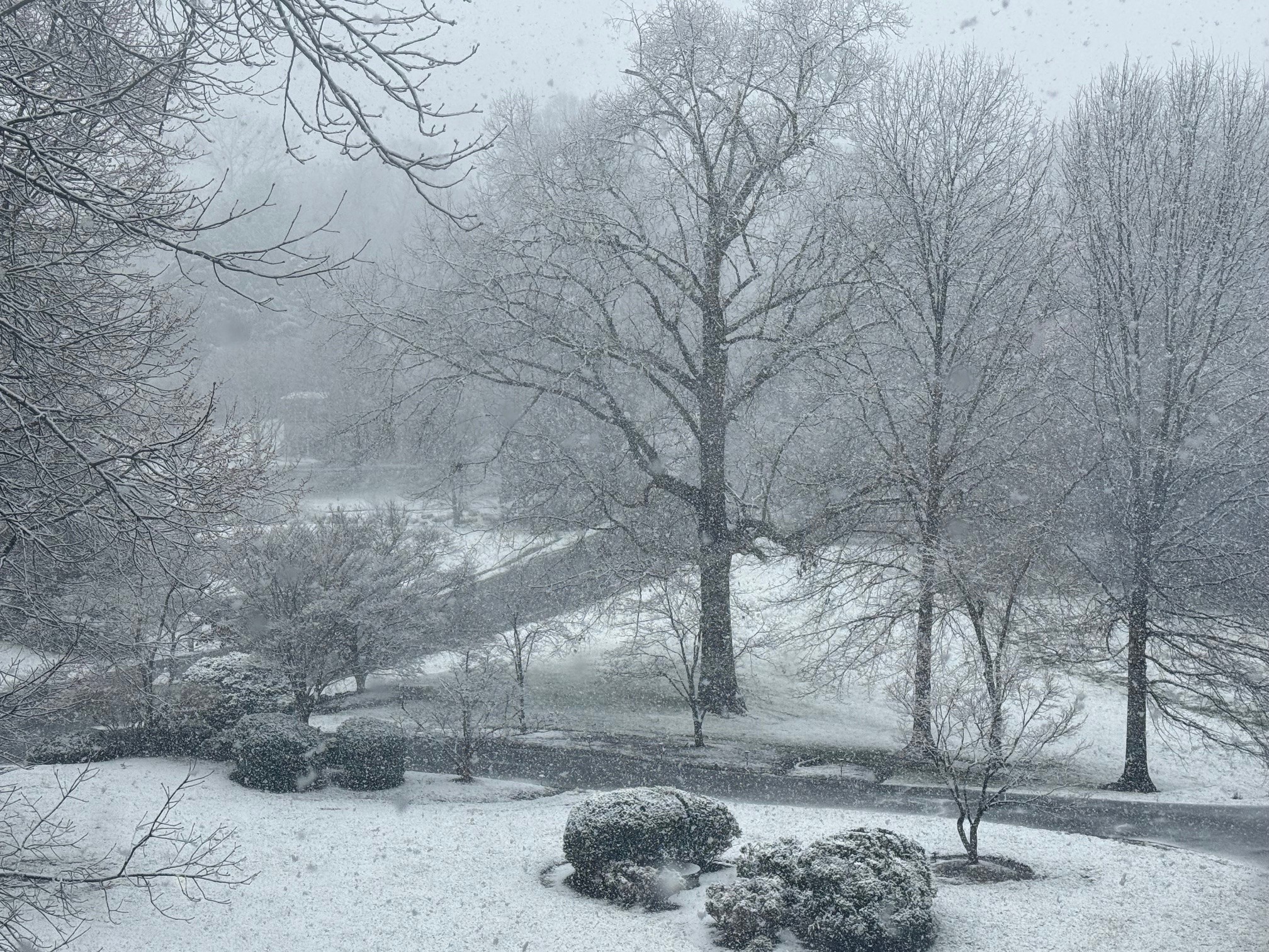
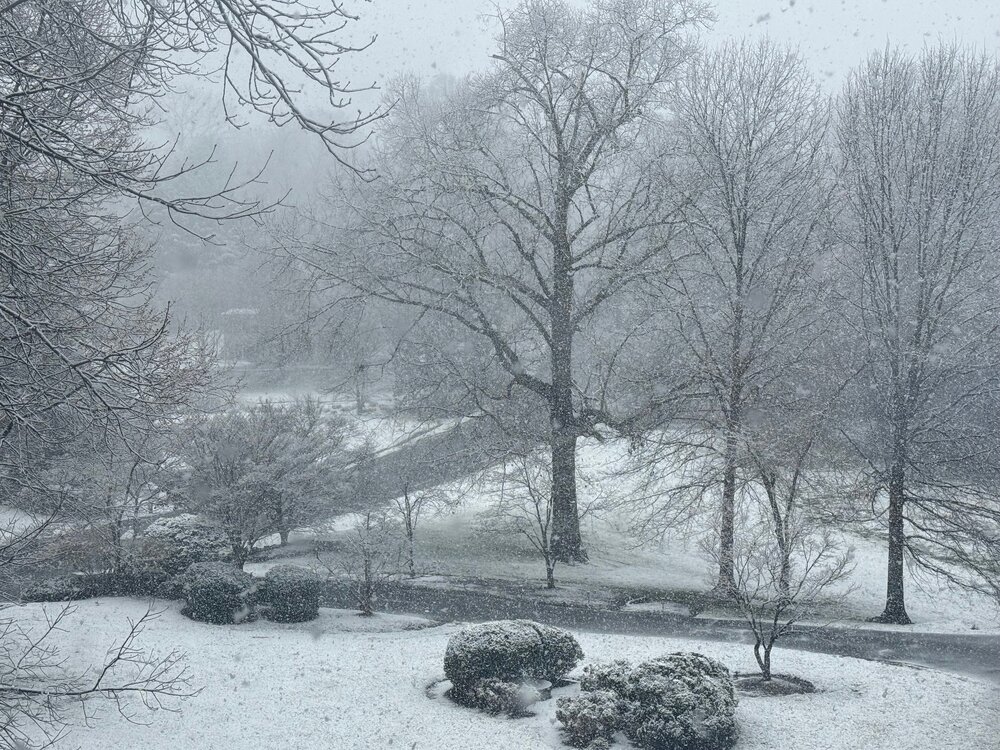
Low of 26.6 Still a wintry look with the remaining patches of snow.
-
It's either gone by sunset or gone just after sunrise tomorrow. Doesn't really matter. The real joy was watching the rates and seeing real accumulation just a few hours after overnight mid-summer warmth.
-
Still a steady light snow here, just a few miles east of the county line. We definitely got the goods for the past few hours. Hopefully those to the east now also cash in.
-
- 680 replies
-
- 12
-
-
Just measured a very unofficial 1.0" on the car. Obviously less on the grass. But looks like more than 0.5".
-
Getting close to a legit 0.1" on the grass. 33.8 degrees.
-
Officially a car topper here. A few specks of white now appearing on the grass as well. 34.5 degrees.
-
Some slushy deck stickage with heavier rates. 35.4 degrees. Also, surprising silence from that Eagles fan guy.
-
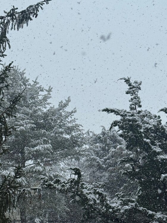
Flakes mixing in Great Falls. 38.7
-
Down to 39.9. Still a rain/sleet mix but more sleet now in the mix.
-
40.8 with sleet now mixing in Great Falls.
-
Highs for the day at IAD and DCA are 76-77. Any accumulating snow would be impressive. That fact that it is very likely going to snow for a few hours, even without accumulation, is also impressive. In my view, that’s the proper benchmark
-
Hopefully everyone recognizes that . . . but the 10:1 and Kuchera clown maps are a lot more fun.
-
Positive snow depth change from the GFS. Still would be impressive given the circumstances:
-
18z GFS. Someone who pays money for these things can post a better map:
-
3k NAM is less enthused but still gives something to most:
-
18z 12k NAM says yes:
-
Kuchera map is notably (and unsurprisingly) less impressive.
-
18z HRRR gives us the goods:
-
Still only 59 for the high here today (and currently 57) … but now up to 65 just a few miles south in Reston.
-
For the past few days, NAM has shown DC N&E staying on the colder side of the front today, at least until evening. 12z 3k NAM seems to suggest that the boundary stays even a bit further S&W for most of the day. We’ll see. But it’s done pretty well this week and is typically good with these setups.
-
I may be on a one-man island but I love this weather. Still warm enough to get outside and do anything you want. And plenty of time for sun and warmth once it is really spring. This was the rule and not the exception through at least April growing up in New England
-
12z NAM remains persistent with the wedge hanging on through Saturday for most of us. 3k NAM shows the same.