MIstorm97
-
Posts
363 -
Joined
-
Last visited
Content Type
Profiles
Blogs
Forums
American Weather
Media Demo
Store
Gallery
Everything posted by MIstorm97
-
May 2020 cold snap; record cold, possible snow?
MIstorm97 replied to michsnowfreak's topic in Lakes/Ohio Valley
May snow/graupel squalls
-
May 2020 cold snap; record cold, possible snow?
MIstorm97 replied to michsnowfreak's topic in Lakes/Ohio Valley
Had some decent snow showers in the metro Detroit area this morning. Will be interesting to see if any squalls make it down here later today -
It pains me to type this out, but..... Going back to 1880, there isn't much in the way of May snow at Detroit. Out of the 140 May's, only 8 have recorded at least 0.1" of snow. The most recent instance of accumulating snow in May in Detroit was 0.1" on 5/3/2005. The other May's that had accumulating snow were 1954 (0.1"), 1923 (6.0"), 1912 (1.5"), 1909 (0.4"), 1907 (0.2"), 1902 (0.5"), and 1883 (5.0"). May 1923's 6.0" all came from one storm on the 9th. May 1883's 5.0" incredibly came on the 21st into the 22nd. The rest of those months had 1.5" or less. Will DTW get accumulating snow this month? It's certainly possible with this pattern. If the airport does, then it would put this month into some very rare air. F this upcoming pattern though. It was beautiful this weekend.
-
Had scheduled maintenance on my car today so it’s in the shop till tomorrow. Would’ve been on the lake otherwise. All this heavy rain is only raising the lake levels more. Gonna be an even worse fall than last year. For sure gonna lose some homes
-
Picked up a few tenths of an inch of snow and sleet last evening. A narrow band to my north got 1-2” of wet snow. I got some nice pictures and video in Richmond and New Haven.
-
Actually got some legit hail up to dime size by New Haven. Was able to distinguish between hail and the other precip.
-
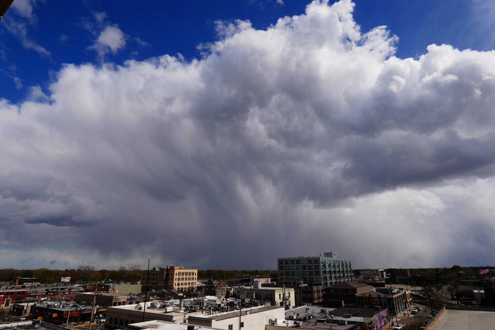
Already have photogenic squalls with lots of graupel. Couple lightning strikes showing up on DTX’s radar

-
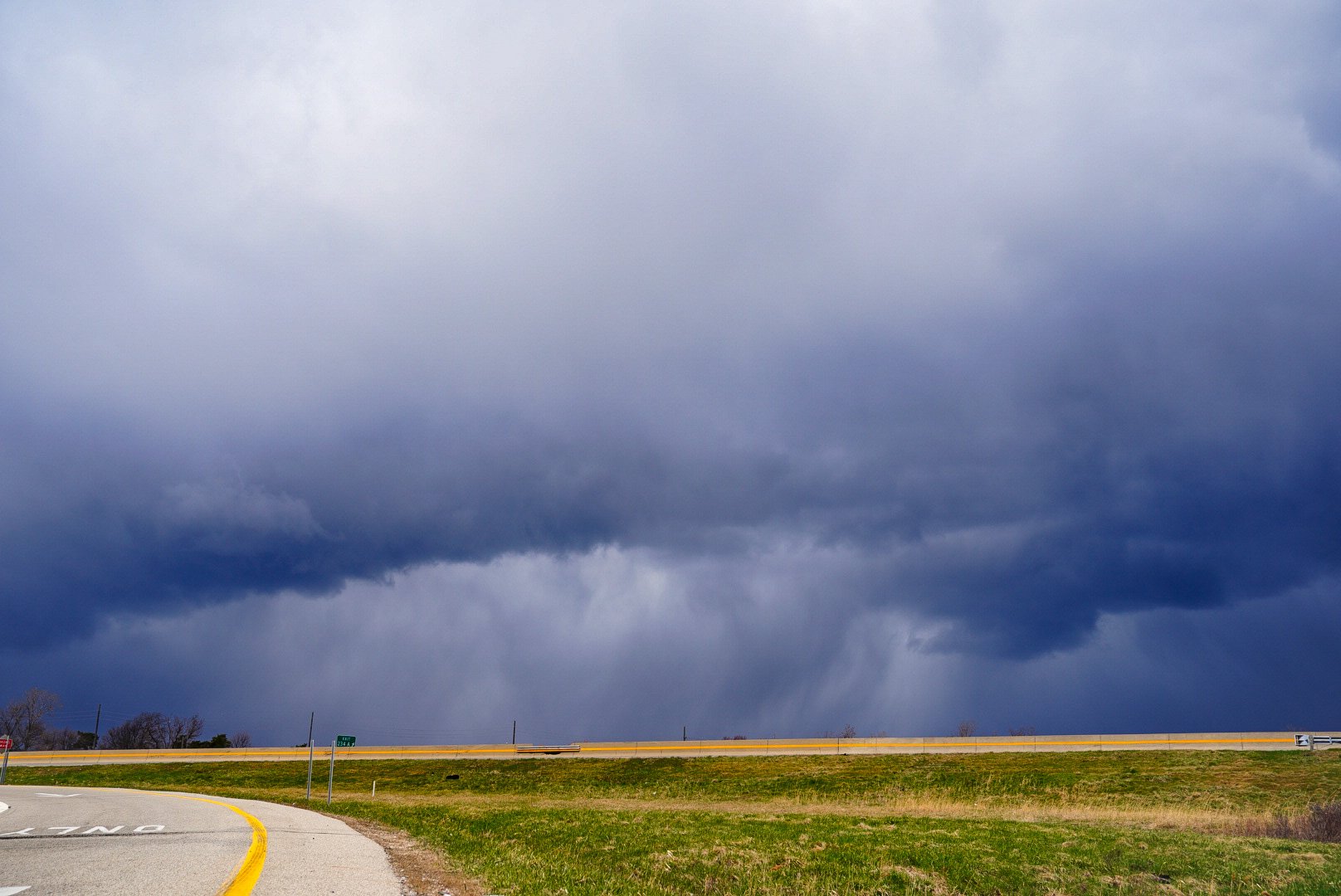
Already over 250 SBCAPE across SEMI per mesoanalysis. RAP has pockets of 500 SBCAPE later today. It’s gonna be a good day
-
HRRR, RAP, and NAMs all have pockets of 200-300+ cape today across SEMI. As mentioned above, LLLR are very steep and freezing levels are low. Definitely some graupel/hail potential in the stronger convection, with bursts of heavy snow also possible. DTX highlighting the potential for convective gusts of 50MPH in the stronger cells. Probably will be out documenting them, as these types of events always excite me for some reason. Should have robust looking convective clouds to photograph as well.
-
Starting to be some general agreement on a potential severe event in the western lakes on Saturday. Specifics to be determined as the event draws closer, but right now there is potential for a pretty decent event. Guidance currently has an impressive upper level system moving into the region with a deep surface low (~990mb). Speed shear is off the charts, with at least some directional shear. Thermos don't look to be a problem either, with 60F dews being brought well north. Lapse rates appear to be decent as well, with thermo profiles generating 1000-2000 CAPE even on the coarse globals. I'm sure this will somehow trend to garbage, like pretty much every snow event this winter, but it's something to watch.
-
A good year for us bustin once again