MIstorm97
-
Posts
363 -
Joined
-
Last visited
Content Type
Profiles
Blogs
Forums
American Weather
Media Demo
Store
Gallery
Everything posted by MIstorm97
-
It was legit rippage After finally feeling better after New Years I was bored and just felt like taking a drive. Was worth it
-
Weenie-ing it up here at the Michigan State Capitol

-
Surprised to wake up to 0.9” of snow and sleet outside. Light freezing rain now. Heard pingers and went back to sleep, sad. Apparently it flipped to heavy snow.
-
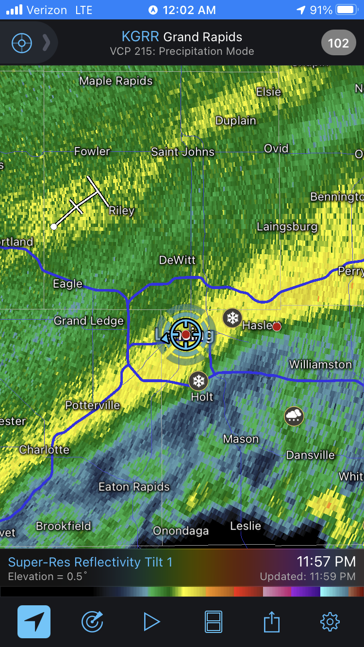
Temp profile still is questionable here in SE MI. Small differences in the strength and depth of the warm nose will mean the difference between sleet and freezing rain here. Plus the onshore easterly surface flow will keep areas east of the glacial ridge, including the immediate Detroit area, slightly warmer. Areas along and west of the glacial ridge certainly have a greater risk of more significant ice accretion. This is demonstrated well in the 12z HREF mean FRAM accretion, with <0.1" accretion in Detroit, 0.1" imby, and 0.2-0.3" along and west of the glacial ridge. A WWA was just issued by DTX, which at this point is a good call. That pivot band of snow on the backside of this storm looks to pass over here after hitting the Chicago area. Going for an imby call of 0.1" of ice accretion and a couple tenths of sleet for the Friday afternoon/evening period, followed by some rain, and then transitioning back to wintry precip with 1.5" of snow falling. The trailing vort on Sunday looks good for 1-3" of snow as well.
-
21z RAP has a thin strip of 1-4" of sleet across MI. The warm nose is pretty shallow and small for the first few hours, so I could see how this ends up being more sleet than ZR for some areas. Honestly would prefer sleet over an ice storm.
-
Picked up a quick 1.0" of snow as that band moved through. Looking solid for a glaze of ice later tonight. Sitting at 10.8" for the season now.
-
TSSN by Nashville, MI as indicated on RadarScope
-
Made a call elsewhere of 1" of snow and a glaze of ice for mby, Looks money based off the HRRR. Jealous of those rates out by Chicago and in Iowa. Buddy in Carol Stream said vis had to have been under 1/10th mile at times.
-
It's a shame that I'll be watching this all slide north and hope to just get a glaze of ice before it melts.
-
Euro has upper 50s dews in the warm sector with SSE winds. Develops a secondary low over Indiana. Honestly that run verbatim is kinda similar to 12/1/18, just farther east. Obviously wouldn’t expect much at all, but it is something to watch with the low looking to track pretty far west.
-
Gonna be 33 and rain here for Wednesday and the New Years storm. Tuff
-
On top of the 7 level parking garage between Washington Ave and Center St in Royal Oak! My favorite local spot for storm/lightning pictures too.
-
I finished with 3.4” of snow. Was looking like it would be a whiff to the east until 18ish hours out. This was the second biggest event of the season, with 3.7” on the 16-17th being the largest. December now has 7.6” total accumulation imby, and the season total is 9.8”. Still have a few inches less than surrounding spots. This December, though, has definitely been better than the last two now. Hopefully can snag something as the month ends.
-
At 3" exactly and it's still snowing. Hoping to squeeze a couple more tenths out this evening and then maybe a few more tonight, as the HRRR brings in a quick round overnight.
-
Measured 1.6" as of 7am. HRRR has a solid 1-2" later today. Officially got a white Christmas. I am pretty happy this morning. Merry Christmas!
-
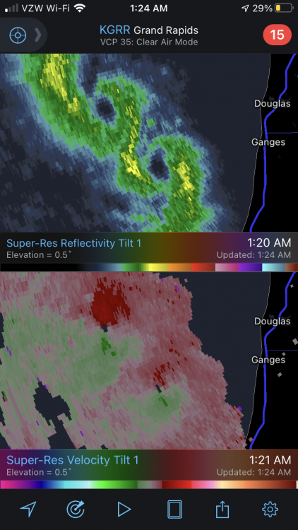
Impressive mesolow action west of South Haven
-
I'm at 0.5" as of 1am. As long as I am at 1"+ at 12z and get a couple more inches total, I'll take it as a big win.
-
I’ll take the 18z hrrr and run. 2” Christmas morning and 3-5” total Christmas Day.
-
Winter 2020-21 Medium/Long Range Discussion
MIstorm97 replied to Hoosier's topic in Lakes/Ohio Valley
Hate 2 c it
-
Got a link for that?
-
Really enjoyed my cold rain to back end flurries this morning
-
Winter 2020-21 Medium/Long Range Discussion
MIstorm97 replied to Hoosier's topic in Lakes/Ohio Valley
Just like last year! -
Winter 2020-21 Medium/Long Range Discussion
MIstorm97 replied to Hoosier's topic in Lakes/Ohio Valley
We can go nab the random Iowa tor that’ll happen at least -
Winter 2020-21 Medium/Long Range Discussion
MIstorm97 replied to Hoosier's topic in Lakes/Ohio Valley
Parade of rainers and misses. Really rockin’ -
My family now has a place between Baldwin and Ludington, right on the Pere Marquette. So I’m definitely more into LES on the west side of the state now than I was before. Looks like this will put a decent bit of snow up there