

olafminesaw
-
Posts
3,061 -
Joined
-
Last visited
Content Type
Profiles
Blogs
Forums
American Weather
Media Demo
Store
Gallery
Posts posted by olafminesaw
-
-
*Wedge Watch*
The GFS has the Triad in the low 70s Friday afternoon, while the hires NAM keeps temps in the mid to upper 40s.
I think I can count on a drizzly miserable Friday
-
The Triad gets a 3-5" snow after March 10th about every 15 years (2018, 1993, 1981, 1974, 1972, 1940). The latest 6" storm on record was March 9th 1960
-
 1
1
-
-
5 minutes ago, purduewx80 said:
It’s weird or perhaps to be expected that the SPC didn’t go with higher probabilities Friday over AL/GA/TN. The low is still deepening and wind fields overall are stronger than Thursday, with more than enough instability progged. Still some timing differences with the front but it’s slowed down a bit, pretty much like every other cut off low. A lot of the point fcst soundings highlight PDS tornado potential.
I would imagine they're still nailing down the area that will be the highest threat. Right now the I-85 corridor, from Atlanta to Charlotte, is looking to be the highest threat and should be in the enhanced tomorrow. A wide region has 40-50kt sustained winds at 925mb, which wouldn't have trouble mixing to the surface. As for tornadoes, it seems hodographs are showing somewhat more unidirectional shear than optimal (more hockey stick shaped than curved), but I could be wrong.
-
 1
1
-
-
Starting to become somewhat concerned about the wind threat Friday afternoon/evening. All the globals have around 50 mph gusts across the Piedmont. Could very well be overdone, but a pretty wide wind field, regardless of track.
-
16 hours ago, GaWx said:
Tony/all,
The prior Euro Weeklies run's March 13-20 had had the strongest cold signal for the E US for any week in March of 2023 yet. And now the brand new one for that week (see image below) has a significantly stronger cold signal than even that one.
In addition, the subsequent week (March 20-27) on this new run has a much stronger cold signal than the prior run had for that week and about as strong a signal as the prior run's March 13-20.
So, this is an impressively strong cold signal for the E US overall on today's Euro weeklies for 3/13-27! The major SSW and the upcoming new very notable strat weakening are looking to do their thing apparently! This new strat weakening is projected to bring 60N 10 mb winds all the way down to near -17 m/s on Feb 28th! The major SSW, though quite impressive in its own right, brought those winds down "only" down to -13 m/s (on Feb 18th).The latest extended GEFS largely agrees. So, the Feb that we've missed out on may actually finally arrive here in March! Tony, sleet could still be in your near future for all anyone knows!
I'll go even further. No single week in any of Jan, Feb, or March of 2023 on any Weeklies run back to Jan 5th (14 runs excluding today's) has had as strong a cold signal (vs normal of course) for the E US as today's for March 13-20 with today's run for March 20-27 and last week's for March 13-20 about tied for second coldest signal.

The CPC agrees

-
3
-
1
-
-
Don't see a 979 mb bomb over the Apps very often...
-
1 hour ago, NorthHillsWx said:
Highs in the 50’s instead of 60’s
Would be nice not to have to use the AC until April for once.
-
-
Yesterday's high of 81 in GSO, ties the all time record for February and the low of 63 ties the all time max-min temp for February.
-
1
-
-
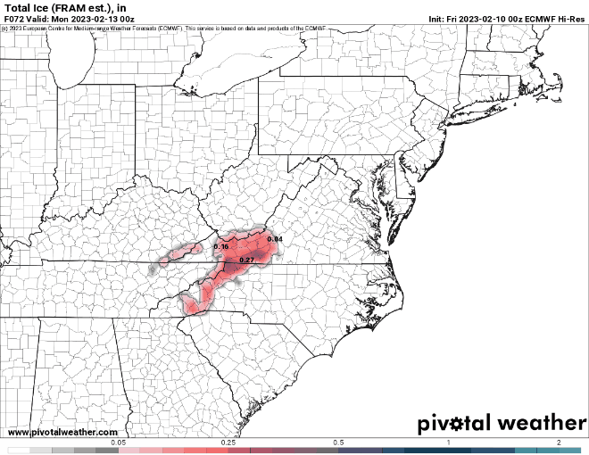
Perhaps one last dance around March 2nd... nothing to lose, little to gain.
.thumb.png.06e4eaf75fa19b750354cfc041ca5fe0.png)
-
2
-
 4
4
-
 2
2
-
-
23 minutes ago, GaWx said:
The models are doubting the freezing part other than near the VA border, but regardless, much of NC has a good chance to be 40-45 colder Saturday afternoon vs Thu afternoon! They're projecting dewpoint drops from 60s to 20s during Friday.
Add it to the pile of cases where the column was just a few degrees too warm all the way up. Still it's far enough out that it could certainly change.
-
2
-
-
It sounds crazy after the warmth late this week, but gotta still watch this coming Saturday for a little light freezing precip, with the high locked in and moisture running along the a warm front.

-
1
-
-
Based on AccuWeather forecasts the piedmont will be near record warm for February:
GSO: +7.8, 1.1 degrees below the record
RAH: +8.6, .5 degrees below the record
-
On 2/17/2023 at 2:32 PM, SENC said:
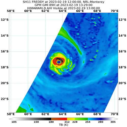
No One talking about TS Freddie?
Dangerous Cyclone Freddy Taking Aim At Africa
There is concern that Tropical Cyclone Freddy will make landfall next week on the eastern coast of Africa with high winds and heavy rain.
&&&
Tropical Cyclone Freddy could be headed for the record books
Tropical Cyclone Freddy formed in Australian waters about two weeks ago and is still tracking across the Indian Ocean, putting it on track to challenge two world records.
The tropical low that would become Tropical Cyclone Freddy initially formed late on Saturday February 4, before being upgraded to a category 1 tropical cyclone on Monday, February 6.
Freddy initially moved to the south until it was about 660km northeast of Broome, where it took a turn to the west. While in Australian waters, Freddy posed no threat to the mainland, Christmas or the Cocos (Keeling) Islands, even as it became a category 4 severe tropical cyclone with wind gusts of up to 265km/h. It eventually left Australia's region of responsibility on February 14, as it tracked towards the west across longitude 90 degrees east.
More @ link---> Tropical Cyclone Freddy could be headed for the record books (weatherzone.com.au)
A good bit of discussion happening on the storm2k forum. Freddy is a beast!
-
Look at that lift right at the dendrite growth zone, lol! Could be a fun little squall line, albeit sub-severe
.thumb.png.18d2b23f2ad2d83f68a2ad2fefbc944e.png)
-
5 minutes ago, olafminesaw said:
Starting to see a signal for a CAD event around the last week of the month. It's kinda more shocking we haven't had anything close to frozen from CAD this year than that we haven't had any snow. This time of year, cold rain is the more likely outcome though.
Actually in Greensboro, 90-91 had two ZR/Sleet events (as well as one period of light snow) and 91-92 had one light zr event (mid February). So this year would be truly unprecedented if no more frozen fell through the end of the winter.
-
Starting to see a signal for a CAD event around the last week of the month. It's kinda more shocking we haven't had anything close to frozen from CAD this year than that we haven't had any snow. This time of year, cold rain is the more likely outcome though.
-
Looks like there's going to be a lot of cold air in Canada for once, but nothing to force it South

-
I will take my token flakes and run:
.thumb.png.40fc2701ab2ce05c1a835656c426dae8.png)
-
*sigh...

-
1
-
-
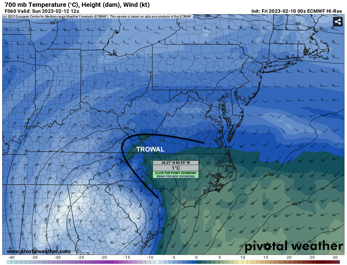
52 minutes ago, purduewx80 said:
There is almost better agreement on the freezing rain potential than for snow. A surface high over the Mid-Atlantic could maintain just enough dry air to wet bulb surface temps down to or below freezing near the Blue Ridge (esp. sheltered valleys and some ridge tops) as the heaviest precip moves through. The TROWAL (trough of warm air aloft) provides the melting aloft for that and also contributes to the upright instability that will be crucial for flipping rain over to snow despite marginal boundary layer temps for elevations below ~1500'. The favored zone for heavy snow will be just northwest of the core of the closed 700/500mb circulations, but predicting where and when convection occurs this far out, even on hi-res guidance, is next to impossible. That's why ensembles are still a good tool for a marginal situation like this.

Any analogs you can think of for this sort of ZR event? I figure there isn't really a chance for this to occur below 1,500 ft or so
-
Not good trends on the overnight models for anyone east of the mountains. No cold air to speak of. Too far North and too weak.
-
10 minutes ago, strongwxnc said:
A stronger low with a slightly more southerly placement than shown two posts above. Going to be a tight fine line this way for sure.
.Yeah, especially since I feel we've seen stronger ULLs get tugged further north/inland (and vice versa). Also the potential is limited because the western Piedmont and northern foothills will likely sit in the dry slot for a while
-
1
-
-
Thermals are kinda trash, but a nice track for the piedmont that run

-
1
-
.png.4b9c03b6071be5d695d90f5e02266d9c.png)
.png.dd43329600341ef450d5edf0b83af148.png)

.png.026ebdcbb34d14daa8dab07277c7f444.png)
.png.c47925b1fa3b83e8f2269366f0a6af33.png)


March 3-4 Potential Winter Storm
in Lakes/Ohio Valley
Posted
Gosh, I feel for y'all, looks like mode spread 3-5 days out, not 24-48 hours out!