HIPPYVALLEY
-
Posts
32,949 -
Joined
-
Last visited
Content Type
Profiles
Blogs
Forums
American Weather
Media Demo
Store
Gallery
Everything posted by HIPPYVALLEY
-
I’m completely ready for two suns setting in my Tatooine back yard. Please give me a summer averaging 80/50 for daytime temp/dp.
-
70+ DP’s? if I didn’t know, better, I would tell you to back away from the bong.
-
-
Same, same.
-
Warm weather is coming and very few are arguing that there won’t be heat and AN temps. Kevin seems to think, for some reason, there’s gonna be some sort of wire to wire HHHHalls of Satan inferno.
-
I mean, haven’t we sort of been expecting that for days now? Middle of next week has looked quite warm on long range for a while. When it’s June, it’s time to have some 80s.
-
GFS wants to rain the following weekend also.
-
Of course we couldn’t get through the day without a rain shower.
-
In bursts, not prolonged stretches. Seasons in seasons.
-
This sums it up.

-
Why would I want a day like this in July?
-
A few upper 80’s days, retreat back to 70’s then bounce back up again. I feel like there’s not going to be any prolonged high heat or prolonged BN this summer. Just up and down steady as she goes kind of summer with bursts of HHH but nothing remarkable.
-
Same here, but I guess we needed to keep the weekend rain streak alive. I think this is now 10 in a row here, with at least some precipitation on one of the days.
-
Oh good, more rain moving in.
-
Yet we can't have this in January with a cold high over W Quebec? It's been .25" of rain per hour since 6pm
-
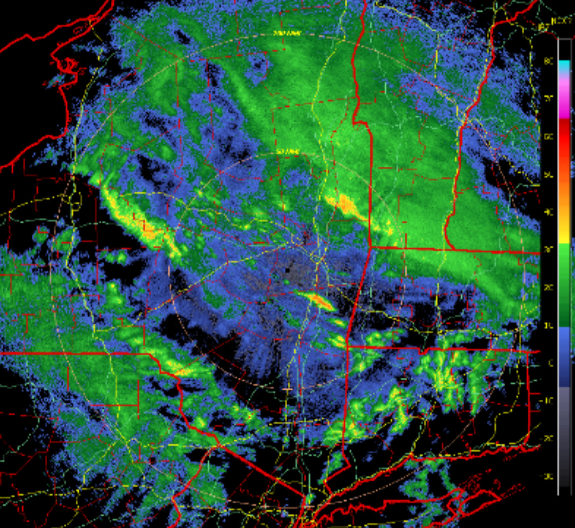
Radar has been impressive for hours now.
-
Wow, only 75” here but coming down pretty good now.
-
42° with windswept showers here right now. Debating whether I should fire up the woodstove or not.
-
Oh, OK. I wasn’t considering any of the dynamics of cold season verse warm season. Just looking at the radar shaking my head. Lol.
-
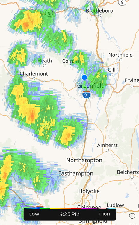
46° in Greenfield with steady light rain, but somewhat bright cloud deck.
-
If this were a snowstorm, west of River would be getting porked.
-
I mean, I hope that somebody that wants to see snow, legit sees snow in the next two days. I am a diehard winter lover, but I am ready for warmer weather and a healthy garden.. I want low 80s and dew points in the 30s.
-
-
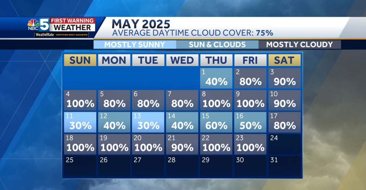
Nice trends towards a bit less precip here. Tomorrow will be as bad as it can gets, with regard to late May raw in SNE.
-
Yet we can’t buy these early deformation bands along RT 2 in winter.