DeltaT13
-
Posts
3,006 -
Joined
-
Last visited
Content Type
Profiles
Blogs
Forums
American Weather
Media Demo
Store
Gallery
Everything posted by DeltaT13
-
 IMG_2879.MOV
 -
That was incredibly heavy snow, wow! Honestly way heavier rates than anything I saw in Buffalo the other day. I was getting lost and disoriented on roads I’ve been on 100 times. 10 foot visibility at best during the peak. Really impressed. That was worth the price of admission. I took a couple vids but the camera does a great job of filtering out scattered light and noise so never really looks like much. I’ll see if any are decent after I eat.
-
It is nuking!
-
I hadn’t expected much after the front but I don’t know how we don’t get something with that kind of upstream seeding.
-
Welp, off I go up 390 to blast through the band. It’ll be my 15 mins of fun tonight. It definitely looks juicy albeit razor thin. I’m hoping to drive back south with it for a bit and hang in the meat of it.
-
This, 100 percent. The front grabs the band, intensifies it, moves it boldly due south and it evaporates like a fart in the wind about 1 hour later. That 1 hour is usually fun but there is no stalling an arctic boundary on a Northerly flow. We barely even get the scraps.
-
I think the convective nature of lake effect causes a lot of vertical mixing within the cloud as strong updrafts cycle snow that is currently falling back up into the portion of the cloud where water is condensing and snow is forming. The combination of these strong updrafts smashing snowflakes together along with a lot of Latent heat release eventually forms the graupel pellets. That’s just my guess at least. I always see graupel in the really heavy bands though, including last week in Buffalo
-
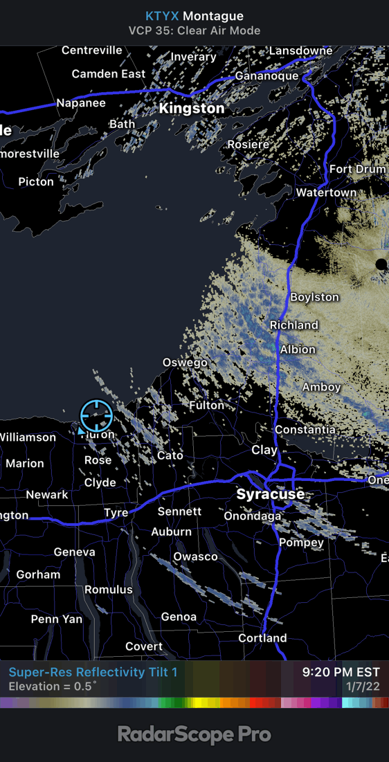
Good Wayne county spotters are important with the lack of radar coverage for lake effect events. Glad to have you two. West of me is a huge hole. I don’t think we have or have ever had one Orleans member.
-
North Huron, right on a bluff in a house that just gets rocked.
-
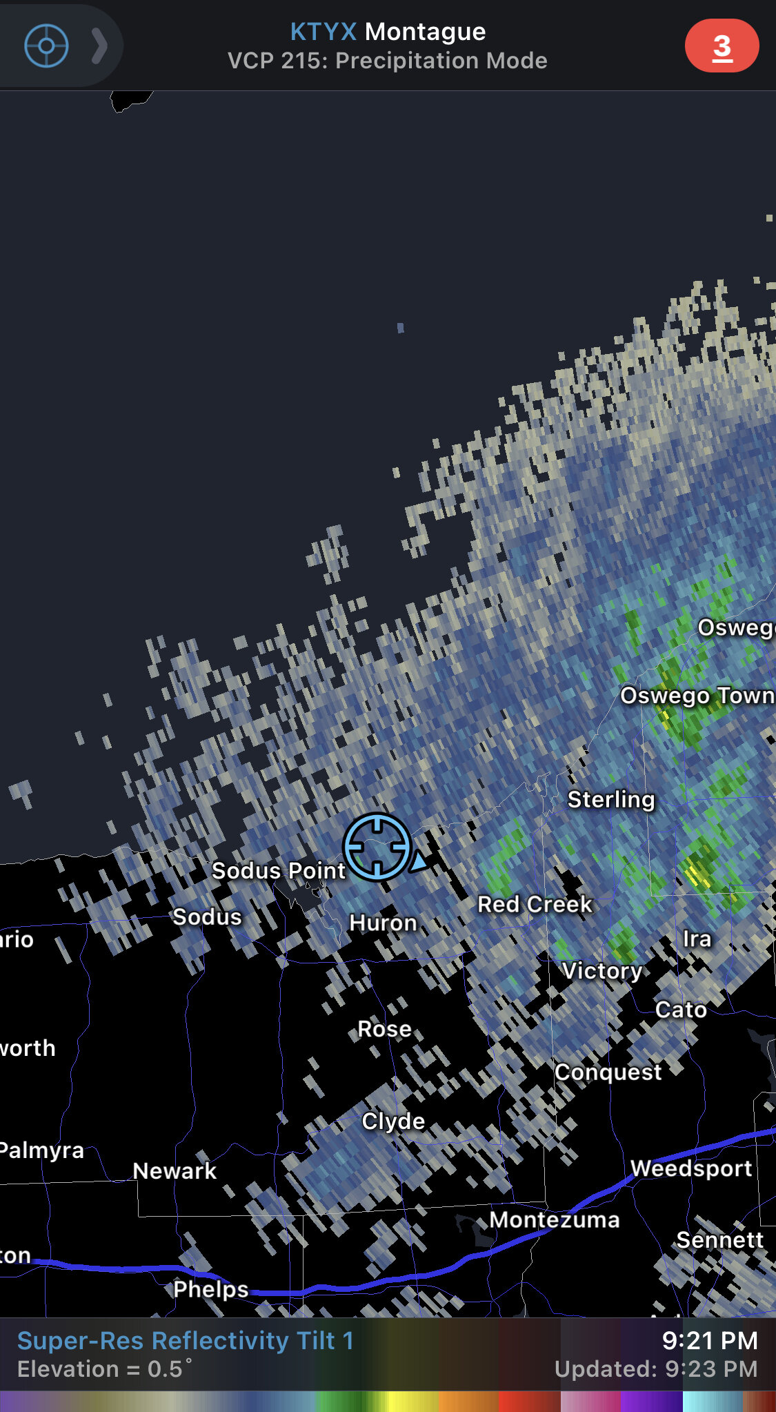
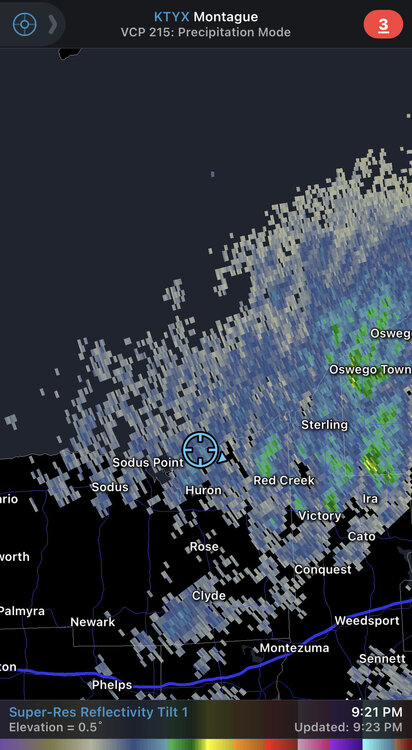
I’m still up on Lake Ontario until tomorrow and the wind is roaring. I’ve never spent time right on the lake during winter. It’s a whole different world and right up my alley. Some heavy squalls popping through every few minutes.
-
Probably 12-16:1. Didn’t seem like an outright fluff bomb.
-
Again, you can’t figure this out yourself and you’re studying to be a meteorologist? As a meteorologist, you don’t get to tell the public hey I really don’t have a lot of confidence in my forecast. You have to make a tough call and then stick to it. That’s why it’s a hard profession. I can just see you in a few years standing up there and telling the public “I really don’t know what’s going to happen tomorrow”, I’m sure you’ll be employed for a long time. Smarten up.
-
Haha. Nah, that’s just the front, but it probably scooped a little moisture. Temps should be dropping real soon for you.
-
The whole premise of this thread is ridiculous. So what, a snowfall forecast was missed for a couple cities on the east coast during a Nor’easter. Missing the position of the coastal front by a couple miles can happen, which sometimes unfortunately affects millions of people. But there were also thousands of accurate forecasts for that event, probably close to 80-90 percent verified. So why bother pointing out the the few that failed, especially in a snowstorm where a missed snowfall amount rarely results in any significant loss of life. The fact that you can’t figure this out right now, as a supposed Met student working towards a masters and after ruminating on it for 26 years; tells me you don’t have the common sense or intelligence to succeed in this field. Stick to the drive through window….you obnoxious troll.
- 148 replies
-
- 10
-

-

-

-
Amazing sounding. Now picture where the lake temp is, around 5c. That’s a shit ton of CAPE to work with.
-
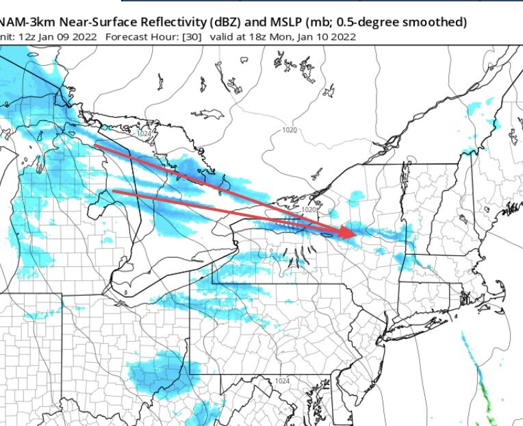
This setup looks about as good as you could hope. Extreme instability from deep Arctic air, upstream seeding from two separate bands on slightly different trajectories, that converge right at the south east end of a lake that has surface temps in the low 40s, and an approaching shortwave with increasing synoptic moisture. I mean come on. If you chase this one you better know what you’re doing.
-
It shows a very dry atmosphere basically devoid of any synoptic moisture. It does show very steep low level lapse rates and thus a conditionally unstable boundary layer, but without moisture it doesn’t mean much. Almost no directional wind shear but winds are nearly due west. Lake induced instability would be extreme under that.
-
I think .5 inch is when the trouble starts. Anything over an inch is massive damage. You’re throwing around big numbers there. 2.5 inches is complete and utter destruction and probably a 100 year or more event.
-
I mean yesterday ended up pretty decent and I’m still in snow showers tonight. I’m not full on ThM yet. Don’t put this on me.
-
It’s just a setting if I remember.
-
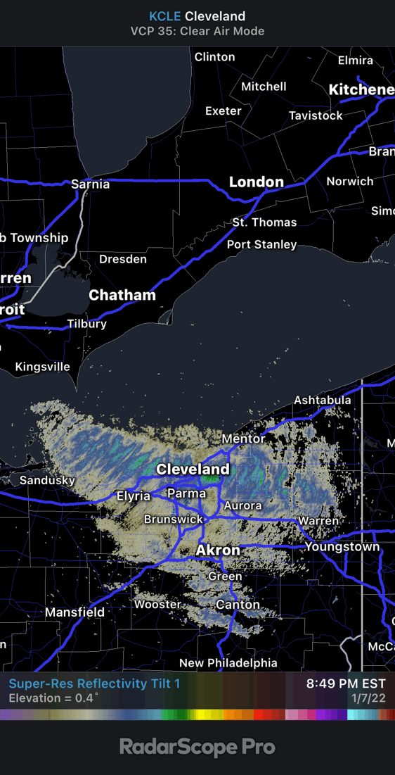
This is pretty impressive looking stuff tonight (for a NW flow). I’m kind of sad that of all night for me to be at this nice cabin my home appears to be getting really nice lake effect. You can’t win.
-
Look at this steam plume on the West end of Erie. Definitely an unusual look to that band and how it diffuses and spreads out.

-
The radar is overshooting me but that’s the location. The drifts on the north south roads were pretty awesome.
-
I’m staying at a friends house on East Bay (southeast corner of Lake Ontario.)The house is on a bluff and the winds tonight have been amazing. Just constant 45mph winds with heavy snow squalls as the roll convection bands just keeps moving through. It’s a different world on the lake.
-
Reminds me of that pattern from February 2015. Just wish we had a nice snowpack laid down to ride it out with.