
David-LI
-
Posts
1,440 -
Joined
-
Last visited
Content Type
Profiles
Blogs
Forums
American Weather
Media Demo
Store
Gallery
Everything posted by David-LI
-
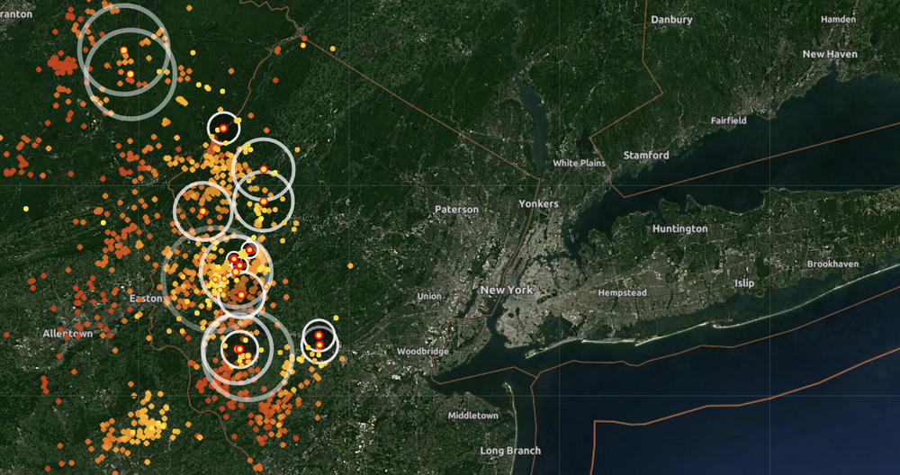
Lots of lightning strikes to our west
-
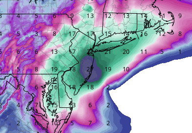
11" reporterd in Malapan Township, Monmouth county nj 8.2" in Battery Park NYC
-
it will be ripping still in the morning tomorrow
-
-
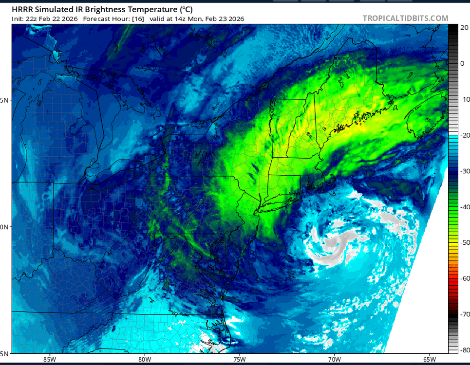
This is 9 am Monday. It will have an eye, like Sauron.
-
It's ripping in north Nassau County.
-
very high chance some of us will loser power
-
if you want to avoid the crowds sure, but it should be ok to drive until the afternoon, it starts early but it cranks up in the afternoon/evening
-
-
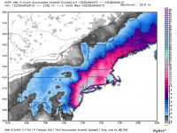
still snowing a bit during this, HRRR 0z
-
according to NAM 3k it could start as early as 8 am in nyc and LI
-
and why is that a red flag?
-
how so?
-
that's awesome and electrifying!
-
0 wind outside, literally the calm before the storm
-
when do they send that alert that makes all the phones start blasting with a loud sound? Havent got one yet. Not officially a blizzard until I get that alert.
-
kudos to you for these updates.
-
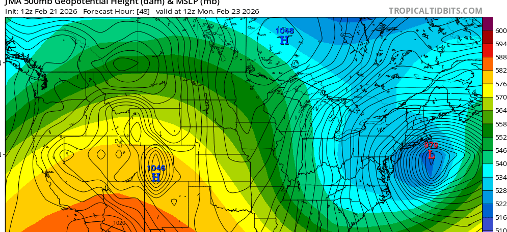
Don't think anyone cares about the JMA but the 12z is stronger than previous runs
-
yep Im losing power. I also just realized we are under a blizzard warning.
-
Im too lazy to go back 10 forum pages. How was the 06z euro?
-
I was honestly thinking about this today. Every model run trends worse. For at least the last 10 years. But not this one. I hope I didnt jinxed it
-
lol not really are you? I actually want spring. My kids are bored out of their minds so am I. I want spring. But if we get a big snowstorm that would be amazing too. Edit: A big snowstorm is cool, but spring is better. I would rather prefer that
-
The storm hasnt even happened yet. The euro might as well be right.
-
I hate to say it but it might be on to something, and I hate AI
-
At least this storm will be easier to clean compared to the last one. It's just that you're going to get a few inches on your porch and a mountain of 40" on your garage or kitchen door, or the other way around depending what direction your house faces.


