stormtracker
-
Posts
64,391 -
Joined
-
Last visited
Content Type
Profiles
Blogs
Forums
American Weather
Media Demo
Store
Gallery
Everything posted by stormtracker
-
 Euro has it, looks light tho
 -
Don't worry, the Euro will save us.
-
Shocked
-
Canadian has it so far...let's see what happens if/when it gets to us
-
Deadly. Lock it up.
-
Popping the champagne right now.
-
Trended better. We'll see how long this lasts
-
I just looked at H5...figured nothing was there
-
We lost the illustrious ICON
-
ICON finally gets a clue. That was fun tho.
-
It's in a league with the GFS. That's not a complement.
-
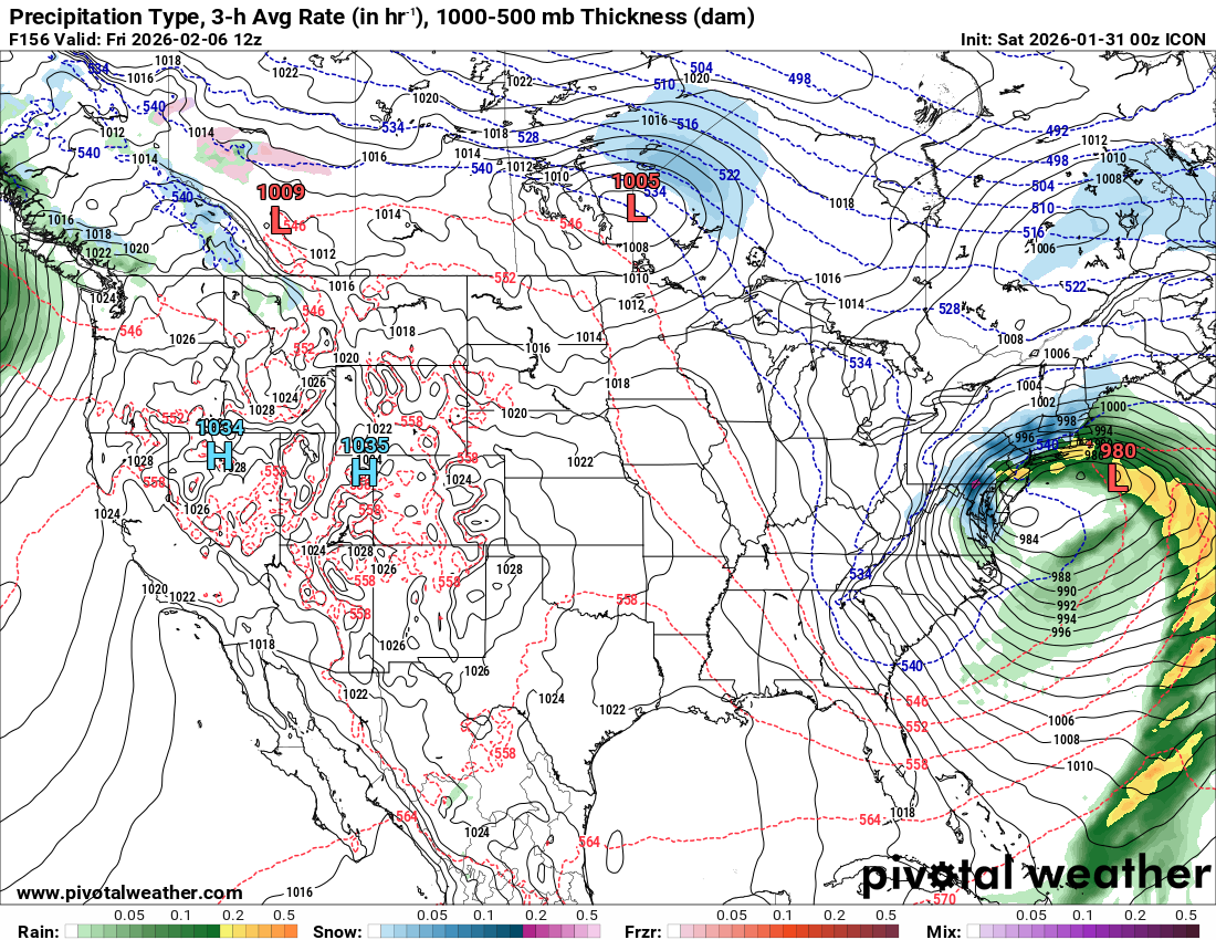
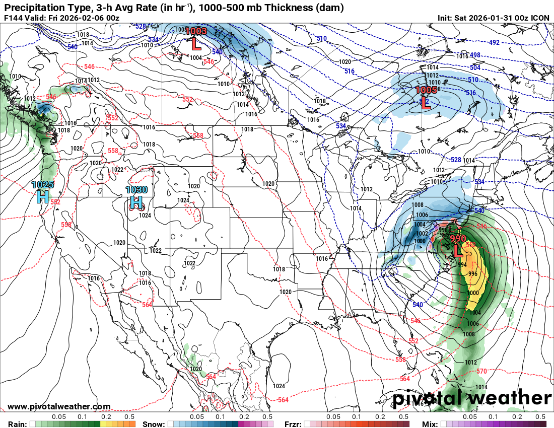
6z ICON is about to do some damage to us. Look at the H5 and surface
-
Looks like a modest hit
-
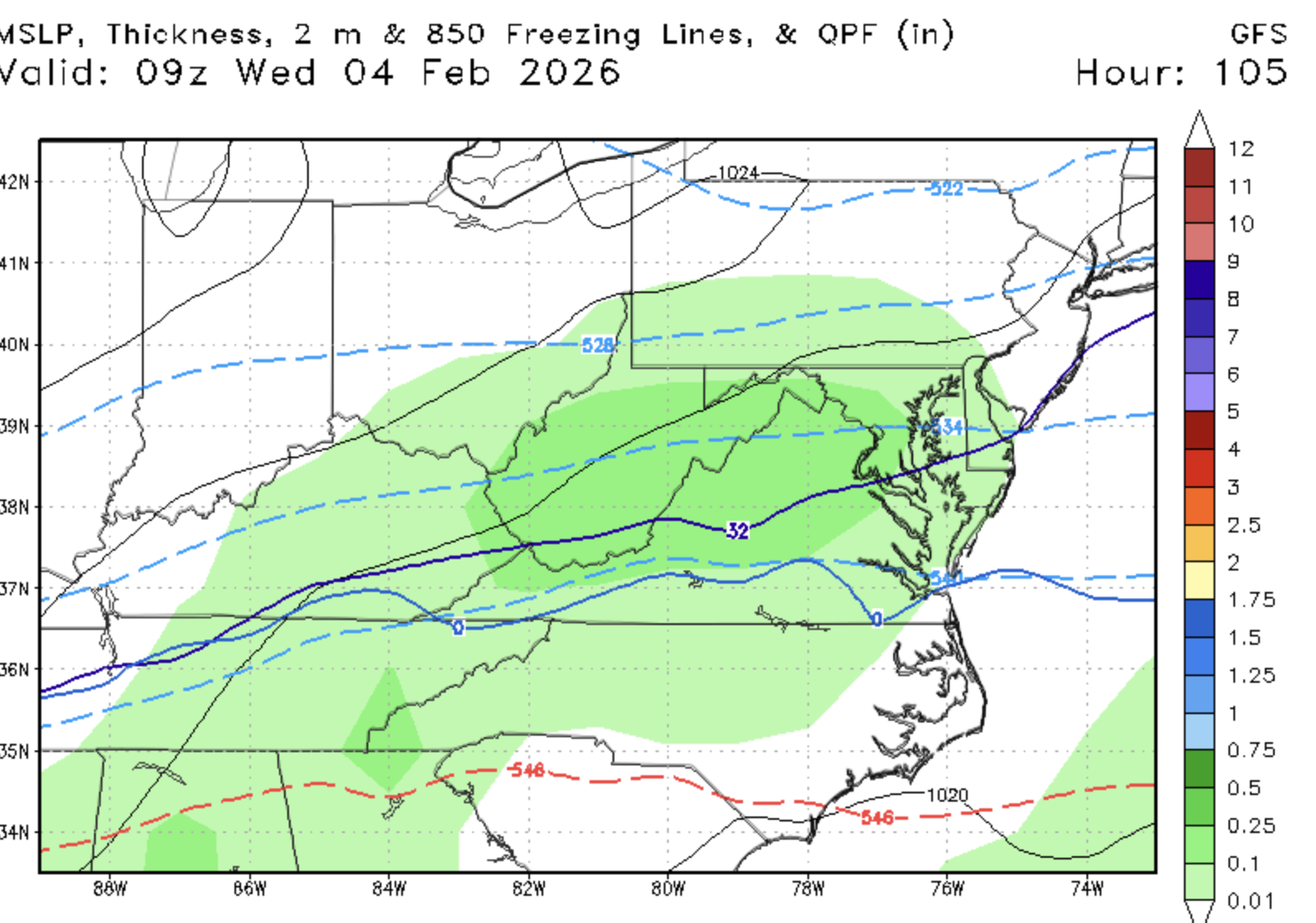
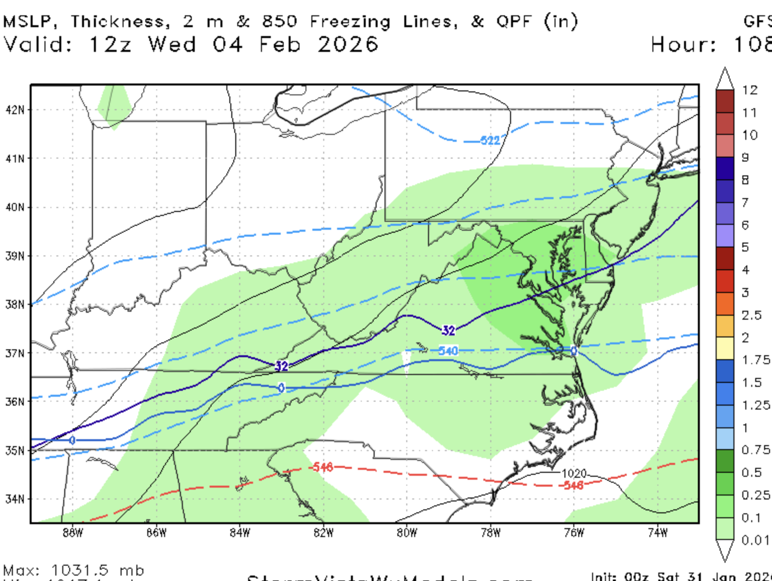
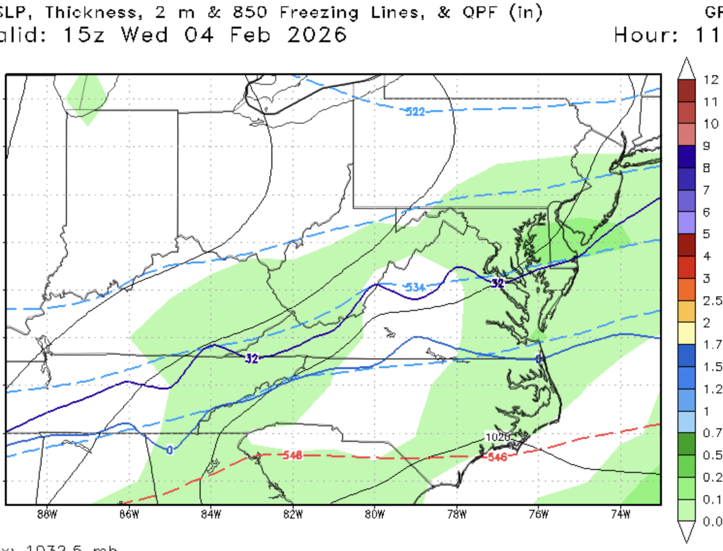
GFS is further north.
-
Well, I don't know if it;s good or bad, but the h5 on the GFS is different. s.w hangs back
-
Snuck up on me good. Looks like 5-10" area wide
-
This one is even better
-
Now that's a good looking panel
-
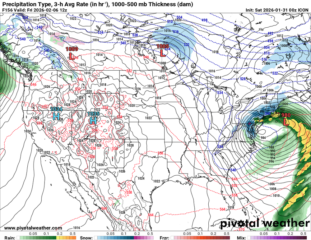
ICON is intese. So much so that we get a mix. Negative tilt and all
-
Eh. Panics isn’t the right word. I’ll wait for some consistency.
-
In this famine, I'd take it
-
Wait, what? And he called that not pretty???
-
Figured