stormtracker
-
Posts
64,391 -
Joined
-
Last visited
Content Type
Profiles
Blogs
Forums
American Weather
Media Demo
Store
Gallery
Everything posted by stormtracker
-
Shut up
-
DC rn
- 553 replies
-
- 16
-

-

-

-
 Keep us posted. This will def help us extrapolate in this here LONG RANGE thread.
 -
ok, 55. Firm. Final offer
-
Pull that snow 75 miles SE and it's a forum winner
-
Yeah, you have the good maps. Looks like non frozen snow? Also has some pre-party event at 162
-
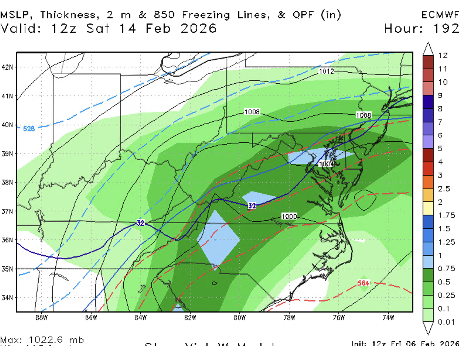
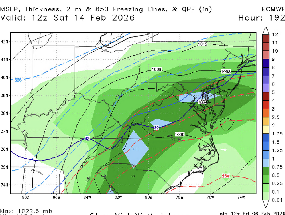
Looks like another sleet bomb, lol. But close enough. Nice QPF
-
Euro so close
-
If by east of Dc you mean Ocean City, yeah
-
Well we all can't make "north of 150k" and be middle managers.
-
CMC looks weird. At least on pivotal. Jumps precip all around us
-
And yet, you're still here. Rage posting, spittle in the corner of your mouth. All the while whining about folks with a sense of superiority while using your salary as a reason why.....you think you're better than people. Can't make this shit up.
-
Well shitfire. Yeah..No questions. Take.
-
Things always look so much better with the pretty maps. That thump is nice. Any accum maps yet?
-
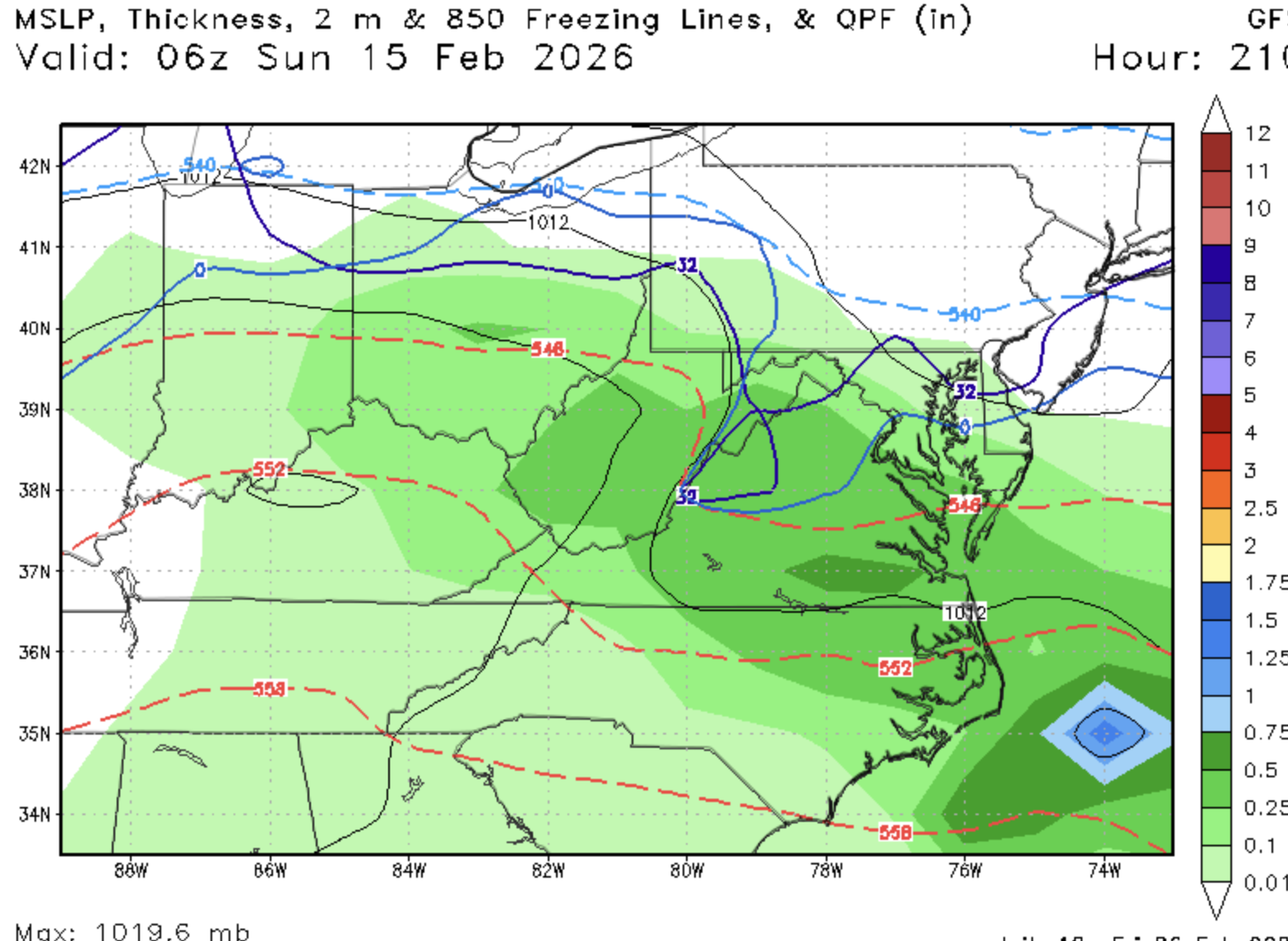
If you don't take this run verbatim wrt to temps, it's not that bad. Cold is close enough and...it's the GFS
-
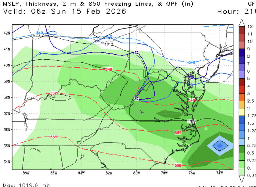
Honestly, it's not bad. Especially for it being the suck ass GFS. Cold enough that it's not rain...warm enough that it's not all snow for everyone. N and W of the fall line appears to be snow?
-
I mean, the takeaway is still....we trackin' next week. STORMTRACKIN'
-
Some weak CAD...zero isotherm is barely south of DC with precip
-
GFS has a good slug of precip to our SW, but is gonna fuck it up with retreating thermals next weekend.
-
Tracks
-
ULL up over Maine just cut that s/w down to almost nothing at the Surface. Goofy Fucking System model.
-
Could be north of that
-
You guys will be shocked to know that the 18z GFS h5 map is vastly different out west. But looks like that s/w is headed for shredderola
-
Happy BHM
-
Yes, this is ideal actually. Wonder how much the met in this pic is paying his mom for rent. Probably has a tray of Tostinos and Mt Dew on that desk.