

wasnow215
-
Posts
2,027 -
Joined
-
Last visited
Content Type
Profiles
Blogs
Forums
American Weather
Media Demo
Store
Gallery
Everything posted by wasnow215
-
Richmond Metro/Hampton Roads Area Discussion
wasnow215 replied to RIC Airport's topic in Mid Atlantic
Nice look for sure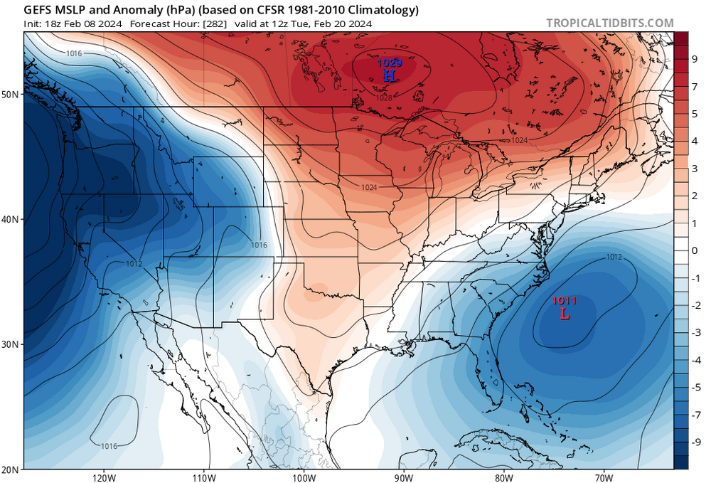
-
Richmond Metro/Hampton Roads Area Discussion
wasnow215 replied to RIC Airport's topic in Mid Atlantic
Exactly what I was thinking -
Richmond Metro/Hampton Roads Area Discussion
wasnow215 replied to RIC Airport's topic in Mid Atlantic
Super busy day but ..let’s go! -
Richmond Metro/Hampton Roads Area Discussion
wasnow215 replied to RIC Airport's topic in Mid Atlantic
6z GFS somewhat more south for both 2/13 and 2/18-19. -
Richmond Metro/Hampton Roads Area Discussion
wasnow215 replied to RIC Airport's topic in Mid Atlantic
@RIC Airportdidn’t the Dec 9 2018 big snow come after some pretty warm early Dec temps or no? I thought it was. -
Richmond Metro/Hampton Roads Area Discussion
wasnow215 replied to RIC Airport's topic in Mid Atlantic
Also, with the pattern change, conditions will be much more ripe for possible snowstorms in our area than they have been for a very long time. So this adds to the confidence of swing at least a SECS or MECS. -
Richmond Metro/Hampton Roads Area Discussion
wasnow215 replied to RIC Airport's topic in Mid Atlantic
Good news is many of us have seen this multiple times in different places, where it’s in the 50s and even lower 60s one day, and a big snowstorm the next day. -
This thread about to get awfully quiet soon except for these Dr Phil sessions (I would put “LOL” here but you know)
-
Lol-that’s cool and fair enough. Wasn’t talking about you in particular. But I had been disinterested for a month but hearing about the -Nao/ridge/blocking pattern upcoming gave me renewed interest. And only heard it would be in the 2/15 to 3/15 window. I really thought the next couple weeks were supposed to be tranquil. That’s why I don’t think it’s can kicking.
-
This forecast only goes to 2/11. Pattern change isn’t supposed to happen until 2/15. I think impatience is the bigger issue and negativity not “can kicking”.
-
Exactly-No can kick. People who root for a bad football team do this same thing. Because their team stinks they only get joy by rooting against other teams. Just arrogance and negativity and little more.
-
Richmond Metro/Hampton Roads Area Discussion
wasnow215 replied to RIC Airport's topic in Mid Atlantic
Lived in Atlantic Co, NJ. Far enough inland it stayed all snow and had a foot and a half in 1979. Was in 5th grade and no school for a week. in 2003 was living in Cape May Co, NJ. Over 20”! Both storms amazing!! -
What I love about Jeb’s consistent positivity is it’s JUST AS REAL and appropriate as anyone consistently writing “I’m not sure” (anyone can say that lol) or “this is gonna bust!!”. Keep it up Jeb -thank God you’re not a DEB!! Hahahaha!!
-
Richmond Metro/Hampton Roads Area Discussion
wasnow215 replied to RIC Airport's topic in Mid Atlantic
Shows some snow around the 16th ish. It’s gonna snow/ice. Conditions will be to ripe for it not to. -
Richmond Metro/Hampton Roads Area Discussion
wasnow215 replied to RIC Airport's topic in Mid Atlantic
I think there will be a ton of tracking starting a week from now and hopefully we cash in by President’s Day and beyond! -
Richmond Metro/Hampton Roads Area Discussion
wasnow215 replied to RIC Airport's topic in Mid Atlantic
100% @RIC Airport! Pattern changes and fantasy clown maps 16 days away have virtually nothing to do with each other. -
Richmond Metro/Hampton Roads Area Discussion
wasnow215 replied to RIC Airport's topic in Mid Atlantic
Lol I don’t get offended by that kind of stuff. Too many other things more important in life. -
Richmond Metro/Hampton Roads Area Discussion
wasnow215 replied to RIC Airport's topic in Mid Atlantic
It’s a true honor to have you here man!! Thanks for checking in!! Down here btw we were originators of “How much for Short Pump?” Hahahaha!! -
Richmond Metro/Hampton Roads Area Discussion
wasnow215 replied to RIC Airport's topic in Mid Atlantic
Perfect split flow. Couldn’t draw it up any better. -
Richmond Metro/Hampton Roads Area Discussion
wasnow215 replied to RIC Airport's topic in Mid Atlantic
2/15-3/15 period is going to be rockin!! -
Richmond Metro/Hampton Roads Area Discussion
wasnow215 replied to RIC Airport's topic in Mid Atlantic
Lol sorry I meant the spread map you put out sometimes that shows the whole region with the average accumulation throughout -
Richmond Metro/Hampton Roads Area Discussion
wasnow215 replied to RIC Airport's topic in Mid Atlantic
Euro ensembles? 12z -
Richmond Metro/Hampton Roads Area Discussion
wasnow215 replied to RIC Airport's topic in Mid Atlantic
12z but yeah -
Richmond Metro/Hampton Roads Area Discussion
wasnow215 replied to RIC Airport's topic in Mid Atlantic
Again looking at 12z GFS it looks again like 2am-4am snow showers and temps below 32° Short Pump area. Clearly from the city south and east nothing really at all I was just concerned about those North west areas of the city. I appreciate the input from all of you! -
Richmond Metro/Hampton Roads Area Discussion
wasnow215 replied to RIC Airport's topic in Mid Atlantic
@RIC Airportspecific question and need your help please regarding a meeting near short pump for tomorrow very early. It’s looking like there could be an inch of snow according to the GFS right around 3 AM-5am. We may cancel or do online only? Thoughts?


