
attml
-
Posts
333 -
Joined
-
Last visited
Content Type
Profiles
Blogs
Forums
American Weather
Media Demo
Store
Gallery
Everything posted by attml
-

Jan 31st - 33rd Storm Obs and Disco like it's 1979
attml replied to Bob Chill's topic in Mid Atlantic
First flakes at 7:30AM - Temp: 32.5 DP: 25 -
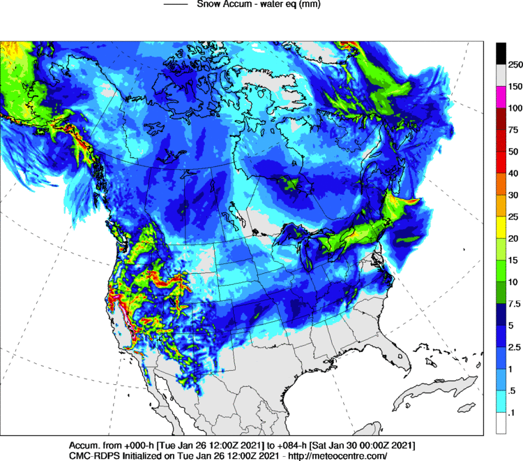
Yes sir! It is just still hard to look at those maps and not laugh! Every state in the country except Florida, Louisiana and South Carolina gets snow on the GDPS map. If it wasn't for Western MD we would be the 4th and final state! Given our placement in the overall CONUS geography of the country that is difficult to do! Once again - I say we overachieve at underachieving!
-
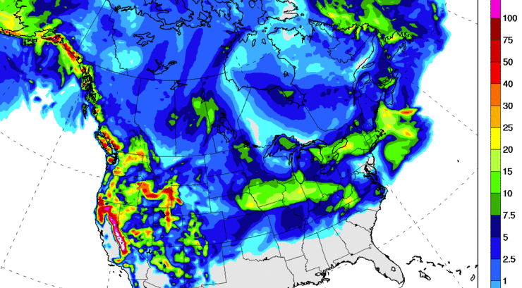
And the RDPS concurs with the GDPS Mid-Atlantic Snow Hole!
-
Just a quick reminder for anyone believing that the 41 inches showing on the current Euro will actually verify! The map below is pretty hard to do but we always seem to over achieve at underachieving! Lol!
-
36.1 degrees / dew-point 20 degrees - light snow just started 10 minutes ago
-
Man this is such a tease! It looks like it should be coming right at us in the form of a coastal!!
-
-
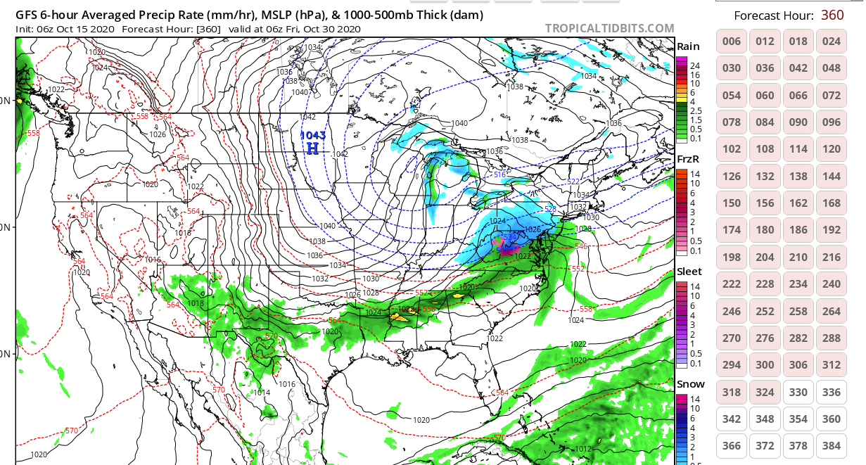
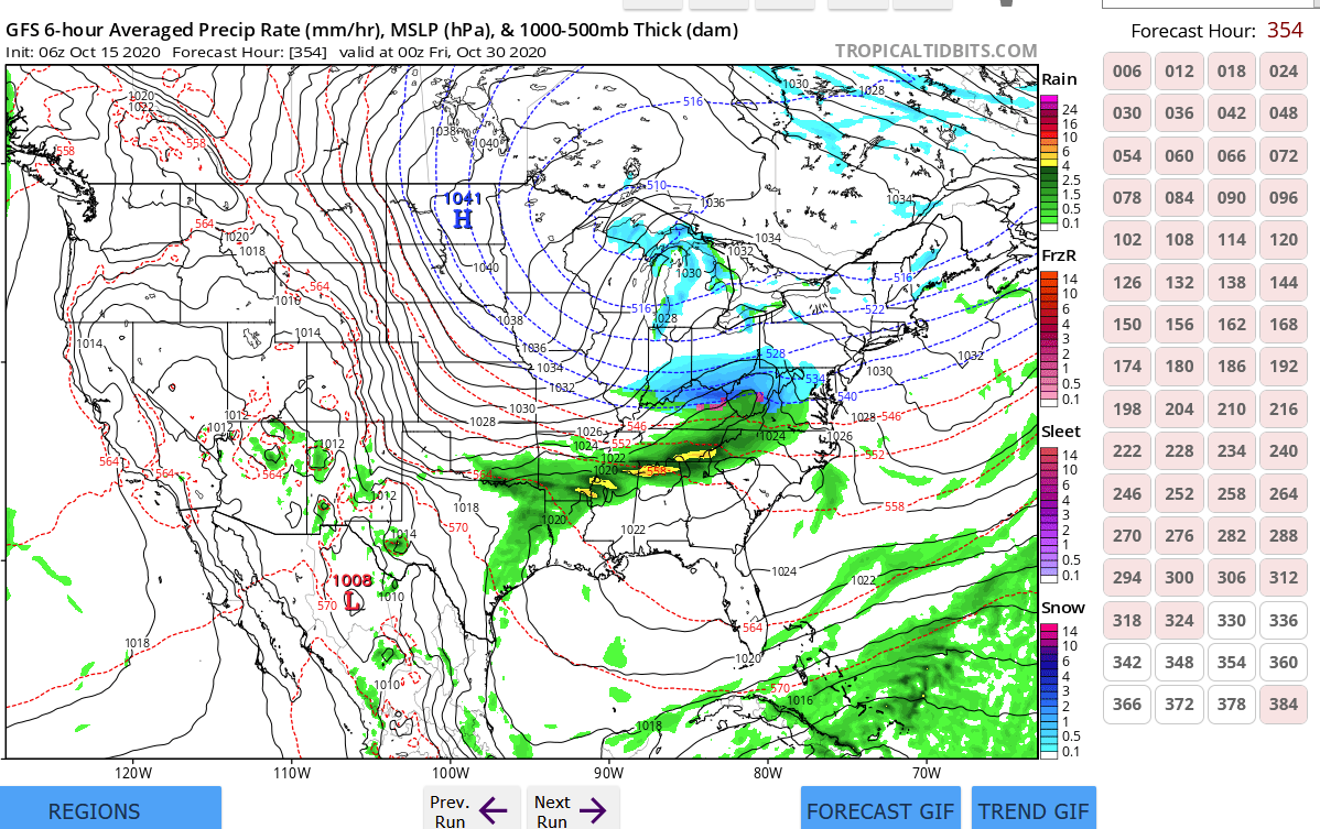
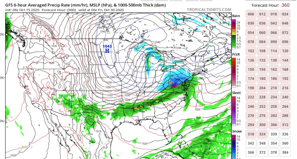
I know it is 300+ out so it will definitely verify - here we go! Trick or Treat?

-
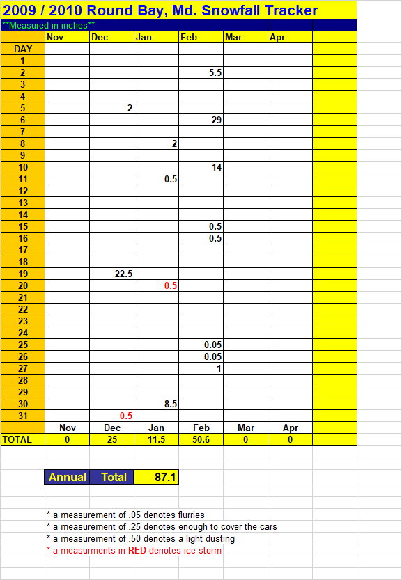
Here is a summary of the forecast for next week's projected storm Sunday and Monday - doom and gloom "its going to rain" everyone is out but secretly watching and hoping. Tuesday: Positive run - everyone is hopeful and reinvested. Wednesday - Thursday - the positive run from Tuesday collapses everyone is back on the ledge. Friday morning - run moves favorable Friday afternoon - run looks significantly better everyone can't believe we are going to luck into something. "Mappy says enjoy your white rain weenies" Saturday - Temps are only marginal - the 6 inches predicted by the ICON is a bust and central MD gets a 1/2 inch of slop and Carrol, Hartford and Cecil gets 2 inches. :-) You're welcome!
-
Here you go

-
28.2 / 17 currently in Severna Park ***Just for reference the current bay water temp (mid-bay) at Thomas Point Lighthouse is 40.3***
-
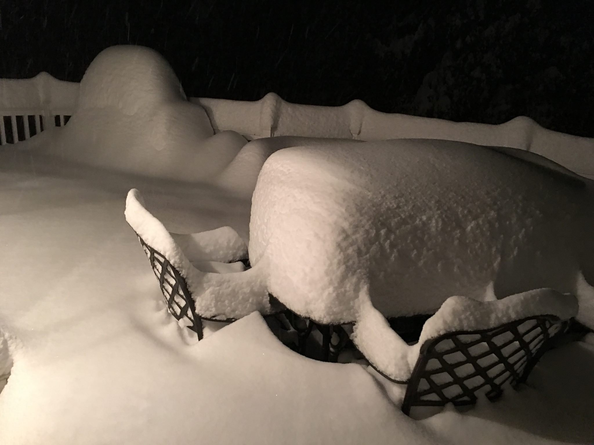
Here are few pictures from my house near Annapolis. It was a great storm that was very scenic!