

wxdude64
-
Posts
7,515 -
Joined
-
Last visited
Content Type
Profiles
Blogs
Forums
American Weather
Media Demo
Store
Gallery
Everything posted by wxdude64
-
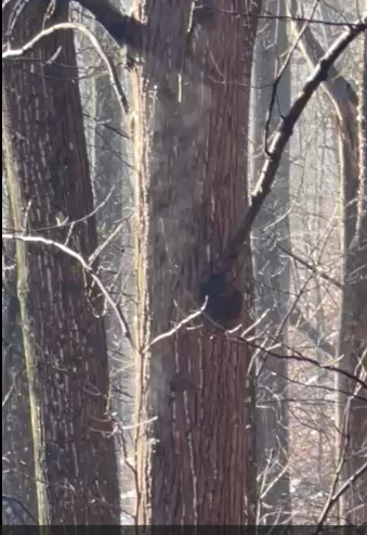
Pic of the trees behind the house, looks like they are on fire, lol.
-
That's a good question. I had more than that in each of Jan and Feb of that year lol.
-
38.3(high)/37.4 at 4:45 pm with mod rain and fog. Just a smidge over 1/2" since 7 am here.
-
Still 37.7/36.9 at 12:45 pm with light rain and fog. About 1/3" has fallen since 7 am CoCoRaHS report.
-
Currently 35.1/34.0 with light rain. A couple times this morning I've went to a rain/snow mix when intensity picked up. Least I saw some mangled flakes. lol. I'd say above 2500-3000 it is likely all (or mostly) snow.
-
I was 50-50 this morning at 7 am, likely my last 'measurement' of SOTG (reported 1.0"). About 2-2.5" in shaded/north facing spots. Likely a 'T' for under 50% tomorrow. No complaints, been a nice 3 week period.
-
No snow action down this way, almost clear skies. What IS happening is the wind (again). Currently 36.4/17.6 with NW wind 14 gusting to 31 mph. Had a 37 mph gust a bit ago. The snowpack melted down to bare ground on S/SW facing slopes (20%) to 2-3" in shaded areas 80% over the past two days while it was warm, don't think there will be any melting next few days.
-
Samantha?
-
One more degree and I hit 50, currently 49.1/31.8 at 1:45 pm. Those 60's from Roanoke south look to try and make a run this way??
-
Sitting at -11.6 degrees for the month so far, and still a glaciated whiteness on the ground. Zero complaints for the month.
-
Temp hit 7.0 around 7:30 am yesterday morning, tied the record low for the day with 1989. Currently 19.4/14.4 at 8 am here with a partly cloudy sky (high cirrus). Even if NWS is off 8 degrees like yesterday, the 55 high forecasted will be mid/upper 40's, should see some melting.
-
Well, the first 'warm' day forecast was a fail. High was 35.3 degrees (at least above freezing) vs forecast of 43. A lot more clouds moved in around noon (or we'd have hit 43 easily) and temp locked right at 35 rest of day. Now down to 32.1/12.0 at 6 pm.
-
Low was 5.4 degrees, a new record for the date, beating 1995's 7 degrees. Currently 7.3/1.0 at 8 am.
-
Set a new 'cool max' for the date at 20.6 degrees. Old mark was 28 degrees from 2010 and 1995. Low this morning was 6.5 degrees, no record.
-
So back to the early/mid December look. Model atmospheric memory at work.
-
And wind, can't forget (is that possible?) the number of days we've gusted 30, 40, 50 mph this winter.
-
Had a 46 mph gust at 2:20 am here. About an inch of snow, though that is an average as last night's wind whipped stuff was a struggle to measure. Absolute crazy 15 minutes last night around 1:30 am. Snow and wind brought vis down to a couple hundred feet at most a couple of times. Easily would have been 2-3 inches if it had continued for an hour. At 7 am CoCoRaHS report I had spots that had been cleared still clear and spots in corners/edges with 6" of new snow. Currently 17.4/1.1 at 10:50 am with NNW wind at 10 gusting to 26 mph, WC 5 to -1.
-
11/11 0.1 11/30 0.1 12/02 0.2 (sleet) 12/05 3.8 12/06 1.5 12/08 0.5 12/09 5.1 01/17 0.1 01/25 4.5 (mix of snow and sleet) 01/26 2.8 (95-97% sleet) 02/04 0.3 02/07 1.0 Total 20.0
-
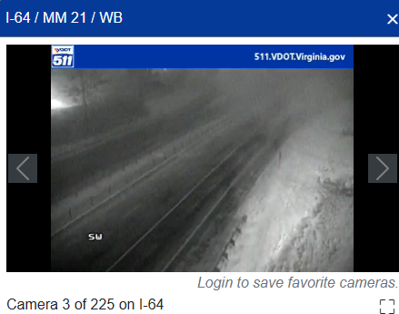
Not sure how long we will be in this band/squall going thru but she's a doing it right now. This camera about 3 miles from the house.
-
Because you don't make 150K/year?
-
Light snow last 1/2 hour, 28.8/22.7. Just starting to whiten things up that aren't already white.
-
Is there a 'person of retirement age' spot to post in the medium-long range discussion? Unless the SS increases dramatically, I won't make that level.
-
A whole year's salary??
-
WOW. I'm with @psuhoffman on this one, someone needs to go with @dailylurker on a LES Tug Hill event and get a healthy snow fix, stat.
-
Made me go look. A LIGHT snow is falling here. It'll have to pick up the pace to amount to anything, but still nice to see falling. 32.0/29.8


