

IWXwx
-
Posts
6,438 -
Joined
-
Last visited
Content Type
Profiles
Blogs
Forums
American Weather
Media Demo
Store
Gallery
Posts posted by IWXwx
-
-
Now that the winners and losers have been ferreted out for the weekend storm (big L here), I glanced ahead. The GFS looks like Josh's dream as it depicts a clipper train from hour 150 right through the end of the run. Guess I'll once again be nickle and diming my way toward climo snowfall.
-
 2
2
-
-
7 hours ago, DAFF said:
I voted for one. Although, a two part would make sense for a "forecasting discussion". Then the "Its happening" observations and real time discussion thread.
I agree with this idea, although I also voted for one thread.
-
The weekend storm is the real deal since Frankie's honking
-
 1
1
-
-
Music to Hoosier's ears:
BEHIND THIS SYSTEM WILL BE SOME OF THE COLDEST AIR OF THE SEASON.
LOWERED TEMPS SEVERAL DEGREES THIS WEEKEND FROM BLENDS WITH CHANCE
OF BELOW ZERO TEMPS. MEDIUM RANGE MODELS RATHER CONSISTENT SHOWING A
STRONG SINGLE BAND DEVELOPING OFF OF LAKE MICHIGAN AND POTENTIALLY
IMPACTING OUR FAR NW INDIANA COUNTIES SATURDAY NIGHT AND SUNDAY.
POTENTIAL HERE FOR A VERY HEAVY SNOW BAND THAT COULD REMAIN
PERSISTENT DURING THIS PERIOD AND DROP VERY HEAVY SNOWFALL. EXTREME
INSTABILITY EXPECTED GIVEN MODEL THERMAL PROFILES AND SETUP FITS
CLIMO FOR THE INTENSE HEAVY SNOW SINGLE BANDS IN THIS AREA. STAY
TUNED!
-
1
-
-
22 minutes ago, beavis1729 said:
FWIW, the 12z FV3 is going crazy again with an arctic outbreak toward the end of January.
Besides the fact that it's 12-16 days out, and has been pushed back in time a bit relative to a few days ago...there is tremendous cold sitting in southern Canada that could be tapped eventually. Ideally, we would need a strong storm tracking NNE through the GL/OV and/or a potent clipper to drag down the cold air. Hopefully it will happen at some point.
Even if the PV does come down for a visit, even I would be forced to admit that the temps shown on the FV3 are overdone.

For posterity:
That is save worthy though.
-
1
-
-
-
3 minutes ago, Stebo said:
Wtf is BAMWX.com lol
I haven't looked into them, but I think they're a couple of wx cowboys that post this stuff on social media and offer private meteorology services.
-
I'll just leave this right here...


-
1
-
1
-
-
I know that this is completely anecdotal, but it seems like specific areas of the subforum are jackpot areas for multiple winters storms for period of time. For example, several years ago, it felt like every time you turned around, Madison was getting hammered. That same feeling later occurred with Mt. Geos, then Chicago, then Detroit. I'm not about to take the time to check it statistically, but it's interesting. Who's next? STL?
EDIT: Of course, that excludes the LES dudes, Josh, Will, Bo, etc. They're always buried.
-
2
-
1
-
-
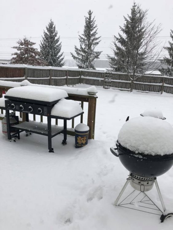
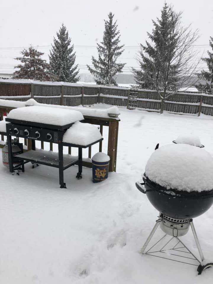
As a few of you said here, every 6 hours-12z, 18z, 00z, and 06z (I usually don't get the last one). Also measure between those times if the snows ends to catch the total before compaction/melting begins. I use long boards and clear half of them after measuring and leave half for total snow depth. With drifting snow, as Josh said, just take a ton of random measurements and average them.
BTW, final total 5.1" here.
-
4.8" here. Looks like a small break, then could pick up another inch or two overnight.
-
1
-
-
Still ripping here. We were forecast for 3-5 (only 2-3 earlier) and we are pushing 5 now and the radar looks great. Very nice spread the wealth storm for those of us in the southern part of the subforum. I thought the amount of qpf was being exaggerated on several of the models, but not this time! Early congrats to everyone.
EDIT: Looking forward to measuring my board in about an hour.
-
2
-
-
2 minutes ago, Street said:
We had 13" in the March 2018 storm. But before that we had a pretty big dry spell.
Duh! I forgot all about that one since it was such a narrow path of snow and we got whiffed on it. I'm thinking the official total was somewhere around 10 and half inches
-
1 minute ago, Street said:
6" And climbing in Plainfield, IN - Just west of Indianapolis.
I'll check later unless someone else knows, but it seems like at least 3 years since IND had a 6" snow.
-
1 minute ago, chuckster2012 said:
Miss to east..
With a little northwest trend, blizz of '78 redux? except the high sinking in is much stronger
-
1
-
-
1.7" here in Huntington as of 1 PM (Eastern time). I'm expecting 3" in the northern part of the county with 5" in the southern part since the models have consistently showed our area on the northern fringe of the heavier amounts.
-
Dude posted a time lapse of United States radar for all of 2018 on his Facebook page. It's about 9 1/2 minutes long, but mesmerizing.
-
3
-
 2
2
-
-
1 hour ago, beavis1729 said:
Nuiqsut, AK (north central part of the state) was -42 at 8 PM last night, south wind at 9 mph, wind chill -67.
At least someone in North America is experiencing winter.
I feel like I'm experiencing winter there. It is 22° with a wind chill of 9° and mood flakes are flying from the lake. Typical mid January day.
-
1
-
-
What a weird set of events. The last 2018 tornado on New Year's Eve in Indiana and the first in 2019 in Ohio of all places.
-
1
-
-
1 hour ago, Hoosier said:
Possible tornado in eastern Ohio today.

-
2 hours ago, Hoosier said:
Where does 12/24/2002 rank?


-
1
-
-
33 minutes ago, Hoosier said:
What site did you try to go to?
Fortunately, MRCC has been a nice workaround when looking up old data, but I know some stuff is hard to find outside of the NOAA sites.
It's not a big deal. I attempted to hit the NCDC site (1981-2010 normals). It was just that it was third time it's happened in the past few days while I've been farting around.
-
The website you are trying to access is not available at this time due to a lapse in appropriation.
NOAA.gov and specific NOAA websites necessary to protect lives and property are operational and will be maintained during this partial closure of the U.S. Government.
See weather.gov for forecasts and critical weather information.
NOAA Federal Employees: For access to the Notice to Federal Employees About Unemployment Insurance (SF-8), please Click Here.
Grrrrr......
-
1 minute ago, buckeye said:
One of those deals where the best case scenario is probably being shown with a couple...maybe 4". Any more phasing and it mixes, any less and it's weak sauce south of us. High pressure to the north is weakening and moving east so there's nothing to stop a more phased storm from sending in the warm tongue.
But hell, at least it's something to track.
The story of our lives in this neck of the woods.


Winter Storm? Jan 18-19th, 2019
in Lakes/Ohio Valley
Posted
Hey! Glad to see that you're still around. You look to be in line for a little more than us up here in Huntington. Let me know how it ends for you. I know Jack will")