

madwx
-
Posts
2,281 -
Joined
-
Last visited
Content Type
Profiles
Blogs
Forums
American Weather
Media Demo
Store
Gallery
Posts posted by madwx
-
-
2.86” of rain so far this week. Should get another round tonight before the pattern reloads over the weekend
-
 2
2
-
-
Tied the record warm minimum yesterday. Should easily break it today.
active stretch coming up starting tomorrow evening. Looking forward to it
-
1
-
 1
1
-
-
3 hours ago, CheeselandSkies said:
Huh. Unless I was reading it wrong all the social media hype seemed to be for Sunday night.
Forecast was off. Imagine trying to predict tornadoes when the only info you got before convective initiation was when a trough hit the west coast
-
4
-
-
3 hours ago, CheeselandSkies said:
Haven't seen any aurora pictures from MN/WI/IL from last night so I'm guessing the smoke busted it?
aurora actually arrived around 2 AM saturday night. the show was all but over by Sunday evening
-
time for my annual repost

-
 3
3
-
 1
1
-
1
-
-
very chilly out there this morning. 40 degrees with gusty NE winds. models have been ramping up the rain event here Tuesday. definitely will get 1" and a good chance at 2
-
1
-
-
daily record of 87 in Madison, breaking the previous one set in 1977 and 2012
-
1
-
-
Don’t sleep on tomorrow evening in southern Wisconsin and northern Illinois.
-
3
-
-
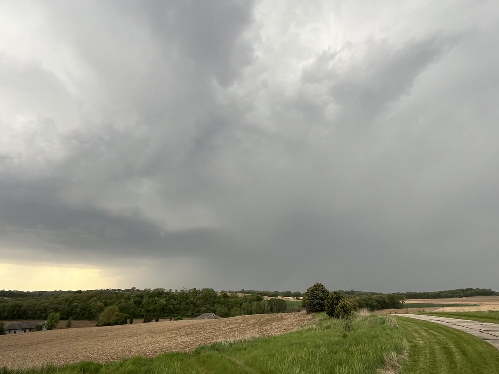
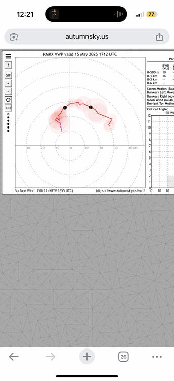
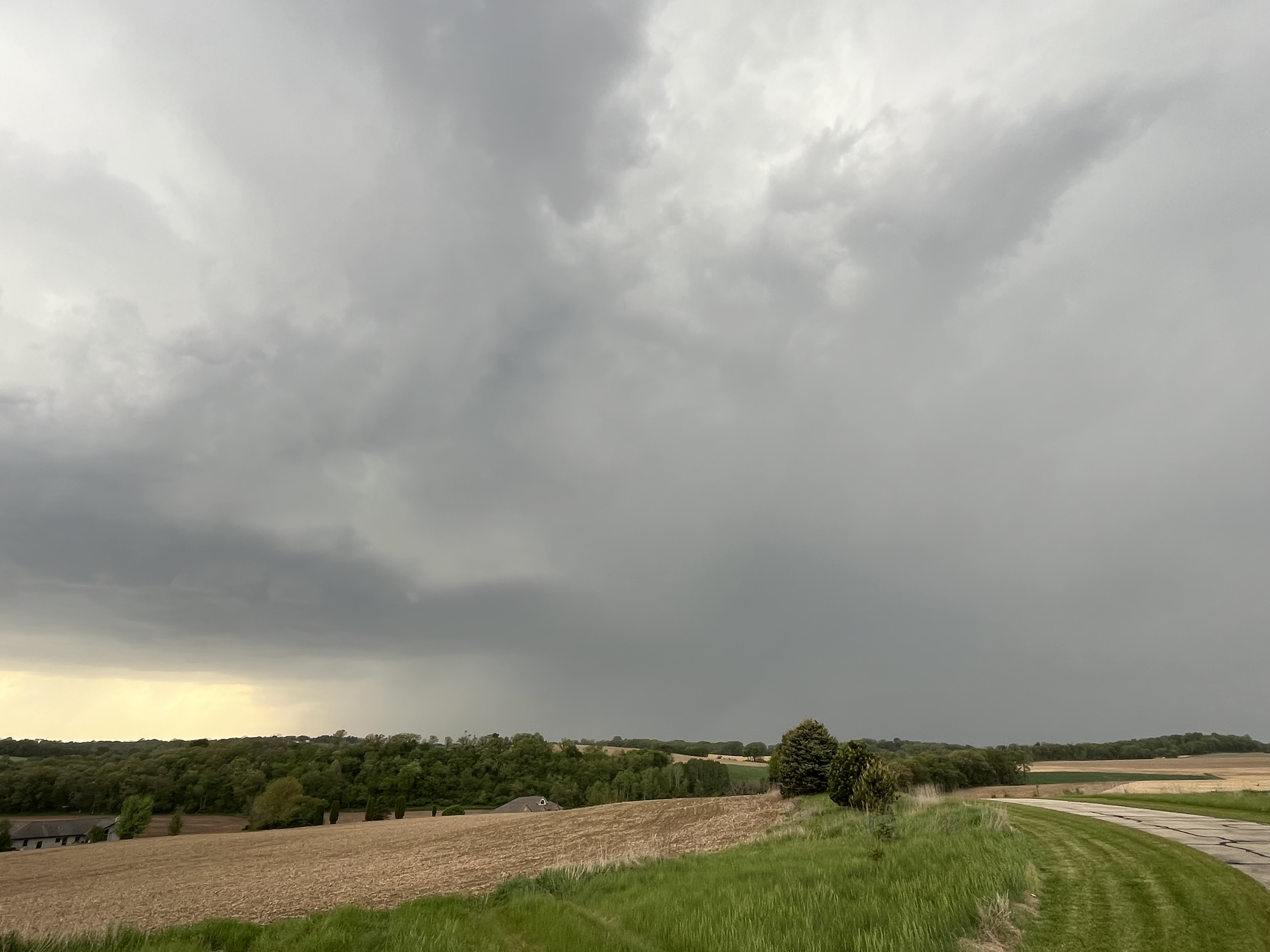
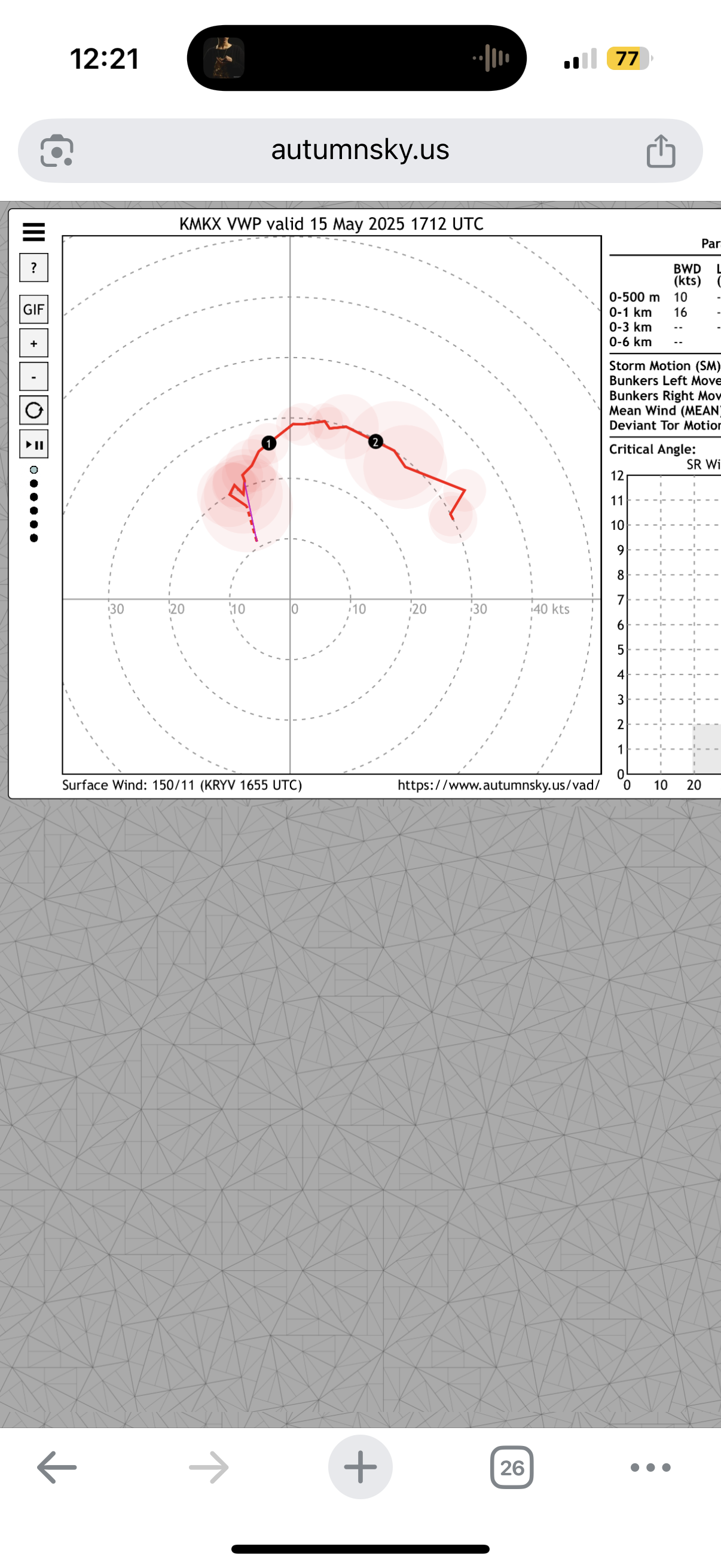
At least some of these cells must be above the inversion at 850 mb
-
Plenty of supercells with hail but everything is still pretty sky high. Watching for any mergers or nudges. Especially the cells south of Madison
-
2
-
-
Cells popping up all over. Winds backed nicely. Bases are a little high but cell level processes bring them down a bit
-
5
-
1
-
-
Can’t argue for much more in low level wind fields
-
1
-
-
79/69 at the house. feeling pretty good so far. Only real concern is if things form just a little northeast of here.
-
1
-
1
-
-
Altocumulus flowing overhead this morning. No better feeling
-
1
-
-
I’m buying this event and am ready to wedge tomorrow
-
2
-
1
-
-
Hit 30 at the house and 32 at MSN this morning.
-
1
-
1
-
-
FYI. For those not trolling, this is a time to really not pay attention to the GFS. Skill scores are some of the lowest I’ve ever seen for anything mid to long range
-
2
-
-
Was an amazing day out. Got up to 69 at the house. Rest of the week should be beautiful too - in the 60s and 70s
-
1
-
-
thinking things will trend drier and warmer over the next 10 days but definitely some cool days mixed in, especially this week. looking at a change to SW flow and more active conditions around the 15th which should last through the end of the month (this is tied to indian ocean convection which climatologically flares up around this time - hence late May being a classic tornado stretch for the plains)
-
4
-
1
-
-
up to 0.79" this morning with more showers throughout the next 2 days.
-
2
-
-
Storms were pretty intense this morning. Tons of cloud to ground lightning. Had 1” hail with the cells that formed behind the main bow
-
3
-
-
I’ll give it a D. Had a pretty ok snowstorm in December. Had a couple bouts of snow centered around a week of deep winter in February that actually featured snow cover. One nice part was that it was sunnier than the average winter
-
2
-
-
-
the last 10 days of this month will be above average. also note that average temps are now pretty pleasant, so anything close to average will be 55 degrees or warmer
-
4
-


July 2025 General Discussion
in Lakes/Ohio Valley
Posted
got 1.53" yesterday. Should pick up a good deal more this evening