

madwx
-
Posts
2,098 -
Joined
-
Last visited
Content Type
Profiles
Blogs
Forums
American Weather
Media Demo
Store
Gallery
Posts posted by madwx
-
-
officially broke the all time Feb and Winter record high temp with 69 here at 1 PM. Already broken the daily record by 11 degrees.
-
1 hour ago, CheeselandSkies said:
When you have a relatively shallow low-level moist layer (only up to about 850mb or a little above at best on a couple soundings I just cherry-picked off this morning's 12Z 3KM NAM), vertical mixing (helped along by sunshine) can bring down that drier air, lowering surface dewpoints, thus raising LCLs (cloud bases) and possibly increasing low-level capping. At least, that's how I understand it.
it would actually decrease capping but higher bases decreases the odds of tornadoes.
-
 1
1
-
-
the front is trending ever so slower, this will be crucial if we want to set a record warm low today.
We ended up tagging 67 yesterday. beat the old daily record by 6 degrees
-
 1
1
-
-
14 minutes ago, hawkeye_wx said:
The HRRR has 74º here at 2pm, snow showers by midnight, and a -15º wind chill by sunrise Wednesday.
The HRRR is pretty wild with the cold air. Assuming it’s overdone but only has us around 12 at noon on Wednesday
-
smashed the old daily record. up to at least 66.
-
1
-
-
a little Madison record watch post.
Today's record high of 61 will almost certainly be broken.
Tomorrow's record high of 58 will definitely be broken. the record warm low of 38 tomorrow is also at risk. tomorrows temp will also make a run at the Feb overall record of 68 set back in 2017. (68 is also the winter record temp, set both in Feb 2017 and Dec 2021.)
We should easily slot into the 2nd warmest winter on record - behind 1877/78.
February will slot somewhere in the top 3 warmest, really depends on how the daily numbers go the next couple days to see where exactly it will fit.
-
2
-
-
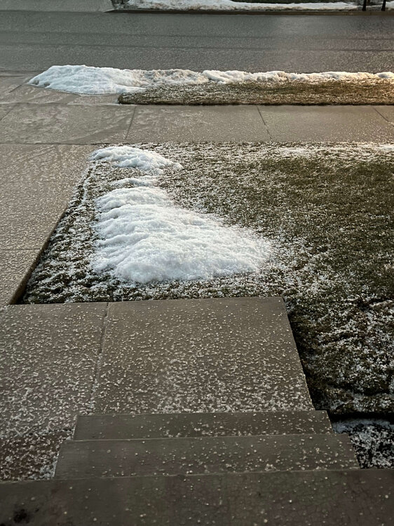
a couple tenths of snow here. after sunset it accumulated on the roads and combined with the freezing of standing water has made things slick out there
-
1
-
-
Had a lake breeze roll through eastern Wisconsin this afternoon. Just an average
AprilFebruary 19th.-
 2
2
-
-
About an inch of pure slush. Hope it can melt today so I don’t have to shovel
-
will be right on the edge of accumulating snowfall tonight. Could easily get 3" or nothing.
-
1 hour ago, SchaumburgStormer said:
New climo - 2 weeks of winter preceded and followed by torch. Random 3 week cold snap in late april/early may when we are all fully in spring mode.

-
4
-
-
Anybody take a look at the 6z GFS?
-
4 hours ago, Geoboy645 said:
Honestly at this point, I don't know if I really want anymore significant cold and snow. The warmth and rain yesterday felt really nice, and there are already the beginnings of some of our early spring plants coming up. I've frankly forgotten that it is in fact early February a few times. We've had our cold and snowy stretch, and a pretty high end one at that. Let's get an early, warm, and drawn out spring in for once. I know that we will get cold and snow still, especially with the incoming SSW. But man, this stretch has been really nice.
Definitely have time for cold and snow but one thing that we will quickly run out of time for is sustained snow cover. By the time we get to the last few days of February it gets harder and harder to keep up a snowpack. And it’s looking dry for another 7-10 days so that only leaves a short period to have a true winter landscape
-
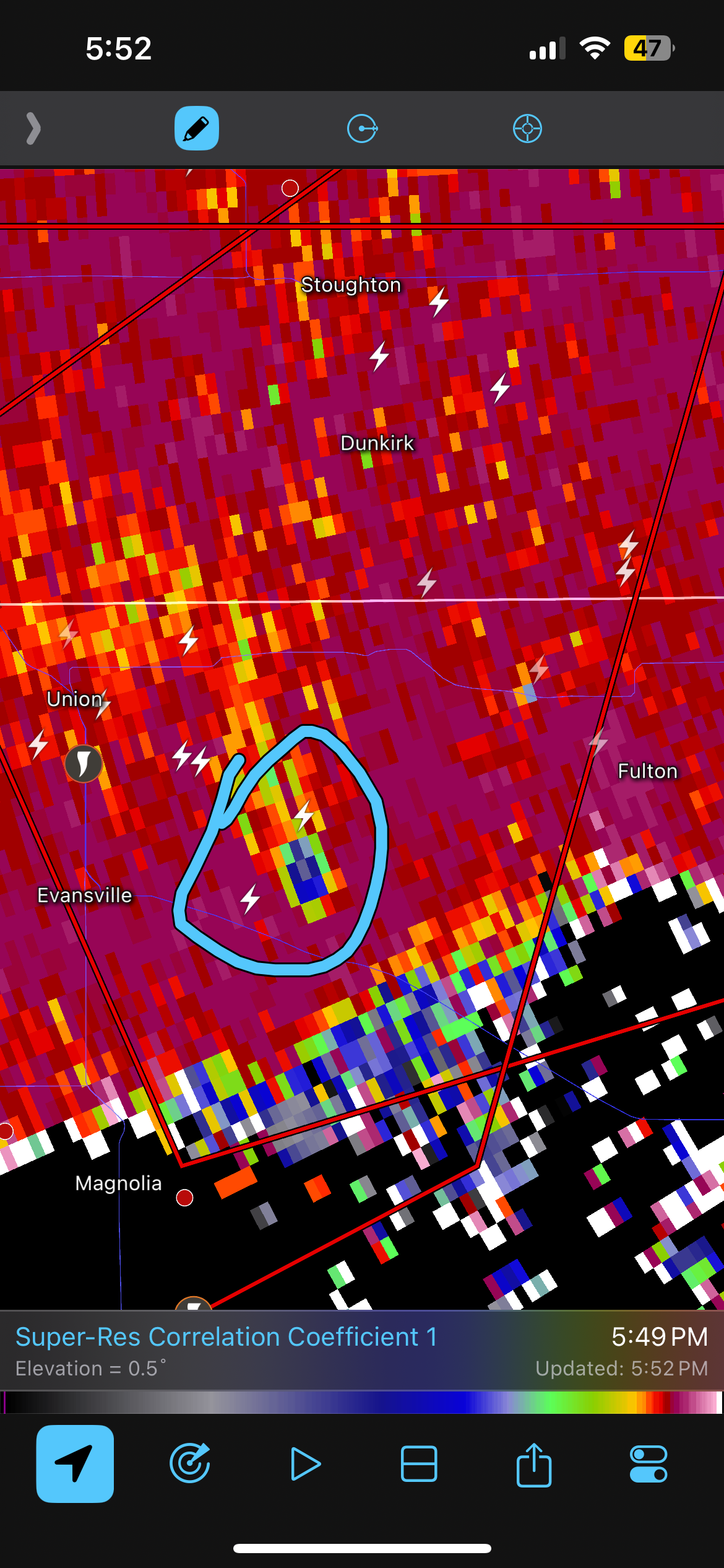
Massive CC drop by Evansville, Wi

-
1
-
-
Might as well go straight to April 1st pls
-
1
-
-
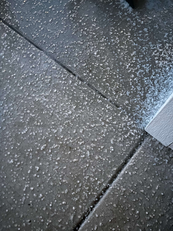
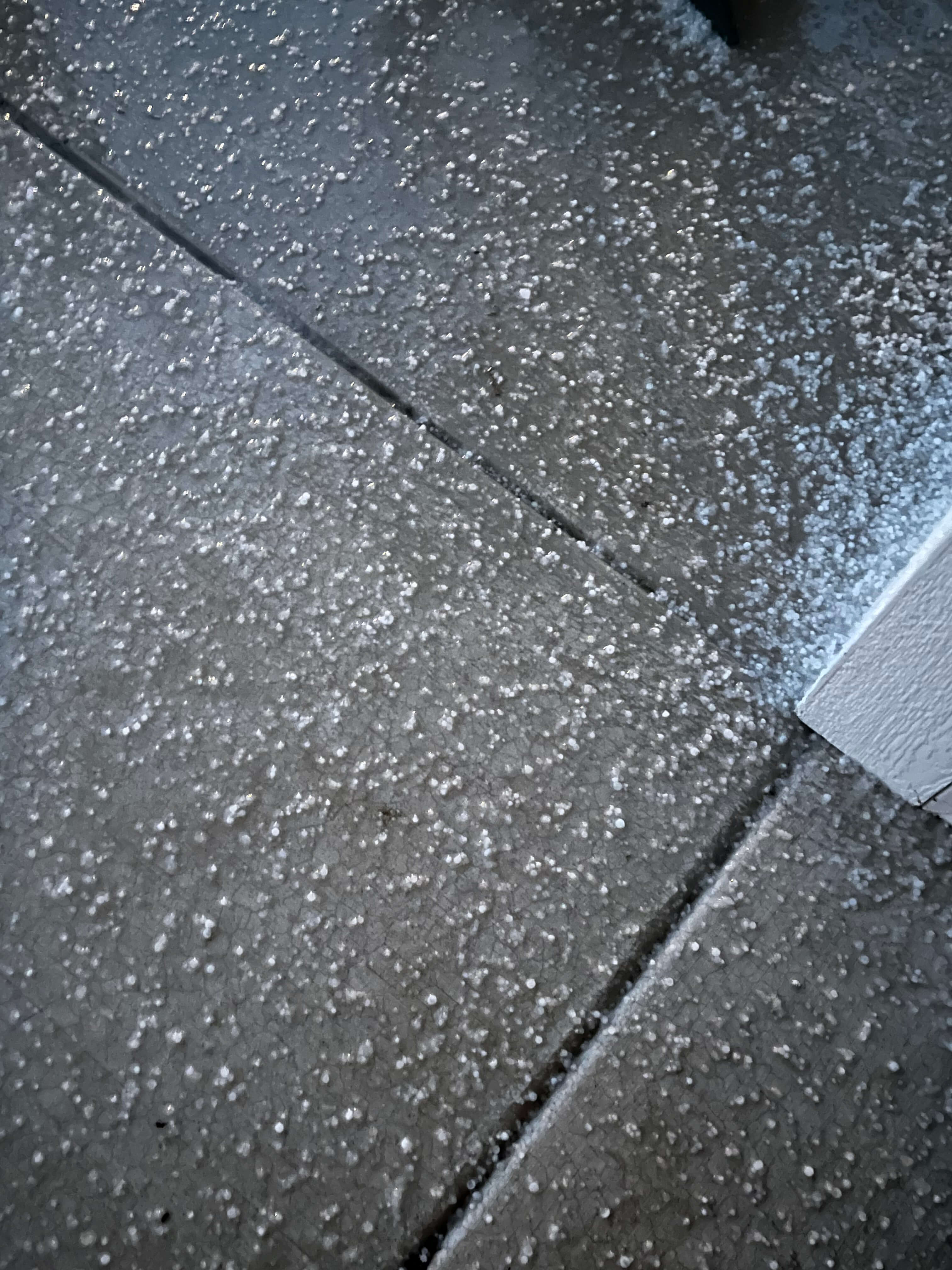
The main line hit the house. Huge burst of hail and about 50 mph winds
featuring a fun hail on snow pile pic
-
4
-
-
Don’t know if the cooler temps are affecting atmospheric optics/acoustics but this lightning and thunder is some of the most vivid I can recall
-
2
-
-
Cluster of storms about to hit. Almost constant thunder and lightning
-
1
-
-
3rd warmest December 1- February 2 on record behind 2001-02 and the infamous 1877-78. Didn’t realize how much we’d torch next week but looking like a very good chance of 50s. Snow down to less than 50% coverage in my yard. Mostly just piles where I shoveled
-
1
-
-
looking like we'll close in on a top 30 warmest January here. Should be 3+ degrees above average
-
the only major signals I see for Feb are drier than average first half, starting warmer but potential for some cool weather mid month. I would expect east coast troughing to maintain for the last half of February into the first week or so of March. Hard to say anything beyond that
-
got some snow, guessing around an inch but it's already melting
-
this system is really conflicting with my mental model of what a snow or ice storm would look like for this region. Not to say it won't happen but it just seems strange to have a 1018 mb low with nothing impressive upstairs dump so much precip
-
1
-
-
Tiny flakes here. Like drizzle hitting your face. No accumulations yet

March 2024 General Discussion
in Lakes/Ohio Valley
Posted
week 3 will be the where the greatest chance of below normal temps will occur. Of course by then averages are steeply increasing so it remains to be seen what the cold actually is