MNstorms
-
Posts
434 -
Joined
-
Last visited
Content Type
Profiles
Blogs
Forums
American Weather
Media Demo
Store
Gallery
Everything posted by MNstorms
-
Models have the severe storms down in Nebraska moving north and turning into snow in Minnesota. I expect insane snowfall rates.
-
Holy Buckets! This is really turning into heck of a snowstorm. Time to get the yard stick out.
-
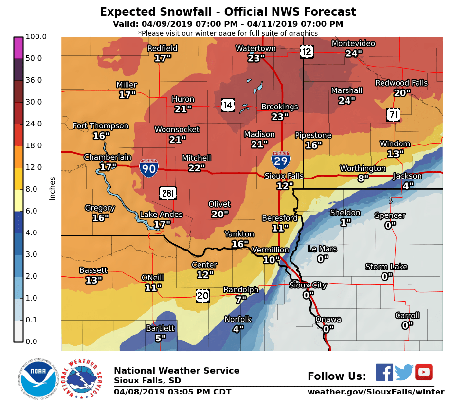
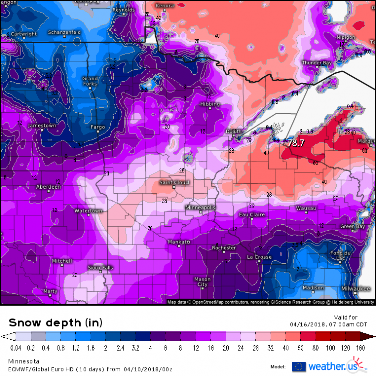
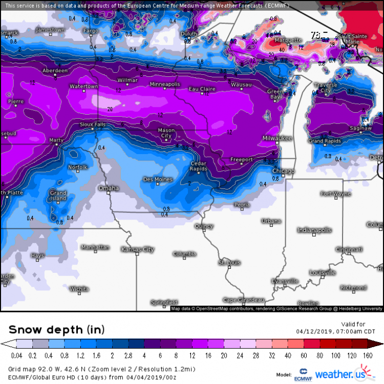
I want snow but I don't think I want the 2.5' the GFS is giving me. This is very similar looking to last year looking at the Euro. 2018 2019

-
Like I said this is still a week out. The big thing is the models didn't see this 30 hours ago.
-
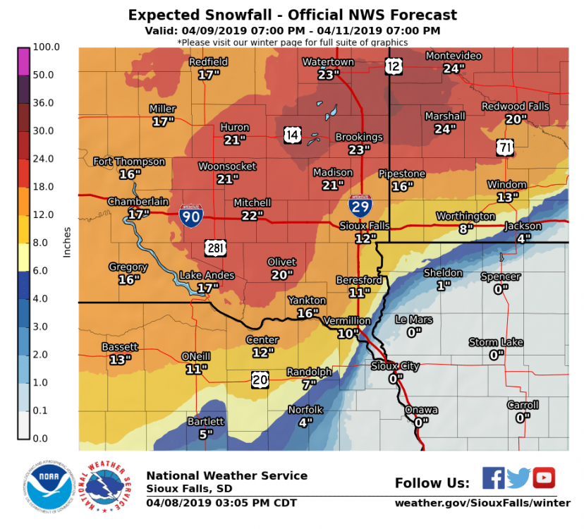
Time to welcome winter back after a month long spring? Still a week out but models in strong agreement
-
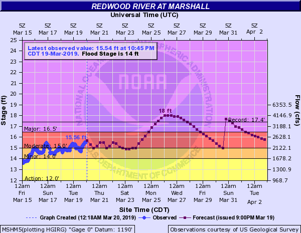
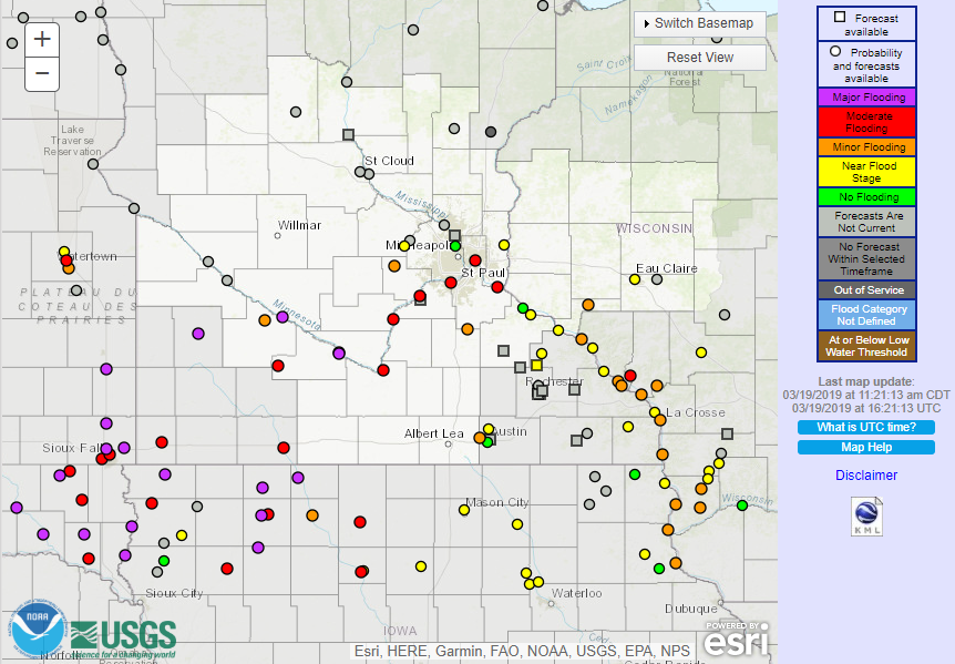
SW of the Twin Cities is seeing the worst of the flooding. This might rank in the top 5 all time
-
This forecast confuses me
-
Rivers here are now rising. Unfortunately they keep upping the river forecasts. The one near me was predicted 734' 2 days ago, 736' yesterday, and now 738' with gauges upstream still rising.
-
So far flooding is actually mild in Minnesota as the NWS says we could see record flooding in the next two weeks.
-
Nope, just poorly predicted I think. Check the new forecast.
-
You would think out of anyone the NWS would be smart enough to not put an office in a floodplain.
-
Not our region but this is awful to see.
-
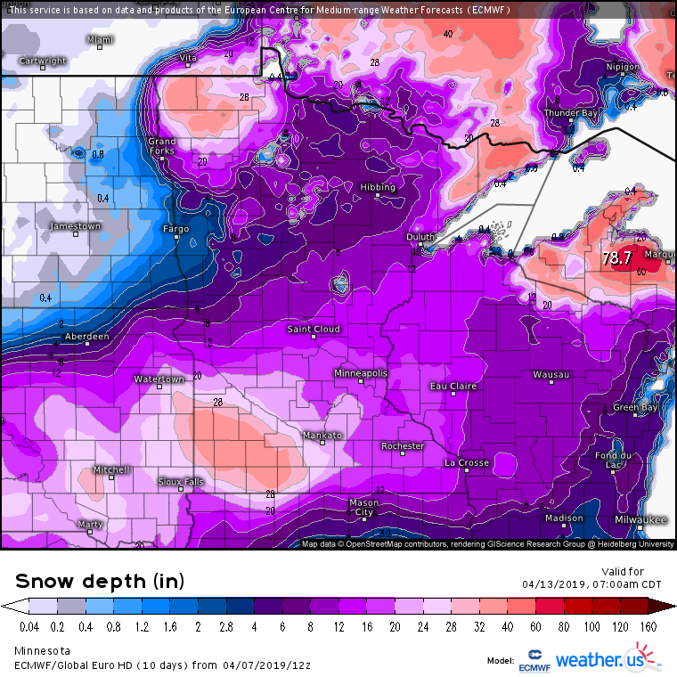
So the 1.5-2'' or rain didn't actually do much to the snowpack here. I measured 4.4'' in 12.5'' of snow. Most of the rain stayed in the snow. 50s-60s next week could be bad. At least no precip in forecast.
-
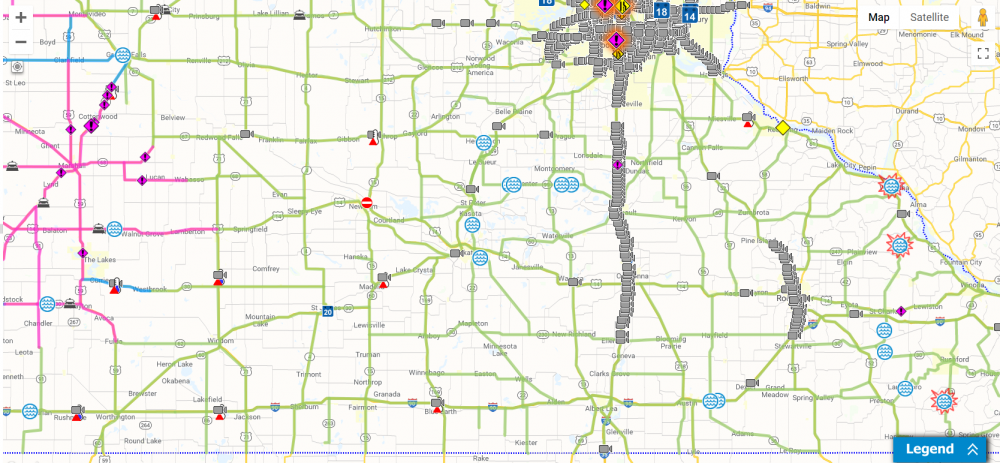
Flooded roads through southern in Minnesota, especially around here yet NWS hasn't issued a flood warning. Travel on gravel roads isn't recommend as many are covered or partly eroded. 1-1.5'' in last two days have brought the snow depth from 20'' to 10''. I90
-
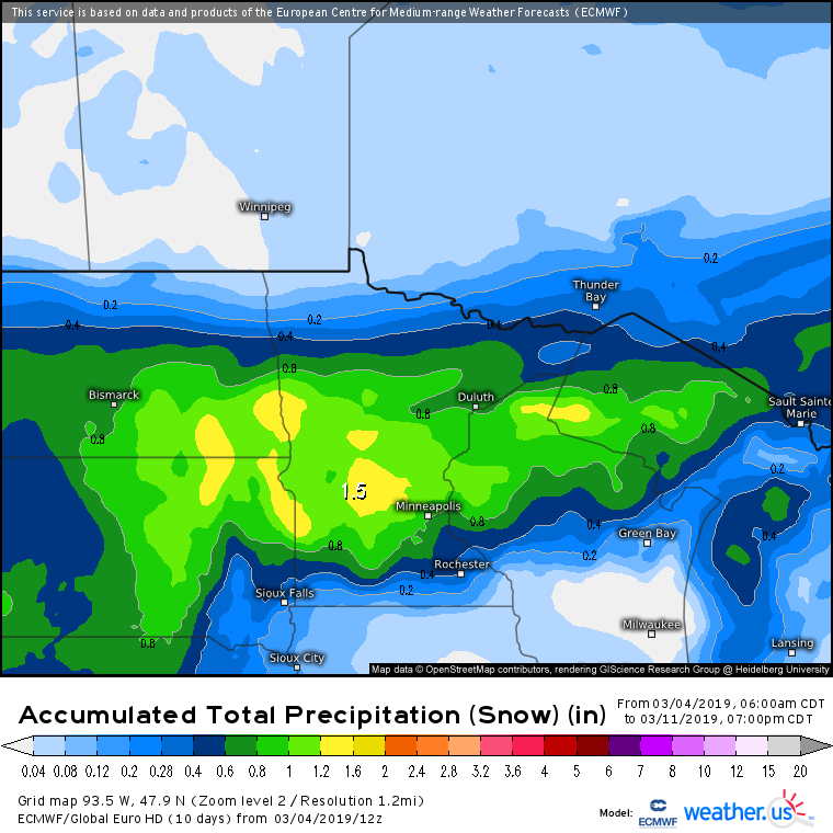
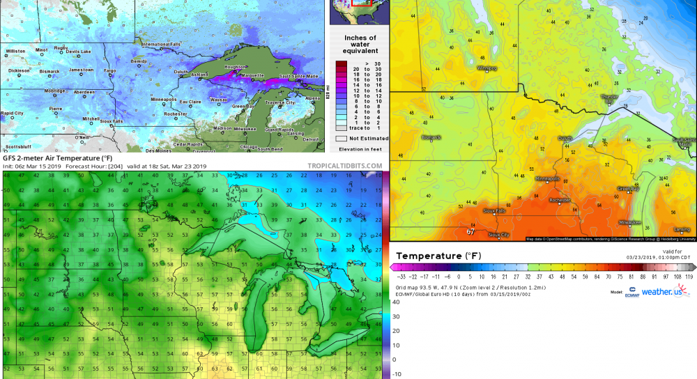
Lots of moderate to major flooding predicted this upcoming week. After this week warm temperatures will cause snow melt in the upper midwest.
-
3K coming into picture. Freezing rain a hazard.
-
NAM with heavy totals and doesn't even have the snow ending.
-
Definitely like the Euro. Same path as the last run but is colder farther south. I kinda want snow but this and the system after will make us have 8'' of water in the snow. Hell of a snowmelt would happen.
-
GFS has been trending northward as the CMC has been in the same spot.
-
Euro

-
This system looks almost exactly the same as the big winter storm last month. Another snowfall to add to spring flooding concerns.
-
Don't get too hyped up. Models have been all over the place. One run will be south of St Louis and one will be as far north as the Twin Cities.
-
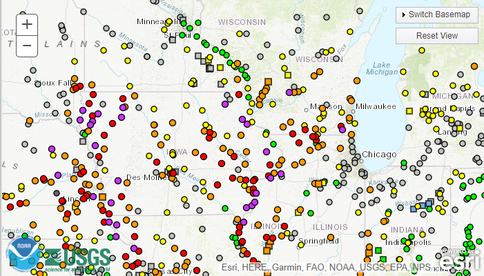
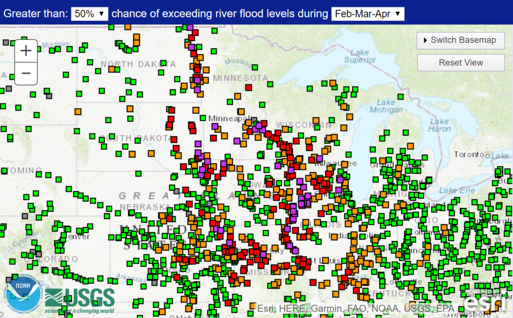
Probabilistic forecasts are out for this month. Looks like a spring flood threat is a good bet with perhaps major flooding. They have St Paul, MN with a 62% chance of major flooding.
-
Common sight in southern Minnesota. I hope to go around the edge of town this morning to see some drifts. This is the next county over from me.
- 212 replies
-
- 15
-

-