

It's Always Sunny
-
Posts
1,946 -
Joined
-
Last visited
Content Type
Profiles
Blogs
Forums
American Weather
Media Demo
Store
Gallery
Posts posted by It's Always Sunny
-
-
6 minutes ago, CoastalWx said:
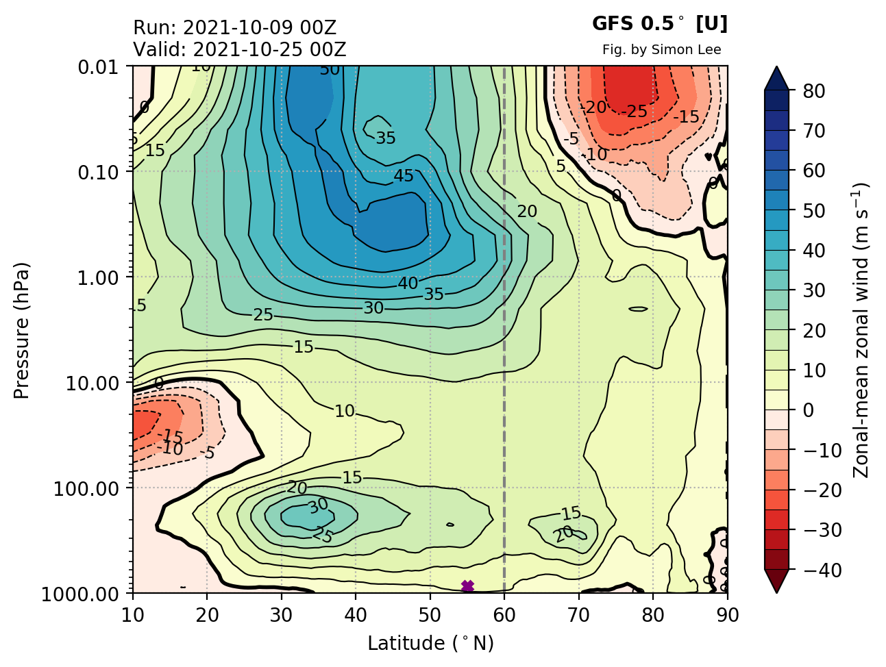
Lots of Davis Strait ridging in weeklies.
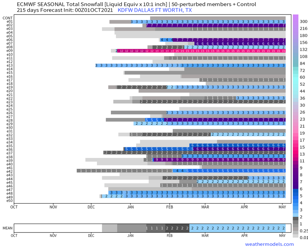
Based on some research I did, early SSWs tend to favor snowfall here in Dallas but I wonder how it fares for you fellow New Englanders. I did some digging and early SSWs appear to correlate with below normal snowfall for KBOS.
-
4 minutes ago, michsnowfreak said:
thanks. interesting to look at. but of course just that lol.
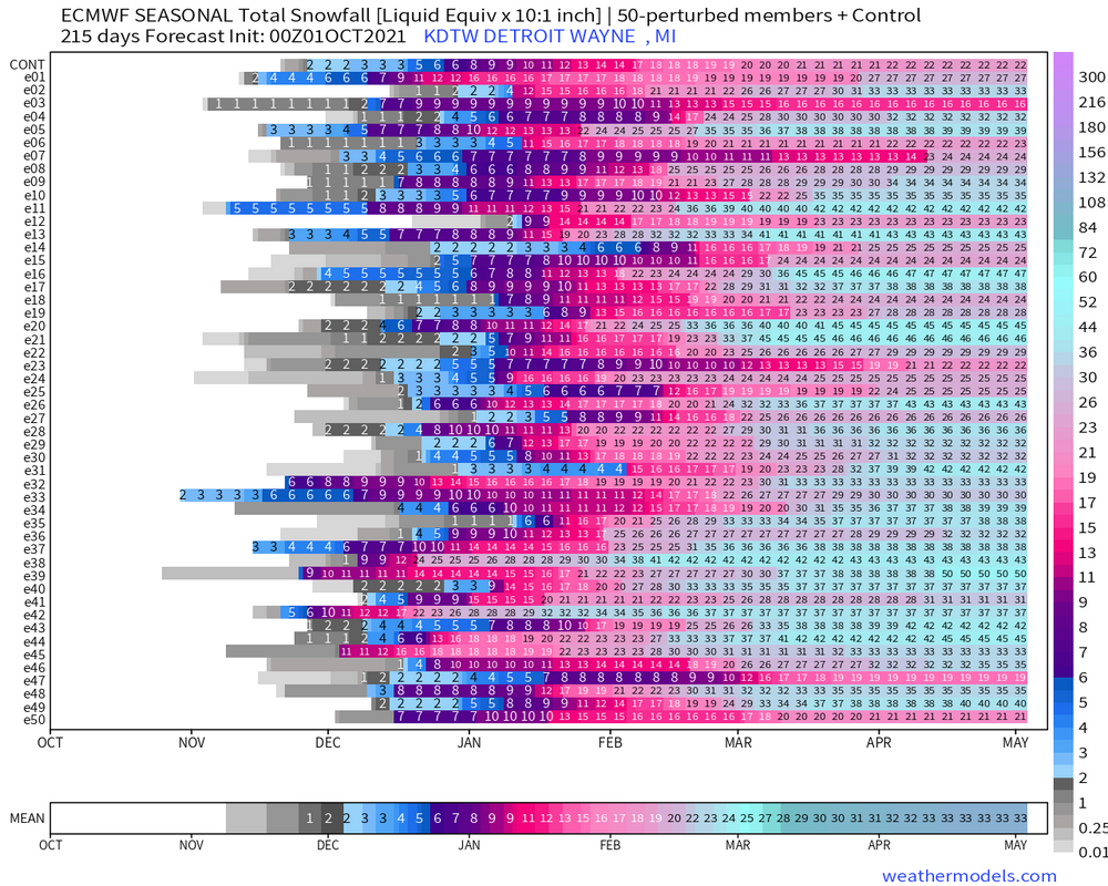
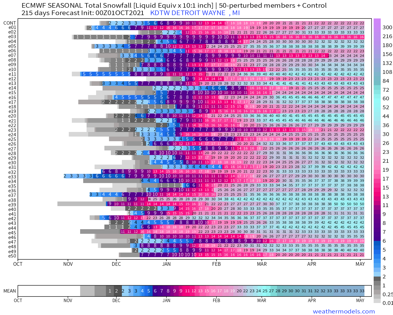
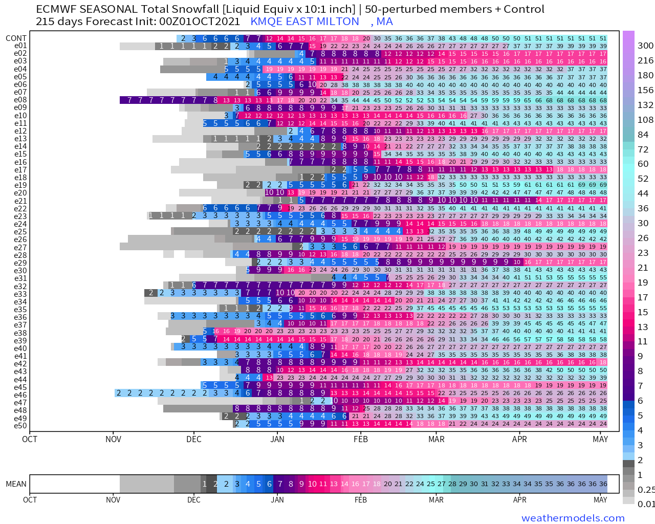
I cannot remember where I saw it, but there is a graph somewhere that will tell you what your city's average snow liquid ratio is.. I think for Detroit it is 12 to 1, which would put this 33 closer to 40" (current avg is 44"). I'm assuming new England is similar? fluffier in nne and wetter at the coast.
Yeah Boston and areas just inland are around 11:1 roughly. Here is the chart: http://www.eas.slu.edu/CIPS/SLR/slrmap.htm
-
 1
1
-
-
Some activity of interest in the stratosphere...

-
2 minutes ago, michsnowfreak said:
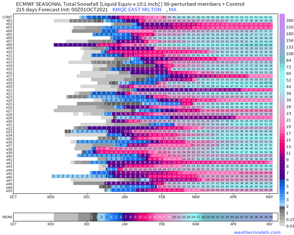
I have weatherbell but they don't have that neat graphic. Could you please show DTW?
-
15 hours ago, 40/70 Benchmark said:

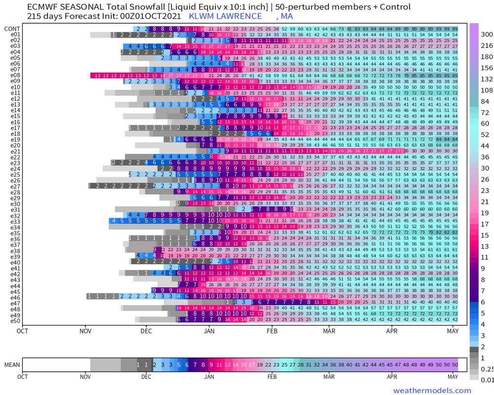
I can't seem to locate this graphic on weathermodels anymore. Anyone else know where to find it? I thought it was in the same place as the city charts in the Lab.
-
Plymouth, NH has 80"
-
1 minute ago, CoastalWx said:
I'd like to mow down that observatory and build a nice Cape style home there.
I'm offended. I was at Trillium last Saturday you can see BHO right from the brewery is was awesome. Perfect weenie drinking spot.
-
Norwood has 36"
Yeah Concord has 70"
Nashua with 50" also, same as LWM
-
Toss Blue Hill. Not a rattah but nearly half of their normal seasonal total.
-
5 minutes ago, 40/70 Benchmark said:
KLWM
-
8 minutes ago, CoastalWx said:
I like the 121" at KPDX. Cute.
3" in KPHX is cuter.
-
 1
1
-
-
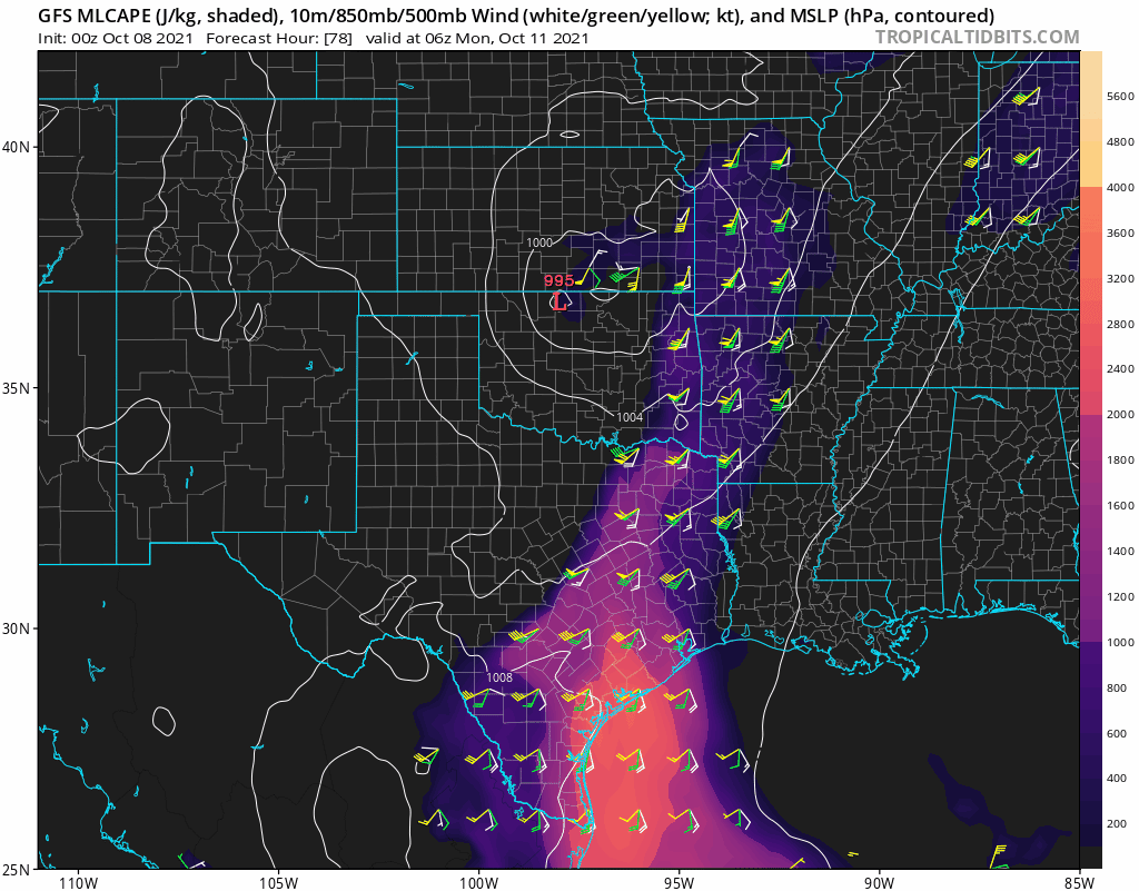
Southerly trend of LP seemingly improves the wind fields across N TX & E OK.
-
I think the only way Kev wins this season is if it's a ratter. JMO.
I’m in and out on the New England forum and have seen that reference before…what’s a rattah? -
17 hours ago, Mr. Kevin said:
Ray, I know its easier for yall to see snow and ice. Elevation is everything. We got lucky in Arkansas last February. I think if November shows the same non cold pattern, we may screwed, blued, and tattooed at that point. Better hope we can get the pv to be weaker than normal, otherwise 22-23 winter he we come
I disagree. November 2020 500mb height anomalies showed no precursor of what would come in February. If anything, it shows a strong TPV. There's way more to it than just looking at 500mb height anomalies to determine how a seasonal forecast will play out. There are still indications that the PV will be weaker than normal. That hasn't changed despite ECMWF's SEAS-5 recent output.

-
2
-
-
3 minutes ago, TheSuckZone said:
Well it is Broyles...
Not sure who he/she is...not a good reputation?
-
Too early to put stock into this but based upon my teleconnection analyses this forecast holds some merit.
-
1 hour ago, Iceresistance said:
Uh oh . . . O_O


Your images don't seem to work (at least on my computer), but yeah not too often you see a 30% issued this far in advance during second severe season. 30% contour is a very defined area personally I'm a little surprised they are issuing something that specific this far out. I thought they'd keep the 15% through at least today.
-
1 hour ago, OHweather said:
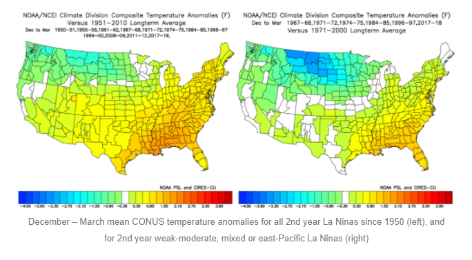
I remember you being all over the better blocking potential last year, so that's good to hear! The more seasonal outlooks one does, the more you realize that location of the ENSO (along with things such as QBO) are much more important than just "El Nino" or "La Nina", and the cited paper is definitely a great resource in La Nina winters. "Modoki" La Ninas aren't discussed quite as much as Modoki El Ninos but it arguably has as large of an impact, especially with non-weak events.
Great write-up, Jim. I haven't analyzed Modoki La Ninas as much as you, Ray and raindance have (I've been looking more into the MJOs influence on us here in TX which generated some interesting findings), but if I am understanding your blog correctly, for us here in TX, a 2nd year, weak-moderate & mixed-east based La Nina could further support the idea of "cooler" temps, correct?
-
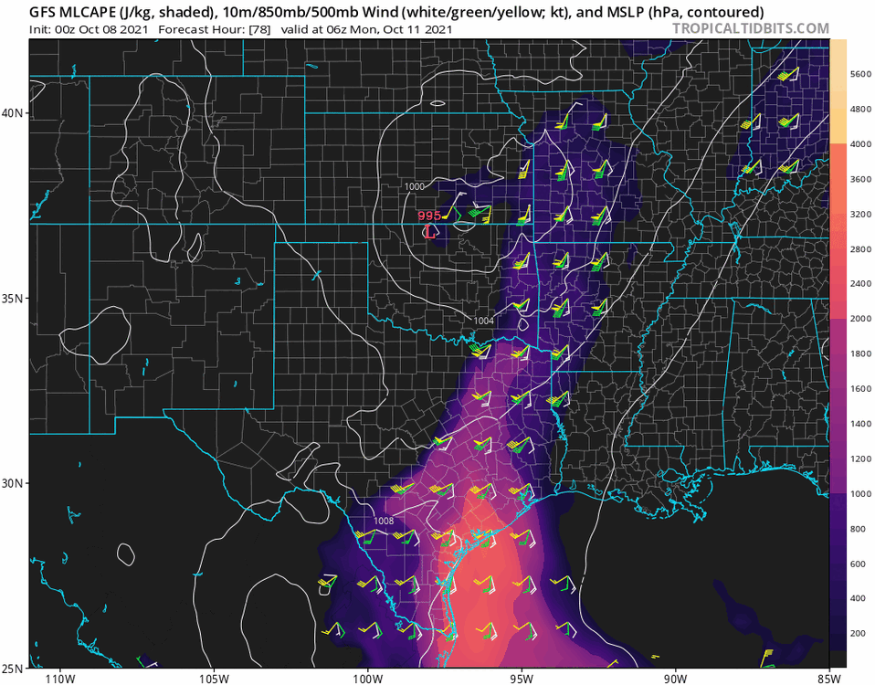
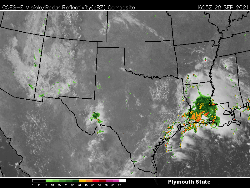
Pretty difficult forecast for N TX today. Models haven't been in too much agreement on timing or areal coverage. Morning cap has eroded with a decent cu field on satellite. Dry line off to the west should also serve as a focal point for convection not to mention westward moving outflow boundary over E TX could complicate matters further this evening.
-
Very negative EPO, too...that was all pacific.How about 14-15. Raging +NAO but +PNA.
Yeah like Ray said that was driven mainly be by persistent -EPO. Didn’t need a -NAO that winter lol. Also before I moved here Dallas got an ice storm & snow out of it too.
-
1
-
-
Looking at 500mb composites over the past 10 years we've done better with a +PNA/-NAO setup. A lot of it isn't textbook but there are a lot of years with near normal to below normal heights. There's obviously other factors/variables that matter but standalone that's what I'm finding at least.
-
1 minute ago, 40/70 Benchmark said:
Stronger la nina correlates to a -PDO, not the other way around....huge Aleutian ridge forces a downstream western US trough.
Ok yeah I had it backwards then.
-
Temps could still be cold enough for snow obviously but I'm talking pattern wise a +PNA would be better.
-
8 minutes ago, CoastalWx said:
How am I confused lol. That’s a good combo here. We’ve had snowy winters with that combo. It’s not a Miller B blockbuster look, but active with the -PNA and the blocking helps prevent lows shooting up our fanny’s. Now if the NAO is positive, yeah.....not good usually.
I'm not doubting you because you are King of the Weenies but you generally get higher heights over the NE & somewhat of a block there with warmer temps.


Winter 2021-2022
in New England
Posted
Just checked it out. It's apparently legit lol. I may throw my hat into the ring for Dallas snowfall. I'll set the bar real low so everyone can feel better about their totals.