Met1985
-
Posts
16,909 -
Joined
-
Last visited
Content Type
Profiles
Blogs
Forums
American Weather
Media Demo
Store
Gallery
Everything posted by Met1985
-
Current temp is at 36 and looking like we start out at a mix before changing over to scattered showers.
-
Yeah that winter I had snow on the ground from December 18th to March. That winter was freaking epic! A snowstorm literally every other weekend. I think even in my area I ended up with close to 80 inches that winter. What a freaking season. It all started December 18th with the synoptic storm then massive flow snow. Had close to 2 feet in my yard.
-
Lol when they melt we snow.
-
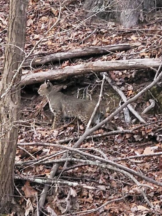
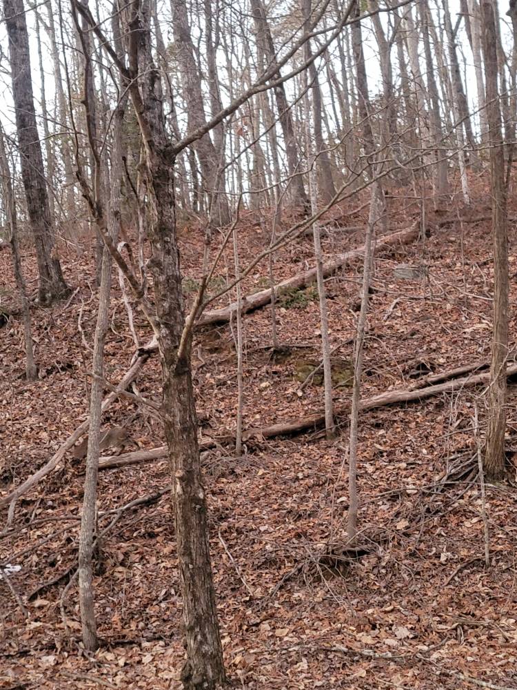
A closer look at the bobcat. Beautiful spots on him. Sent from my SM-G998U using Tapatalk
-
As for the systems next week. We just literally wait and see. Like I said in the main thread yesterday the models are all over the place because of the extremely strong Arctic blast coming in and all the energy.
-
Euro and GFS still showing a nice thump tomorrow morning. The NAM has backed off but we will see. Sent from my SM-G998U using Tapatalk

-
The gfs is really showing a nice setup for flow snow Sunday. A pretty long flow snow as well. Sent from my SM-G998U using Tapatalk
.thumb.jpg.43ee98087155ca5a056d960eb94809b1.jpg)
-
Not weather related but this is extremely rare to see. A beautiful bobcat today up in the mountains. And boy he blends in very well. Sent from my SM-G998U using Tapatalk

-
What happened in the main thread? Lol just trolling. Models are having a rough time.
-
Pretty good consensus that Saturday morning is going to be wintery. Sent from my SM-G998U using Tapatalk
.thumb.jpg.2a810f3f3ad76abf2aa29d3f5ee36d05.jpg)

-
This is definitely trending better. 12z NAM Sent from my SM-G998U using Tapatalk
.thumb.jpg.dcad85718068209a62c3d0d3317a98e8.jpg)
-
With the severity of the cold air coming in that will squash any system south. That's why the coast was looking really good because the low was forming at the bottom of the trough right along the coast. But the further this pushes south it's no Bueno.
-
The NAM was not right on several things with this last storm. Really the only thing the NAM was correct on around my area was the warm nose to an extent but that only lasted for about 2 hours here and did not verify in other mountain towns. The NAM screwed TN by being overamped and them not seeing snow totals anywhere close to the NAM. I don't think the NAM got close to what Atlanta saw in terms of snowfall. I lot about what the NAM showed was WRONG. Honestly the RGEM did a much better job in my opinion and the Euro did decent as well.
-
We are 7 days away from this event and yall think the models have this laid out already? Good luck with that. Again and Again we have seen major changes just 2 to 3 days before a storm hits. Don't get sucked in or out at the long lead time.
-
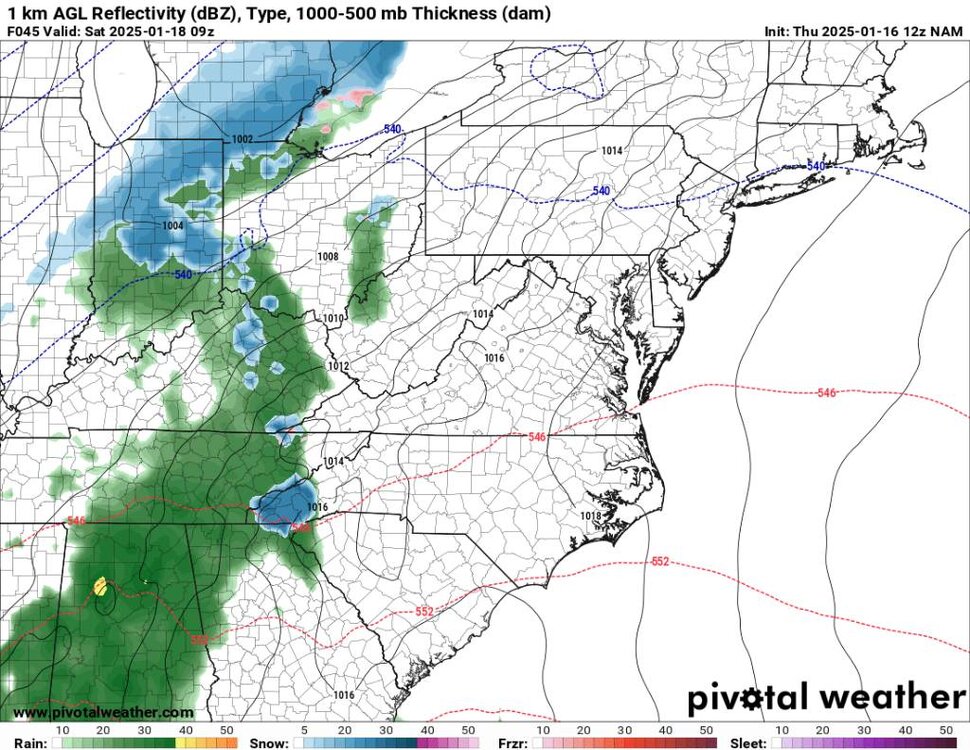
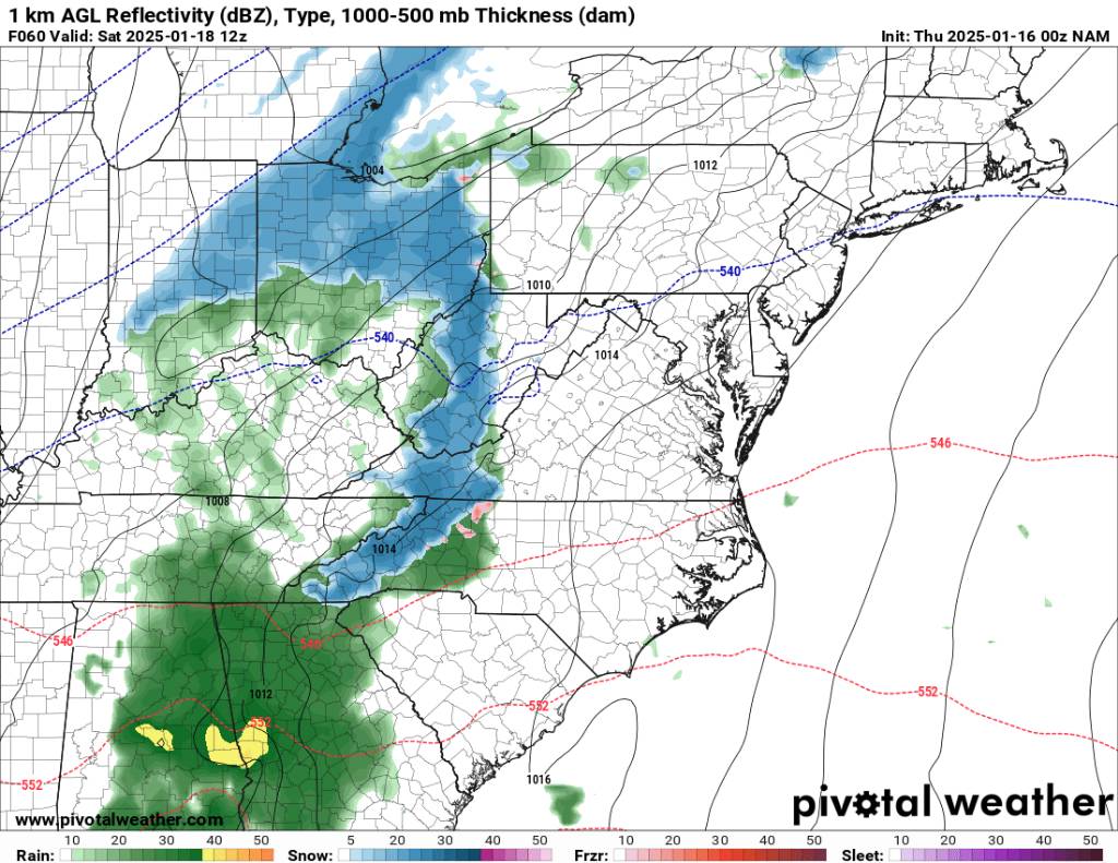
00z NAM on board with morning snow for the mountains. Sent from my SM-G998U using Tapatalk

-
Yeah that's interesting.
-
Yeah and especially with the super cold lurking next week. And if we get a decent 6 plus inches. Yeah fun and games.
-
This is acceptable. Sent from my SM-G998U using Tapatalk
.thumb.jpg.11577c3104360d02eead296d6834b1f7.jpg)
-
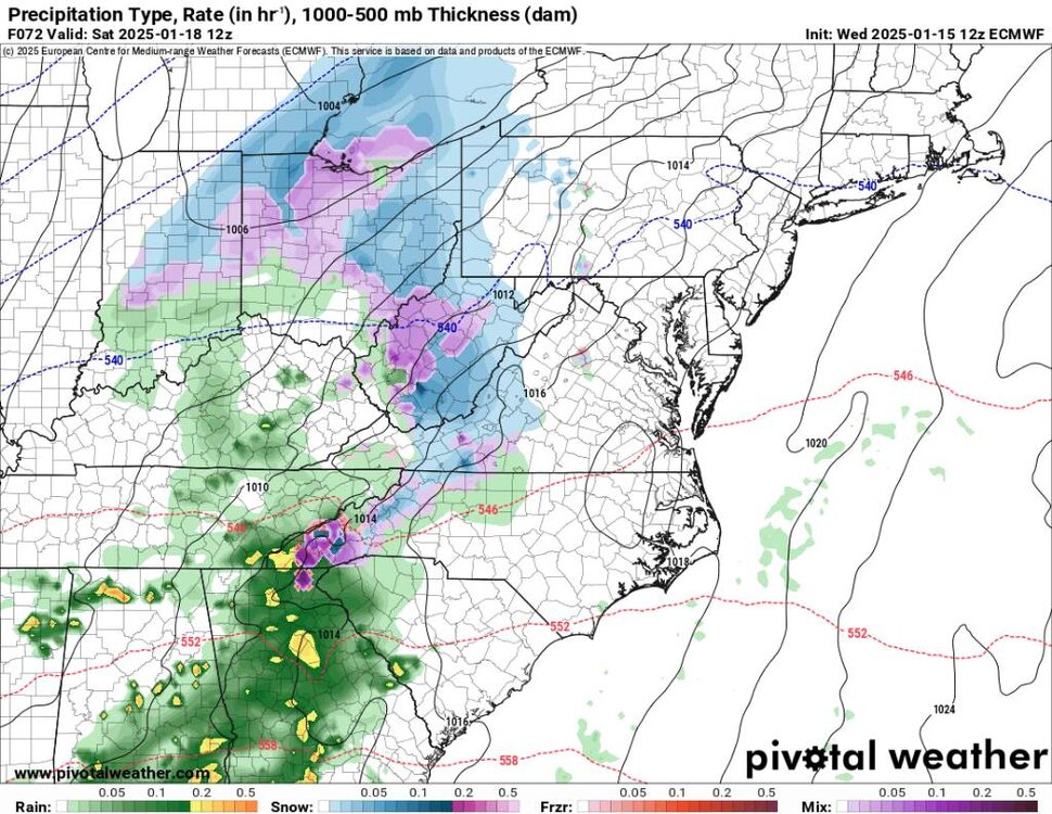
Still a big question about how the precipitation starts Saturday morning in the mountains. Also the Euro doesn't shoe a big storm but show multiple rounds of snow for us through the run. Lots of signals. Sent from my SM-G998U using Tapatalk
-
This will do. Sent from my SM-G998U using Tapatalk
.thumb.jpg.89fb69d1a8f817f7ec3b2f9ded67f450.jpg)
.thumb.jpg.b9ca12e28974fc62ccfbb8c72959bcb8.jpg)
-
The gfs really whiffed on the flow snow last night and only got down to 20 degrees. Things still look very interesting and yep still snow on the ground.
-
Meh it's pretty simple..there is a strong storm signal..Now just wait and see how things play out daily.
-
Another solution for the end of the weekend. Not going to dive into it but a strong signal is there. Sent from my SM-G998U using Tapatalk
.thumb.jpg.10e22f24dd3ea2a74f78f11e6136b827.jpg)
.thumb.jpg.7a20836c2ba8434ba4fb6b0490906357.jpg)
-
Euro know showing a front end Trump and upslope for the end of the week system. Sent from my SM-G998U using Tapatalk
.thumb.jpg.2885fedabbe87a9ff54e4c4c83e16805.jpg)
-
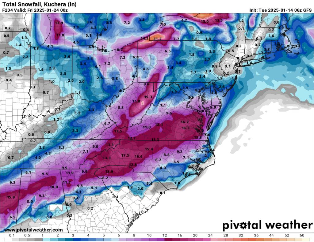
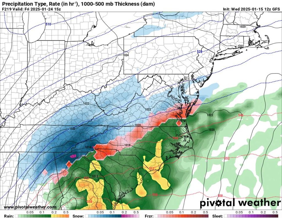
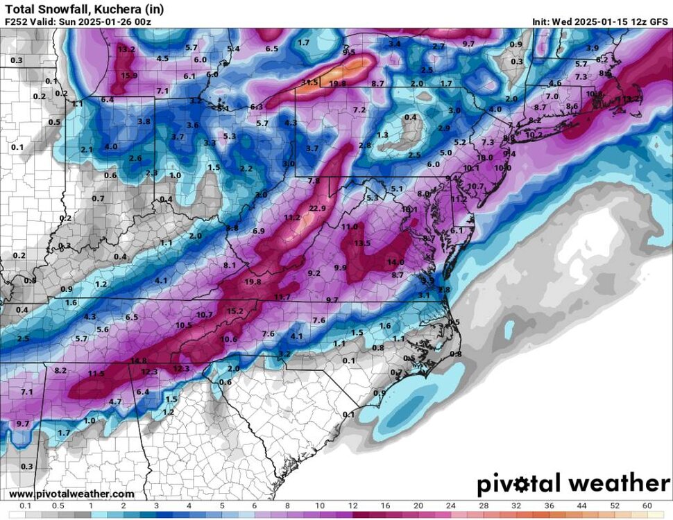
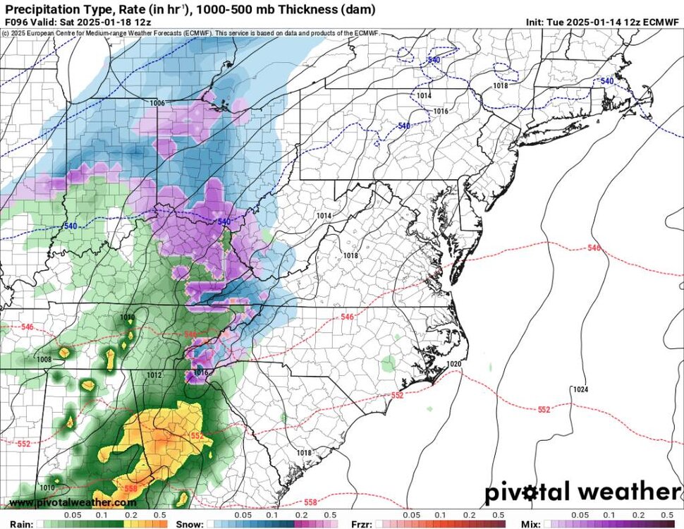
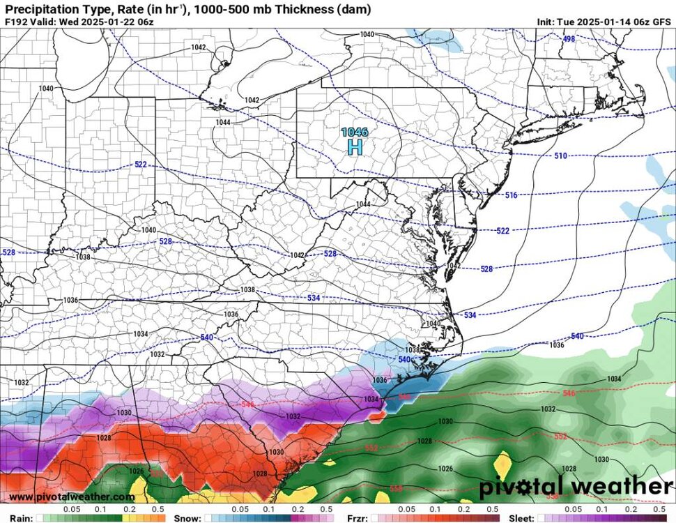
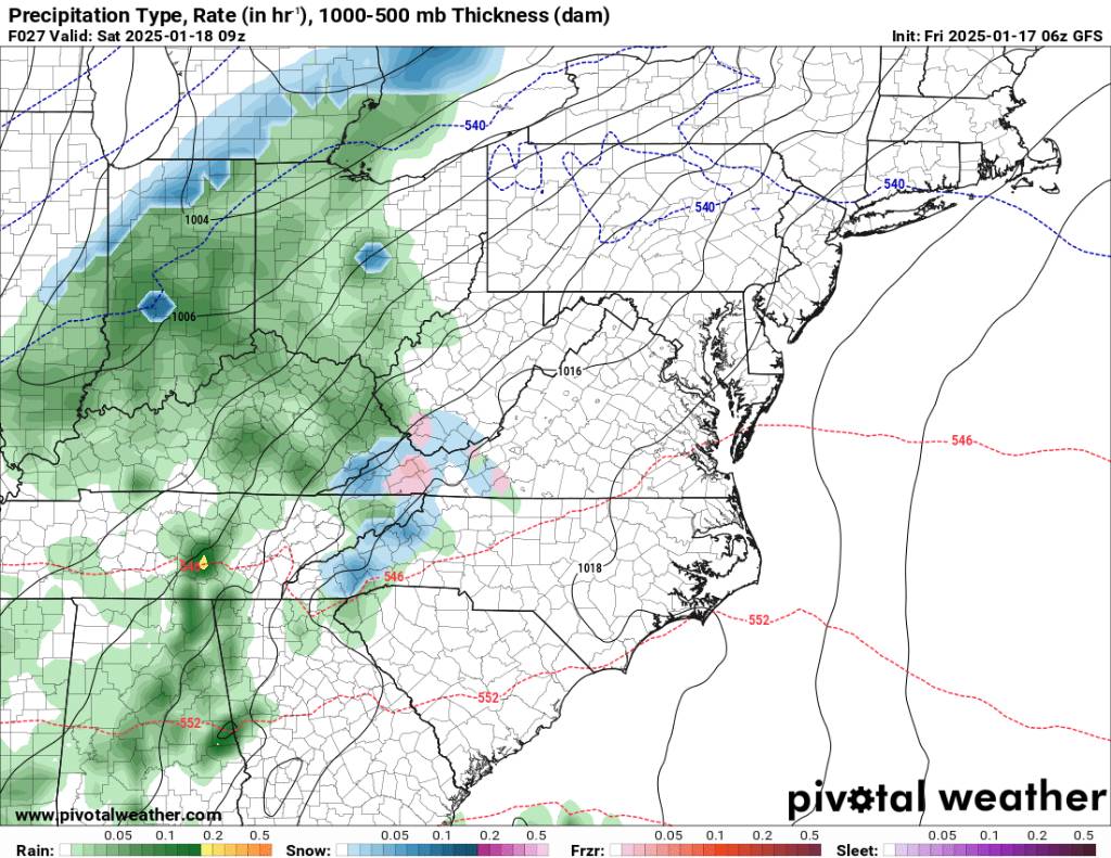
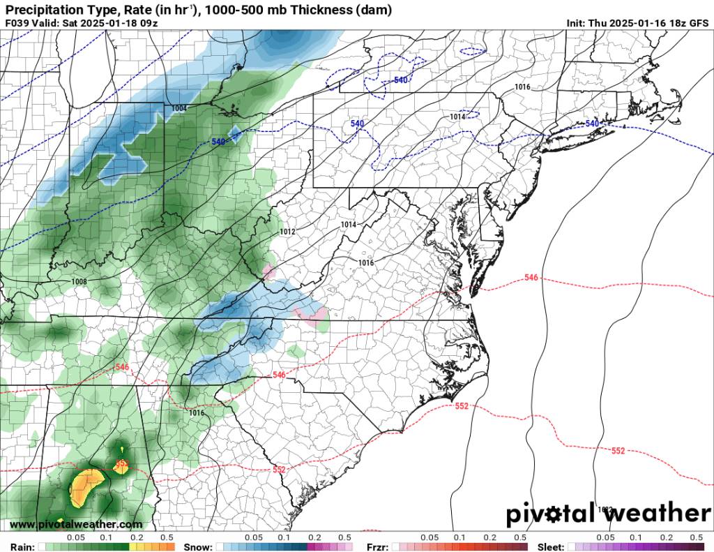
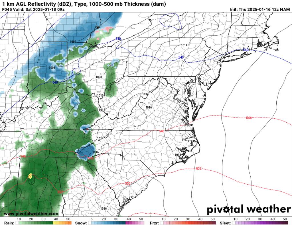
A big question is the system right around the 20th and the 21st. Obviously, we are several days out, but it's been entertaining to watch. This is what the gfs is spitting out this morning. Interesting and way south and another solution. This would bring a smile to a lot of people's faces. Sent from my SM-G998U using Tapatalk
.thumb.jpg.e323903ae43522b2379eaddd8aa3a491.jpg)
.thumb.jpg.7a5adc46f30693d06a9a2bf3a96ab09b.jpg)
.thumb.jpg.4e954609d6dd0f3c42f2d32f782ff20b.jpg)


.jpg.2d6dc2ad2e51a0155b617c388cfe6f2f.jpg)

.jpg.898020c795aa9feee784b06e2181df7b.jpg)
.jpg.86c52f7da4938d9f555cc83671ce2952.jpg)

.jpg.3262189c4a909f973a22fa681766b42b.jpg)


.jpg.89498f2fc7676540506f4f1e2e97e643.jpg)
.jpg.8ddd7e9fac737566c808033fed05f267.jpg)

.jpg.cb63d6e66b9e56c84c06f14fa950cb20.jpg)
.jpg.ea993546df188be1bca7ef3e4d407ba7.jpg)

.jpg.a1881e654fc4e02685cb29b3ca965835.jpg)

.jpg.042f2df820184e0f4d1adf911a2db605.jpg)
.jpg.ad34034ef0cf85e2525dbd2164eb0390.jpg)
.jpg.b380be4a03dfc34efdc8dfe720abaa85.jpg)