Met1985
-
Posts
16,564 -
Joined
-
Last visited
Content Type
Profiles
Blogs
Forums
American Weather
Media Demo
Store
Gallery
Everything posted by Met1985
-
Temps where all over the place this morning. At home I only got to 38, 42 in Asheville, 38 at the bottom of old Fort, and 52 in Morganton.
-
Just got home. Current temp is 41 degrees, very windy and it looks like it's rained on and off today. Hoping to see some flakes tonight.
-
Nice! Down to 35 here but no flakes.
-
Heck yeah! Raining currently with a temp of 41. Been at 41 for hours.
-
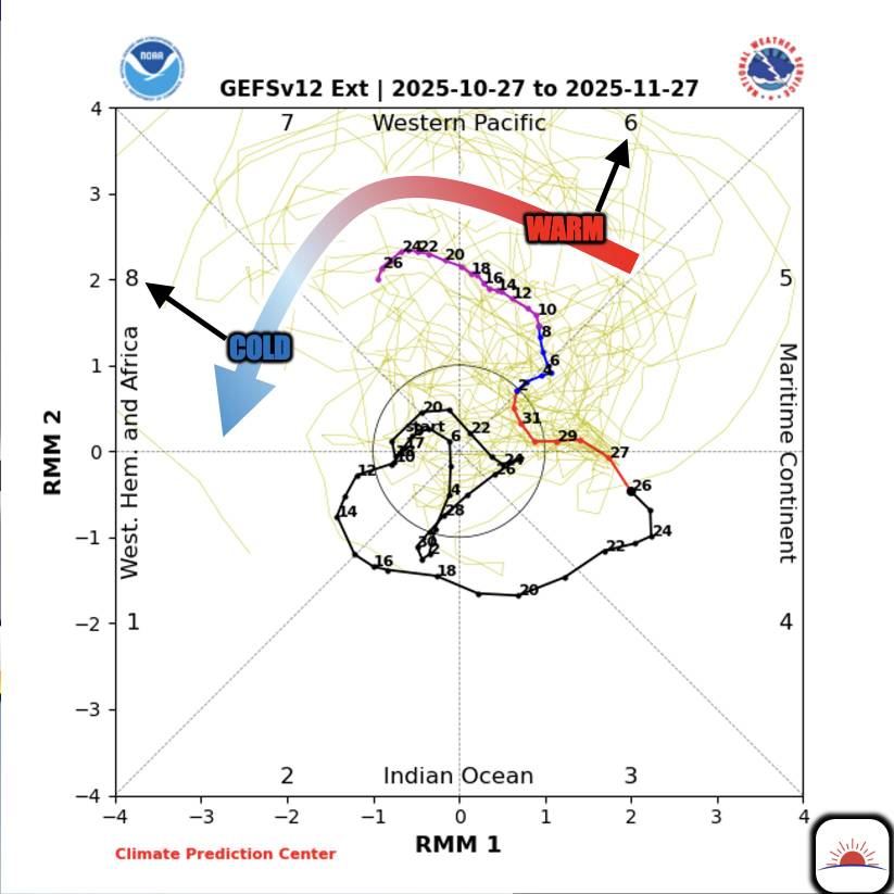
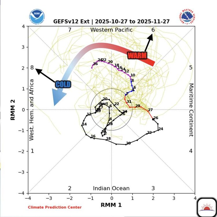
I got this from Bam weather but it's being talked about currently as we head into Met winter. This would be perfect heading into the cold season. Just 1 variable but a nice one. Watching the MJO closely ahead. "Phase 6" through mid-NOV offers an overall warmer outlook. However, especially as we transition to "phase 8", cooler temps will be the theme. Key will be timing but below normal temps loom to open up DEC Sent from my SM-G998U using Tapatalk
-
Seems like we still may see some high elevation snow Thursday night and most should see a freeze Friday night so bundle up those trick or treaters Friday evening. After that we get another cool shot then it looks like the pattern goes zonal for a bit. So we will see but after some much needed rainfall the weather will turn beautiful.
-
Feels like winter out there this morning. Temp of 38 with rain. Mt Mitchell is at 31 with rime ice.
-
Oh yeah not trying to be a pain but with the current climate and all the variables. I wish it was as easy as it used to be. With pattern recognition and rolling things forward. Seems like it's more frustrating than anything.
-
Yeah obviously last year was an anomaly of sorts. If we do see a mild November then we may be cooked for Winter. But im hedging on the optimistic side of things with us being in a weak enso state and a multitude of other factors.
-
Well let's hope this one is different because I do think that this November starts out cold but goes mild and may average out to above average in temps. But as we've all talked about these winter patterns tend to last 4 to 6 weeks so mild November, cold December, mild January and possibly cold February? Obviously the blocking is a crapshoot and there is no way of really forecasting that with any kind of accuracy. But I do like the PV in a constant weakened state and we've already seen that this Fall. Oh the joys of this hobby lol.
-
With today's climate and also a plethora of variables im not so sure about a cold November leads to a cold winter. Last November was pretty warm for many and we then had one of the coldest January's on average in about 30 years. I think we actually see a mixed bag this winter to average things out in my opinion.
-
Yes it would have. About a foot plus.
-
The PV remaining weak can lead to better and more blocking sessions in the NAO and AO regions. The PV has remained weak all the way back to last spring and so far this Fall has continued that trend.
-
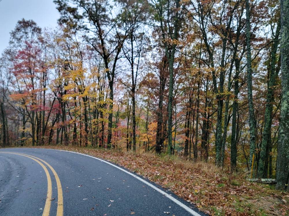
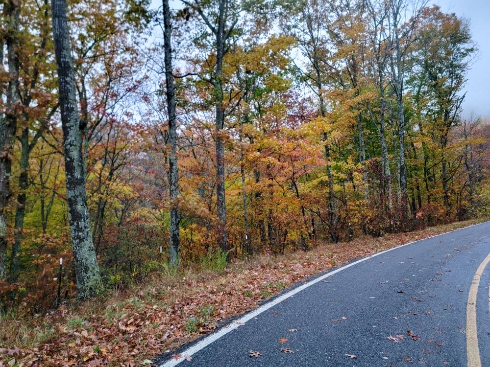
Socked in here with just a bit of color remaining. Sent from my SM-G998U using Tapatalk
-
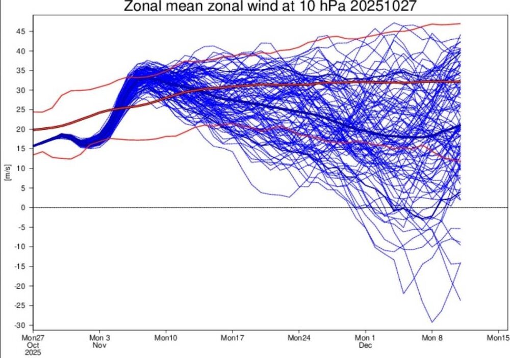
The latest EC46 showing a significant deceleration of the stratospheric vortex as we progress through November with a small cluster showing a major stratospheric warming early December. The models at long range want to strengthen the PV but it never fully does. I still don't think it does and this will lead to better blocking down the road hopefully for our area. Sent from my SM-G998U using Tapatalk
-
I was just going to post about this, this evening.
-
Yep. I went from 39 to 42 for a high and that's where im at currently. That's impressive for the end of October.
-
This week will definitely help with any drought worries. I still like our chances of seeing a mix around here at least especially if the cold core low passes right over us. And it looks like we see several cold fronts passing down in the next week or two.
-
Yeah especially in these downpours. They've canceled work for us today so going back home myself.
-
You might not get out of the 30s today.
-
A raw morning out with a low of 39 and rain knocking on the door.
-
A spectacular Fall day. A high of 54 and current temp of 44.
-
Yeah I think we will see some high elevation snow for sure.
-
Yeah as you stated in the mountains thread we will see some high elevation snow the next 5 to 7 days.
-
Im hoping so. Obviously way to soon to tell and we've seen patterns go to crap quick but I do like the look of the next few weeks.