

Met1985
-
Posts
15,465 -
Joined
-
Last visited
Content Type
Profiles
Blogs
Forums
American Weather
Media Demo
Store
Gallery
Posts posted by Met1985
-
-
3 minutes ago, WNC_Fort said:
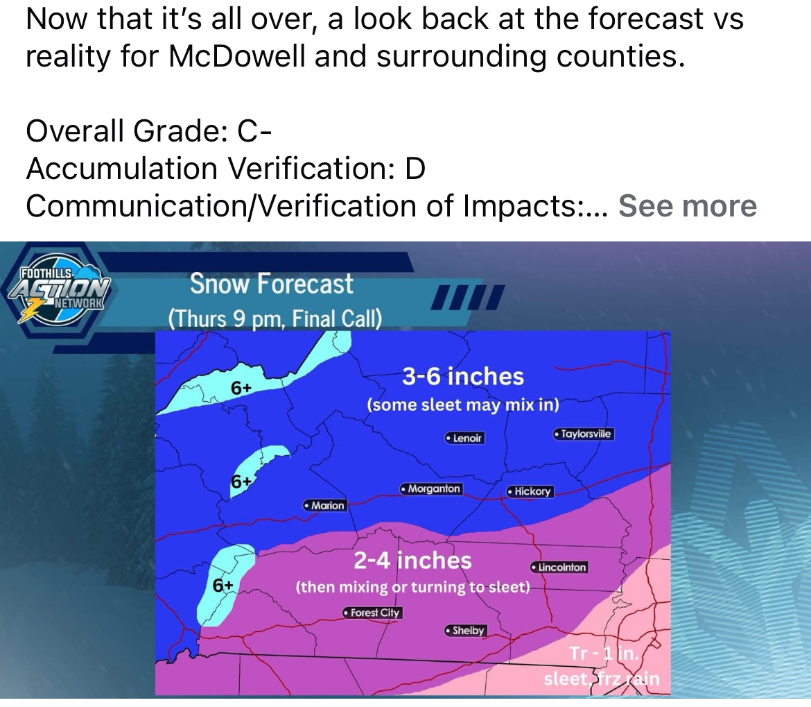
I think it depends on where you are located. Each model had flaws. I think for AVL/East towards Raleigh, the NAM scored in terms of calling for the transition to sleet and the warm nose/generally lower totals.
The HRRR was trash in terms of amounts, except did fairly well for Atlanta. I just don't see how anyone considers this event anything but a bust unless you're in Atlanta or west.
Upstate of SC did not get anywhere near the amount forecast. The foothills fared “ok” but generally lower than forecast. SW mountains were hit or miss. Charlotte was way under. Raleigh didn't get what the models were showing 24 hours before the event. Generally, an underperformer.
Look at how much Justus, Boyer, and Panovich were calling for just to see why many are calling it a bust.

Yeah the NAM scored on the warm nose but that eroded pretty quick. It was a mixed bag all over the SE. I know the guys in TN were not happy with the NAM because it was way to amped for them.
-
1 minute ago, SnowDawg said:
Hi-res nam was absolute garbage in the SW mountains, GA, AL, MS, and TN. Its 18z run the night before the event still wasn't showing any snow in North GA, AL, or MS and incorrectly showed mixing way too far north in TN. Euro and RGEM were far superior to the NAM and it wasn't even close, I don't understand the praise it is getting.
Yeah absolutely. The RGEM did a great job for the short range models. The NAM was too amped in a lot of places and definitely failed in GA. I mean not 1 model was saying Atlanta was getting 5 inches. Euro did end up doing well also.
-
31 minutes ago, WNC_Fort said:
Over 4000’ might have eeked out a decent event but overall, man what a bust (outside of the NAM)
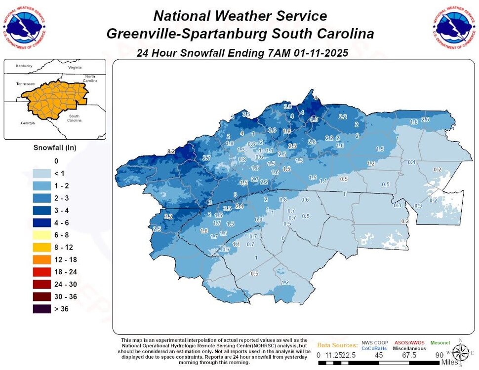
It really wasn't a bust here. We've had several posters get 3 plus inches which is right in line for what the models showed. I'm sorry yall in the foothills got shadowed but the moisture feed wasn't right for yall and it showed. You need to go back and read through this thread and look at what people have posted on accumulations. It's very telling.
-
 4
4
-
-
5 minutes ago, NavarreDon said:
Happy for all who cashed & especially those who over preformed! I’m really liking the pattern for the next couple weeks so, I might pop in or stick around.
.You should Don! Pattern looks ripe.
-
4
-
-
3 minutes ago, WxKnurd said:
Nice pics everyone! Starting to think I’m too close to the Buncombe County snow hole since the county like is only 2-300 yards away haha! Quick walk around the property earlier found 2” in last nights tire tracks and sheltered spots with 3”. So unofficially I think we ended up around 4” snow plus whatever sleet fell for the storm total. 2-3” is what’s on the ground and deck right now with pixie dust light snow falling all morning. Guess the better stuff stayed south of me last night since Met measured 6.5” and my buddies in waynesville and Clyde said 6” for them too. I’ve been having a sneaking suspicion lately that even at my elevation I get downsloped by Crabtree and Sandy Mush Balda since they are 1500’ higher.
Yeah when I drove up Rush Fork and Fines Creek, I was amazed at how little snow they had. I had to go up to over 4k feet to find anything significant but then even going out to lower Max Patch rd it was putrid. This storm was wild.
-
3
-
-
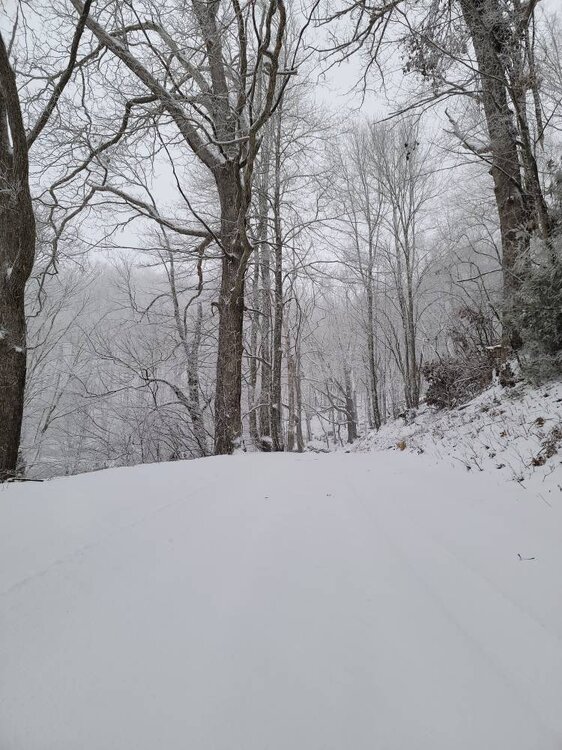
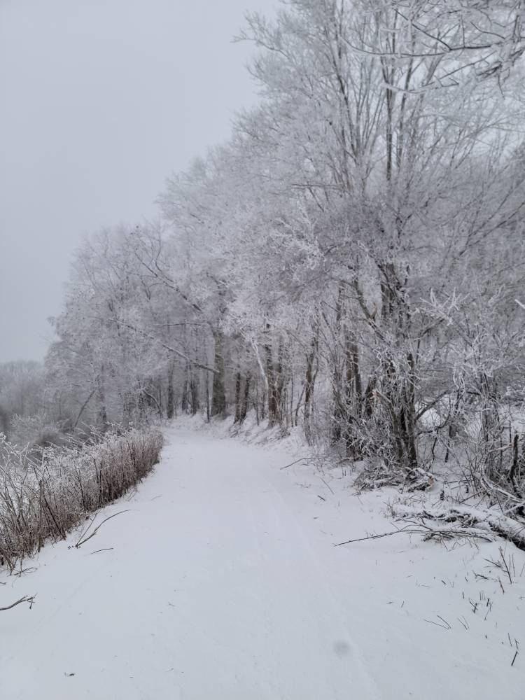
More pics from flow snow.
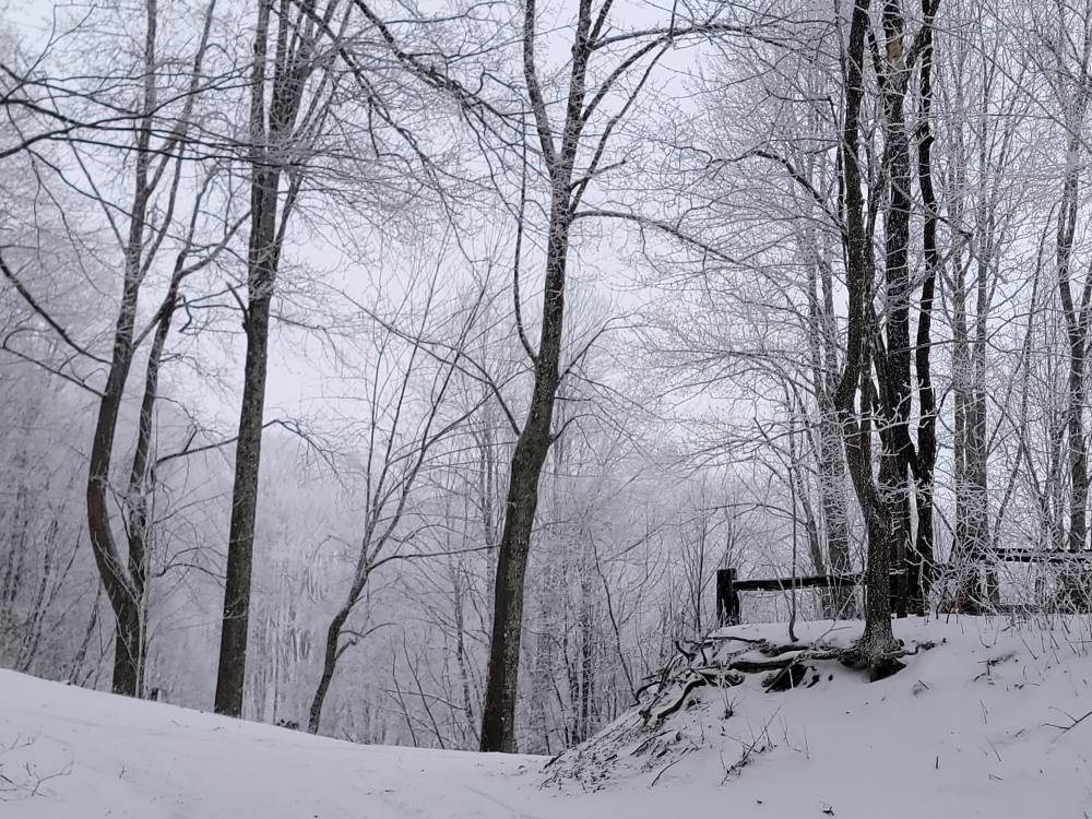
Sent from my SM-G998U using Tapatalk-
8
-
 1
1
-
-
1 minute ago, strongwxnc said:
Great stuff guys! This was as stated by gsp. 1" of snow and then everything else!
Had some great sledding time with the family as the pasture today. 38 now with gusts over 20.
Was not an over performer but was the first time since 2022 that we have had something. So win in my book!
Keep those pictures coming guys. You all have great spots.
Glad you got to enjoy it. I know yall wanted more but it will come.
-
3
-
-
IV got to say this has been one of the best weeks of winter weather we've had in a long time. Absolutely loving this week. Snowed everyday since Monday afternoon.
-
6
-
 1
1
-
-
Just got back from this mornings adventure. It's snowing lightly with an additional .75 inches best I can tell because the wind is howling. Temp has dropped to 23 also.
-
5
-
-
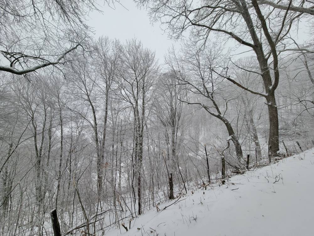
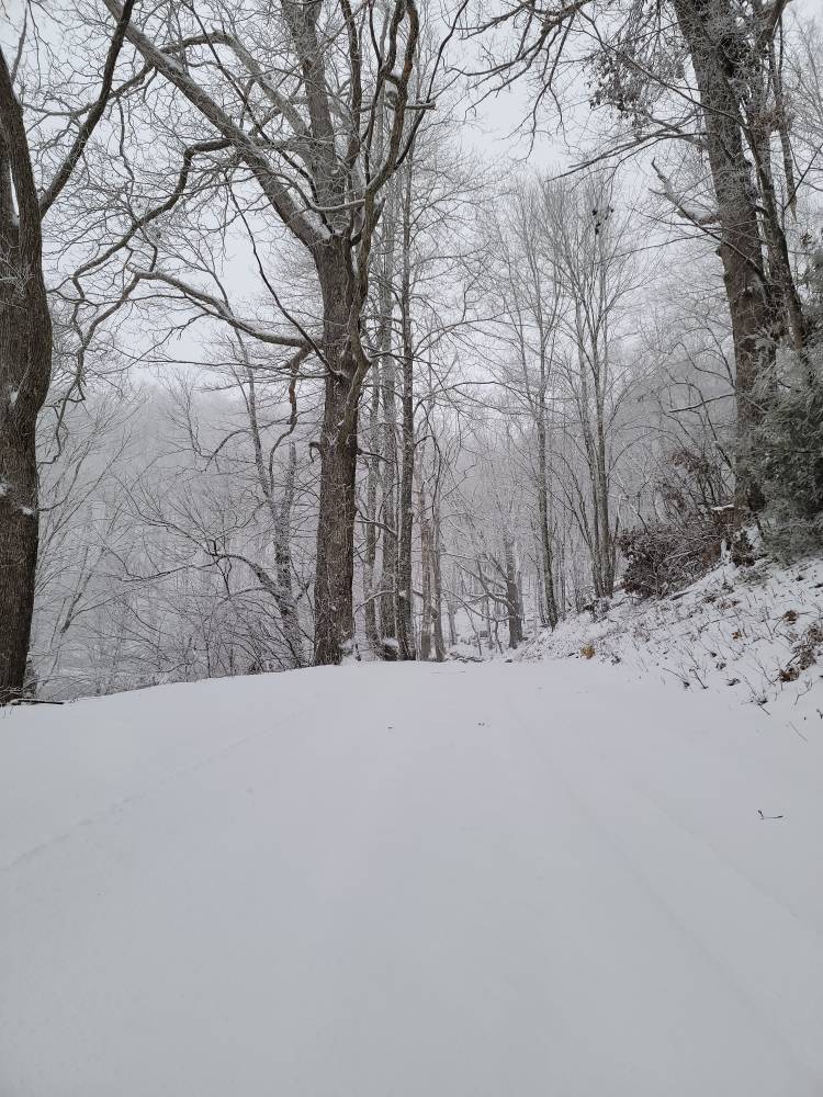
Flow snow in high gear
Sent from my SM-G998U using Tapatalk-
9
-
-
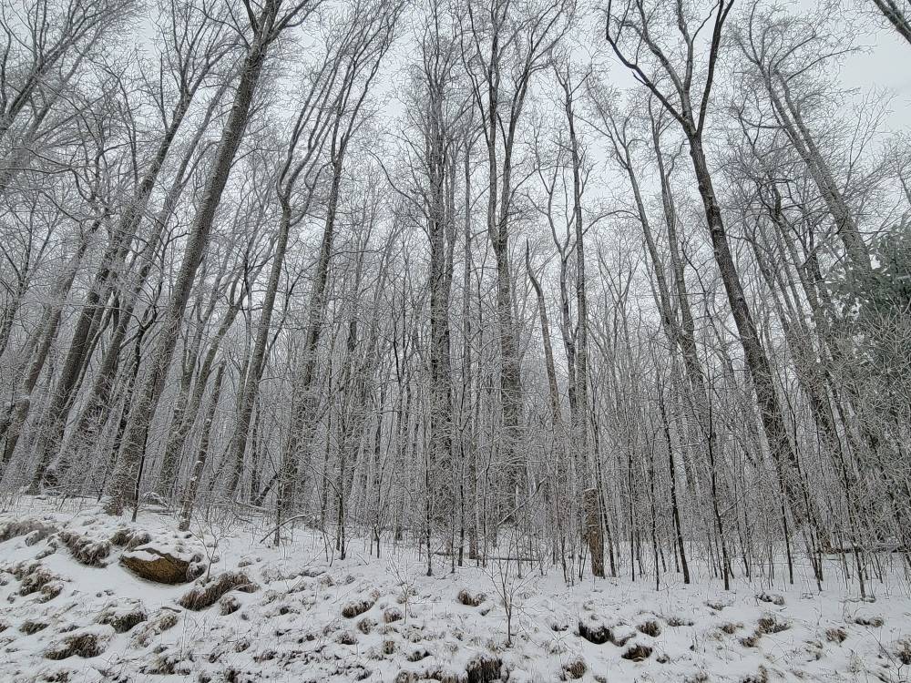
Up top looking down into town while a snow squall moves in.
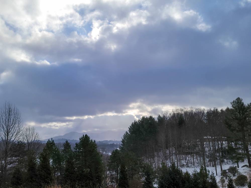
Sent from my SM-G998U using Tapatalk
-
5
-
-
This morning as I look at this event it really did well all in all. The Buncombe snow hole is real. The foothills did ok. But most along the border and from Haywood south did very well. Most saw between 3 to 6 inches plus and that's a huge win in my book. The NAM did verify to a point but so did the Euro AI and the GFS. This was a win for most of us and it ended the snow drought for many.
-
5
-
-
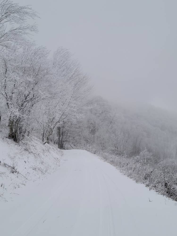
Moderate snow this morning with a temp of 25. Looks like about another inch overnight. 6.5 inch storm total.
-
10
-
-
Just now, Buckethead said:
Nice! This has been a great week!
Sent from my SM-S908U using Tapatalk
Yeah one of the best weeks in a few years!
-
1
-
-
IV picked up another inch in the past hour here. It's just pouring. Total is 5.5 inches now.
-
5
-
-
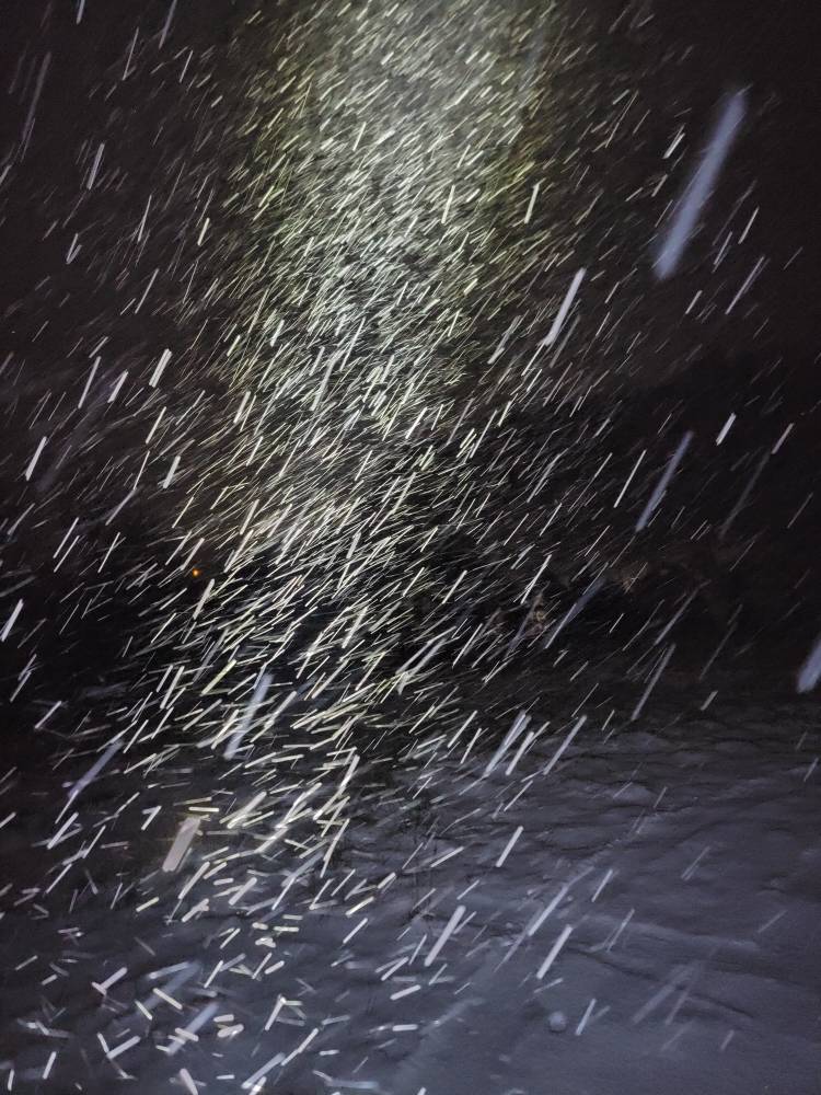
This is the hardest it's snowed all day.

Sent from my SM-G998U using Tapatalk-
4
-
-
3 minutes ago, Buckethead said:
22 and heavy snow here. Over 6" now. Just had to pull my wife and a couple of neighbors out of the ditch. It's not the night to be out without aggressive tires or chains!


Sent from my SM-S908U using Tapatalk
Did you charge your wife 40 dollars lol?!
-
1
-
 1
1
-
-
12 minutes ago, Blue Ridge said:
30 dbz returns rolling in resulting in the fattest and wettest of the night!
Rain drops, that is.
Sure...
-
I think we actually will continue to see snow despite the radar for a good portion of the night. That low level moisture will continue to feed over the mountains.
-
1
-
-
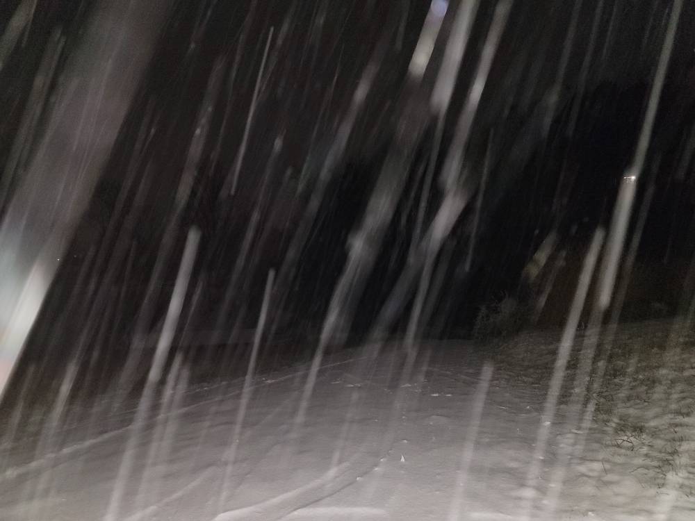
Still hammering here..IV added another 1.25 inches so that brings me to 4.5 inches so far.
-
9
-
-
5 minutes ago, WNC_Fort said:
We just switched back over to snow. Its light but ill take it over the sleet! Road is a mess
Glad you are getting in on the fun.
-
3 minutes ago, NavarreDon said:
I’m really surprised also, it may end up with the N Mnts being the winners from this one. I certainly have some egg on my face at this point.
.Nah Don ill take the hit on this. You did great and we greatly appreciate your posting here.
-
2
-
1
-
-
Congratulations guys! I know this wasn't the big one but dang sure was nice to see.
-
5
-
1
-
-
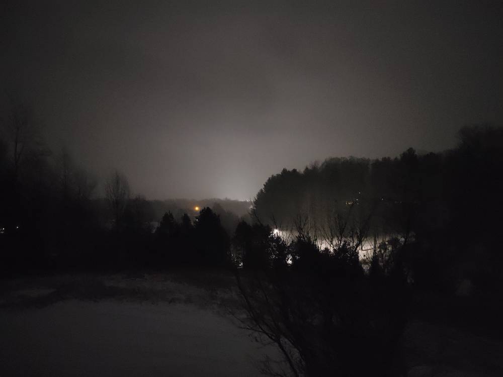
It's hammering the snow again now. Just puking.
-
6
-

2024-2025 Fall/Winter Mountain Thread
in Southeastern States
Posted
I actually think that heavy precipitation pulled down the warm air from aloft then switched back during the lighter periods at least for them.