

Met1985
-
Posts
15,464 -
Joined
-
Last visited
Content Type
Profiles
Blogs
Forums
American Weather
Media Demo
Store
Gallery
Posts posted by Met1985
-
-
With the severity of the cold air coming in that will squash any system south. That's why the coast was looking really good because the low was forming at the bottom of the trough right along the coast. But the further this pushes south it's no Bueno.
-
 1
1
-
-
The NAM was not right on several things with this last storm. Really the only thing the NAM was correct on around my area was the warm nose to an extent but that only lasted for about 2 hours here and did not verify in other mountain towns.
The NAM screwed TN by being overamped and them not seeing snow totals anywhere close to the NAM.
I don't think the NAM got close to what Atlanta saw in terms of snowfall. I lot about what the NAM showed was WRONG. Honestly the RGEM did a much better job in my opinion and the Euro did decent as well.
-
 1
1
-
-
We are 7 days away from this event and yall think the models have this laid out already? Good luck with that. Again and Again we have seen major changes just 2 to 3 days before a storm hits. Don't get sucked in or out at the long lead time.
-
5
-
2
-
-
00z NAM on board with morning snow for the mountains.

Sent from my SM-G998U using Tapatalk-
2
-
-
8 minutes ago, wncsnow said:
A lot of that snow is from Saturday morning in WNC. Sneaky little event could be a few inches for SW Mtns especially
Yeah that's interesting.
-
7 minutes ago, Buckethead said:
I'm beginning to think I may not see my yard until sometime in February. This stuff just won't melt, even on a balmy 27° day.
Sent from my SM-S908U using Tapatalk
Yeah and especially with the super cold lurking next week. And if we get a decent 6 plus inches. Yeah fun and games.
-
2
-
-
This is acceptable.

.thumb.jpg.1201edc22e1d242cdbc1f30dc08e4f3f.jpg)
.thumb.jpg.11577c3104360d02eead296d6834b1f7.jpg)
Sent from my SM-G998U using Tapatalk-
2
-
-
Still a big question about how the precipitation starts Saturday morning in the mountains.
Also the Euro doesn't shoe a big storm but show multiple rounds of snow for us through the run. Lots of signals.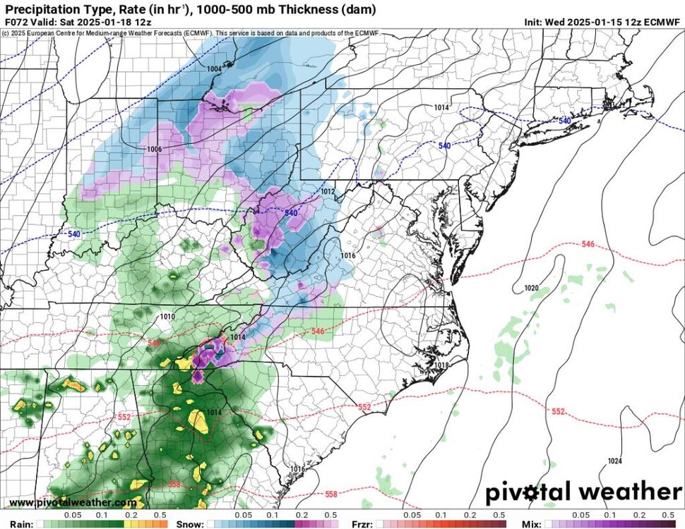
Sent from my SM-G998U using Tapatalk -
This will do.
.thumb.jpg.89fb69d1a8f817f7ec3b2f9ded67f450.jpg)
.thumb.jpg.b9ca12e28974fc62ccfbb8c72959bcb8.jpg)
Sent from my SM-G998U using Tapatalk-
1
-
-
The gfs really whiffed on the flow snow last night and only got down to 20 degrees. Things still look very interesting and yep still snow on the ground.
-
1
-
-
Meh it's pretty simple..there is a strong storm signal..Now just wait and see how things play out daily.
-
7
-
-
Another solution for the end of the weekend. Not going to dive into it but a strong signal is there.
.thumb.jpg.10e22f24dd3ea2a74f78f11e6136b827.jpg)
.thumb.jpg.7a20836c2ba8434ba4fb6b0490906357.jpg)
Sent from my SM-G998U using Tapatalk
-
4
-
-
Euro know showing a front end Trump and upslope for the end of the week system.
.thumb.jpg.2885fedabbe87a9ff54e4c4c83e16805.jpg)
Sent from my SM-G998U using Tapatalk-
2
-
-
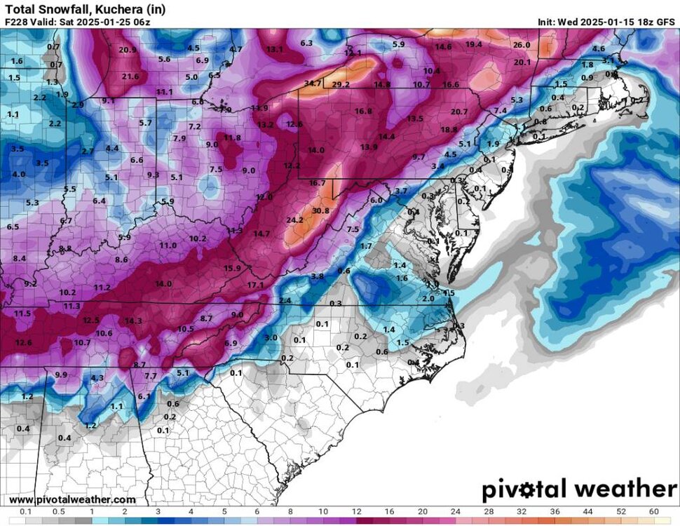
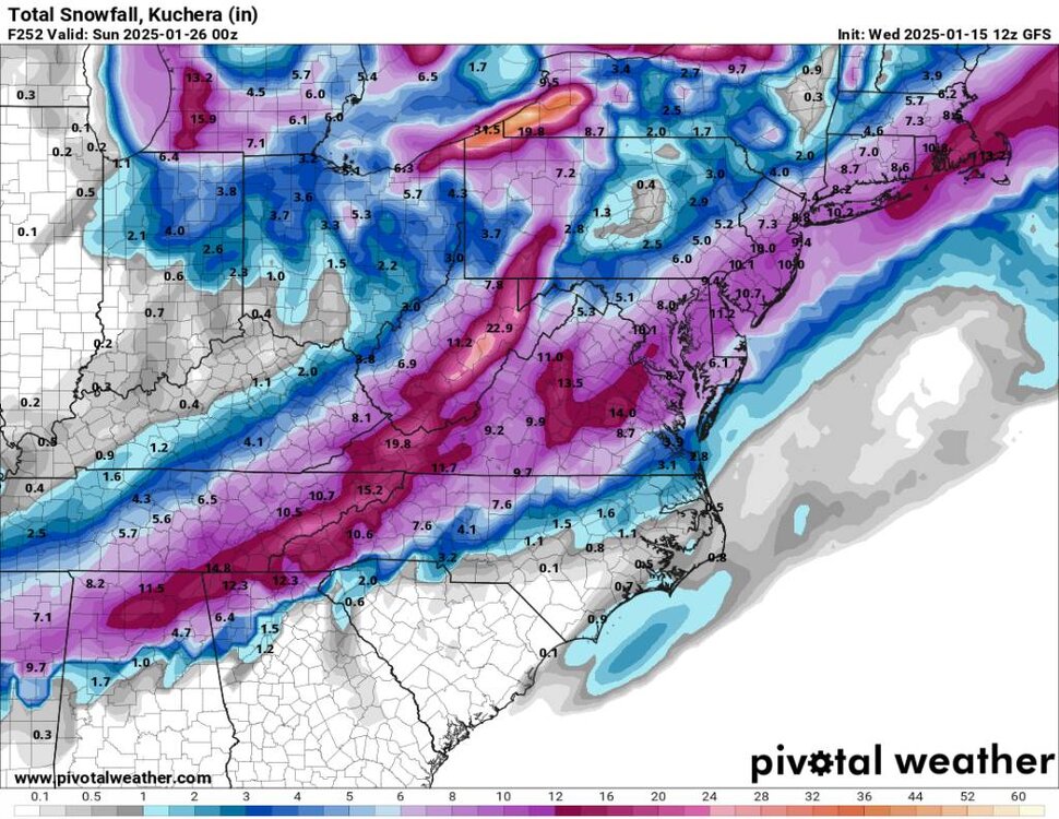
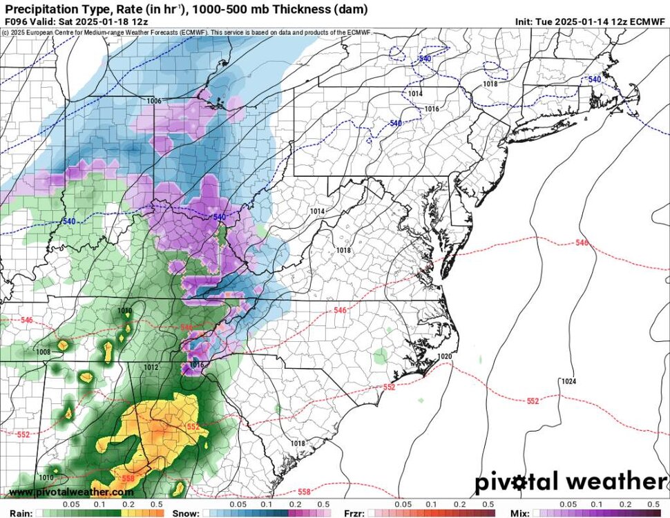
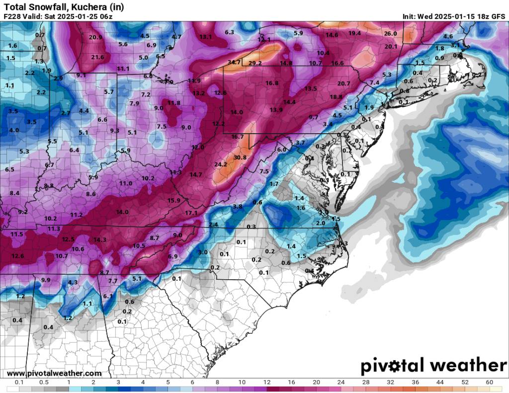
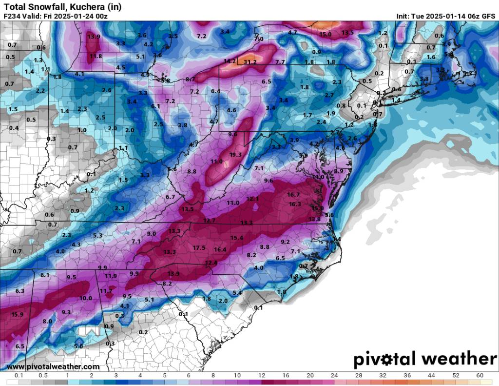
A big question is the system right around the 20th and the 21st. Obviously, we are several days out, but it's been entertaining to watch. This is what the gfs is spitting out this morning. Interesting and way south and another solution. This would bring a smile to a lot of people's faces.
.thumb.jpg.e323903ae43522b2379eaddd8aa3a491.jpg)
.thumb.jpg.7a5adc46f30693d06a9a2bf3a96ab09b.jpg)
.thumb.jpg.4e954609d6dd0f3c42f2d32f782ff20b.jpg)

Sent from my SM-G998U using Tapatalk-
4
-
-
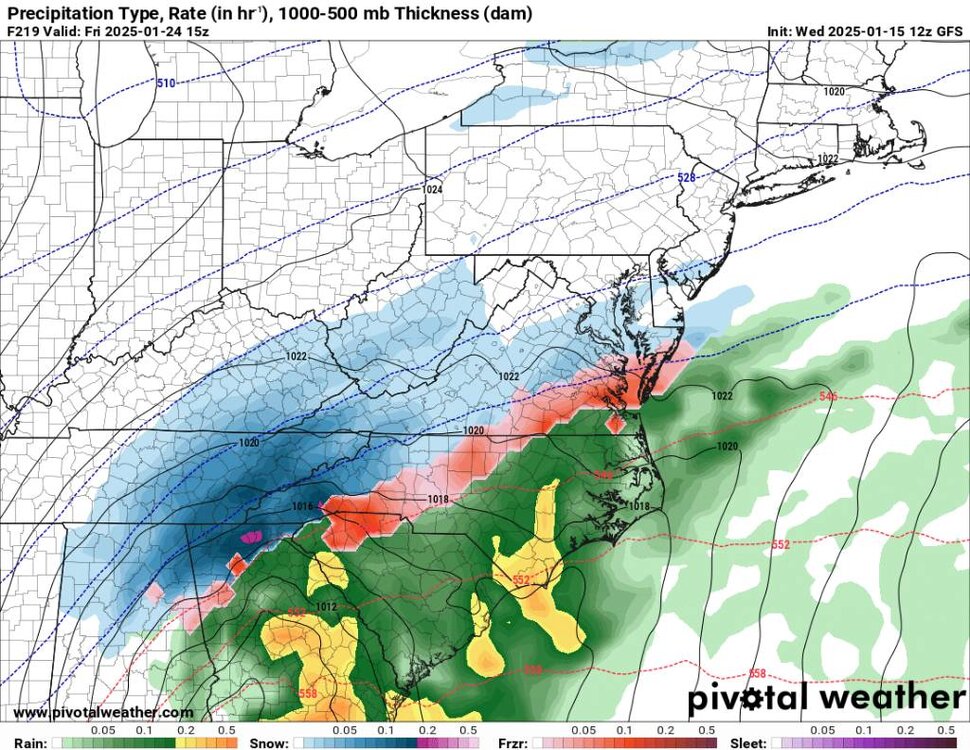
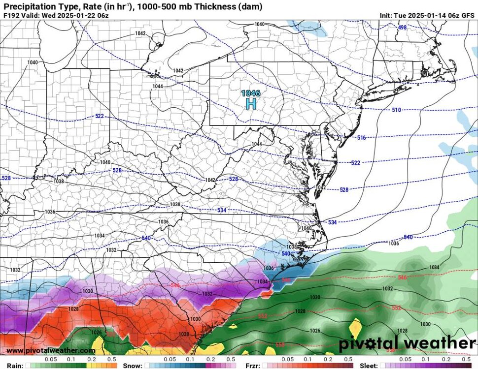
Second is the storms coming around the 19th. The gfs has been showing this beginning as snow or a mix recently and that's something to watch for. The flow snow looks pretty stout behind that system also.
-
2
-
-
Several things are catching my eye this morning.. First is the cold front coming through tonight. We should see some light snow along the border and maybe an inch from Buckethead north.
-
3
-
-
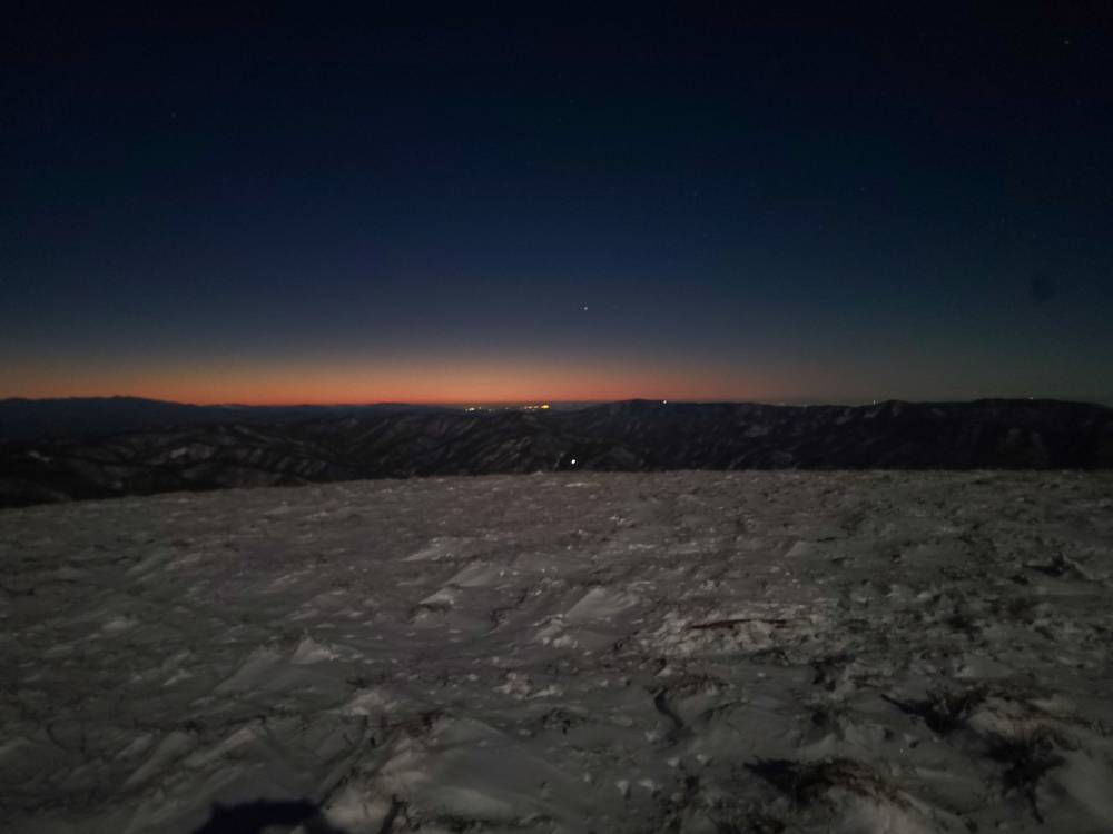
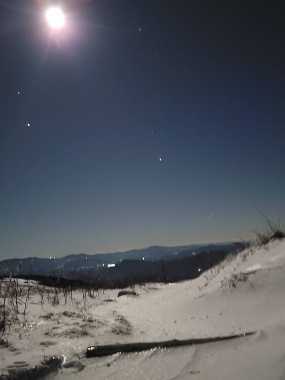
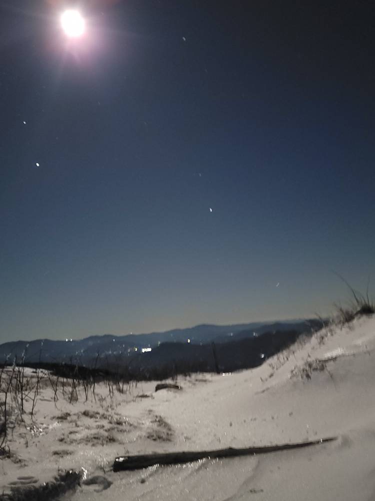
Had a freaking amazing night hiking up to over 5500' with Buckethead! He's taught me a ton about photography, and the scene tonight was remarkable!

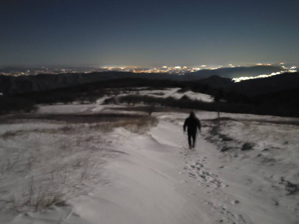
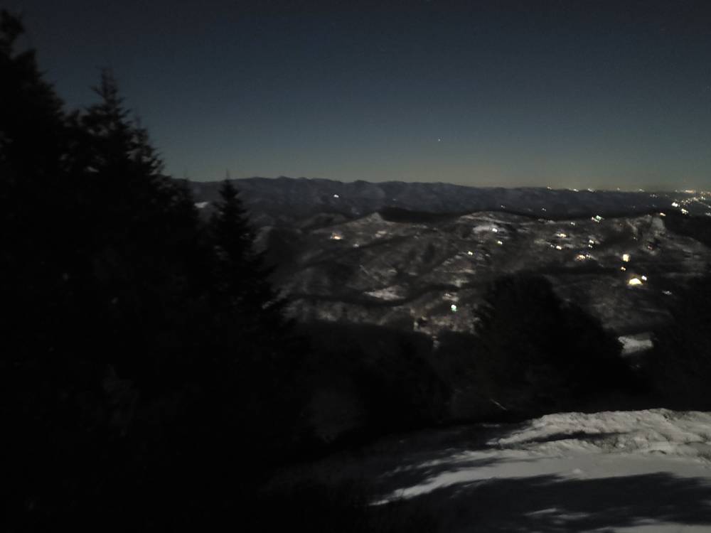
Sent from my SM-G998U using Tapatalk-
14
-
-
Today was a heat wave. High of 43.
-
Just now, strongwxnc said:
You can count my weenie for sure
")
It's fun to look at. Definitely a storm signal for that time period.
-
28 minutes ago, NavarreDon said:
12Z Euro is the stuff dreams are made of!!!
.Yeah for sure. Weenies losing it in the main thread lol.
-
1
-
-
Had a low of 10 this morning. This stuff is a glacier now.
-
1
-
-
53 minutes ago, WxKnurd said:
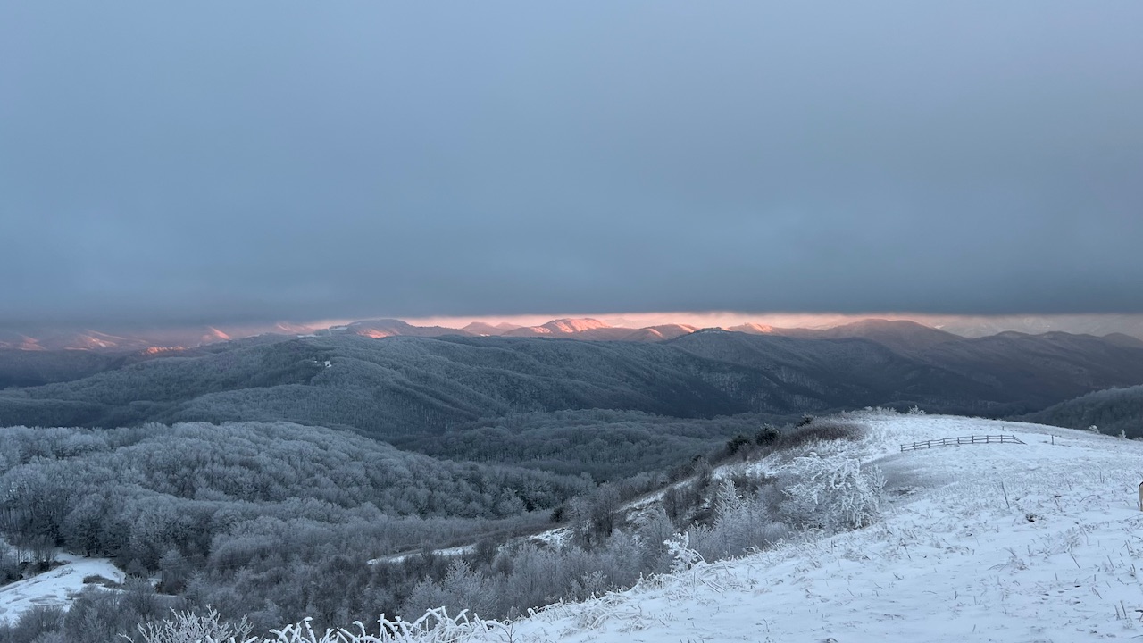
Just got back from Max Patch, awesome sunset! Flakes flying while there. Just a gorgeous winter day post storm. I’d say what, 6-8” depending on where you were up on that end of the county @Met1985? Also, was that Nissan Frontier off the road when you were there earlier today? No clue how they’ll pull that one up and back onto the road with out something with a bucket.
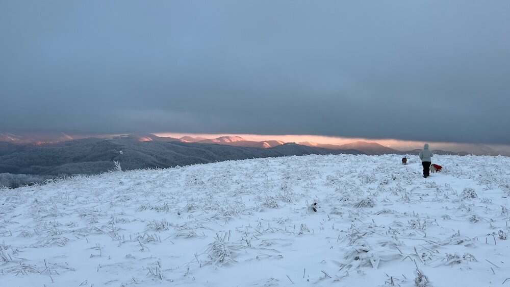

I didn't go that far in. Just to the lower side of Max Patch rd but someone had posted several vehicles got stuck or ended up in the ditch somehow. Beautiful pics.
-
14 minutes ago, franklin NCwx said:
Not a bust here. We had around 5 inches of frozen fall. Nam gave us several hrs of freezing rain. We only had sleet during the warm nose
Yeah your right. Absolutely no freezing rain around here that I can confirm!
-
1
-
-
2 minutes ago, WiseWeather said:
The foothills would have been at that total or above “if” that warm nose didnt move in during the hardest precip of the evening. It was fat heavy flakes and switched to sleet for 45 mins to an hr between 6-6:45.
.I actually think that heavy precipitation pulled down the warm air from aloft then switched back during the lighter periods at least for them.
-
1
-

.jpg.ccbdfcb91a1b3f221412514ac1da847e.jpg)
.jpg.3262189c4a909f973a22fa681766b42b.jpg)


.jpg.89498f2fc7676540506f4f1e2e97e643.jpg)
.jpg.8ddd7e9fac737566c808033fed05f267.jpg)

.jpg.cb63d6e66b9e56c84c06f14fa950cb20.jpg)
.jpg.ea993546df188be1bca7ef3e4d407ba7.jpg)

.jpg.a1881e654fc4e02685cb29b3ca965835.jpg)

.jpg.042f2df820184e0f4d1adf911a2db605.jpg)
.jpg.ad34034ef0cf85e2525dbd2164eb0390.jpg)
.jpg.b380be4a03dfc34efdc8dfe720abaa85.jpg)

2024-2025 Fall/Winter Mountain Thread
in Southeastern States
Posted
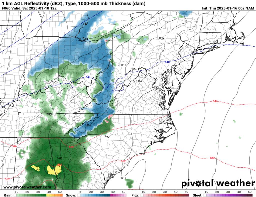
This is definitely trending better. 12z NAM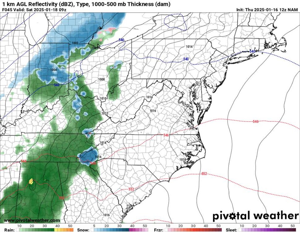
.thumb.jpg.dcad85718068209a62c3d0d3317a98e8.jpg)
Sent from my SM-G998U using Tapatalk