Thunderblizzard
-
Posts
1,430 -
Joined
-
Last visited
Content Type
Profiles
Blogs
Forums
American Weather
Media Demo
Store
Gallery
Everything posted by Thunderblizzard
-
0.5” this morning before going over to a 34F drizzle. An overperformer.
-
Euro amping back up at 12z it looks like.
-
Euro looks pretty flat and progressive compared to the 12z run.
-
Haven’t seen the sun peek through once… socked in clouds and 46.
-
 UKMET looks significantly east of 12z. Over eastern upstate NY at 144 as opposed to MI.
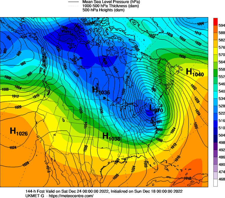
-
Handling of the TPV was much more favorable than 12z... need to see that show up in other models.
-
That was a rather large shift on the CMC... much more confluence up top. A lot snowier in NNE.
-
Less amped... but that's still a cutter.
-
I'm guessing it will cut again based off the look at hour 114... nothing like the GFS.
-
UKMET also still cuts.
-
ICON looks wildly different at hour 105... TPV much further ahead and south and the main vort seems to be lagging.
-
Preliminarily ... a medium impact partial Miller B, Friday
Thunderblizzard replied to Typhoon Tip's topic in New England
Man, I wish I could trust that 0z GFS run. -
Preliminarily ... a medium impact partial Miller B, Friday
Thunderblizzard replied to Typhoon Tip's topic in New England
18z Euro looked a fair bit colder than the 12z run. -
Fairfield County Crusher 12/11-12/12
Thunderblizzard replied to Go Kart Mozart's topic in New England
Final total was 3.6” here. -
Fairfield County Crusher 12/11-12/12
Thunderblizzard replied to Go Kart Mozart's topic in New England
3.6" here, some very light snow still falling. -
Fairfield County Crusher 12/11-12/12
Thunderblizzard replied to Go Kart Mozart's topic in New England
Just shy of 3" here with light snow. -
Fairfield County Crusher 12/11-12/12
Thunderblizzard replied to Go Kart Mozart's topic in New England
Coming down good with some great snow growth right now. Hopefully can keep this going for a little while. -
Fairfield County Crusher 12/11-12/12
Thunderblizzard replied to Go Kart Mozart's topic in New England
Starting to get going here... steady light snow, coating up. -
Fairfield County Crusher 12/11-12/12
Thunderblizzard replied to Go Kart Mozart's topic in New England
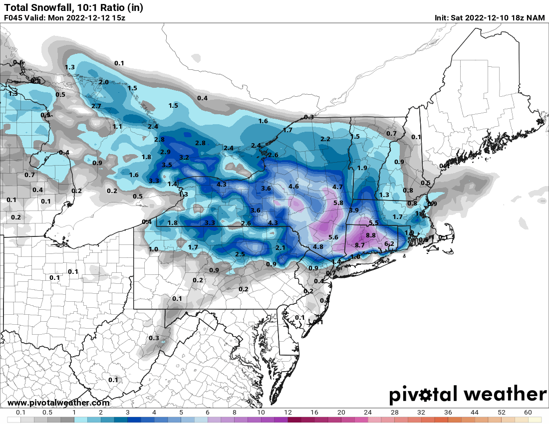
18z NAM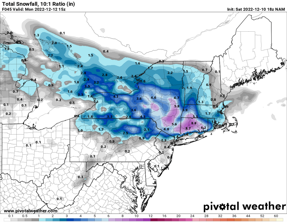
-
CMC with a 2 foot jack near Newtown/Southbury... lol.
-
Sleet/rain mix here now at 33F. Maybe a tenth or two of snow/sleet on cold surfaces.
-
Pure sleet falling now. Tickling down to 32.
-
Temperature down to 34, moderate snow.
-
Well... it's coming down quite good right now. Big flakes and starting to stick on cold surfaces.
-
It's all snow here right now. But too warm to really stick. 36F