
hooralph
-
Posts
1,317 -
Joined
-
Last visited
Content Type
Profiles
Blogs
Forums
American Weather
Media Demo
Store
Gallery
Posts posted by hooralph
-
-
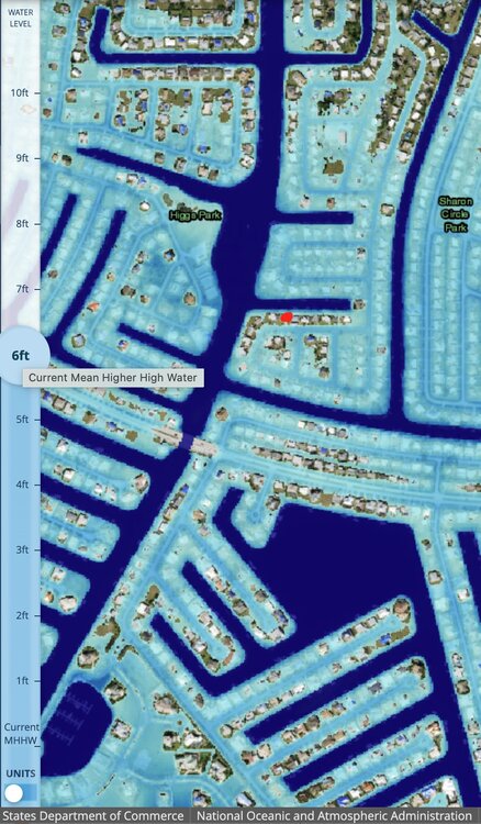
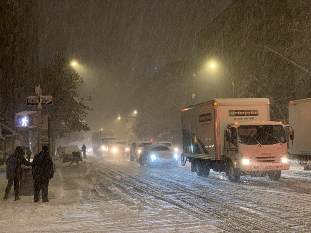
My in-laws at this red dot location in Charlotte Harbor have dug their heels in will not be leaving. The have a false sense of security because the slight elevation of their side of the street has kept them dry in 5-6" surges. At 7, the water is at their door.
My last plea to move was met with this: "Actually it would be better if it lands closer to us because a lot less surge if that happens"
-
 3
3
-
-
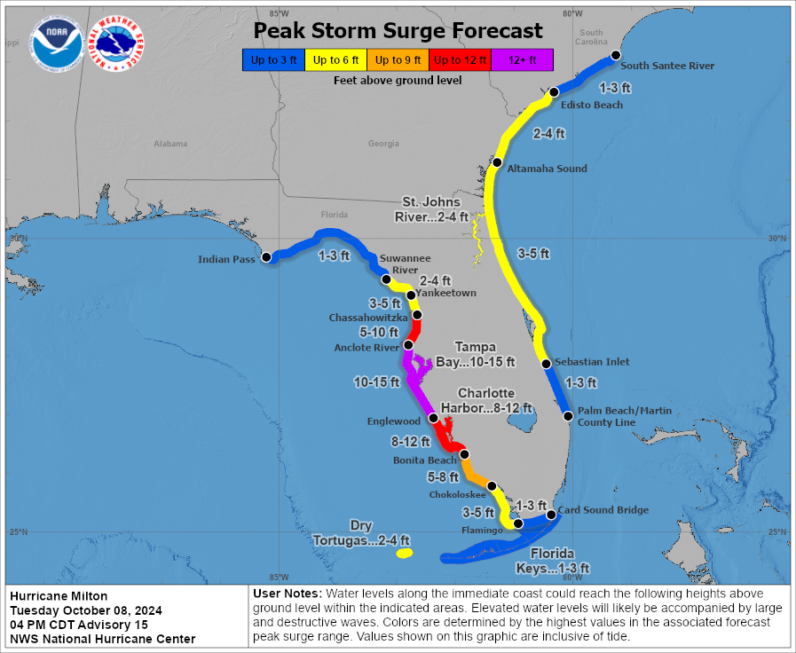
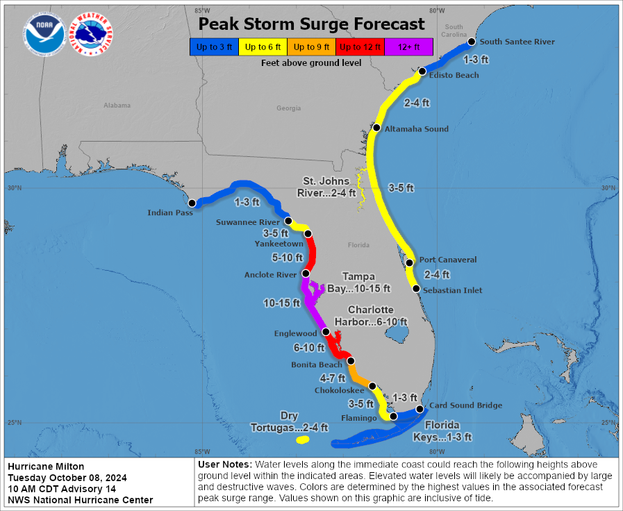
Charlotte Harbor up to 8-12'
-
I hate to go all IMBY (or specifically in-laws back yard), but given that the track is tucked in just S of TB, does the surge forecast seem shifted a little too far north here?
Specifically I am wondering about Port Charlotte. With an expanding wind field, how far down would the max surge extend? (and again, wouldn't it extend further S than N?)
-
 3
3
-
-
This is a fantastic tool. Using it to look at the surge impact in port charlotte, where my father in law who lives on a canal refuses to evacuate. Playing with the levels I can see how 4-5’ (seen in Ian and Helene) has not reached his house. But at 6 it reaches him.
-
 4
4
-
-
2 hours ago, Seminole said:
Filled out a missing person report for my son in Ashville, NC. I last heard from him Friday at 1:30 PM. He said he was on the second floor of his home and cut off from everything because of flood water and debris. The situation there is beyond dire.
Amazing amount of information here. https://www.reddit.com/r/asheville/ - you can really see the community rallying to help, but yes, it is dire. But it's clear there is very little communication, so you can reasonably hope he simply doesn't have a way to call.
-
1
-
-
Charlotte Country (Port Charlotte) has already ordered evacuations. Overreaction? Proper reaction?
-
10 hours ago, WxWatcher007 said:
Congrats Nova Scotia. Newly designated 99L is trying to develop…while getting blasted by 40kt shear lol.

The MDR can’t even generate real convection lol let alone have it attempt to organize.
We're supposed to fly out of Halifax on Saturday afternoon (after a 3.5 hour drive from PEI).
 Safe to say this snuck up on us. Trying to figure out if we need to try to proactively change it.
-
1
-
-
Awesome lighting and thunder. A summer classic.
-
LFG.

-
1 hour ago, Gravity Wave said:
I assume that these departures are specific to the summer given how the sun roasts everything? It would be interesting to see the winter version.
I think that’s the full year. I think it comes from a national study. You can click on the article and then go to the research.
-
Forgive me if this was shared previously; relevant to the CPK discussion and the summer in general. Very localized heat island map.
I was gratified to find I live by that “cooler” tongue on the UWS; I suspect the streets (esp the wide ones : 106 and 110) providing more of a channel for upsloping winds.https://www.thecity.nyc/2023/07/26/heat-island-hot-map-temperature/

-
3
-
-
These things have been falling apart before hitting Manhattan like Adams put up some deflector shield.
-
Pretty garden variety strong thunderstorm on UWS.
-
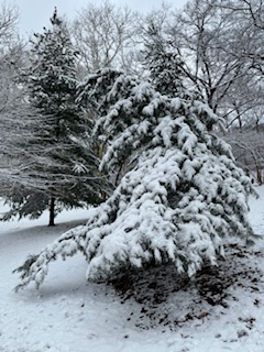
Eyeballing about 2.5” here in Riverside Park. Maybe closer to 3? Glorious morning. I usually get coffee and just take a walk in the park. This one is perfect.
-
5
-
-
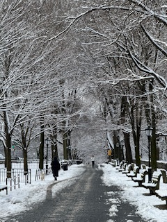
Should be perfect for a nice Saturday morning Jebwalk.
-
2
-
-
WOW. Totally different world downtown. NOTHING.
-
1
-
 3
3
-
-
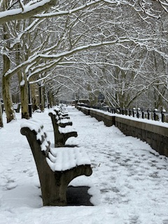
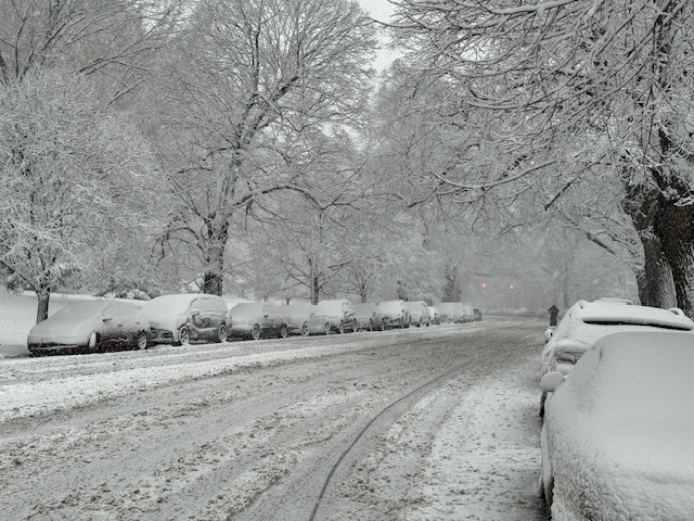
Just got on the subway to head downtown. I’d estimate 2.75 to 3 on the bench, with glorious fat flakes coming down. Snow is somehow accumulating on the cast iron skillet that is Riverside Drive (main road).
")
-
2
-
-
2 minutes ago, ILoveWinter said:
Heavy snow, cars and grassy surfaces are covered here in UWS
yeah, it has picked up substantially since I complained. Not sure I'd say "heavy" yet but getting there fast now (also on UWS)
-
1
-
-
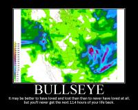
How is the Euro still putting us in the bullseye? There's a lot of work to do here in the city (speaking of rates and what I can see of accumulation on cars, etc)
-
1
-
-
eager to see this "destroying" you speaketh of as rates since I got up have sucked.
7 minutes ago, nycsnow said:That stuff coming in from offshore is gonna destroy the metro area
-
1
-
-
11 minutes ago, MANDA said:
Not impressed with this map. Knock some off for not pure 10:1 event and you are notably less than NWS amounts. Especially up my way. Going to be interesting from around daybreak through noon. Some will be disappointed IMO.
That map is Kuchera, not 10:1.
-
1
-
-
9 minutes ago, Brian5671 said:
that was a great storm-it did help that it was mainly an overnight event too.
It was not an overnight event. Destroyed the evening commute. Started at 2, peak was 4-6 PM. So heaviest was during dark, but just after. https://www.wunderground.com/history/daily/us/ny/new-york-city/KNYC/date/2018-11-15
-
1
-
-
Not to beat this horse to a second death, but here’s Amsterdam Ave on 11/15/2018. I checked the dailies for the month and the days prior were in 40s and 50s. We hadn’t had a freeze yet in 2018.
Heat island, yes. It’s not the surface of the sun.
-
2
-
-
10 minutes ago, LongBeachSurfFreak said:
What eventually happens in the city will come down to banding. As this is a dynamic rapidly deepening system with plenty of moisture, 2” hour type bands should set up during the hight of the storm. If they end up over the city, it will accumulate even on pavement. I think the November rush our crusher attests to what rates can do. If we end up with .5” hour rates, it’s a grass storm. (City)
that is one of my favorite surprise storms. just went haywire overproducing.


Hurricane Milton Banter
in Tropical Headquarters
Posted
I can't speak to all the individual choices that go into not evacuating, but in the case of my in-laws (on a canal in Port Charlotte), it is a toxic stew of nihilism/fatalism, MAGA-disenchantment with "experts" and just bad info or rationalizing based on past experience. My MIL last night said "It's a wait and see game as to where it makes landfall. Actually it would be better if it lands closer to us because a lot less surge if that happens."
With Helene, the amount of people (at least per social media) in Appalachia who were "not expecting" to be impacted that way was an alarm bell that says how people are getting critical information is getting distorted by cord cutting and reliance on social media.