

buckeye
-
Posts
8,772 -
Joined
Content Type
Profiles
Blogs
Forums
American Weather
Media Demo
Store
Gallery
Everything posted by buckeye
-

Autumn/Winter 2019-2020 Banter/Complaint Thread
buckeye replied to IWXwx's topic in Lakes/Ohio Valley
Meh, I think we picked up 2" with the Sunday night portion, advisory was 2-4, so technically... Last night's part 2 was definitely a bust but it looks like it was a widespread bust for the northern portion of this. I wonder if all the severe stuff down south stole the thunder up north...or is that just an old meteorologists wives tale. -
Had the exact same thought when it came in last night....almost looked like fake snow. Big slow-falling flakes.
-
We have certainly become a cynical bunch here in central ohio...first winter headline of the season and cue the crickets .
-
lol... yea, I don't even have to look at models...if Alek and Stebo are machine gun posting in a storm thread, I know things aren't looking good for us folks in the forum subtropics. As far as this one, I have no feeling either way, probably thinking the best snow is across the northern 1/3rd of Ohio somewhere. Models all have us changing over to rain...seems reasonable.
-
Lighting the Yule torch....
-
As I said awhile back....its all fluff until it's inside of 48hrs showing the same solution on the euro plus 2 additional major models. Scoring in this pattern is like trying to get a rabbit pregnant by throwing it in a tumbling dryer with 10 other horny rabbits. Sure it can happen but there's gonna be a lot more thump'n and bump'n before any hump'n.
-
Lest we forget, we live in Central Ohio.
-
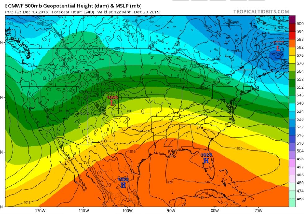
The euro weeklies thru the 24th of January has a snowfall mean for us of 8-10" I'm thinking it's 20-30 pennies, 8 -10 nickles, and a dime or 2.
-
lol this would have to be pretty darn close to a record
-
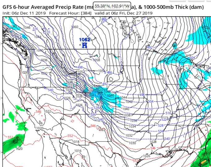
Wavy-ass long wave pattern is gonna be generating all kinds of fantasy storms on the models. Best advise is not to raise an eyebrow on any solution until the gfs, euro, and ggem all have the same thing inside 96 hrs....then you can do 2 eyebrows if it remains inside 48hrs.
-
Oh well, so much for consensus. Also. starting to look like a fairly boring...aka average...December setting up. Lots of dreary gray days with temps in the 30s and 40s. Probably a few post-cutter nickels and dimes as well. Actually glad to see the depth of these Arctic shots muting as lead time shortens. We're so back logged with work the last thing I need right now is the ground freezing up. Get us to December 24th and then crank up the snow machine!
-
all obvious caveats aside.... time of year, geography, and lead time.... ...there's a pretty impressive signal from the euro and gfs ensembles of an OV threat day 10. Notable because of the agreement across models this far out.
-
So wxbell revised their winter forecast to go slightly colder in Dec and significantly colder in Feb. Main reasoning is an almost exact match to 2013/14, (I can literally hear the drool hitting the floor in here), and 2002/03 SST. Of course the chaos factor always seems to b*tch slap down even the best matching analogs. Winter forecasts are all over the place this year. Usually you have a common thread with a few outliers, but this year I've seen forecasts that are total opposites of each other, (especially in month to month breakdowns). Should be interesting to see the winners and losers come April.
-
Agree, it's actually a pretty close to normal call for our area. This winter is looking pretty run of the mill. Would be nice to get one blockbuster event with a long lead up....something us folks in central ohio have not had in several winters. Otherwise it will end up in the overflowing file of forgotten winters.
-
Don has always done a nice job. I think last winter was his first bad bust since reading his winter outlooks over the years. In fairness lots of Mets went way too bullish last year with all the "winter of yore" calls. You never know, but I personally wouldn't bet on Don busting 2 in a row.
-
69 years ago.... 45 punts, (10 on first down) snowbowl
-
so I had to check out the source, I couldn't help myself....after all we have a blizzard warning about once in 10 years around here....so several in one winter would be quite the feat. lol His reasoning for the Big Blizzard area is based on his expection for frequent deepening low pressure areas off the new england coast due to unusually warm water in the northeast....(yes because we all know that's the classic textbook setup for big blizzards in Ohio and IN). I hope this guy isn't actually a meterologist.
-
Amen... I checked and the 6z gfs has our first peek at Thanksgiving day and we're close to 60 degrees
-
Impressive bust....did you guys ever go over to a warning?
-
Looks like a couple inches... Amazing similarities almost exactly 5 years ago to the day. So since everyone loves analogs, what was winter 14'-15' like?
-
someone needs to fix the lock... ...it doesn't seem to want to hold for very long. Oh well, it's about to lock-in again here in a few hours.
-
I don't know what it is about winters lately, but good ole fashioned cold and snowy Decembers are about as rare as a triple phaser anymore. Same thing with winters that end when they're suppose to rather than dragging into fricken April and May.
-
Yesterday when locals were calling for 1-2" today I was scratching my head wondering what model showed that...other than the nam of course. Next week is reminding me of that mid November outbreak...(I think it was '14 or '13...I'm terrible with recalling years), but I remember driving to an appointment in the evening out in the country and it was in the low teens, with low visibility from snow blowing across the road. These shots this time of year are not unheard of....but still too damn early IMHO lol. edit: Actually it was Nov. 13, 2014....just looked back on my calendar
-
Personal opinion , (and I'm sure not very popular here), but too early for this stuff. I know there are some exceptions but doesn't a colder and snowier November pattern usually get followed by a mild and dry December?
-
....more like a glance than a lock.


