buckeye
-
Posts
8,784 -
Joined
Content Type
Profiles
Blogs
Forums
American Weather
Media Demo
Store
Gallery
Everything posted by buckeye
-
Tell us what you really think, no need to hold back here
-
AKA misery loves company. I concur.
-
this afternoon he made a post using January '78 as an example of a January that in spite of being remembered as a severe winter month, featured several warm/rain storms in the east. so now i'm excited....we are in the midst of January'78....we just don't know it yet!!!!!!
-
I think that's right. All through December he was calling for the potential of an all-time coldest January for much of the east. Ended up being a record high month
-
This is where you need to refer to THE METEROLOGICAL CYA HANDBOOK by Joe Bastardi Chapter 2 : What to say when the cold never comes pg 127: "....I still nailed the pattern at 500mb!"
-
brutal....
-
#post0120patternchange
-
I have NO doubt....
-
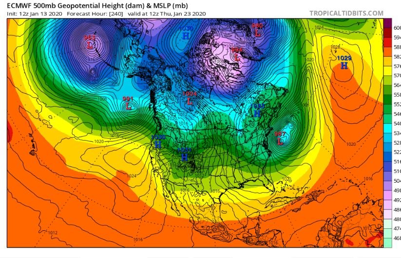
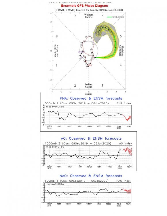
c'mon, if it was showing the polar vortex over Cleveland it would fit nicely with the calls for the end of this garbage pattern and no one would say a thing. The point is if anything is going to show a flip to cold....it's the long range gfs. It was for awhile, and now those looks are becoming muted more and more. I've got other arguments as well.... have you seen the latest mjo? What's the argument for the flip? Trust me...i hope i'm eating crow a week from now... and yes, we'll definitely get a cold shot after the slop storm....but I'm just not seeing us leaving this repeated back and forth, garbage pattern.
-
Concensus among the weather community.... Pattern change commences January 20th. Day 11 of pattern change :
-
if this is where we are 10 days from now....I'm not seeing a pattern change. Same old craptastic, wavy, fast moving, cold air-lacking, hoping-for-a ---well- timed wobble to accidentally fall into some snow.... pattern.
-
maybe there'll be a severe aspect to track with this one?
-
Good point. Also, no way a respectable storm is trending south in this stew of meterological indice garbage. It either keeps heading nw or it dissolves and ends up a putrid weak reflection that slides under us and out to sea....(like this week's situation)
-
definitely no respect for the models in here...lol
-
it's so true. I can't think of a scenario where the euro was showing a wound up low, (say sub 990), in the long range, that ended up verifying stronger.....(unless it's a coastal low). 9 time out of 10 they weaken, flatten, shear out to nothing, or just disappear all together.
-
I trust nothing, especially the euro. I was really focusing and following the 'threat' that was showing for this coming week. If you recall, it started as a major low cutting to the lower lakes with a lot of wind and snow on the nw flanks. It then started to look like a Josh special with the low cutting through Ohio. Then came our turn with a few runs of the low tracking through KY. Now, it looks like it will end up a sloppy, slushy 1-2" event for DC. I see Chicago just ninja'd me
-
Over definitely. Like pondo said, we always find a way to scratch ourselves to near normal, and typically that happens in March and April. It'll be another forgettable winter though.
-
Agree. 40 and rain is nothing more than an agonizing reminder of what could have been whereas 50s and 60s has a way of making you forget winter.
-
seen that light before

-
When you proclaimed awhile back that this was going to be your winter, was that because you love nap time?
-
Models are all over the place with a 3-4 day storm....and not just a little bit.
-
What determines whether it's a cutter or not is the geography of the poster. Of course that's a cutter to snowlover2....what's he suppose to call that? A hit? An app runner is a cutter to the i95 crew. A Milwaukee special is a cutter to you and a Fargo crusher is a cutter to Milwaukee. Happy New Year!
-
It's really hard to imagine any storm not cutting well nw of us under this current pattern. Even the temporary cold shots will probably become muted as long range turns into short range. Not being a downer....we are just in an absolutely hostile pattern for winter storms, at least through the first 10 days of January and probably well beyond.
-
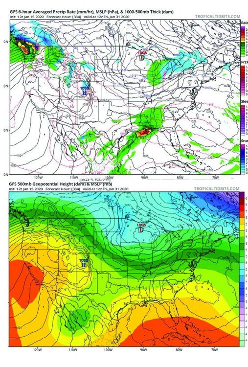
+ao /+nao/ +epo/ -pna/ I'm dubious of anything that looks like this/\
-
True....assuming in a perfect world you get a stretch of near normal temps and storms riding more west to east....or one big block buster in the middle of a zzzzz book-ended pattern. How often do those things happen? The reality around here is we get a cutter that sends our temps soaring into the 50's followed by a cold front that drops us into the 20's....so yea, overall we end up with average temps and higher precip but it's predominantly rain and flurries. To get a lot of snow it usually requires a storm to go southeast of us or a clipper pattern, which almost always means colder than normal temps.