

buckeye
-
Posts
8,861 -
Joined
Content Type
Profiles
Blogs
Forums
American Weather
Media Demo
Store
Gallery
Everything posted by buckeye
-

1/24-1/25 Major Winter Storm - S. IL, IN, and OH
buckeye replied to A-L-E-K's topic in Lakes/Ohio Valley
hmmm, I could have sworn that the Dec 04 storm blasted them with more than that. I know there were some locations in se IN and along the OH/IN border that got like 30" -
I think they do have a favorable set up for this coming weekend....at least a shot unless it goes OTS. After that a clipper pattern sets up for the sub, with several, (seen as many as four forecasted on some models). Then the trough retros further west and the sub might be open to something bigger?
-
Winter 2025-26 Medium/Long Range Discussion
buckeye replied to michsnowfreak's topic in Lakes/Ohio Valley
I’m cool with big snows…. But not cool with dry tundra weather with no end in sight, can always hope to reel in this weekends upcoming HECS…. That’s going to be a monster for those guys -
Winter 2025-26 Medium/Long Range Discussion
buckeye replied to michsnowfreak's topic in Lakes/Ohio Valley
Totally depressing to see no end in sight to this tundra -
Let’s talk winter!! Ohio and surrounding states!! 24'-25'
buckeye replied to buckeye's topic in Lakes/Ohio Valley
Yup it should be in a 24 hour period or as a single event. March 08 was around 22” in 24 hours and PD03 was a biggie also around 15” but it came in 2 parts with about a 12 hour lull in the middle. surprised at that 11.6 yesterday. Definitely about 14-15 my -
1/24-1/25 Major Winter Storm - S. IL, IN, and OH
buckeye replied to A-L-E-K's topic in Lakes/Ohio Valley
I shoveled twice since 6am. Each time there was 6” of snow….easiest snow I’ve ever shoveled. It was about as light as fake snow. -
Let’s talk winter!! Ohio and surrounding states!! 24'-25'
buckeye replied to buckeye's topic in Lakes/Ohio Valley
Hrrr says 3-4 more, probably too bullish but definitely a couple more looks good. End up with 14-15”… nice! -
1/24-1/25 Major Winter Storm - S. IL, IN, and OH
buckeye replied to A-L-E-K's topic in Lakes/Ohio Valley
Back from a walk. 12”. With possibly couple more,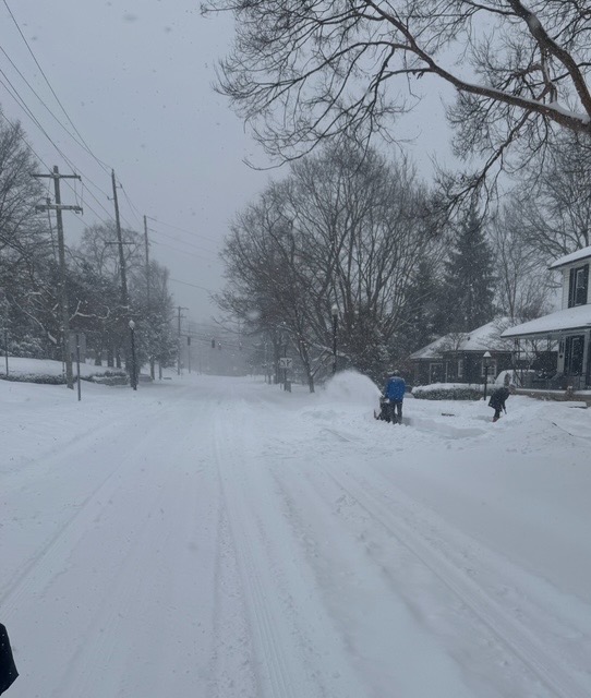
- 935 replies
-
- 15
-

-
1/24-1/25 Major Winter Storm - S. IL, IN, and OH
buckeye replied to A-L-E-K's topic in Lakes/Ohio Valley
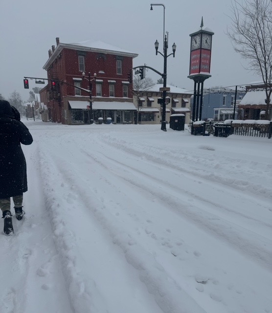
most places around CMH should have 11-12" OTG at noon....then models show about another 6 hours of snow after that.. Pretty impressive, won't beat #1 2008, but definitely could come in as #2 largest snowfall in CMH history since that would require greater than 15". -
1/24-1/25 Major Winter Storm - S. IL, IN, and OH
buckeye replied to A-L-E-K's topic in Lakes/Ohio Valley
Just took our dog out to pee. Measured exactly 6” on the driveway -
1/24-1/25 Major Winter Storm - S. IL, IN, and OH
buckeye replied to A-L-E-K's topic in Lakes/Ohio Valley
Not even trying to plow
-
1/24-1/25 Major Winter Storm - S. IL, IN, and OH
buckeye replied to A-L-E-K's topic in Lakes/Ohio Valley
Gett’n buried radar looks juiced -
1/24-1/25 Major Winter Storm - S. IL, IN, and OH
buckeye replied to A-L-E-K's topic in Lakes/Ohio Valley
I’ll just say better than 50/50 we hit 12” -
1/24-1/25 Major Winter Storm - S. IL, IN, and OH
buckeye replied to A-L-E-K's topic in Lakes/Ohio Valley
3:30 am. Woke up looked out …holy sh*t. Now looking at radar, no way I can fall back asleep -
1/24-1/25 Major Winter Storm - S. IL, IN, and OH
buckeye replied to A-L-E-K's topic in Lakes/Ohio Valley
Flurries started here (cmh area) -
1/24-1/25 Major Winter Storm - S. IL, IN, and OH
buckeye replied to A-L-E-K's topic in Lakes/Ohio Valley
Stopped by a dispensary yesterday. when it comes to an impending snowstorm, dispensaries tell the supermarkets to hold my beer. -
1/24-1/25 Major Winter Storm - S. IL, IN, and OH
buckeye replied to A-L-E-K's topic in Lakes/Ohio Valley
This is one of the most widespread snowstorms for the forum I remember. Warnings from just south of Chicago to Paducah across all IN,OH into southern MI. And it’s all snow. Sure there’s an axis of heaviest but kinda cool we all score some before the arctic hammer slams down and settles in. -
1/24-1/25 Major Winter Storm - S. IL, IN, and OH
buckeye replied to A-L-E-K's topic in Lakes/Ohio Valley
By the way, I'd like to nominate Alek as official forum-wide storm thread initiator. -
1/24-1/25 Major Winter Storm - S. IL, IN, and OH
buckeye replied to A-L-E-K's topic in Lakes/Ohio Valley
If you use a regular 10:1 snow total, you shave off about 4" everywhere. Question is which is a better predictor, kuchera or 10:1 ? -
1/24-1/25 Major Winter Storm - S. IL, IN, and OH
buckeye replied to A-L-E-K's topic in Lakes/Ohio Valley
nice -
1/24-1/25 Major Winter Storm - S. IL, IN, and OH
buckeye replied to A-L-E-K's topic in Lakes/Ohio Valley
eh, gotta feel for them a little. Nothing worse than tracking a big dog only to have the rug pulled. At the same time though, if I lived there I would always be concerned of the mixing and warm air....it literally comes with every threat they get, so they shouldn't of been too shocked once models started showing it a couple of days ago. That trend always gets worse and never reverses once it shows up. -
1/24-1/25 Major Winter Storm - S. IL, IN, and OH
buckeye replied to A-L-E-K's topic in Lakes/Ohio Valley
pretty sure start time wasn't till late evening -
Let’s talk winter!! Ohio and surrounding states!! 24'-25'
buckeye replied to buckeye's topic in Lakes/Ohio Valley
Yeah, exactly. I’ll be checking surface obs compared to radar west of us. -
Let’s talk winter!! Ohio and surrounding states!! 24'-25'
buckeye replied to buckeye's topic in Lakes/Ohio Valley
I think we can rule out any worry about that. Even the nam barely gets sleet north of the Ohio river. And this set up is a little bit of a different animal than we’re used to. usually on these things at this time out, we’re nervously watching the models pull the sleet line up to i70. -
Let’s talk winter!! Ohio and surrounding states!! 24'-25'
buckeye replied to buckeye's topic in Lakes/Ohio Valley
I remember we had back to back big snows during that period. Didn’t realize it was that much.


