

buckeye
-
Posts
8,772 -
Joined
Content Type
Profiles
Blogs
Forums
American Weather
Media Demo
Store
Gallery
Posts posted by buckeye
-
-
This one is a tough one. Lots of moving parts including the storm coming thru the lakes tomorrow and the lead wave later in the week. There’s also the placement and timing of the pieces to the north that will determine how much the ser can be kept in check or allowed to pump.
The bad news for us folks in the southern flanks of the forum is the gfs wants to bring this too far north for us, the good news is most of the other globals are at a perfect track.
The winner stripe is going to have a huge prize but it’ll be narrow. Either way I’d rather roll the dice with a powerful storm and risk the wtod vs. left hoping for a strung out weaker storm and smaller prize….especially this time of year. Go big or go home-
 2
2
-
-
euro laughs at gfs
has a strung out southern POS before the next cutter develops. Gonna be hard to get cold into the game when there's no high pressure in Canada, only a bunch of LPs dancing all around.
-
1 hour ago, dilly84 said:
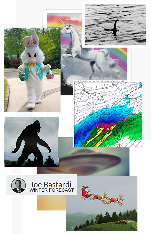
The joe bastardi has me dying lol. Do you still subscribe to his blog? Lol
i have my usual 3 month subscription that I'll end in March. Kinda embarrassed to admit

-
1
-
-
12z gfs fits my collage nicely

-
 1
1
-
 7
7
-
-
16 hours ago, Chicago Storm said:
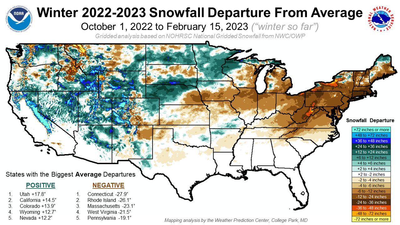
it's 80 in D.C. today, they've had 18 60+days this winter, and they have 0.4" of snow on the season.
perfection.
God love 'em. 4 months and hundreds and hundreds of pages on tracking and analyzing models and potential snow.... and .4" to show for it.

-
6
-
-
12 hours ago, michsnowfreak said:
I wonder if they are using always coop data which always runs low/missing data for some areas which brings the curve down. It's definitely inaccurate in southeast MI
Detroit
2019-20: 43.7" (-1.3)
2020-21: 44.9" (-0.1)
2021-22: 47.1" (+2.1")
2022-23: 19.3 (-12.5") thru 2/15
Cumulative -11.8Flint
2019-20: 53.7" (+1.6)
2020-21: 48.6" (-3.5)
2021-22: 60.5" (+8.4)
2022-23: 28.9" (-8.5") thru 2/15
Cumulative -2.0
FYI...this is not meant for snow
-
4
-
 2
2
-
-
2 minutes ago, dilly84 said:
Official. Stick a fork in er, it's done. May be the worst winter I can ever remember. Who's ready for the torch? I know I am. Let's get to the 60s and 70s and stay there.
Sucky winter but definitely not our worst ever. In fact I often judge a winter by whether there were any memorable events. I will always remember that insane front centered on Xmas eve. -8 at 1pm in the afternoon on Xmas eve. I have not seen that kind of cold during the day since the infamous Jan 94. Almost 30 years.
We’ve had many winters where we hit avg or even above snowfall without a single event to remember them by. Also we had a white Xmas, we ended up scoring the most synoptic with that event in the forum outside les. We also got a nice over performer (while I was on vacation). We’ve had bigger ratters then this…by far.
-
1
-
-
clouds will small breaks, low 50's, damp.
-
1
-
2
-
-
10 minutes ago, Chicago Storm said:
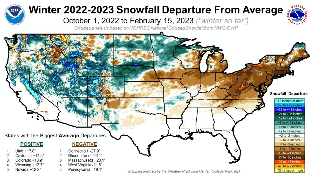
Appropriately shaded sh*t brown…only thing missing is the squatting big dog
-
8
-
-
We still get them... it's just that they are now drippers instead of clippers.
-
3
-
-
29 minutes ago, A-L-E-K said:
lol
53 this morning….loving it! Tomorrow we have an enhanced severe threat. Feb is definitely rock’n!

-
1
-
-
11 hours ago, michsnowfreak said:
Wishful thinking again.

Does @hardypalmguy get complimentary breakfast with that free rent in your head?
-
1
-
5
-
-
14 hours ago, michsnowfreak said:
Not really. We've gotten far more advisory and warning criteria snowstorms than Indiana and Ohio. It's the model fantasy storms that turn to dust that annoy us all. One of these days a storm is not gonna shear out and it will be like the boy who cried wolf. No one will believe it and someone will get absolutely buried.
and it’s not like we’re south of you either…
-
3
-
-
17 hours ago, psuhoffman said:
Did he start getting all religious and philosophical Iike he does when he is wrong
he said he nailed it at 10mb
-
1
-
-
2 hours ago, luckyweather said:


looking like a toasty morch on tap lol
Ahhh yes, the sswe, aka the last vestige of a weenie
-
3
-
-
Officially hit 70 today at the airport.
Impressive.
by the way, @michsnowfreak , the first step is acceptance.

-
1
-
-
first high wind warning that actually was warranted here.
 The steel and glass door to my office just blew open....scared the crap out of me.
-
1
-
-
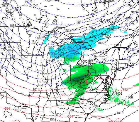
This is an example from the 12z gfs. It seems with storms this winter, the cold sector precip shield almost always has rain outside the heaviest precip band, (even on the nw flanks). I don't recall seeing this in past winters on models, at least no where near as prevalent.
-
On 2/6/2023 at 11:35 AM, jbcmh81 said:
Needs about 17" more to hit average. Not seeing it barring a 1987-style finish.
Never underestimate the ability for CMH to pile up enough March and April car-toppers and single-day-slush-melts to bring us up to average leaving us scratching our heads wondering how the hell we got there.
BTW, looks like it's gonna be a bit breezy tomorrow.
-
1
-
1
-
-
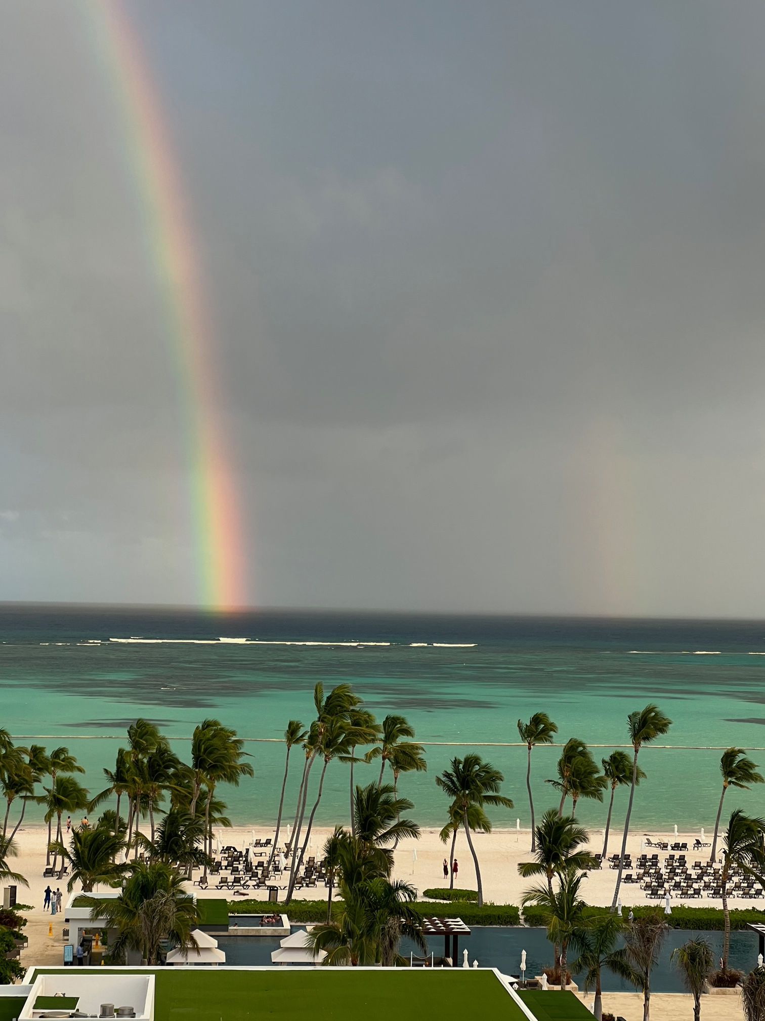
22 minutes ago, pondo1000 said:
Oh, you missed ALL the action!! LOL
Hope you had a nice trip!!
the only 2 hours that it was cloudy at least had rainbow with it

-
3
-
1
-
-
ugh, from 84 degrees, blue skies, soft breeze, and sipping away my days with mojitos and rum and cokes....to this craptastic 35 degrees, gray, and slushy slop piles. Well at least I have a nice tan lol.
Next week kinda looks interesting depending on where that boundary settles in... icestorm anyone?
-
 1
1
-
-
6 minutes ago, pondo1000 said:
Have a great vaca Buck!
thanks! 6 days of 'forget about life for awhile'. Coming back to snow or something to track would take the edge off returning to our usual depressing climo. So let's see what you guys can do to make that happen
") . Maybe find where Josh's magnet went, clearly he's misplaced it.
. Maybe find where Josh's magnet went, clearly he's misplaced it.
-
1
-
1
-
-
On 1/14/2023 at 5:05 PM, HighTechEE said:
Welp, I just put my snow blower away for the season, used it once, AGAIN!
My snowblower is still sitting in the back of the garage with a flat tire. The thing is a monster, more suitable for Buffalo then CMH but I got it super cheap brand new, ($168.00 a couple of summers ago). I was going to pull it out for the xmas eve snow but it was too damn cold and snow was like dry sand anyways. I'm heading for the carribean for a short vacation...hopefully something delivers on Sunday so I come back to snow followed by another storm on our doorstep later in the week. Truth be told, I'm worried next week's snow and turn to cold might be another headfake....just another batch of weakening lows and cold starved systems....hope not. The gfs is a dumpster fire but the euro is

-
3
-
-
Nothing like a late March/ early April trash storm in the heart of winter.
-
6
-

Let’s talk weather!
in Lakes/Ohio Valley
Posted
Tornado sirens blaring….probably gonna happen again with the next storm. Crazy wx