cyclone77
-
Posts
18,897 -
Joined
-
Last visited
Content Type
Profiles
Blogs
Forums
American Weather
Media Demo
Store
Gallery
Everything posted by cyclone77
-
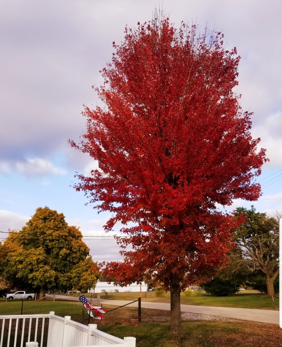
A lot of the area trees are past peak color now, but some of the late turners are still looking quite nice, like the hard maples etc. The Autumn Blaze out front is at peak now, and will probably be bare in a week or two.

-
First measurable snow of the season early this morning with 0.3". Looks nice with the trees still holding on to some color. Chance for some cold rain Thu, but other than that it looks pretty quiet into next week.
-
0.15" overnight/this morning as the storms mostly crapped the bed before getting here, which the models had predicted. Back to reality today with the cold weather.
-
Yeah it was a crazy change. Opened up the garage late this afternoon and everything fogged up instantly, as it was probably a good 15 degrees cooler in there, with mid 60 dewpoint air rushing in. Still 70/62 as we approach 11pm, with a ripping south breeze. Party's about over though, as the CF is already passing through Muscatine.
-
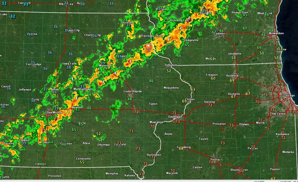
Impressive temp (and dewpoint) contrast across Iowa this eve.
-
MLI made it to 80 late this afternoon. Hit 77 here. Dews in the mid 60s is making it feel pretty muggy out there. Quite the change from the low 50s around midday.
-
Finished with 1.86", nice soaker.
-
Cedar Rapids is dead center in the middle of the slight risk today. Cedar Rapids is killing it this year. Derecho, multiple early season snows, epicenter of potential severe today. If luck continues maybe you guys can breach the 1ft mark for a snowstorm this winter.
-
Pretty entertaining evening with lots of lightning flashes, and slow-rolling thunder. Hasn't been too much rain yet (0.22") but chances for good downpours the rest of the night.
-
Elevated showers/storms working in here. Could be some nice downpours this evening. Looking forward to the mid-upper 70s tomorrow.
-
Day 3 marginal risk for areas that received significant snow yesterday. Temps/dews will be well into the 70s/60s. Quite the turnaround.
-
Very impressive! Great start to the new season. Temps crashed from 41 to 33 here as the snow moved in. Had a brief period of moderate snow. No accum but very nice to see a daytime snow event in mid Oct. Had a burst of sleet with a convective shower at the tail-end.
-
Pretty impressive stuff with that band out in central Iowa. Lightning icing on the cake. 41 here with some filtered sun. Ever so slight chance we could see some wet flakes if we can precipitate hard enough, but doesn't look very likely. First flakes may have to wait another week plus if it doesn't work out this afternoon.
-
saw a few partially melted flakes mixed in with the larger rain drops earlier in Clinton. Think it stayed all rain at home where there was less bright-banding. Just light rain now @ 40 degrees.
-
Got colder than expected here this morning, as it got down to 33. Probably had frost in at least some patches. Looks like first freeze on the way for tonight.
-
Feels like fall out there today with temps near 50 and spits of cold rain.
-
First frost here this morning (patchy) at 34 degrees. Was in the low 40s till 3am due to lingering clouds, but plummeted after that.
-
They should have painted triple phaser on there somewhere dammit.
-
zzzzz. Pretty quiet start to the month. Hopefully something of interest later on in the month.
-
From DVN a few days back..
-
Just a few days ago was the anniversary of the record earliest measureable snowfall for part of the sub, 1947.
-
But what's the kuchera accums??
-
She sounds like she was in a glass case of emotions.
-
Margin of victory with cutters always seems a bit iffy due to dry slot issues, positive-tilt warm-sector convection robbing the cold-sector precip, overaggressive WAA, etc. Hybrid clipper systems is where it's at.
-
^ NIce pics Hawkeye, thanks for sharing!