-
Posts
8,736 -
Joined
-
Last visited
Content Type
Profiles
Blogs
Forums
American Weather
Media Demo
Store
Gallery
Posts posted by USCAPEWEATHERAF
-
-
Just now, TauntonBlizzard2013 said:
It’s worse, which is all that really matters.
Look, it looks worse for people west of 72W longitude, it is all relative from where your location is, let me get my system in and then we all enjoy the WED system. Let the SE Coastal New England folks cash in their prize for the winter and then everyone can rejoice for the WED system. Again, it does not act like that in the real world, but I just pray we get a lot of snow.
-
 4
4
-
-
The 2/7/03 system brought more snow to the Cape then PDII
-
Just now, weathafella said:
2/7/03
I will gladly take that result
-
Very small timing differences in the flow with the southern stream energy. Newest run is a tad slower, like three hours slower than the 12z run.
-
Differences between the 18z and 00z are minute at best. Very small differences. Northern stream is a bit more amped, and the flow ahead of the southern stream shortwave is more NNE then NE. Just have to see how the downstream ridging reacts the next few frames.
-
2 minutes ago, Typhoon Tip said:
Too bad WPC discontinued the initialization monitoring
Damn, I am guessing budget cuts
-
Just now, 40/70 Benchmark said:
I was about to add that it was all relative
-
1 minute ago, 40/70 Benchmark said:
Eh....18z Euro was dissapointing. GFS must have sucked, too.
Nope it did not disappoint for SE MA and RI
-
Just now, dryslot said:
If its not going to phase, Best to lift out and allow the southern stream to get further north.
So you want a snowstorm with cold air present with a southern stream dominant storm? Heck, without the presence of the northern stream shortwave, this system floods the region with warmth and rain. You won't get snow with a single southern stream dominant system.
-
 1
1
-
 1
1
-
-
3 minutes ago, Baroclinic Zone said:
Disagree, I'd like to see the northern shortwave get the hell out of the way, allowing the southern stream to become more dominant/amplified.
Actually rather have them phase 75 miles southeast of the benchmark into a monster sub 960mb low, but hey I don't get what I want.
-
2 minutes ago, TheBudMan said:
Who was the one who had the horrible maps a year or two ago way worse than Wiz'
You talking about Paint IT?
-
1 minute ago, Baroclinic Zone said:
S/W is stronger and a bit further south and west so maybe offsetting
Remember Bob, with this setup, we want the southern shortwave to be a tad out in front of the northern stream digging shortwave. This is different then the pattern has been lately. Similar to the JAN 2017 event.
-
Just now, Greg said:
They did have a lot of drifting though down there, that can become very tough to get an accurate, that I can understand.
Dude the snow I measured was legit, I saw the drifts and non drifts, a lot of them were 4-8 feet high. We had 12" at midnight, at 6 am we had 24" and at the end of Sunday we had 35", the wind were unbelievable. The heaviest snow band I had ever witnessed was weakening after it struck Taunton with 8" in 75 minutes, we had rates near 4-5"/hour when it came overhead.
-
Just now, Greg said:
It must be like the movie Poltergeist where it only precipitated over your house in Harwich.
Sure
-
 1
1
-
-
Just now, Greg said:
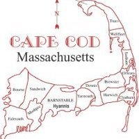
Not official with 24" in Hyannis and 26" in Denis and 15" in Chatham. Sounds like the roof snow fell in the yard where you measured it.
Nope I measured it correctly, the NWS had a little blip on the south coast of Harwich in their official snow map of over 30"
-
1 minute ago, The 4 Seasons said:
he's alive. did u get any snow? if so how much?
A few flurries between 8-10 am and then non stop rain since noon. Heavy rain now with a high temp of 41F. Winds have been cranking since late afternoon
-
Just now, The 4 Seasons said:
Blizzard of 05? He got like 2 feet+
35" roral
-
 1
1
-
-
Man the dry slot tries to get closer and more bands just organize. Someone is going to get obliterated. Remember when the HRRR model showed almost 48" for Allentown last night, well someone in NE MA can get close to 30" by tomorrow evening. This moisture is insane.
-
 1
1
-
-
Just now, JC-CT said:
None of you deserve it. You didn't earn it.
Umm after this mess I definitely do deserve the next one missing everyone outside of the I-95 corridor
-
 1
1
-
 1
1
-
-
Of course the one storm that does not dry slot the south coast is the one that pours rain for me and the Cape and Islands. Wow what freaking luck. The storm next Sunday, better come through for my area, and let everyone smoke cirrus, and we get the deformation banding and the best blizzard conditions and the storm deepens to 950mb 75 miles southeast of the benchmark. Everyone who got stumped today will get their blockbuster on Sunday and Monday.
-
 1
1
-
 1
1
-
 1
1
-
-
NAM tries to get some snow WED morning pre-dawn
-
 1
1
-
 1
1
-
-
Raining at 36-38F today, we had no snow to start, maybe flurries between 8-10am. But the east wind won out in the boundary layer!
-
Moderate snows falling over the Vineyard
-
 1
1
-
-
Amazing lift in the DG Zone for CHH around 4-7pm tonight should overcome the weak boundary layer warming for a time this evening, until the warming wins as the lift shuts off. I think the warmer models are overdoing the warmth in the boundary layer, and I think a few inches on the front end seems most reasonable.
-
 1
1
-
 1
1
-


Quick Hitter Coastal Threat, Feb 7-8th
in New England
Posted
3 KM NAM is a lot more amped and bullish at hour 60.