

LongBeachSurfFreak
-
Posts
9,277 -
Joined
-
Last visited
Content Type
Profiles
Blogs
Forums
American Weather
Media Demo
Store
Gallery
Posts posted by LongBeachSurfFreak
-
-
18 minutes ago, LibertyBell said:
imagine if it was all snow lol, we'd jackpot
Yeah. This is definitely the snow hole of Long Island. Getting progressively worse as you head south, with Long Beach being the least snowy location.
-
Almost an inch in Sw Nassua with a very presistent band of moderate rain. It’s actually brighter now then it was during mid afternoon.
-
 1
1
-
-
2 hours ago, Dark Star said:
So is this pending Alaskan eruption being overblown? (pun intended)
Looks to be a rather small VEI 4 eruption of a side vent with a recurrence time of 50 years or so. Cool to watch but a very small climate effect. The main cone has a recurrence time of something like 5,000 years and I would think would be much larger VEI 5 or 6.
-
 1
1
-
-
8 minutes ago, Sundog said:
Which storm are you talking about?
It was January of 2010 I believe
-
2 hours ago, LibertyBell said:
We had this storm in February 2010 I think it was-- could have been January 2011 too, don't remember because both those winters were great. We had 5 inches of snow in Lynbrook and Valley Stream and JM in Long Beach was going back and forth with a mix. I remember us watching it on radar too and it clearly showed the mixing line on the barrier islands but it didn't make it up to us.
I’ll never forget that day. I was living in Long Beach and working in new Hyde park. The strangest rain snow line I have ever seen. South of sunrise nothing but white rain, north of sunrise several inches of snow, and it stayed relatively constant up to new Hyde park. Usually the rain snow line sets up along the terminal moraine (northern state)
Meanwhile steady moderate rain continues
-
1
-
-
16 minutes ago, TheClimateChanger said:
Do you think in the absence of human activity, the planet would be destined for a near-permanent ice age in the geological future? Obviously, such an ice age could not truly be permanent, because solar irradiance is increasing over time as the sun is a main sequence star. In the very distant future, this will inevitably lead to runaway warming. But in the nearer term (next few millions of years), it seems likely that ice age conditions would become the norm. In millions of years, could the earth go from near snowball earth conditions to typical quaternary ice age conditions from Milankovitch cycles [rather than from ice age to interglacial]. Looking at the geological record, we can see, generally, a long-term cooling since the Paleocene, which coincides with a long-term decrease in carbon dioxide. This appears to be due to increased weathering and a decrease in volcanism over time. As the earth continues to age, there would continue to be fewer and fewer volcanic eruptions over time, which, in the absence of human activity, would result in continued decreases in carbon dioxide. I wonder if carbon dioxide levels would eventually drop so low that photosynthesis might cease. It looks as though the planetary trajectory is towards extreme cold and eventually extreme heat.
Great post.
I have thought allot about what would happen in the absence of humans. A propensity towards longer harsher ice ages and shorter cooler inter glacial periods would eventually tip the scale in a runaway cooling towards snow ball earth.
The question is what’s left when the suns expantion finally warms the planet enough to melt the ice. Likely single cell extemeaphile life. Which likely wouldn’t have enough time to evolve much further before it’s too warm for any life.-
1
-
-
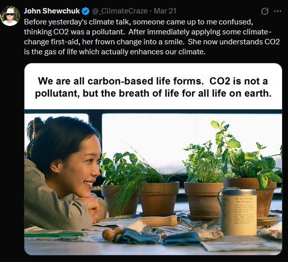
13 minutes ago, Typhoon Tip said:
It's possible - I don't know Mr Shewchuck's established and/or known biases .. no clue, just using this example - that this was a part of a longer sermon.
C02 is critical to the existence of life on this planet. Without it ... most species cannot exist. How? That's where the Oxygen we need to live comes from.
02 dependent organisms cannot live without C02 --> 02 fixing mechanisms to continuously resupply the O2. Oxygen breathing/metabolizing organisms evolved after this fixing mechanism arrived on the scene, ~ 2.5 billion yrs ago . C02 was here first, however. Virtually all the O2 in sufficient amount to sustain all this bio-diversity ( ..as well as the oxygen used in/for human forced combustion ) since, required the fixing. It owes its ongoing existence to this background exchange between CO2 and O2. O2 cannot otherwise exist in sufficient mass long enough on its own because of it's reactive volatility - look at how fast iron turns to rust.
When raising the mass of CO2 beyond the exchange rate, while maintaining the same amount of incoming energy, the temperature rises with it. When lowering the CO2, the temperature, there temperature thus falls. This critical fact is what keeps this world in an inhabitable temperature range. For this, it is a climate regulator.
So, Mr Shewchuck is right: it enhances the climate.
See where I'm going here? If you stop there, that entire message conveys a marvelous denial manipulation. This is just one way in which miss-representing a source and intent, miss-guides a reader. He may have done this deliberately? Or, he may have been a victim of a redacted repost - in which cast that was not his intent. Either way, we end up with his 'enhancing of the climate' leaving off the following key facet and the whole fucking problem:
It's the part above where adding more CO2 to a planetary system raises the temperature. If needing it spelled out...when exceeding the background CO2 fixing/exchange rate, we end up with a surplus which inimicably creates a surplus in temperature.
That conceptual arithmetic could not be any simpler... And the physics shows 100% causal with zero objective variance. It's amazing how clad it is... God at times even trips over his own creation and has to go, 'shit i can't deny that' it's so clad. The objective physics is that C02 stores energy --> more C02 stores MORE ENERGY. As for those lower educated mouth breather asshole deniers( along with sociopathic leaders that know all this yet don't care or demonstrate any cognitive dissonance to it one way or the other... ), well ... shit - this is probably going to have to end as a slow moving Darwin award.
Obviously I was being simplistic and sarcastic. I think a great analogy for C02 is poking a bear. Bears are beautiful creatures that are extremely important to their habitats. Live and let live and it’s all good.
I am really starting to think that at the higher intelligence end of the denier spectrum it’s turned into a game. It’s just become too incredibly obvious that the planet is warming at an accelerating rate. It’s fun too make up self serving skewed facts, knowing that others will believe regardless of the truth.This really is a can of worms. We could probably spend a week discussing this in person.
-
7 minutes ago, dryslot said:
Dried sea foam.
I lived literally on the beach for years during one of the snowiest periods ever on Long Island and never saw anything like that.
My guess is it something for the soil that’s concentrating on the front of the snow blower. -
7 minutes ago, LibertyBell said:
I bet that's why we get that howling southerly wind as soon as it warms up even a little. It actually felt warmer here because of the lack of wind and I was sitting outside in the full sun this afternoon.
I think the wind is blocked here, aside from a few hours this morning, I haven't noticed the tree branches moving.
I live in Lynbrook too as you know and it the difference between home and the beach was remarkable. Even if it was only a few degrees cooler at the beach, something about the higher dews and of course the wind just makes it feel so raw.
-
1
-
-
53 minutes ago, LibertyBell said:
I mean there's no reason for it to get cold since we have no more arctic shots coming.
I would have thought that CC would have ended these unusual late season cold shots, but I suppose late March is still vulnerable even though the nights are now shorter than the days.
Even a 2c warming isn’t going to end cold shots. Well into April.
One thing to consider this spring is the cold pool formed from upwhelling with all the offshore flow this winter. I was just at jones beach to go for a run and with the wind out of the south it was remarkably cold.
The cold pool to our north east will also have the ability to bring down chilly maritime air anytime we are in a cutoff pattern. Those patterns are common this time of year as the jet slows and retracts.-
2
-
-
3 hours ago, Sundog said:
Wow you made it to the national level Spelling Bee? That is very impressive.
I made to the state championship three years in a row, 6th 7th and 8th grade. Never made it to the nationals, those kids know the most obscure geography facts lol
Yeah if I had access to google earth as a kid I probably would have too! It gets a little boring staring at an actually globe.
Even now I spend hours looking for obscure surf breaks in isolated places. Also glacial retreat facisnates me and can be seen on GE.-
2
-
-
13 minutes ago, LibertyBell said:
April 1997 was so overrated, April 1996 was MUCH better.
I still don't see how Boston got 24 inches of snow, Logan is right on the water.
Boston is at a similar latitude as Albany so that will do it in a marginal setup. Had it been 2 or 3 degrees cooler all that white rain here would have been a foot plus of snow. They are also in a better spot for late maturing miller B’s into the gulf of Maine. And often get some ocean enchantment.
-
1
-
-
Just now, MJO812 said:
We have seen snow in April
Of course, but based on the lack of true Arctic air available it’s safe to hedge with highest elevations. I’m not sure if you remember 97, that storm had everything going for it and we ended up with hour after hour of white rain. As soon as we would build up a coating it would turn to drizzle over and over.
-
1
-
-
3 hours ago, ChescoWx said:
I think you should set up the first colony on Venus! Plenty of lovely C02 there. Good thing C02 does not create a positive feed back cycle of planetary heating…
-
 1
1
-
-
16 minutes ago, MJO812 said:
Euro AI!
Above 2500’ in the Berks and southern greens sure!!! Anywhere else not so much…
-
3 hours ago, Sundog said:
Where did your grandmother live in Queens if you don't mind me asking?
Forrest Hills in a big prewar apartment building. I went there a few days after Sandy as well as they never lost power.
I think there are surprises in store with the coming season just like last year. The new normal is expect the unexpected.-
2
-
-
10 minutes ago, LibertyBell said:
Wild to think we might be *overdue* for another one of these, although we don't know what the return time of a behemoth like this should be, we've not seen anything like it since.
As a child, I remember how scary it was hearing news reports about Gloria the night before it was supposed to come in. It was supposedly a Cat 4 abreast of Atlantic City, but of course we know that wasn't true and it was rapidly weakening and its eye was expanding as it approached our latitude. It probably wasn't even a Cat 4 near Cape Hatteras.
Yeah, I was only three for Gloria, but it is my first weather memory. We evacuated south wantagh to my grandmothers in queens. Gloria had allot of similarities to 38 and 44 both in regards to strength and pressure while it was south east of North Carolina. So I understand the hype at the time. The difference between that hurricane and the formers is that it didn’t phase with the trough as cleanly and thus suffered from slower movement and land interaction which caused dry air entrainment destroying the southern side of the storm. The satellite pic in my profile shows that very well. It also hit at low tide.
As far as the future, it will always take the perfect setup to get a major up here regardless of rising water temps. Too many land interaction issues based on our geography. Warmer waters enhance the risk but aren’t the end all when you are a 90 degree angle coast.-
2
-
-
18 minutes ago, LibertyBell said:
Yes, I think there was a time when hurricane strength was determined by MSLP not wind speeds. And that storm could have been much worse even back then, they were lucky it came in at low tide.
Even the 1944 hurricane was thought to be Cat 3 at landfall until it was reassessed. It was reassessed down to Cat 2 wasn't it?
Cat 2 105mph into South Hampton.
Speaking of historic Long Island hurricanes, the nature center at west end 2 at jones beach has some great photos of the damage to jones beach during the hurricane of 38. Pretty similar damage to what we saw with sandy, which is truly remarkable considering jones beach was on the weaker western side of 38. Meaning at the time of peak surge the winds would have been out the north east and then north and offshore. The damage was likely caused by the tremendous waves associated with the storm. I would love to have been on the second floor of the west bathhouse and witnessed those waves coming in to opposing 100mph gusts. Likely spraying a hundred feet or more into the air!-
2
-
-
1 minute ago, LibertyBell said:
If that happened today, it would be horrific. I wonder if there were any actual pressure readings from that storm? Even if it had Cat 3/4 pressure it still wouldn't necessarily be a Cat 3/4?
Yeah I fully agree that storm is a worst case scenario for the NY/NJ coast, far worse then Sandy as you have much greater wind impacts with similar or even greater surge. As far as pressure, that may be why it has been historically thought to be a cat 3/4. Again, using the Sandy example hurricanes at our latitude often have pressures much lower then generally associated with its maximum sustained winds if it were fully tropical. Sadly the only way to know for sure would be to go back in time.
-
1
-
-
21 minutes ago, Stormlover74 said:
Yeah I found it a bit confusing. The post said leaves were popping in Pittsburgh but the map shows some here but I've seen nothing but some buds.
We tend to lag areas at the same latitude due to the marine influence. So I get it with Pittsburg but the maps definitely off for the island especially. Even Bradfords (hopefully they will all be dead soon, pitiful tree) are just starting to swell right on the south shore.
-
1
-
-
5 minutes ago, Sundog said:
Where are there leaves popping in our area? I see nothing.
Unless I'm misunderstanding this map.
Yeah barely even bud swell on the earliest fruit trees here in the island. Only thing really up a crocus’s and the beginnings of daffodils.
-
3
-
-
11 minutes ago, STORMANLI said:
If Cumbre Vieja Volcano in The Canary Islands western wall collapses then according to studies years ago, it could send a tsunami to The East Coast of The US of indeterminate height. However, subsequent studies infer that would require a complete collapse, and a multi-stage event might mean it could not create a basin-wide tsunami.
It’s highly unlikely the 1300s event came from the Canary’s. That’s if it even was a tsunami. It’s possible it was surge related to 1,000 plus year hurricane or nor’easter. If it was a tsunami the possibility’s are endless, from a meteor hitting the Atlantic, a major earthquake in the Caribbean or off of Europe or some sort of marine landslide.
-
1
-
-
50 minutes ago, LibertyBell said:
A Tsunami from an earthquake in the Azores-- that would be really wild!
When you mentioned 185 mph the hurricane that came to mind was Dorian, it reached 185 mph and wrecked the Bahamas and for awhile it seemed like it was headed right into Central Florida, but it swerved to the north and hit NC instead (as a minimal Cat 1.)
By the way, another hurricane I'd love to see more info on was the only major to ever hit NYC directly-- the Norfolk and Long Island Hurricane that also hit Cape May as a Cat 4 and then Manhattan as a Cat 3.
That one is highly suspect in my opinion. It’s next to impossible to maintain even a low end major with that much land interaction. As we saw with sandy NY harbor is extremely surge prone and therefore does not need major winds or pressure for a 15’ surge to form.
I think that storm was likely a stronger version of Isias. Maybe hitting the Carolina’s as a major then riding the coast while interacting with a trough. Producing enhanced winds on the east side that probably did gust over 100mph. But likely with a very disrupted core and skewed wind field.
-
2
-
-
Just now, Yanksfan said:
With this new climate we’re entering I wonder what a worst case scenario up here would be for a TC. High end cat 3 perhaps?
Yeah something like that. Maybe Carol 54 plus 5-10mph to account for increased water temps. That was the strongest purely tropical system in modern history in our area. 38 and the 44 great Atlantic hurricanes were undergoing extra tropical transition. That and increased forward speed had the effect of spreading the max sustained winds out from the center, especially on the eastern side. So equal distances from the eye east or west in 38 had huge impacts on winds. So 120 sustained with gusts to 145mph at the Hamptons beaches while more like 80 with gusts to 105mph at jones beach.
-
1
-
March 2025
in New York City Metro
Posted
Throw in the cold pool off New England and it’s a lock the back door is stronger then expected. I would much prefer the warmth but reality is reality.