

CoraopolisWx
-
Posts
2,960 -
Joined
-
Last visited
Content Type
Profiles
Blogs
Forums
American Weather
Media Demo
Store
Gallery
Everything posted by CoraopolisWx
-
 P14 looks the most realistic best case scenario. Has that classic sharp cutoff to the NW.
 -
Yeah, keep those H5 and H8 vorts south of us, and at least we have a chance
-
Fall 2022 Pittsburgh/Western PA Discussion
CoraopolisWx replied to Ahoff's topic in Upstate New York/Pennsylvania
That 1/17 storm had potential, just didn't have the mid level cooperation. SMH -
Fall 2022 Pittsburgh/Western PA Discussion
CoraopolisWx replied to Ahoff's topic in Upstate New York/Pennsylvania
Same here, a bit afterward. -
Pittsburgh/Western PA Summer 2022 Discussion
CoraopolisWx replied to Ahoff's topic in Upstate New York/Pennsylvania
Looks like a hybrid/Miller B snowstorm map. Yellow is the 12"+ area. -
Pittsburgh/Western PA Spring 2022 Discussion Thread
CoraopolisWx replied to Ahoff's topic in Upstate New York/Pennsylvania
Maybe next winter we get a 1/17/22 redo, without the messy mid levels a la 1/4/1994. Although my gut tells me we're more likely to see the next monster come from a 2/5/10 hybrid type setup. -
Western PA/Pittsburgh Winter 2021/22 Discussion
CoraopolisWx replied to meatwad's topic in Upstate New York/Pennsylvania
Hard to be disappointed in April, but was hoping for some snow tv today. The stronger CAD flow warmed the low levels a bit to much unfortunately. Hopefully we get some flakes tomorrow. -
Western PA/Pittsburgh Winter 2021/22 Discussion
CoraopolisWx replied to meatwad's topic in Upstate New York/Pennsylvania
35 year revenge storm. 4/4/87 was the first of many disappointments for a young lad. Went to bed that night with snow and a WSW, woke up to rain and a flood watch.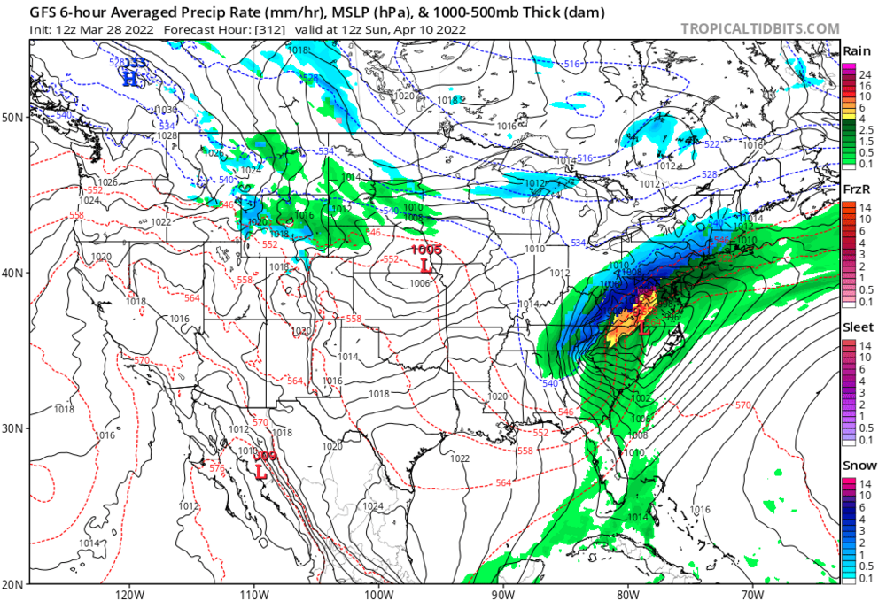
-
Western PA/Pittsburgh Winter 2021/22 Discussion
CoraopolisWx replied to meatwad's topic in Upstate New York/Pennsylvania
Nice rates with that line moving through. Snow globe outside -
Western PA/Pittsburgh Winter 2021/22 Discussion
CoraopolisWx replied to meatwad's topic in Upstate New York/Pennsylvania
Just got in from a measurement/walk. Averaged about 7.5-8” here in Mt Lebanon. Nice squall conditions out there, probably should’ve wore the mask though. -
Western PA/Pittsburgh Winter 2021/22 Discussion
CoraopolisWx replied to meatwad's topic in Upstate New York/Pennsylvania
How much enhancement the secondary wave provides, before the whole trough moves east will be key. -
Western PA/Pittsburgh Winter 2021/22 Discussion
CoraopolisWx replied to meatwad's topic in Upstate New York/Pennsylvania
Solid AFD from the NWS breaking down the storm. Might have to nap earlier to stay up for the best rates. -
Western PA/Pittsburgh Winter 2021/22 Discussion
CoraopolisWx replied to meatwad's topic in Upstate New York/Pennsylvania

-
Western PA/Pittsburgh Winter 2021/22 Discussion
CoraopolisWx replied to meatwad's topic in Upstate New York/Pennsylvania
Gfs not ready to cave...stays the course. -
Western PA/Pittsburgh Winter 2021/22 Discussion
CoraopolisWx replied to meatwad's topic in Upstate New York/Pennsylvania
Gfs holding steady for now. Would like to see that wave strengthen a bit faster in the Carolinas. -
Western PA/Pittsburgh Winter 2021/22 Discussion
CoraopolisWx replied to meatwad's topic in Upstate New York/Pennsylvania
Waves are so tricky. Blow up to soon we get slotted/rain, too late and everything goes east. -
Western PA/Pittsburgh Winter 2021/22 Discussion
CoraopolisWx replied to meatwad's topic in Upstate New York/Pennsylvania
Seems like there's been an overall progressive shift the last two days. We'll see if the GFS moves toward the Euro/Nam. -
Western PA/Pittsburgh Winter 2021/22 Discussion
CoraopolisWx replied to meatwad's topic in Upstate New York/Pennsylvania
Elevation ? -
Western PA/Pittsburgh Winter 2021/22 Discussion
CoraopolisWx replied to meatwad's topic in Upstate New York/Pennsylvania
IMO a muted CAD/SE flow helped everyone (sans the 119 corridor). A nice example of what our winters would be like without CAD. -
Western PA/Pittsburgh Winter 2021/22 Discussion
CoraopolisWx replied to meatwad's topic in Upstate New York/Pennsylvania
Based on the traffic cams, I-70 has been the R/S line all morning. -
Western PA/Pittsburgh Winter 2021/22 Discussion
CoraopolisWx replied to meatwad's topic in Upstate New York/Pennsylvania
Probably some white rain tomorrow, although above 1100 ft maybe some grass covering. -
Western PA/Pittsburgh Winter 2021/22 Discussion
CoraopolisWx replied to meatwad's topic in Upstate New York/Pennsylvania
Weird CAD setup for tomorrows system. Weekend has an odd semi progressive look. -
Western PA/Pittsburgh Winter 2021/22 Discussion
CoraopolisWx replied to meatwad's topic in Upstate New York/Pennsylvania
Any even a longer shot would be a March 1995 redux for Mon/Tue. I remember the kids at school being pissed at me for saying it was gonna snow the next day, after being in the low 70’s. Lol -
Western PA/Pittsburgh Winter 2021/22 Discussion
CoraopolisWx replied to meatwad's topic in Upstate New York/Pennsylvania
Only needs to hold for 10 more days. -
That January storm did sting. Not so much for the overall totals, but how anomalous the 850 intrusion was for what would normally be a great surface track.


