

dta1984
-
Posts
1,698 -
Joined
-
Last visited
Content Type
Profiles
Blogs
Forums
American Weather
Media Demo
Store
Gallery
Posts posted by dta1984
-
-
Getting somewhat of a consolation prize. Didn't get a chance to measure, but probably 1-2" overnight and still snowing.
-
OHweather looks to be sitting good for the end of week storm. Maybe we can get that to toss some scraps our way too lol.
-
Looks to be a little light snow building in from the south.
-
That must have been the case. Everything looked great with the wind direction... but not with the band placement. I'm guessing the western basin is mostly ice covered at this point.
Ya looks like it's pretty close to being frozen. Another day or so...
-
If I'm doing my math right you're up to about 5" so far which is okay. The band is already lifting farther north, we'll see how far that next trough later tonight can push things back south.
Yep 5.25" total so far. I tried to be conservative measuring this morning, as there was some drifting.
-
Picked up about 2" overnight. The bands must have shifted north fairly quickly. Looks slightly further north than last week. Hopefully we can get them to swing back later today.
-
Same here. Nice start. Now we see what happens with the les. The biggest wild card is wind direction but the dry Arctic air is also a concern. Still looks like north of here does the best but we may get a decent snowfall.
Ya Cle mentions the dry air possibly becoming a concern later on.
Good band forming now from here out towards the west side.
-
3.25" looks to be the total so far from the artic front / enhancement. Now waiting on the lake.
-
2.25" as of 330 pm. Snowing light to moderate at times.
-
Perfect, thanks I'll bookmark those. The ARW does look decent..
-
Looks like much like last week the NMM is north with the band (and has it close to last week's event) while the ARW has the heaviest along or a bit south of 322. Both models have a 1-1.5" QPF bullseye somewhere in Geauga County.
Do you have a link for those models?
Off and on light snow has recently became quite heavy. Grass quickly re covered.
-
Great forecast OHweather! I'll be pulling for a slightly south band placement tonight lol.
-
Not a bad first forecast from CLE, although I'm personally more optimistic about parts of Cuyahoga getting warning criteria snow. I definitely think some areas will get 12-18" where the bands are more persistent.
Looks like cle expanded the 8-12 area slightly and added 12-18 near Chardon and northeast. Hopefully it all comes together.
-
Les watch from sun-tues for 8-12 or more. CLE mentions in their disco about a possible advisory for Cuyahoga.
First snow map; http://www.weather.gov/cle/Winter_Weather
-
Fantastic research OHweather! Definitely remember several of those events well.
Looking forward to sun-mon. Won't take much to top the biggest event of the season (4").
-
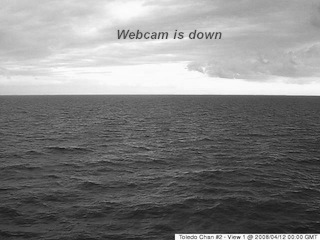
Not sure where this cam is located, but the ice looks to have broken up pretty good since a few days ago.
-
1.5" overnight.
CLE already has a hwo for les Sunday and Monday. Should be interesting!
-
I didn't get a chance to measure again, but looks like maybe an additional 1" since last measurement. Event total estimated 4".
-
Ya I just came back from Chesterland. Definitely better rates there. Seems like just constant light snow here. Hopefully it'll come this way for a little bit.
-
Band looks pretty intense just south of 322. It would be nice if it could settle just a little more south.
-
I've got a spot on my deck that doesn't get too much wind. Measured 4" here. There was probably 1" already there from the other day. Will go with 3" so far.
Light snow currently, lots of wind.
-
Ya it's definitely looking good so far. We'll see how long it holds and how much it strengthens.Radar is starting to light up over the lake... right on schedule. The meso models are handling things pretty well. It will be interesting to see how things play out tonight. I think the one positive thing for us on the southern fringe as that the winds are fairly strong... which I think will reduce the backing of winds over land.
Yikes at the ice build up! Amazing how fast that happened. Hopefully it'll be rather thin and melt some as long as we don't get a stretch of temps like last year.
-
2" seems about right. ^^wow at that lake band! Maybe we can get lucky on this one?
-
It looks like northern Geauga got 4-5" totals based on the reports this morning, the bands got going kind of late and by that point everything was shifting north pretty quickly. This one wasn't a bad bust but it certainly didn't reach its potential.
CLE...managed to squeak out 1.3"...the streak is over
Ya that seems right. My 1.5 may be low, but it was hard to measure.
Is tonight through Weds still looking good?
Northern Ohio Obs/Discussion Part 2
in Lakes/Ohio Valley
Posted
Wow! That area seemed to be in all of the good bands the past few days. I'll have to take a drive later.
Still snowing good , maybe we can salvage an 8-10" storm total?